Inspiration — Urban flooding data is fragmented, so we wanted to turn existing infrastructure data into actionable decisions.
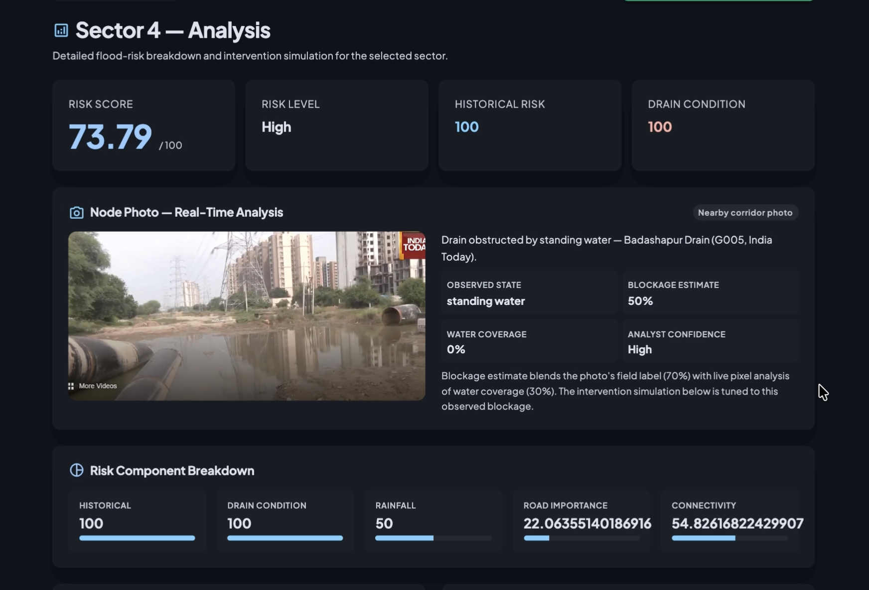
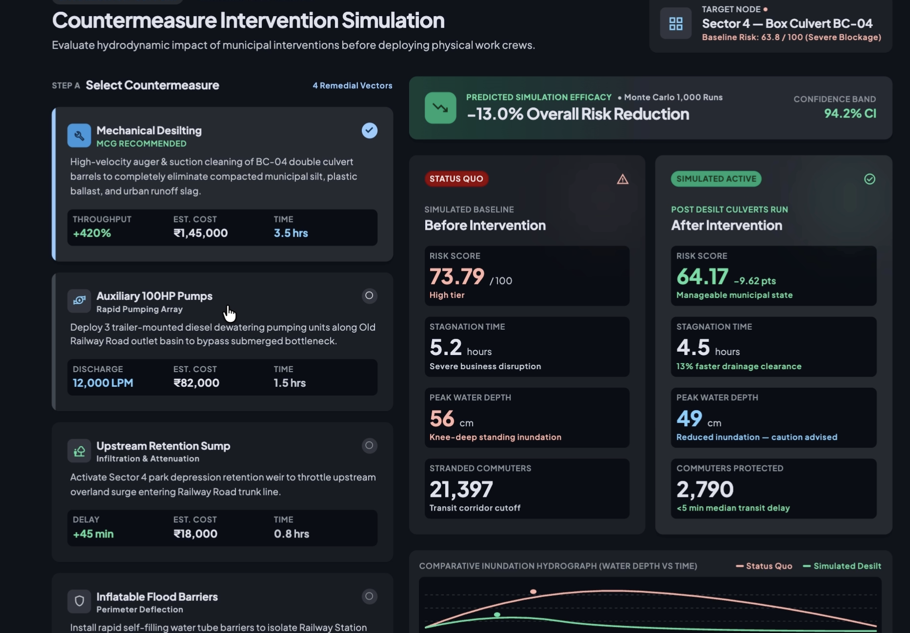
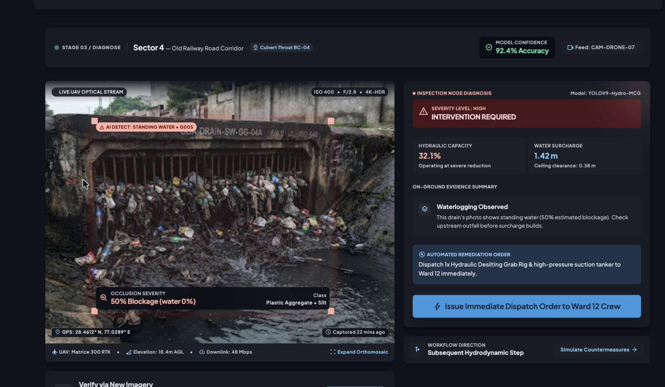
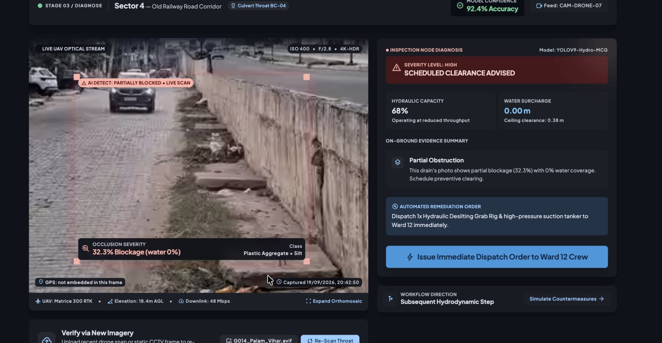
What it does — DrainSight combines risk analysis, AI field inspection, intervention simulation, and flood-aware routing to help identify, prioritise, and respond to infrastructure risks.
How we built it — We used Python, FastAPI, JavaScript, GIS/road-network data, rainfall and flood datasets, and computer vision to build a software-first prototype.
Challenges we ran into — Integrating diverse datasets and connecting multiple technical components into one coherent end-to-end workflow within a hackathon timeframe.
Accomplishments that we're proud of — We built a working decision platform that connects detection, diagnosis, prioritisation, simulation, and routing instead of treating them as separate features. ## What we learned — We learned that useful AI is not just about prediction; it is about turning data and models into decisions that can support real-world action.
What's next for DrainSight — Expand with richer GIS/elevation data, larger inspection datasets, live sensors, maintenance workflows, and integration with existing infrastructure-management systems.
Built With
- api
- artificial
- css
- fastapi
- gis
- github
- html
- javascript
- learning
- machine
- numpy
- opencv
- openstreetmap
- osm
- pandas
- python
- rest
- yolo


Log in or sign up for Devpost to join the conversation.