-
-

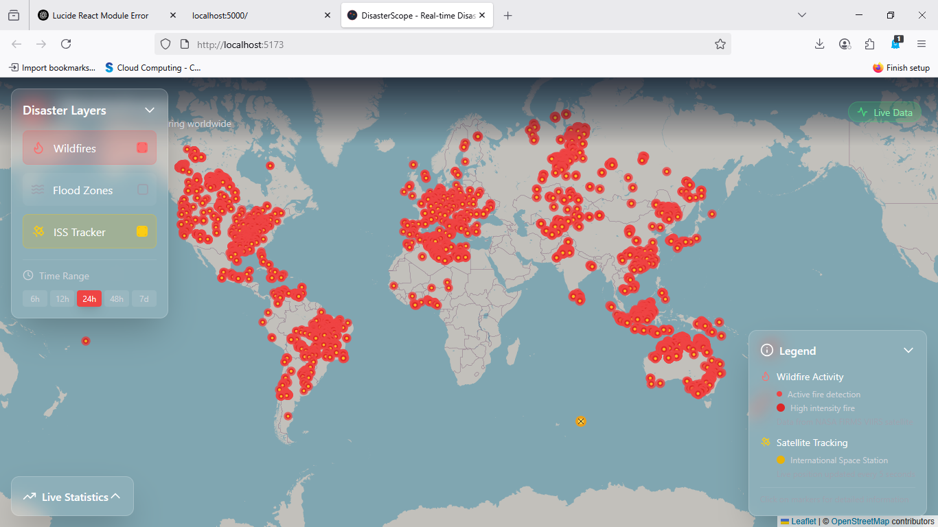
Whole Website View
-

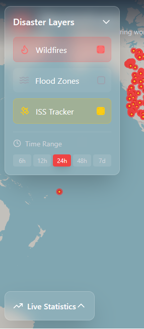
UI View (Glass UI)
-

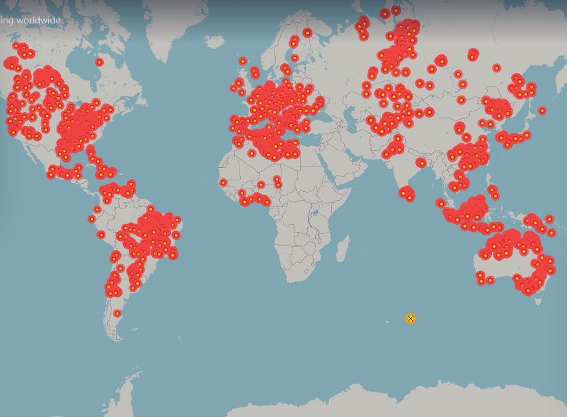
World Map with Interactive Legends
🌟 Inspiration
The increasing frequency and severity of natural disasters like wildfires — combined with the fascination around space and satellite data — inspired us to build DisasterScope. Our goal was to create a visually engaging, real-time dashboard that helps users understand the impact of environmental events from space-based data in an intuitive and meaningful way.
🔥 What it does
DisasterScope is a full-stack web application that:
- Visualizes near real-time wildfire data from NASA FIRMS on an interactive map
- Tracks the current location of the International Space Station (ISS) using the N2YO API
- Presents disaster data and satellite tracking together in a clean, responsive interface
- Provides a backend proxy to bypass CORS and enable safe API consumption
🛠️ How we built it
- Frontend: Built with React, TypeScript, and Vite, using Leaflet.js for map rendering
- Backend: Developed a lightweight Express server (in TypeScript) that acts as a proxy for NASA and N2YO APIs
- Data Sources:
- NASA FIRMS (CSV wildfire data)
- N2YO Satellite API (JSON ISS data)
- Deployment: Hosted both frontend and backend on Render, with dynamic environment variable support for clean integration
🧗 Challenges we ran into
- CORS Issues: Most public APIs (like NASA FIRMS and N2YO) do not support client-side requests. We solved this by setting up a secure backend proxy.
- CSV Parsing: FIRMS data comes as raw CSV. Writing a parser that could handle edge cases, missing fields, and still output clean data required care.
- TypeScript Type Safety: Ensuring strict typing for API responses added reliability but also complexity when dealing with dynamic external data.
- Deployment Friction: Getting the monorepo structured correctly for deployment on Render (including proper
tsconfig, environment variables, and.envhandling) took multiple iterations.
🏆 Accomplishments that we're proud of
- Successfully integrated two real-world APIs into a single app
- Designed a clean, minimalistic UI with responsive map and controls
- Achieved full separation of concerns between frontend and backend
- Built and deployed a working full-stack app using only TypeScript
- Added fallback mock data and error handling for resilience
📚 What we learned
- How to consume and transform live geospatial data in both CSV and JSON formats
- How to design and build a TypeScript-powered Express API
- Best practices for proxying external APIs safely and efficiently
- How to work with Vite + React in a real production use case
- Deployment strategies using Render for multi-service projects
🚀 What's next for DisasterScope
- 🌪️ Integrate other disaster data sources like earthquakes, floods, and hurricanes
- 📦 Add data caching and rate-limiting to optimize backend performance
- 🧭 Enable map-bound-based dynamic filtering (i.e., fetch fire data for only visible area)
- 🧪 Add tests and CI workflows for better maintainability
- 📱 Build a mobile-optimized version with PWA support
DisasterScope is open-source and extensible — we hope it becomes a useful tool or foundation for anyone interested in disaster awareness, satellite data, or earth observation tech.
Built With
- express.js
- github
- leaflet.js
- n2yosatelliteapi
- nasafirmsapi
- node.js
- openstreetmap
- react
- typescript
- vite


Log in or sign up for Devpost to join the conversation.