Inspiration
When there is a student strike, our CEGEP sends the information through Omnivox MIO, the school's internal mail. It gets buried between normal emails; it only goes one way, and on the day of the strike nobody knows where things are calm and where they are getting out of hand.
Protesting is our right. But when a few people break things, all young people get judged for it. We wanted a tool that keeps the peaceful majority safe and organized, so the few who break things don't write the story.
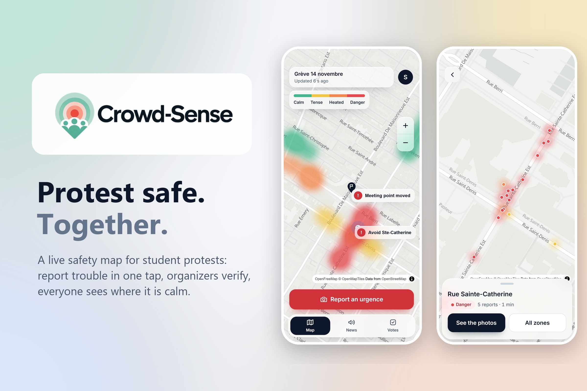
## What it does Crowd-Sense is a live safety map for student protests.
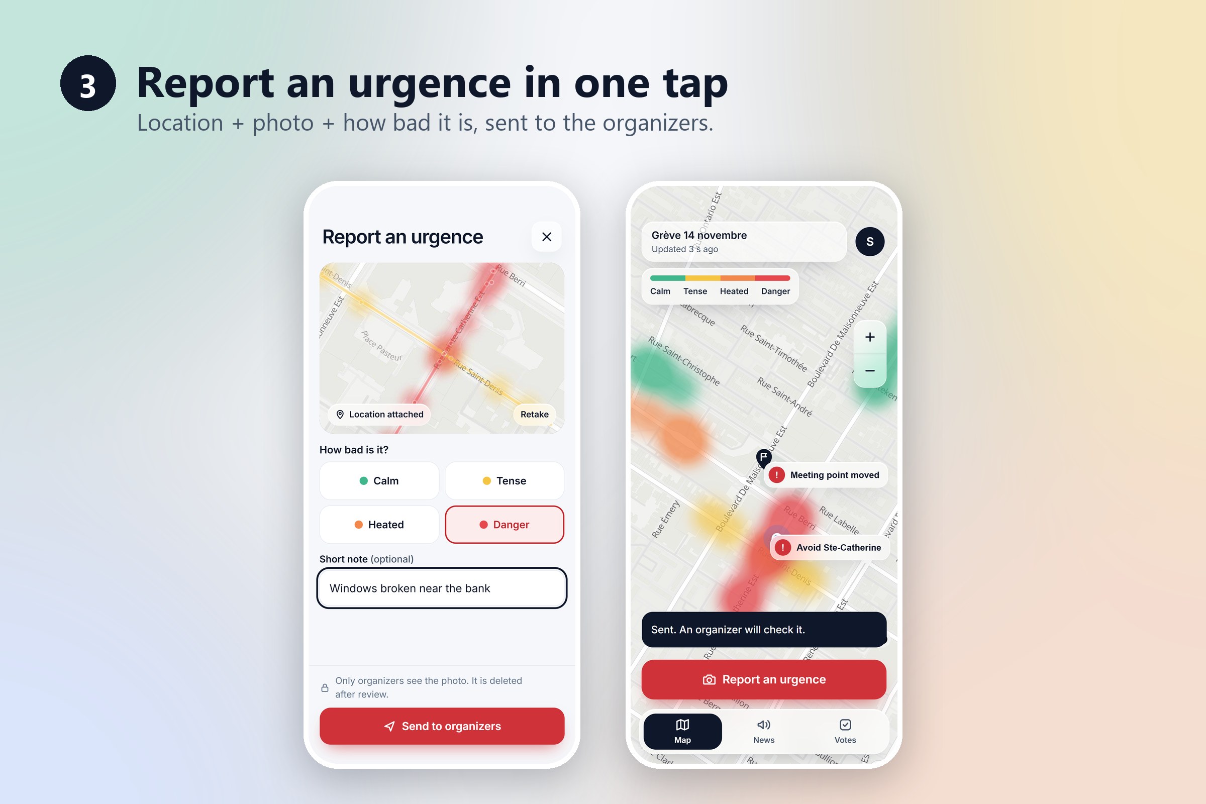
- Report an urgency: one tap sends your location, a photo, and how bad it is (calm, tense, heated, danger).
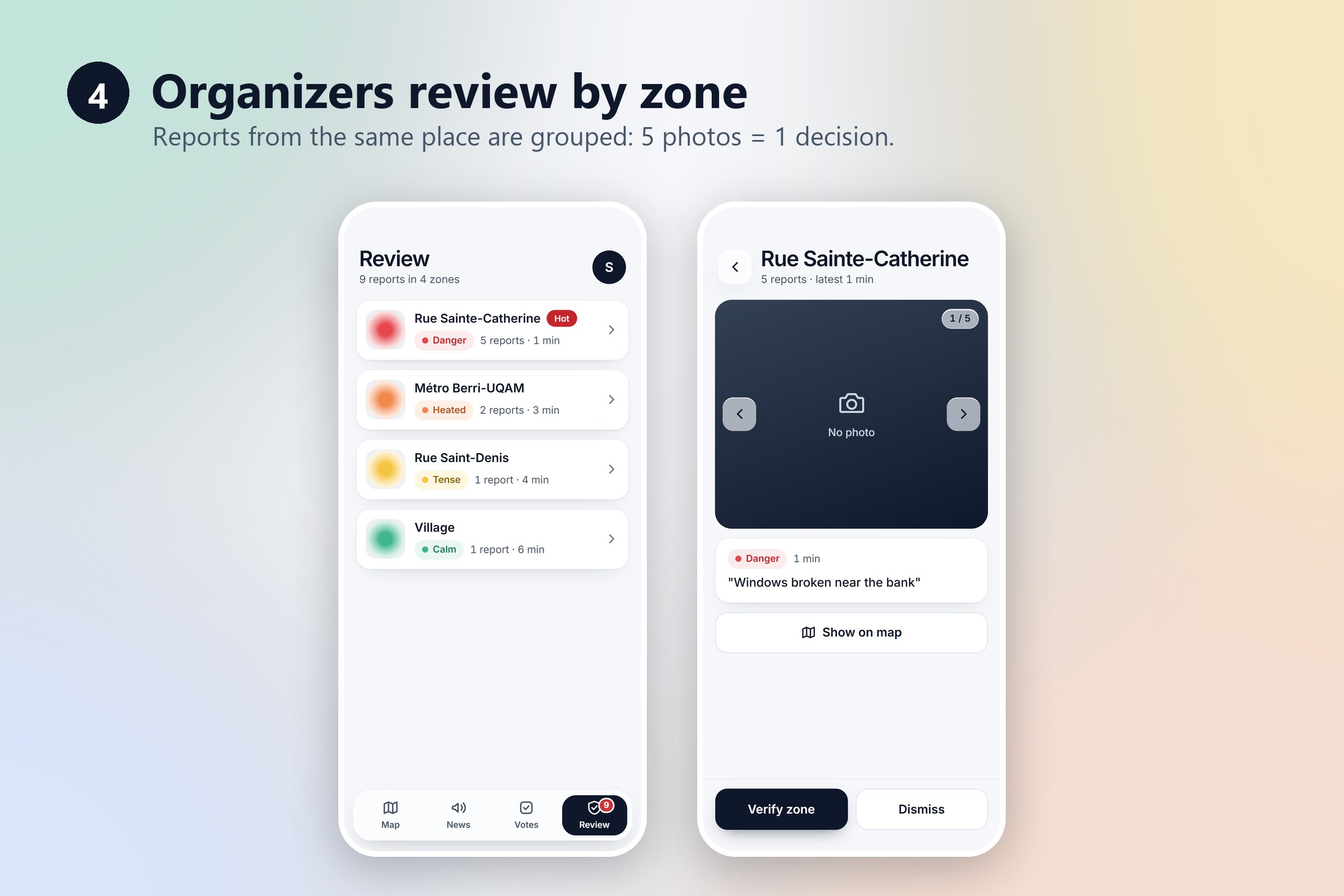
- Organizer review: reports from the same spot (about 100 m) are grouped into one zone, so 5 photos = 1 decision. The organizer verifies or dismisses the whole zone.
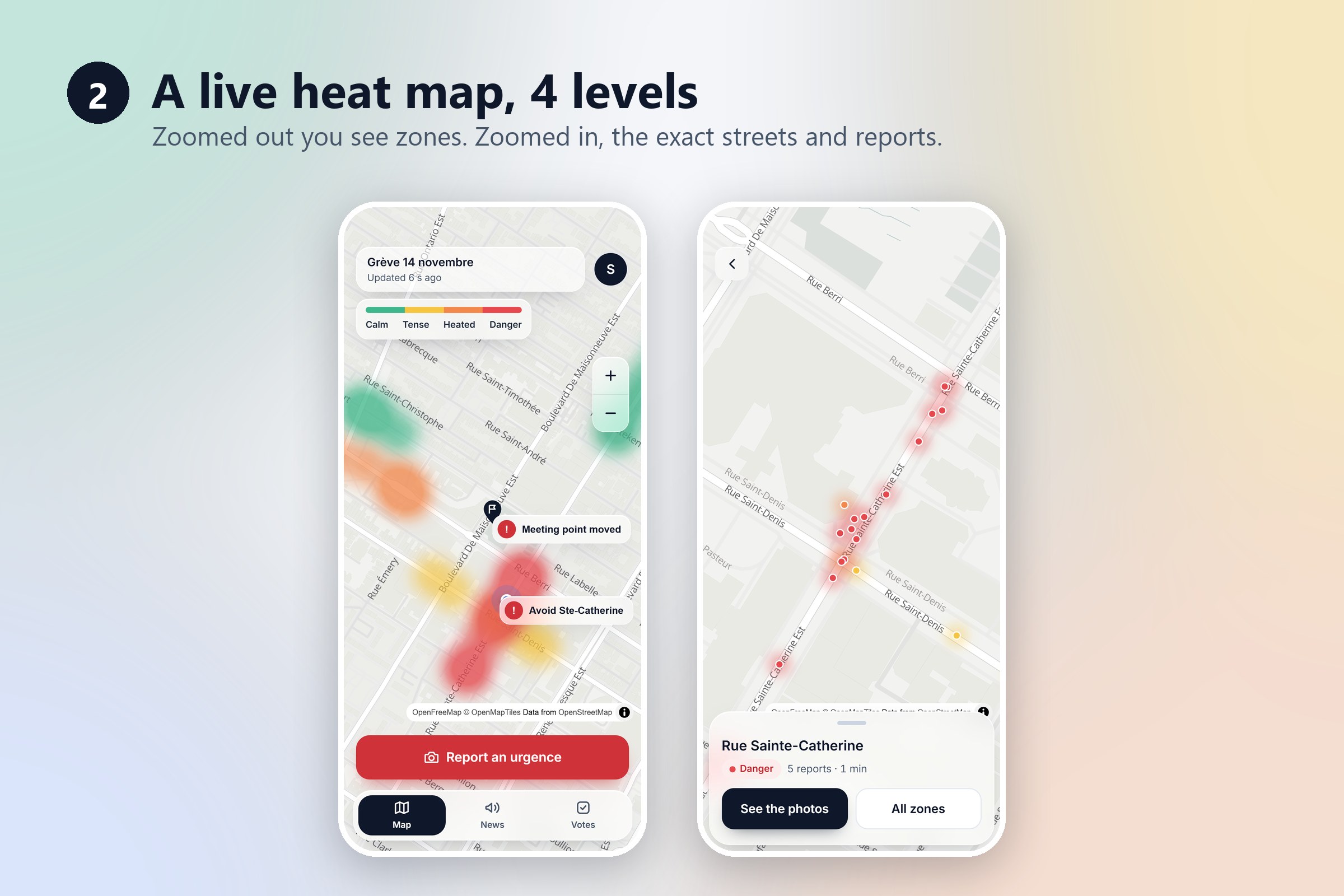
- Live heat map: verified zones appear on everyone's map within seconds. Zoomed out, you see soft zones; zoomed in, you see the exact streets.
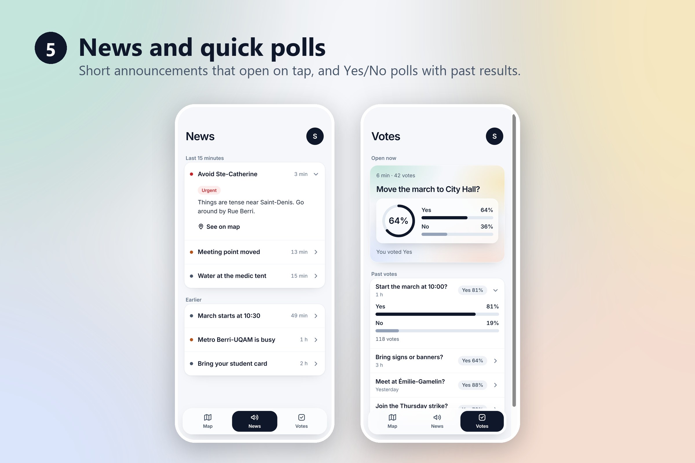
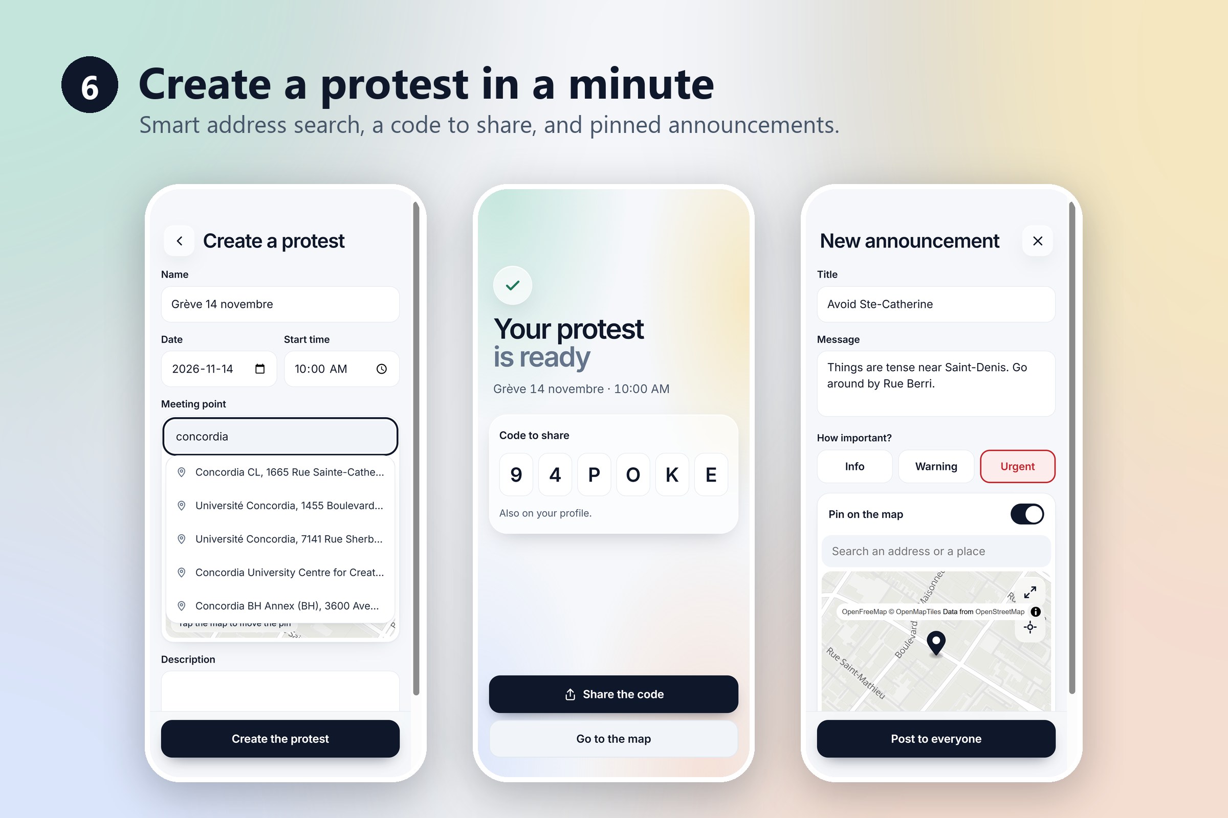
- Announcements and quick polls: organizers post updates (pinned on the map if needed) and run quick Yes/No polls.
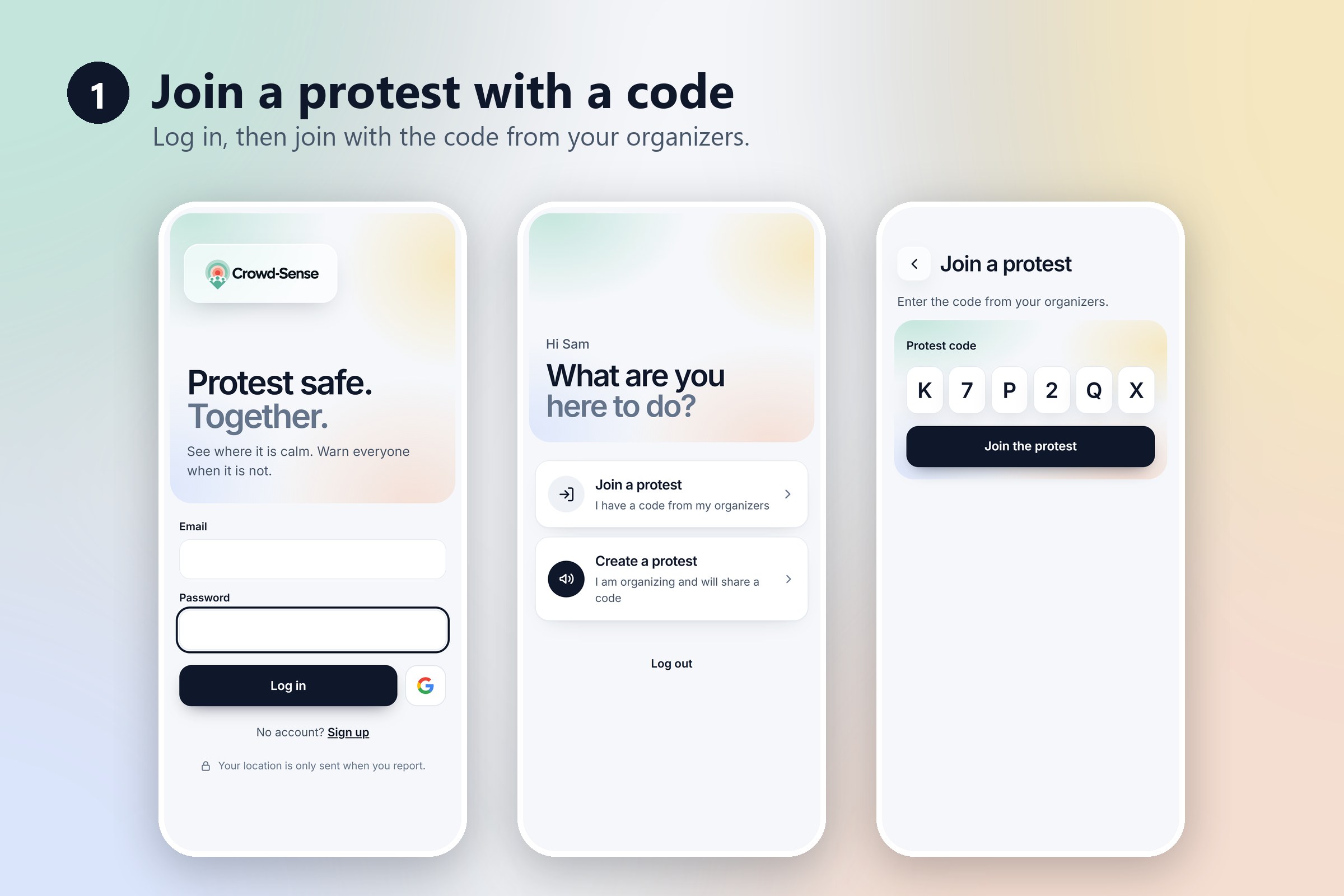
- Join with a code: whoever creates a protest becomes its organizer and shares a 6-character code; students join with it.
Privacy by design: photos are only seen by organizers and are deleted right after review. The public map only shows zones, never people or exact positions. Your location is only sent when you report.
## How we built it
- Frontend: React + Vite, React Router, MapLibre GL with free OpenFreeMap tiles (OpenStreetMap data), one heat layer per danger level, and Photon for address search.
- Backend: NestJS (TypeScript) with TypeORM and SQLite, JWT login with bcrypt-hashed passwords, Multer for photo uploads, Swagger for the API docs.
- Deployment: one Docker image where the backend also serves the frontend, hosted on Render, so the whole app has a single https link that works on any phone.
- We designed every screen as clickable mockups first, then built them for real.
## Challenges we ran into
- Phones need https for the camera and location, so testing on a real phone over Wi-Fi (and a hotspot, and a public network that blocks devices from talking to each other) didn't work. We solved it by deploying early with Docker on Render.
- Joining the frontend and backend: small mismatches (like danger levels 1 to 5 vs 4 levels) broke things until we tested the full flow end to end.
- A heat map that stays precise: we wanted soft zones from far away but exact streets up close, without fake circles.
- Free hosting resets the database on every redeploy, so the app reloads demo data on startup.
## Accomplishments that we're proud of
- The full loop works live: a student reports with a photo, an organizer verifies, and the zone appears on everyone's map.
- Privacy decisions built in from the start, not added at the end.
- One link, real HTTPS, works on any phone.
## What we learned
- How to connect a React frontend to a NestJS API with JWT authentication.
- How map tiles, heat maps, and geocoding work, all with free and open tools.
- Docker and deploying a full app, and why phones require HTTPS.
- That designing the screens first saved us a lot of time when coding.
## What's next for Crowd-Sense
- Push notifications for urgent alerts.
- Several organizers per protest.
- A persistent database (PostgreSQL) and encrypted photos until review.
- Google sign-in (the backend part is ready).
Built With
- docker
- github
- javascript
- jwt
- maplibre
- nestjs
- node.js
- openfreemap
- openstreetmap
- photon
- react
- render
- sqlite
- typeorm
- typescript
- vite
