-
-
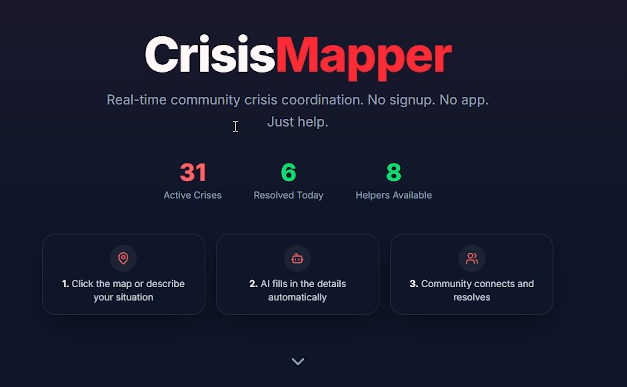
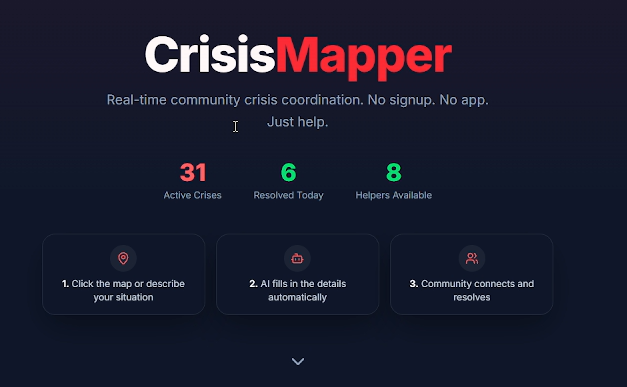
Live Dashboard
-
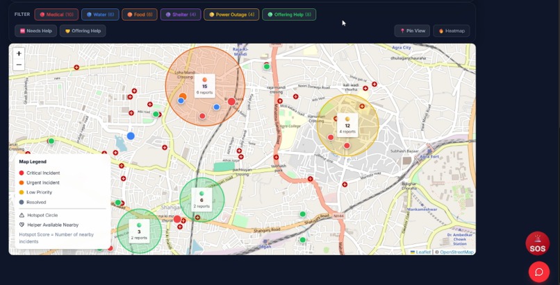
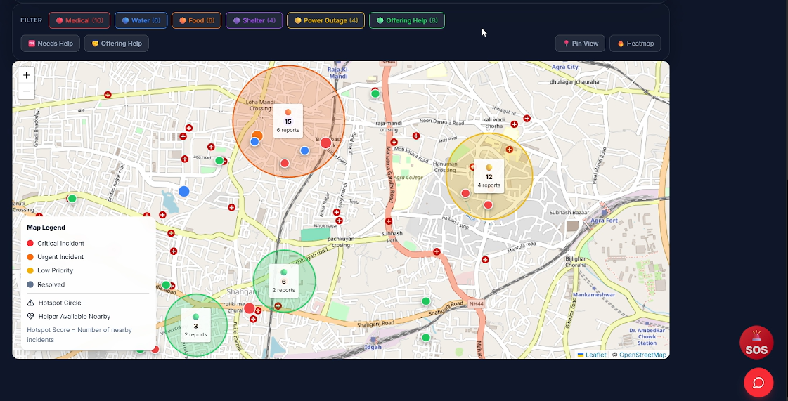
Heatmap
-
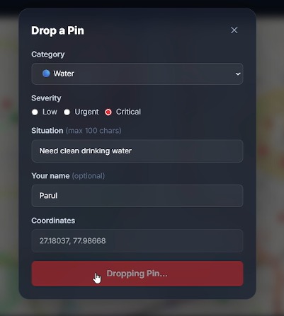
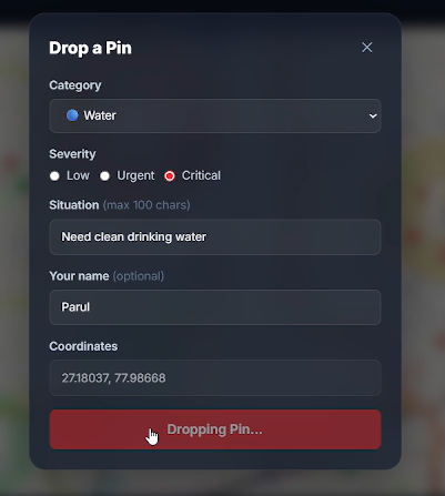
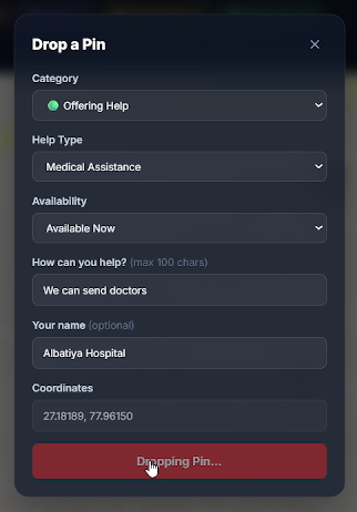
Manual Reporting
-
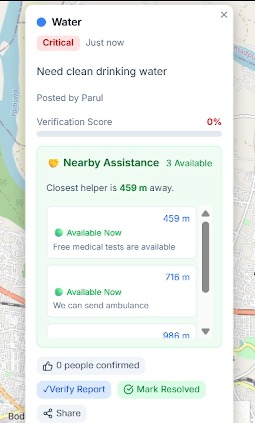
Live pin
-
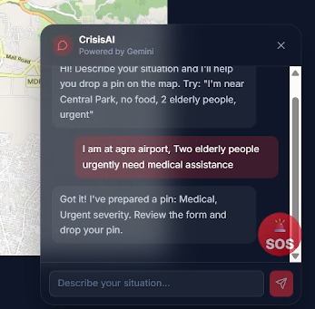
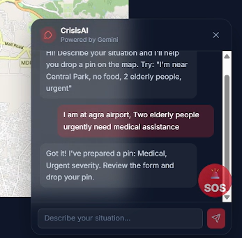
AI based Reporting
-
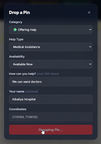
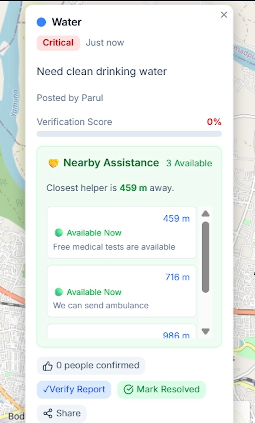
Nearby Assistance
-
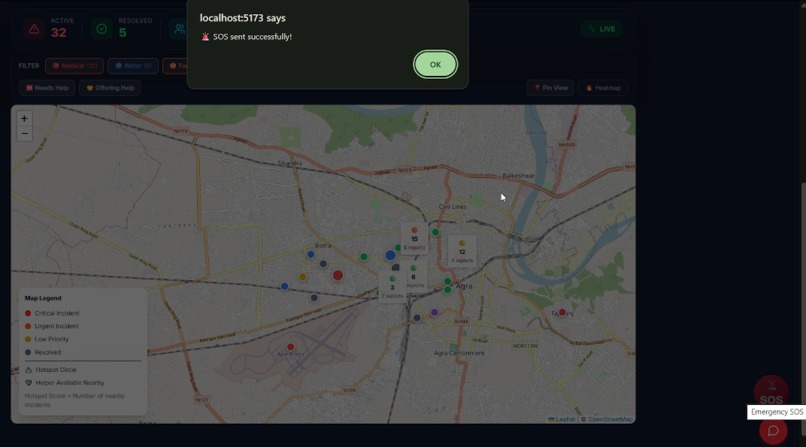
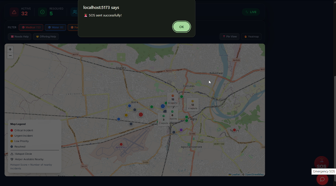
Emergency SOS
-
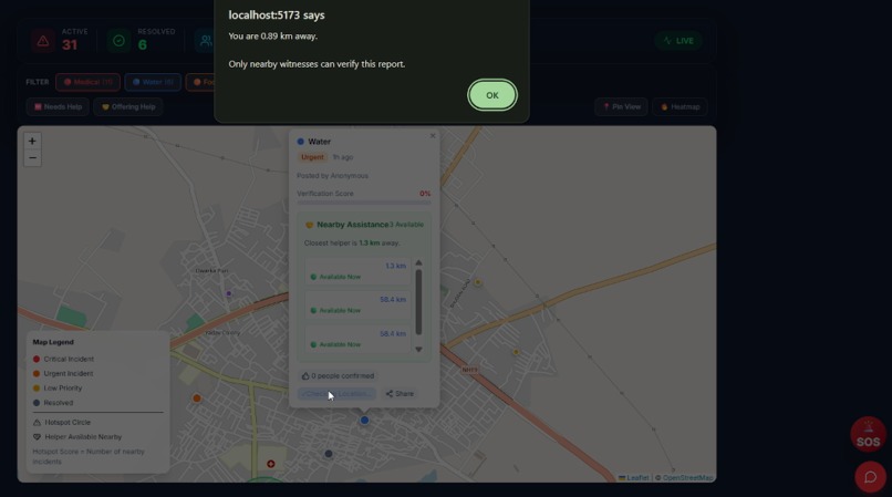
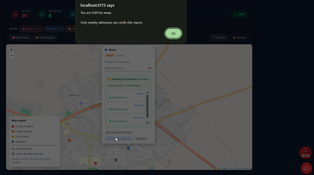
Location Based Verification
🌍 CrisisMapper AI
Inspiration
Natural disasters and emergencies demand quick action, but reporting is often fragmented, difficult to verify, and slow to reach the right people. We wanted to build a platform that empowers communities to report incidents instantly, verify them using location-based evidence, and connect nearby volunteers all while leveraging AI to simplify emergency reporting. Our goal was to create a practical tool that improves situational awareness and enables faster, more trusted community-driven emergency response.
What it does
CrisisMapper AI is an AI-powered community emergency mapping platform that enables users to report incidents, verify emergencies through GPS-based witness confirmation, and coordinate nearby volunteers in real time.
Key features include:
- AI-assisted natural language incident reporting
- Interactive live emergency map
- GPS-based geo-verification
- Community support and verification scores
- Heatmap and hotspot visualization
- Nearby volunteer discovery
- One-tap SOS emergency reporting
- Live statistics dashboard
- Real-time synchronization using Firebase
How we built it
We built CrisisMapper AI using React, Vite, Tailwind CSS, and React Leaflet to create an interactive mapping experience powered by OpenStreetMap.
For the backend, we used Firebase Firestore to synchronize incidents, support votes, helper registrations, and verification data in real time. Firebase Anonymous Authentication provides unique user identities while keeping the reporting process frictionless.
To simplify emergency reporting, we integrated the Google Gemini API, which converts natural language descriptions into structured incident reports by identifying categories, severity levels, and descriptions.
Additional features such as hotspot detection, nearby helper recommendations, verification scoring, automatic incident expiry, and shareable incident links were implemented to create a complete emergency response workflow.
Challenges we ran into
One of our biggest challenges was designing a reliable real-time synchronization system that updates every connected user without requiring page refreshes.
Implementing GPS-based witness verification required accurate geographic distance calculations while preventing duplicate verifications. We also had to ensure anonymous users could not repeatedly support the same incident.
Another challenge was building an AI workflow that consistently extracted structured emergency information from natural language while keeping the reporting experience simple and fast.
Balancing real-time performance, map rendering, and an intuitive user interface across desktop and mobile devices also required careful optimization.
Accomplishments that we're proud of
We're proud of building a platform that combines multiple technologies into a single, cohesive emergency response system.
Highlights include:
- AI-assisted emergency reporting
- Real-time collaborative mapping
- GPS-based witness verification
- Dynamic hotspot and heatmap visualization
- Nearby volunteer coordination
- Live synchronization across multiple users
- One-tap SOS reporting
- Shareable incident links
- Anonymous authentication to reduce misuse
Most importantly, we built a solution that demonstrates how AI and community collaboration can work together to improve disaster response.
What we learned
This project strengthened our understanding of real-time application development, cloud databases, AI integration, geolocation services, and interactive mapping.
We learned how to design scalable Firebase data models, integrate AI into meaningful workflows instead of using it as a standalone chatbot, optimize React applications with continuously updating data, and build location-aware features that improve trust and usability.
Beyond the technical aspects, we also gained valuable insights into designing technology for real-world emergency scenarios where speed, reliability, and user experience are equally important.
What's next for CrisisMapper AI
We plan to expand the platform with several advanced capabilities, including:
- AI-based image verification for uploaded incident photos
- Offline reporting with automatic synchronization
- Push notifications for nearby emergencies
- SMS emergency alerts
- Government and disaster management dashboards
- Rescue route optimization
- Predictive disaster analytics
- Drone-assisted monitoring
- Multi-language support for wider accessibility
Our long-term vision is to evolve CrisisMapper AI into a scalable community-driven emergency response platform that can support citizens, volunteers, NGOs, and public agencies during disasters.
Built With
- firebase
- firestore
- gemini
- github
- javascript
- leaflet.js
- openstreetmap
- react
- tailwind
- vite

Log in or sign up for Devpost to join the conversation.