-
-
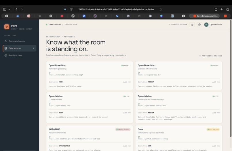
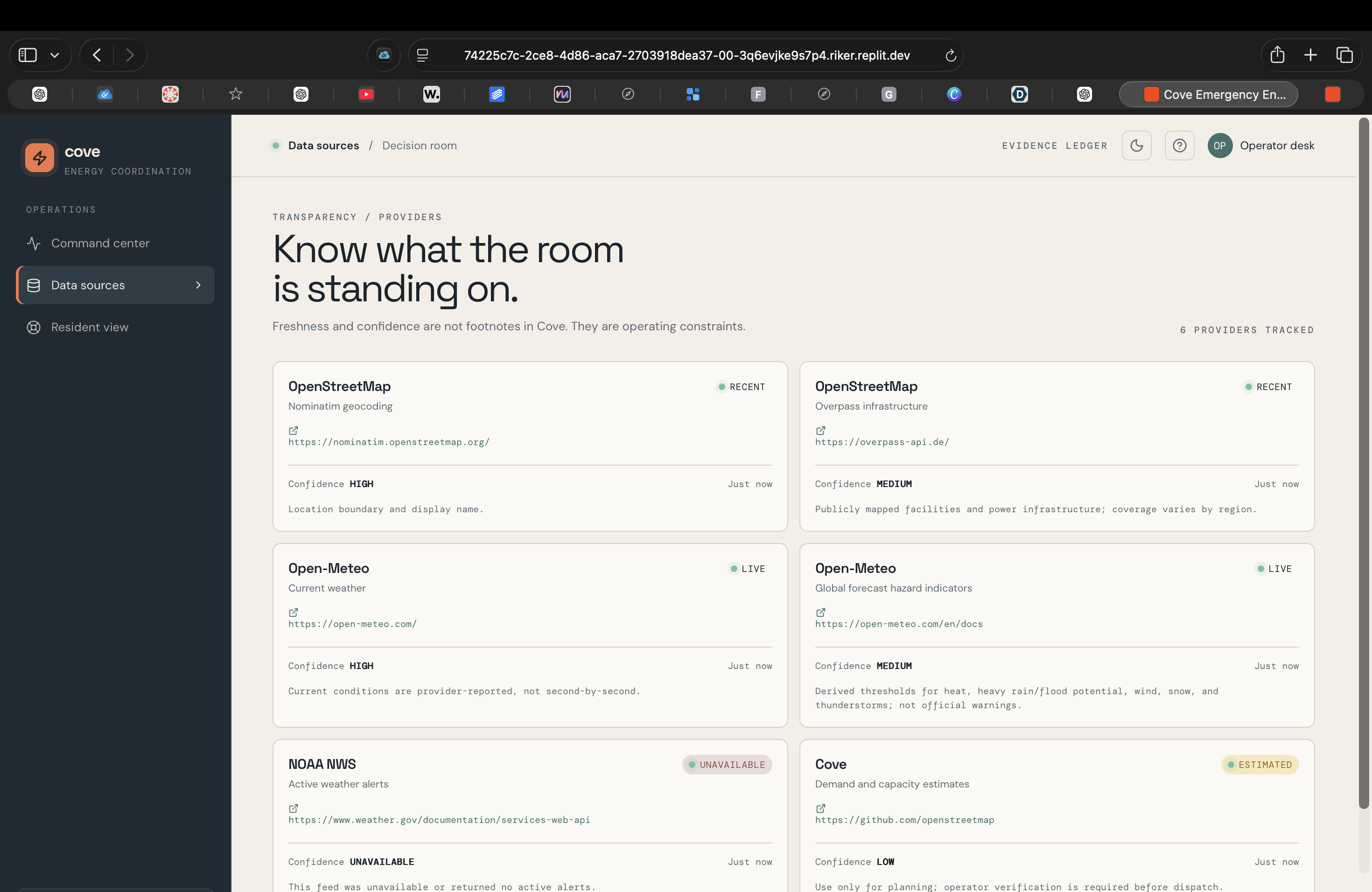
Evidence Ledger shows what Cove is standing on: each source’s freshness, confidence, and availability before decisions are made.
-
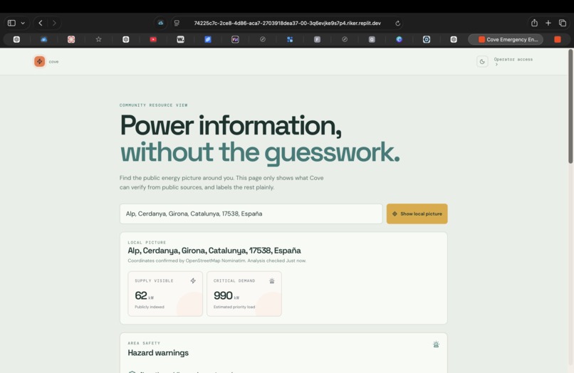
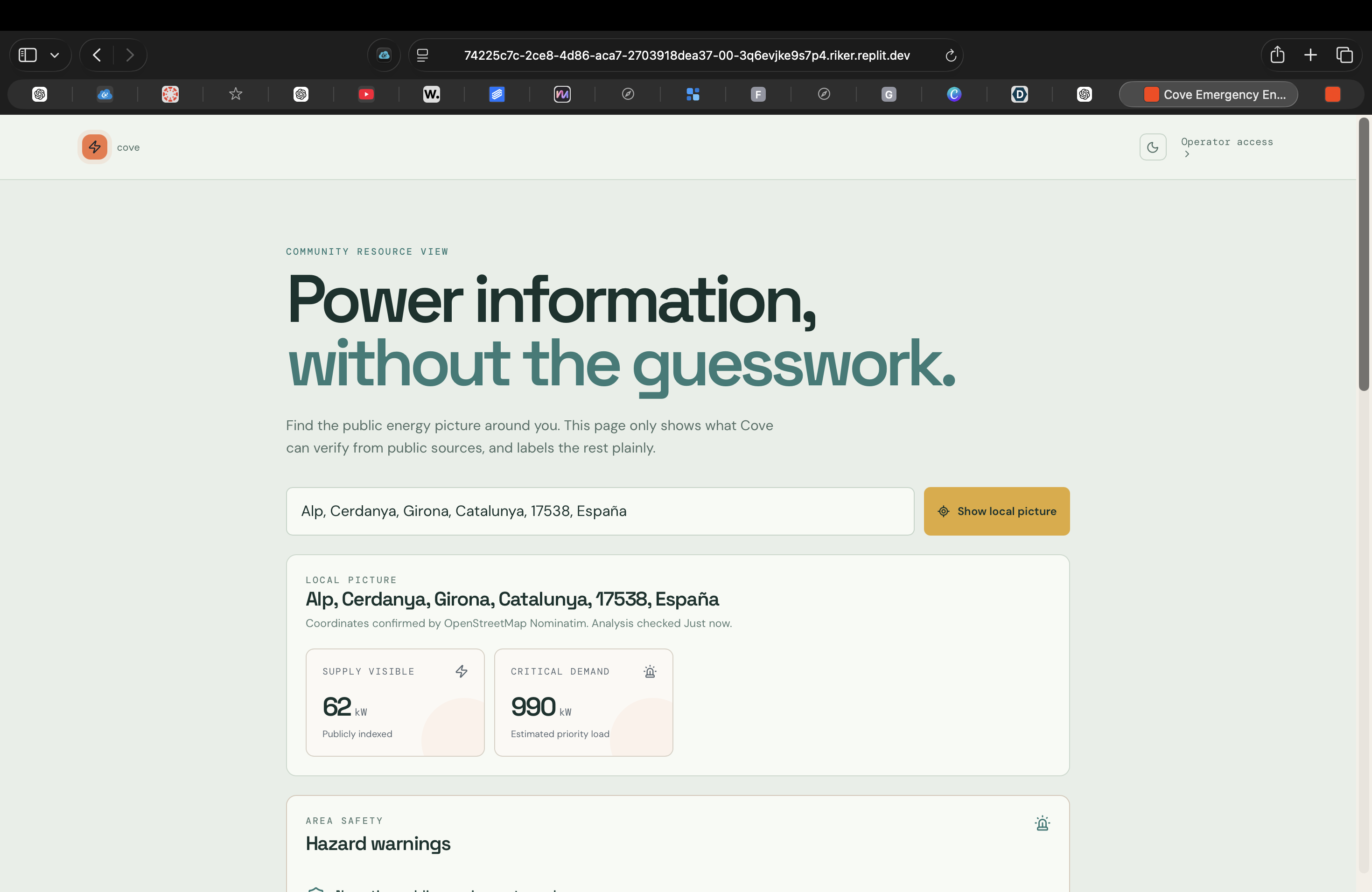
Resident View removes operator complexity so people can quickly understand local conditions and find nearby help.
-
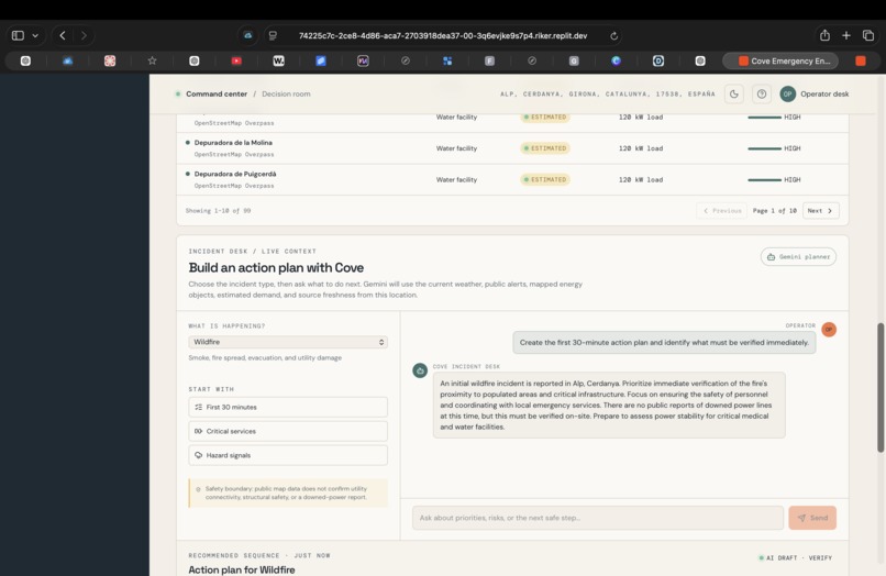
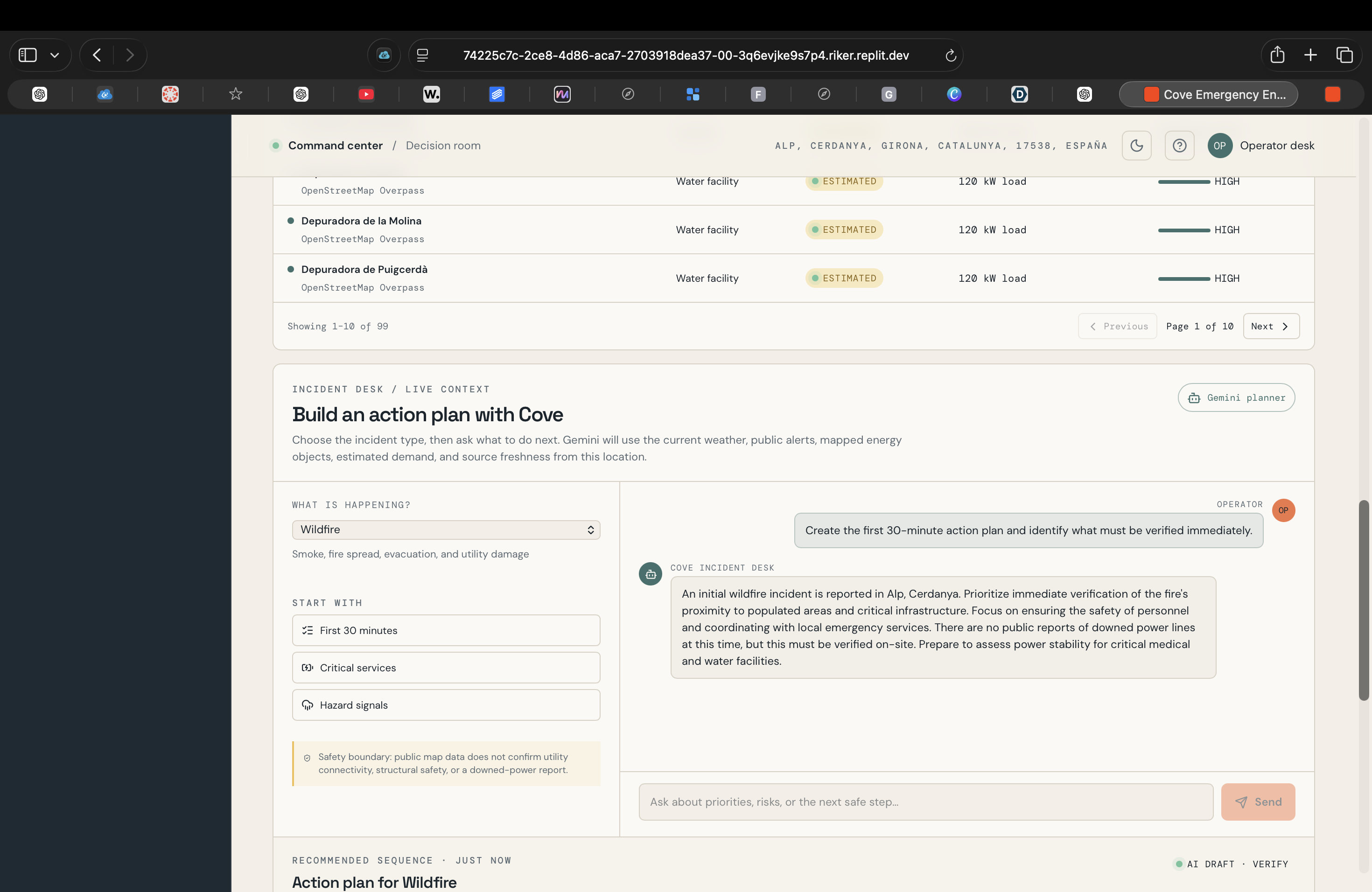
Cove Incident Desk turns the local snapshot into an AI-assisted emergency action plan grounded in the evidence available.
-
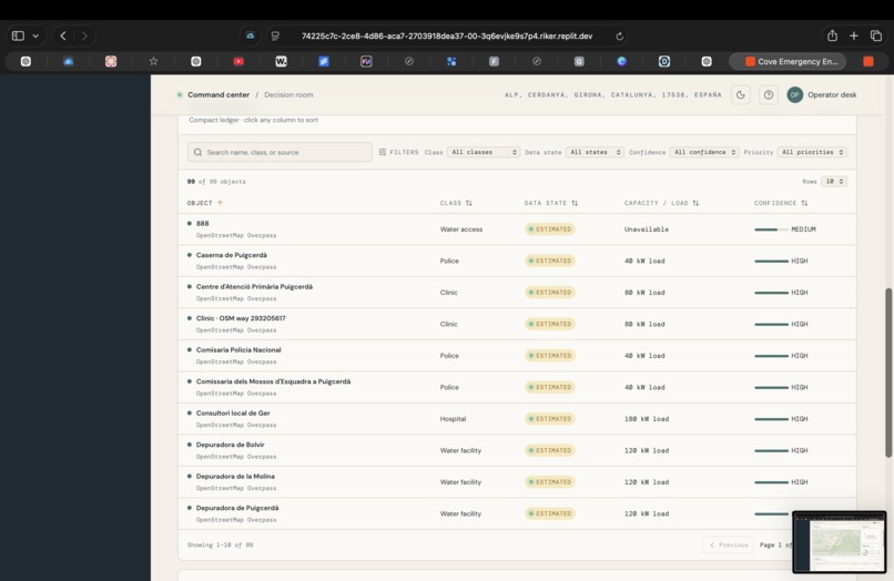
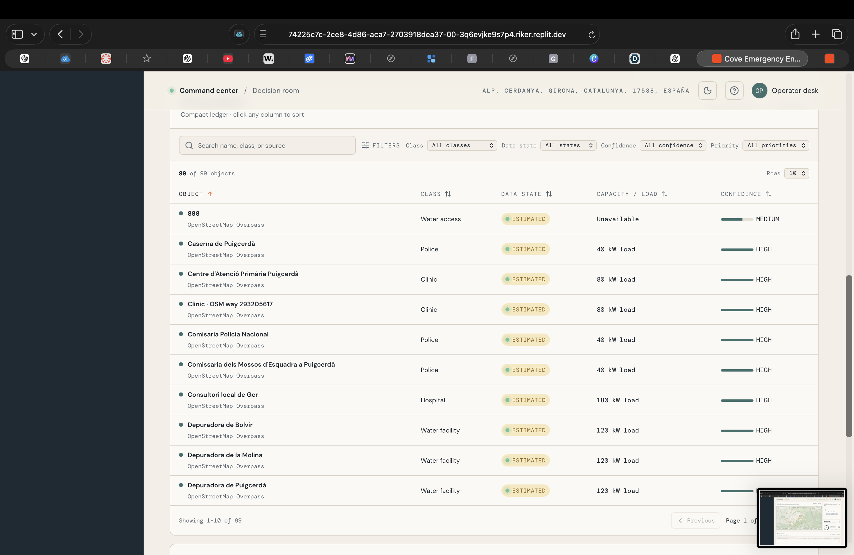
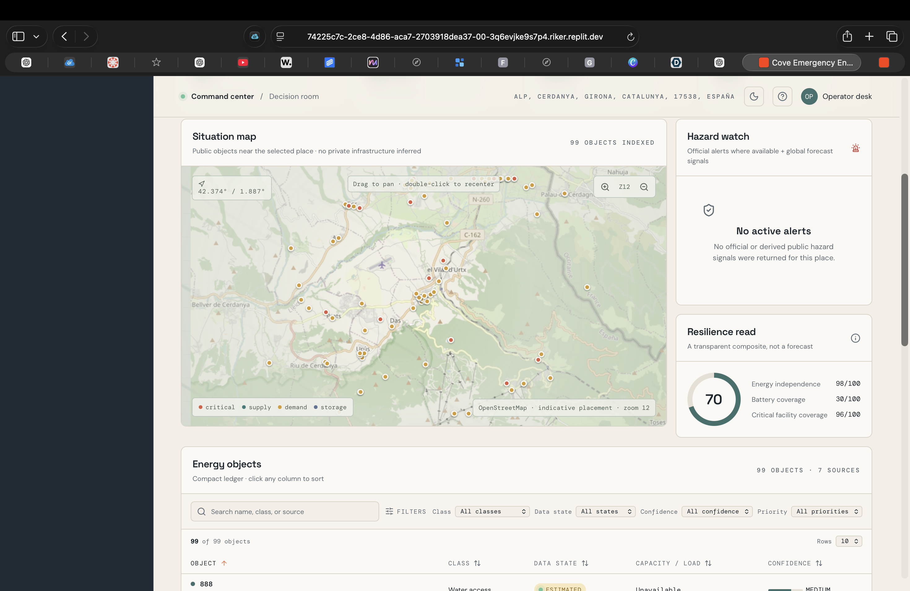
Energy Objects makes infrastructure auditable, showing source, confidence, data state, and estimated capacity for each asset.
-
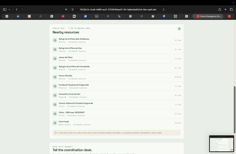
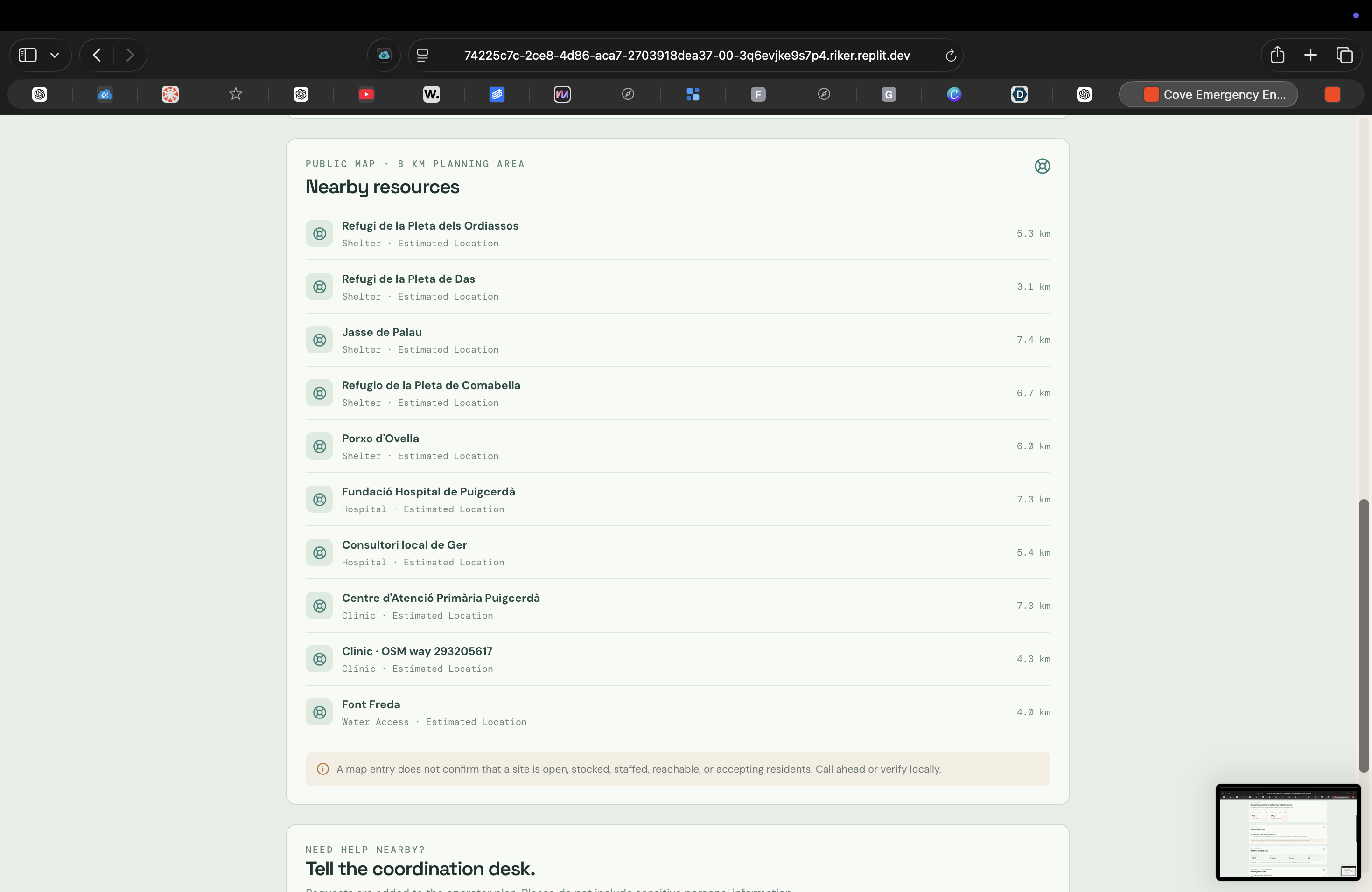
Nearby Resources lists practical help around the user—medical sites, shelters, water, charging, and more—with distance.
-
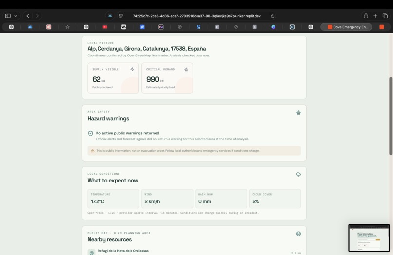
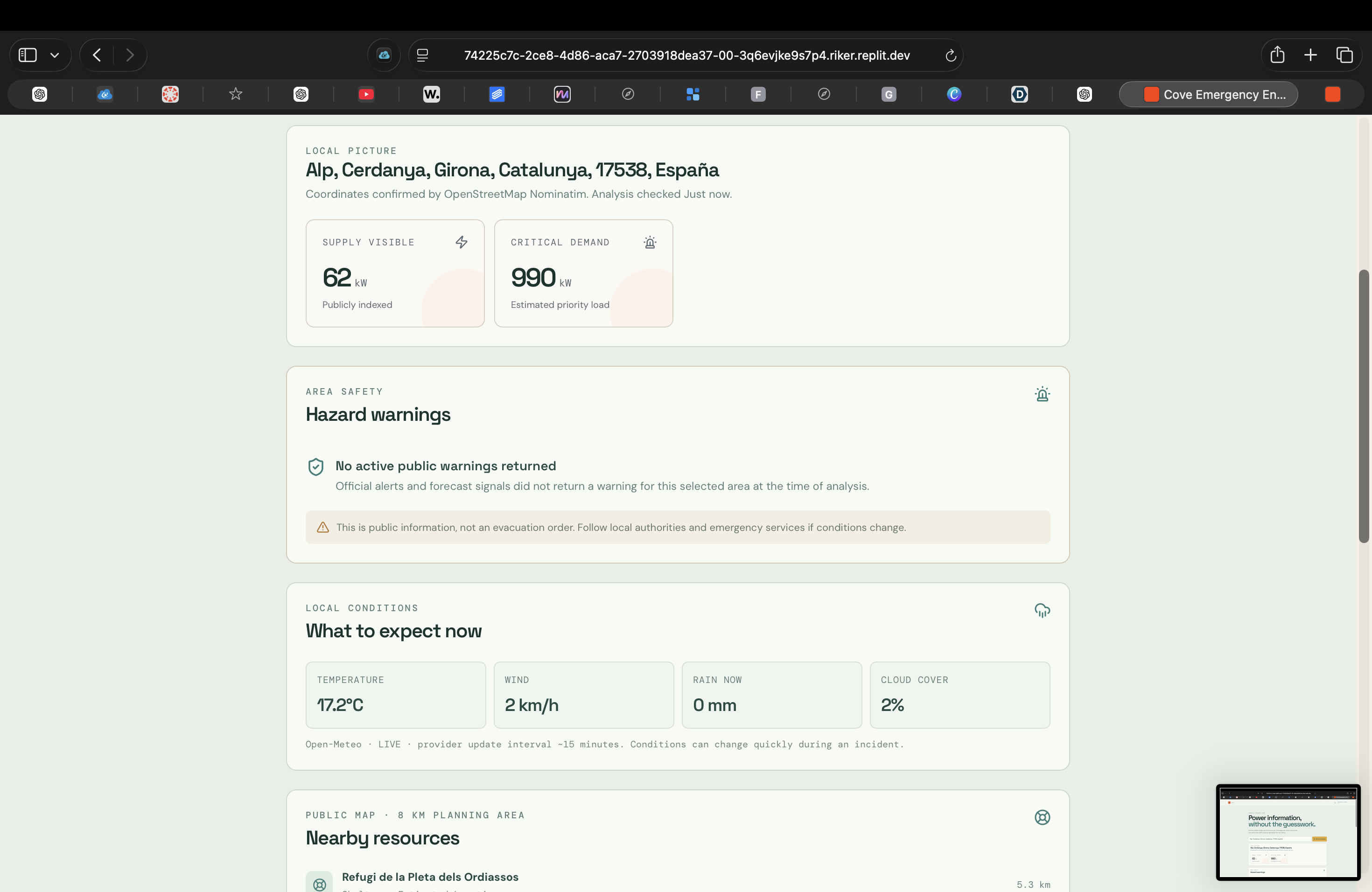
Residents get a simple local status snapshot with current hazards, key conditions, and nearby resource availability.
-
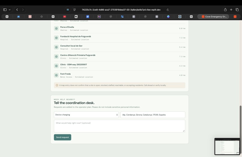
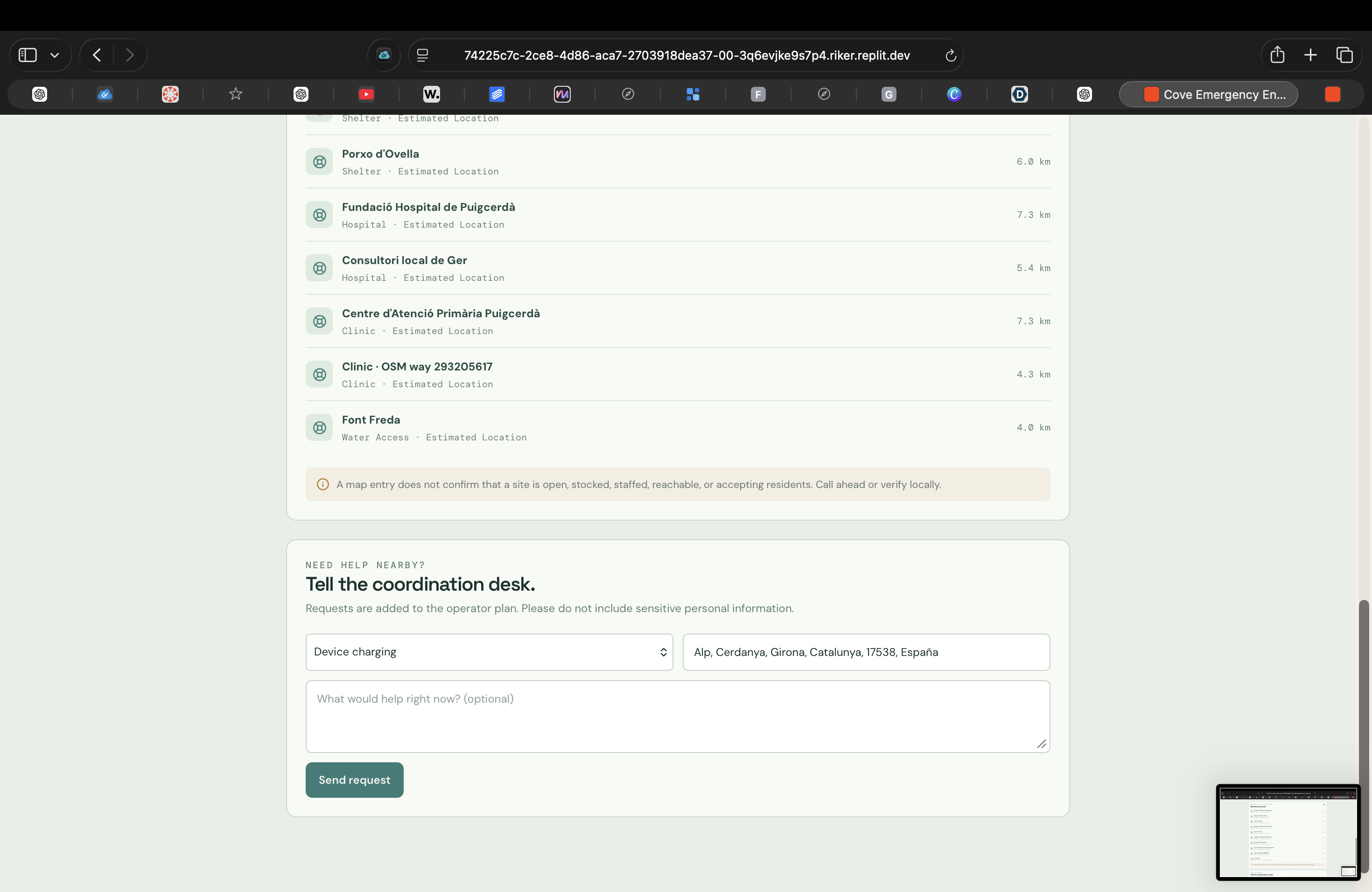
Residents can send the coordination desk a resource request so urgent local needs can be communicated directly.
-
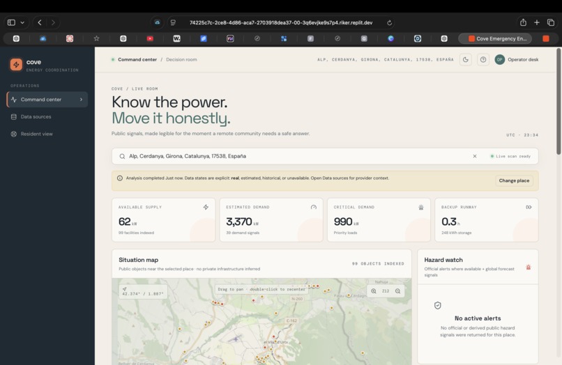
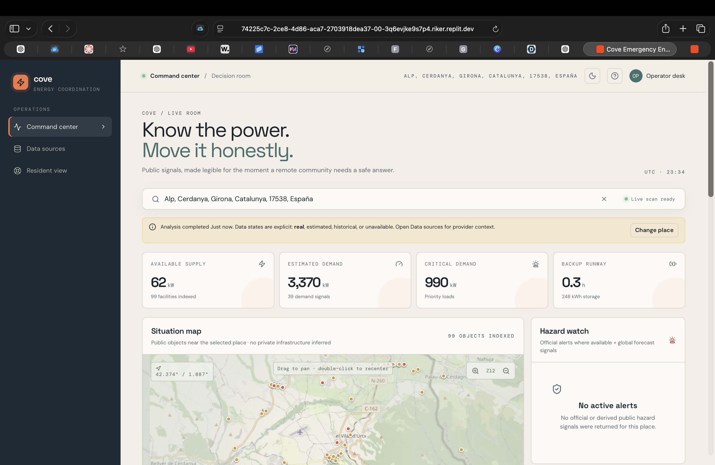
Command Center turns a real location into a quick view of supply, demand, critical load, backup runway, and local risk.
-
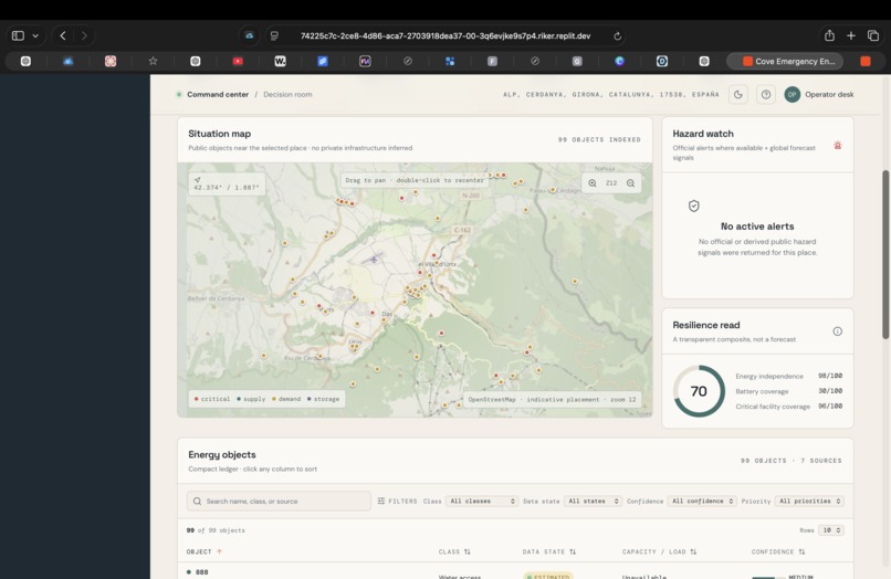
Situation Map combines nearby critical infrastructure, hazards, and energy resources into one location-based operating picture.
Inspiration
COVE started from a simple problem: during an emergency, useful information is often available, but it is scattered across different maps, weather services, alerts, and public databases. For remote islands and communities with limited backup resources, losing time finding and comparing that information can make a bad situation worse. We wanted to create one place where emergency operators could quickly understand what is happening, what resources are nearby, and what information they can actually trust.
What it does
COVE is an emergency energy coordination platform for island and remote communities. An operator can search a real location, and COVE builds a local operating picture using nearby infrastructure, weather conditions, official alerts, and estimated energy information.
The platform shows critical facilities and resources on a map, estimates supply, demand, critical demand, and backup runway, and clearly labels information as real, estimated, historical, or unavailable. COVE also includes an AI-powered Incident Desk that uses the collected data to generate an ordered emergency action plan while showing both the evidence it used and what still needs human verification.
A separate Resident View gives community members a simpler way to see nearby medical facilities, shelters, water, charging resources, hazards, and other useful information.
How we built it
We built COVE with a React and TypeScript frontend and an Express backend.
Our backend connects several public data sources:
- OpenStreetMap Nominatim for geocoding locations
- OpenStreetMap Overpass for nearby infrastructure
- Open-Meteo for current weather and forecasts
- NOAA and the National Weather Service for official alerts when available
We normalize those different sources into one structured data model and use our own calculations to create COVE's energy and resilience estimates.
For the Incident Desk, we use Gemini 2.5 Flash. Instead of letting the AI generate its own facts, we send it only the structured information COVE has already collected. This lets the AI focus on analyzing the situation and creating an action plan based on actual available evidence.
Challenges we ran into
One of our biggest challenges was combining several APIs that all return information in completely different formats. We had to normalize locations, infrastructure, weather, alerts, and energy-related data so they could work together inside one system.
Another challenge was incomplete public data. Many mapped facilities do not include exact energy capacities or operating information. Instead of hiding this problem, we designed COVE to clearly show confidence levels and whether a value is real or estimated.
We also had to make the AI useful without allowing it to sound more certain than the data actually supported. That led us to build the Incident Desk around evidence, limitations, and human verification rather than treating AI as the final decision-maker.
Accomplishments that we're proud of
We are especially proud that COVE works with real locations instead of being limited to one hard-coded demo island. The platform can build an emergency picture around different communities wherever enough public data is available.
We are also proud of the transparency built into the system. Operators can see where information came from, how reliable it is, and what COVE still does not know.
Finally, we are proud of how the Incident Desk combines multiple parts of the project. It takes the location-specific infrastructure, weather, hazards, and energy information already collected by COVE and turns it into an actionable emergency plan without hiding the uncertainty behind the recommendation.
What we learned
We learned that building a useful AI system is not just about connecting an AI model. The quality of the information given to the model matters just as much as the model itself.
We also learned how difficult it can be to work with real public data. Information can be missing, outdated, or inconsistent between sources, so designing around uncertainty became an important part of the project.
From a product perspective, we learned that emergency operators and residents need very different interfaces. Operators need detailed evidence and technical information, while residents need clear answers about what is happening nearby and where they can find help.
What's next for COVE
Our next step would be connecting COVE to more live energy and infrastructure data so the system could rely less on estimates. We would also like to build a persistent operator request queue so resident resource requests can be tracked, prioritized, and resolved in real time.
Longer term, we could add more regional emergency-data providers, offline support for areas with damaged connectivity, stronger accessibility information, collaboration between multiple emergency operators, and tools for comparing how different emergency scenarios would affect the same community.
The goal is to move COVE from a decision-support prototype into a platform that could help communities prepare for emergencies before they happen and coordinate resources more clearly when they do.
Built With
- 2.5
- api
- apis
- express.js
- flash
- gemini
- national
- noaa
- node.js
- nominatim
- open-meteo
- openstreetmap
- overpass
- query
- react
- rest
- service
- tanstack
- typescript
- vite
- weather

Log in or sign up for Devpost to join the conversation.