-
-
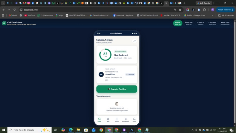
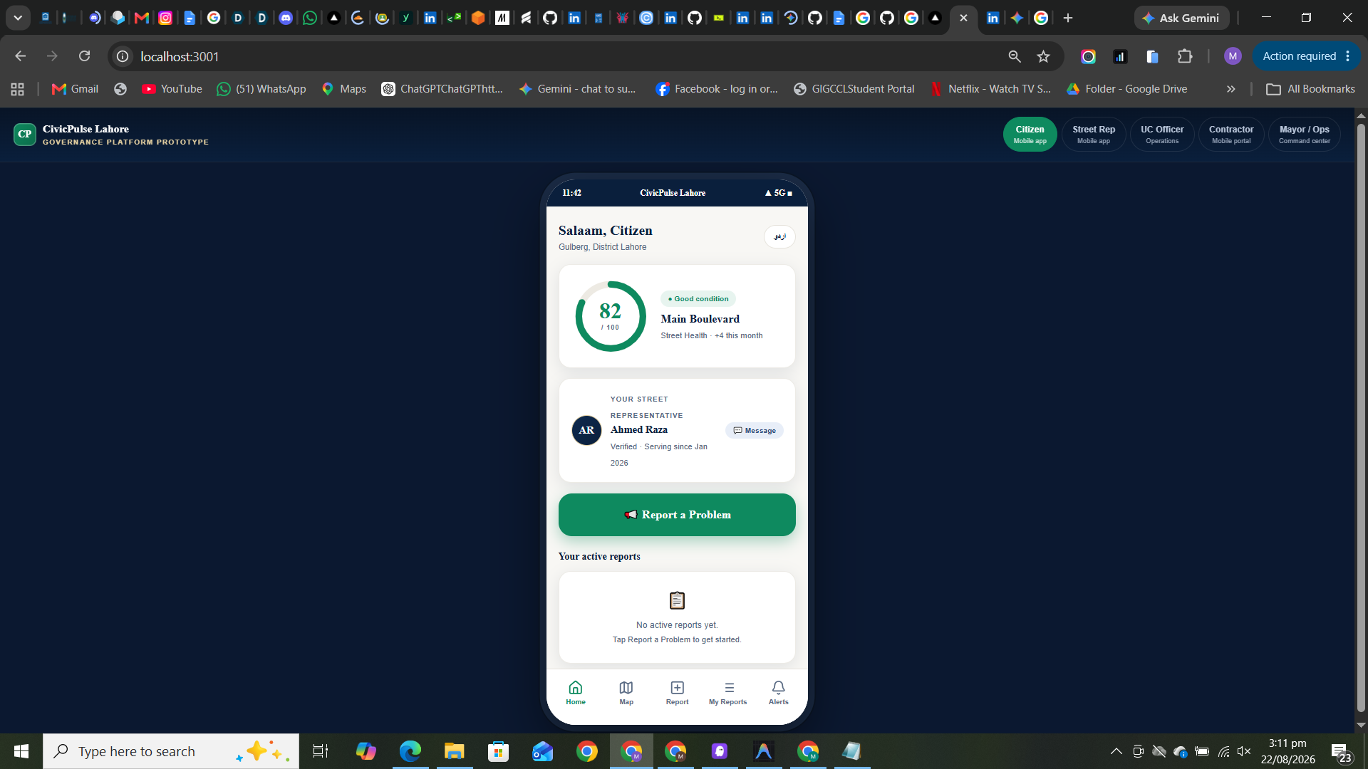
Here is the citizen dashboard where the citizen can report a problem track it and also view open problems etc
-
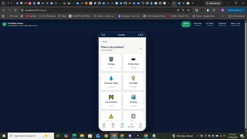
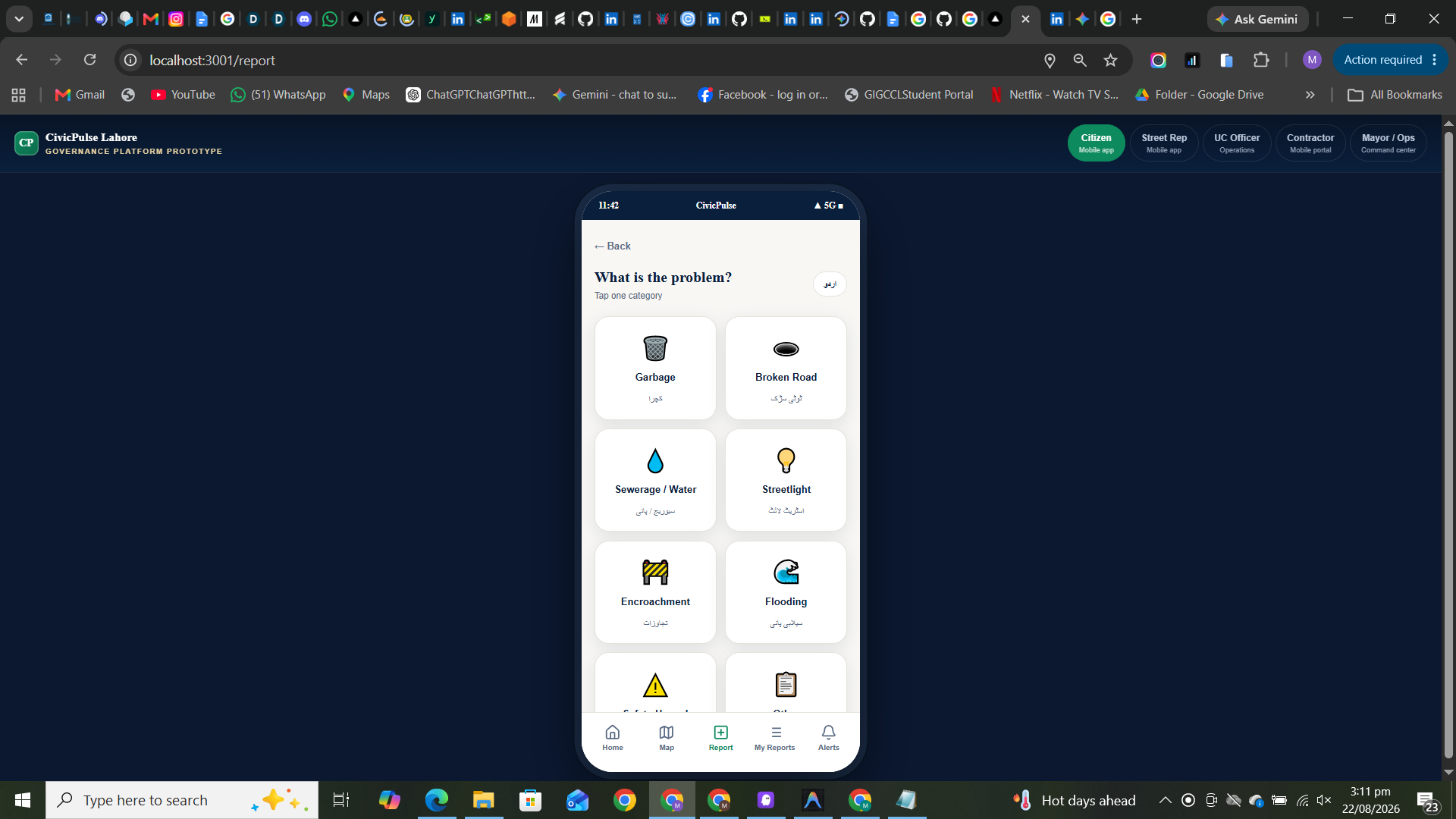
ths is the interface where user can select his problem type
-
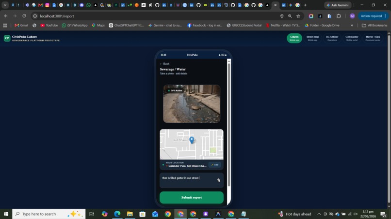
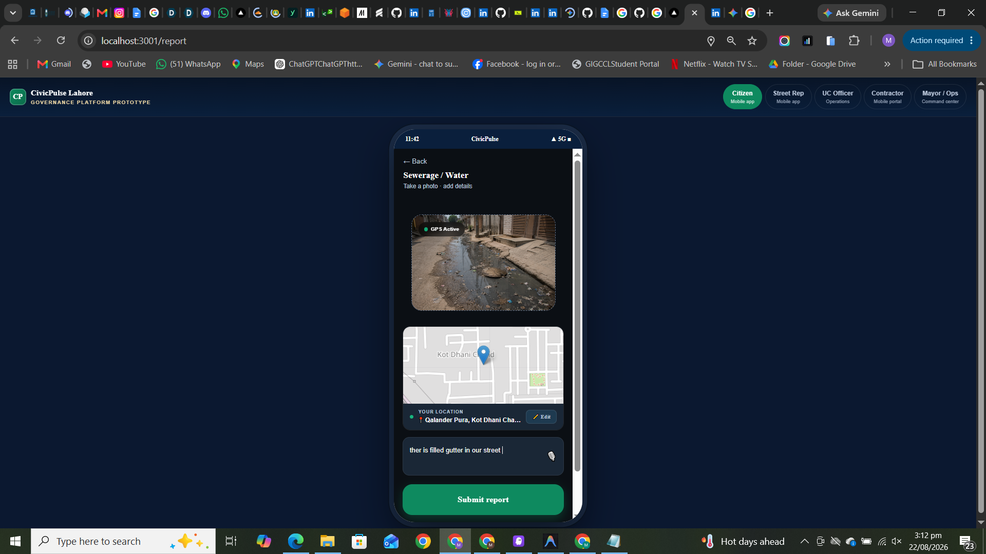
here user is going to upload a picture of complain area as an evidence and ai autodetects the location time and coordinates
-
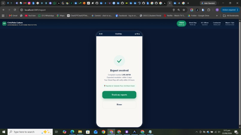
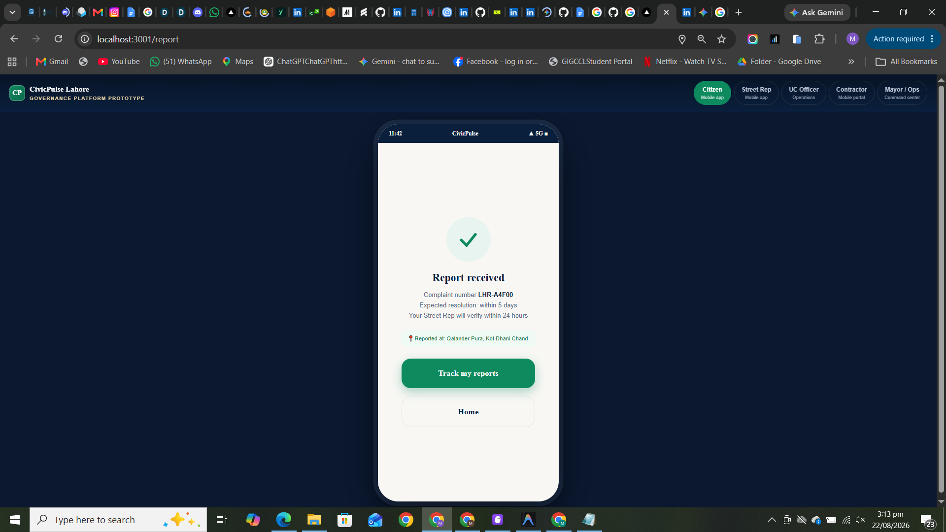
here the report submitted successfully and the report number is assigned
-
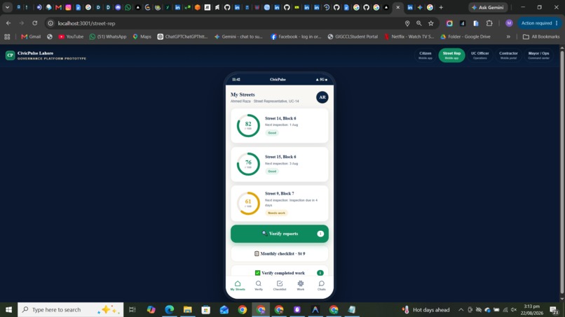
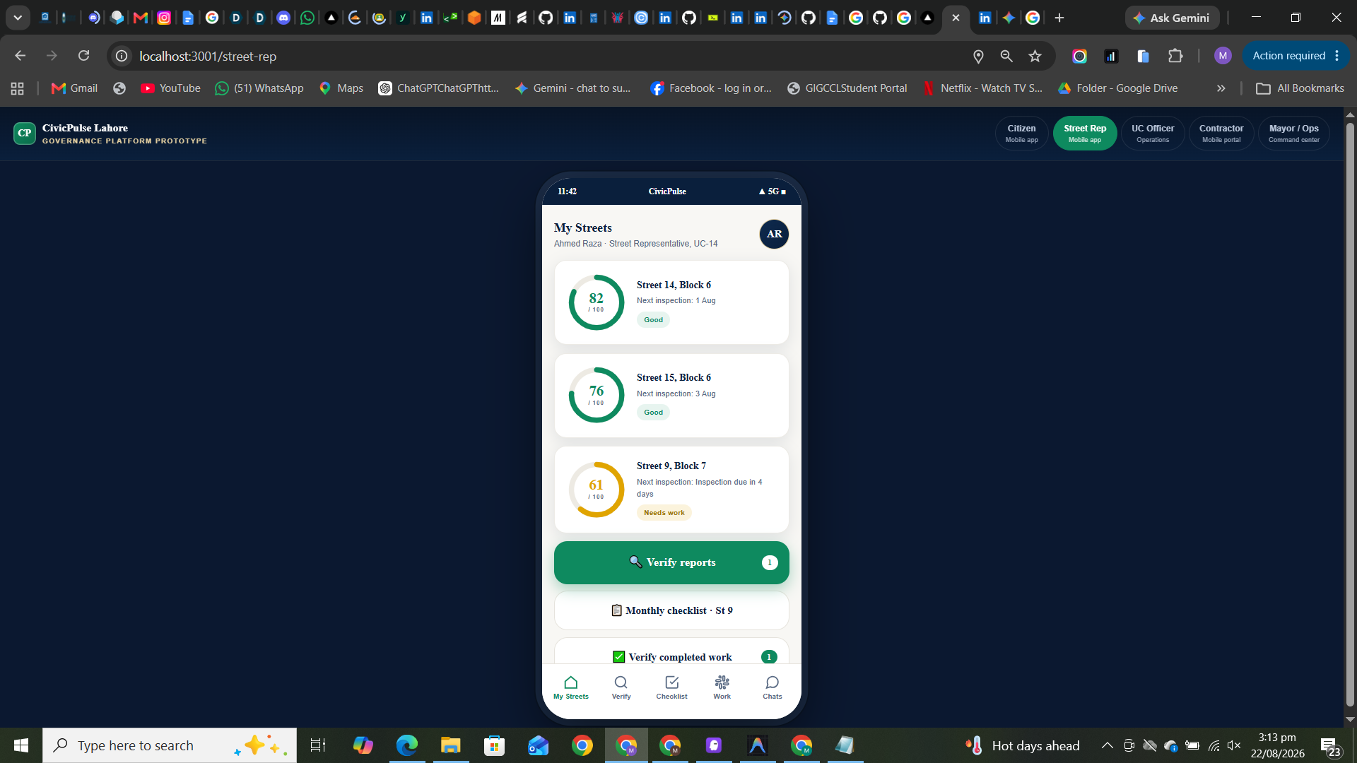
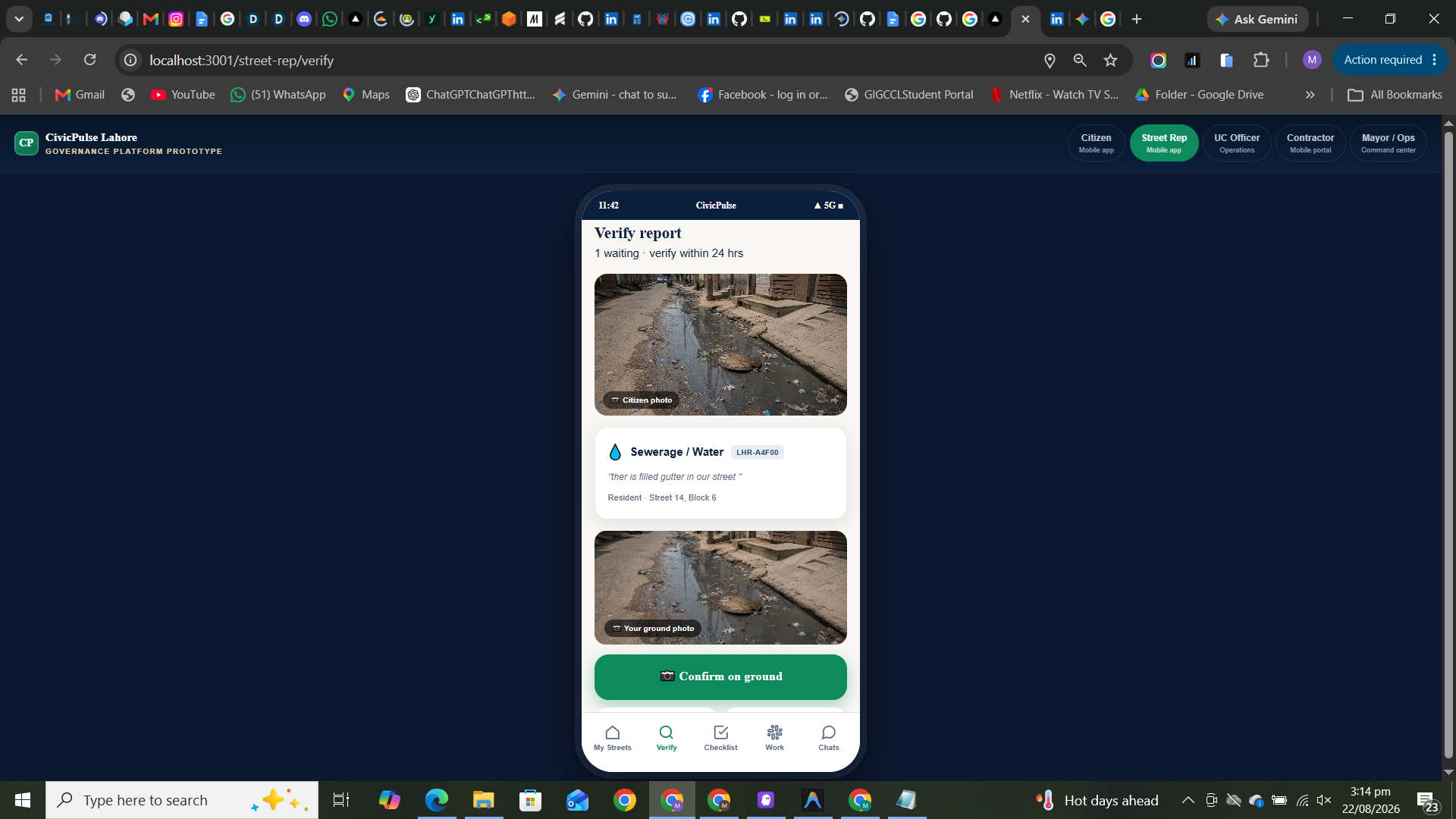
this is the street representatice dashoard who can verify the report by going on exact location and also verify the solution of problem
-
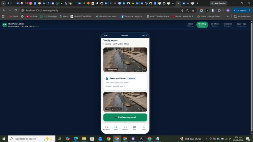
here he also needs to upload the picture for the problem of citizen to verify he can also reject the problem if it is wrong or fake
-
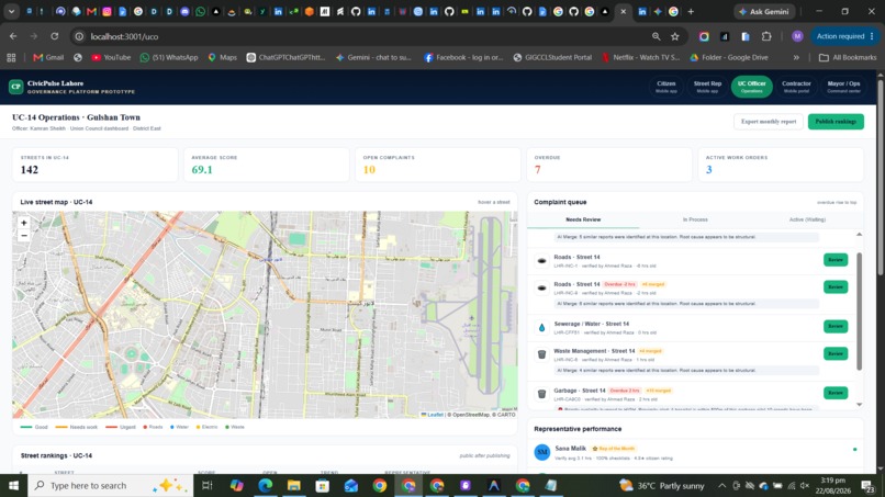
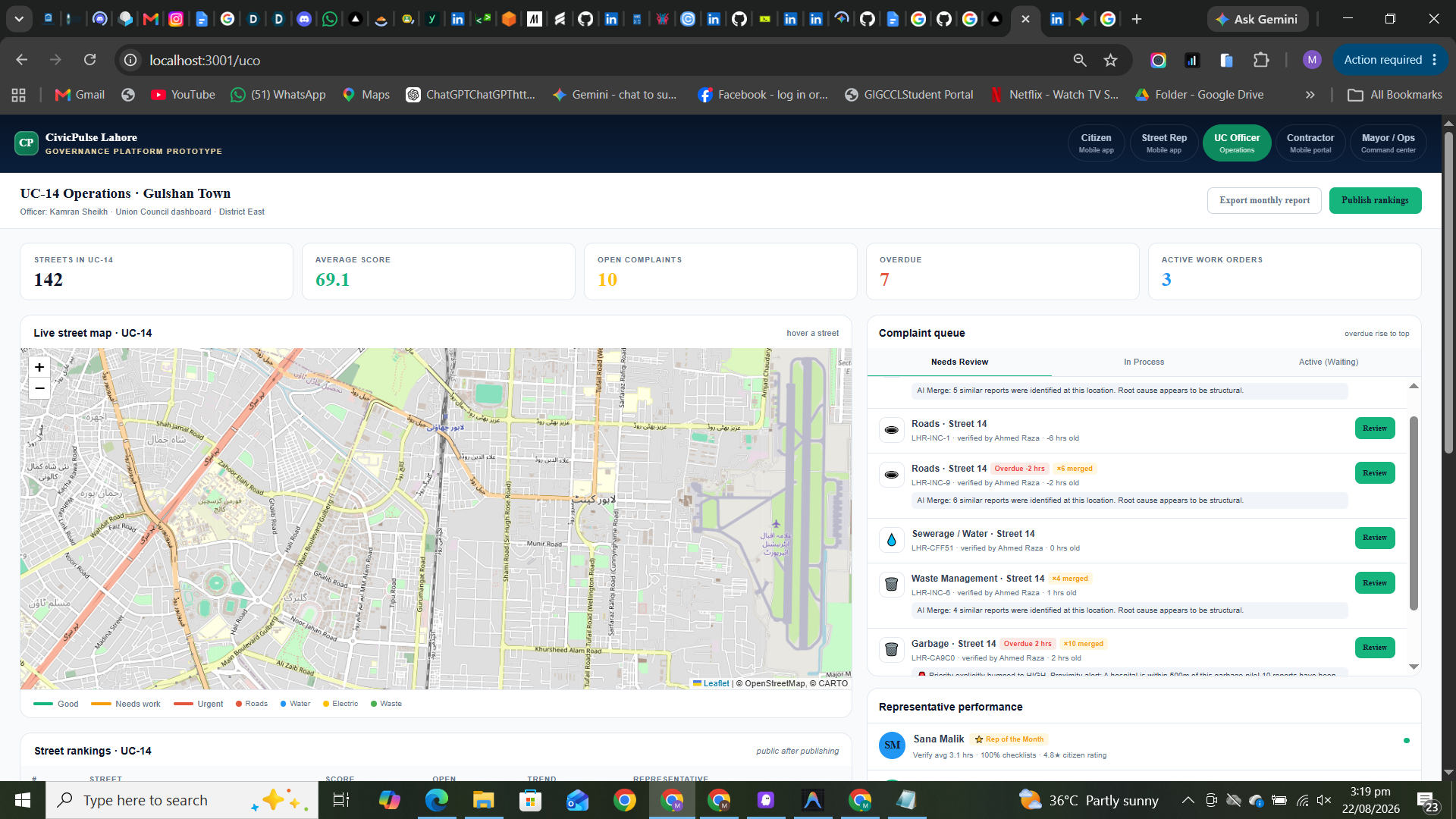
this is Union Council dashboard where they see the approved reports and generate work order and a map to view where are the problems exist
-
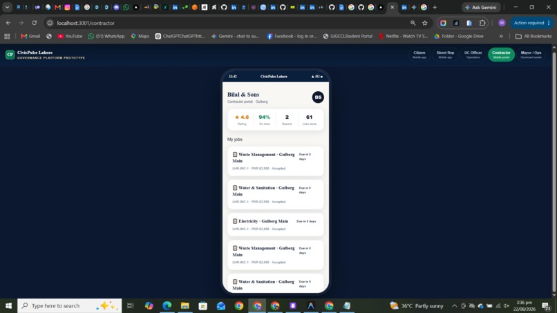
thsi is contractor dashboard where he can see the details of the issue and the work order recieved from uc
-
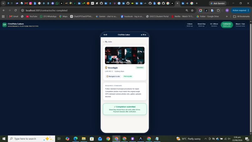
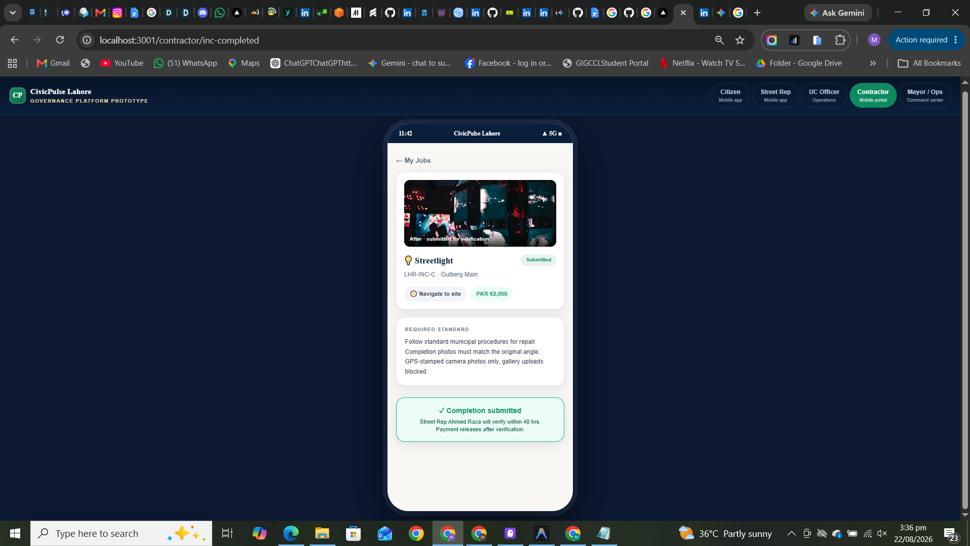
here after resolving the issue contractor needs to take and upload the picture of the solved problem and his payment is still on hold
-
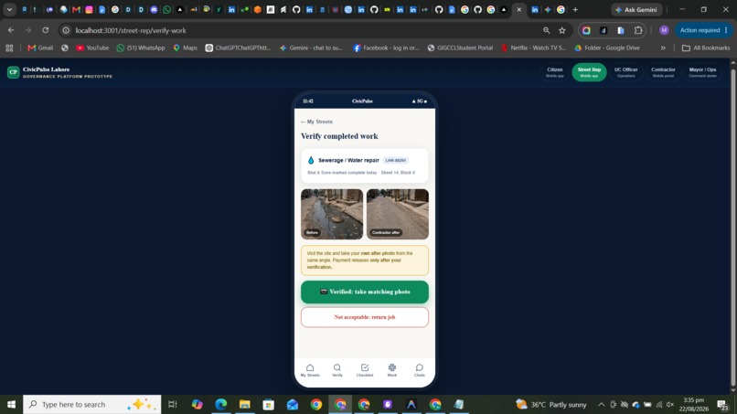
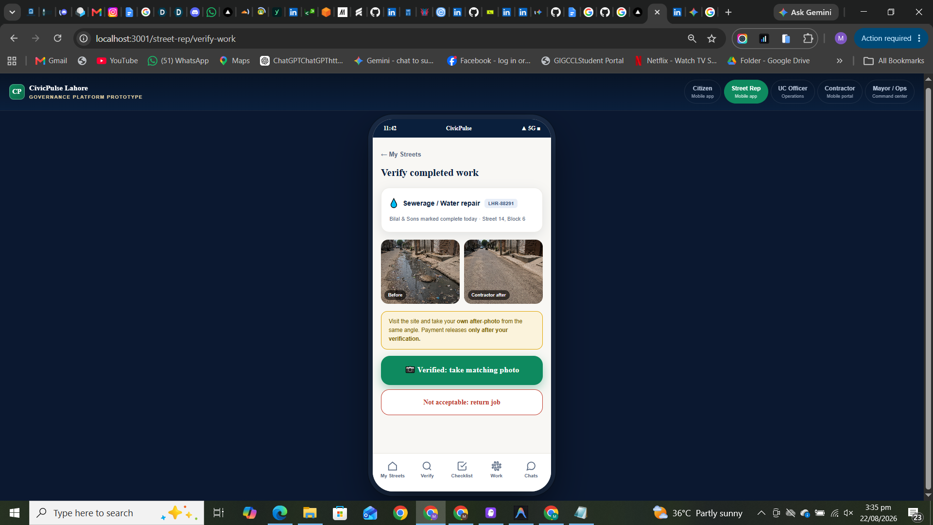
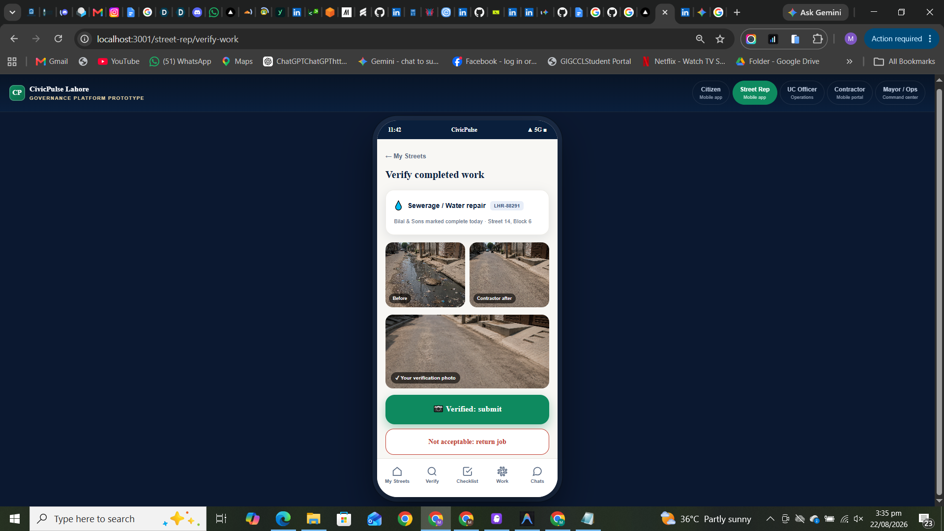
here when contractor complete the job then street representative needs to verify by uplading a picture and visiting site he can also reject
-
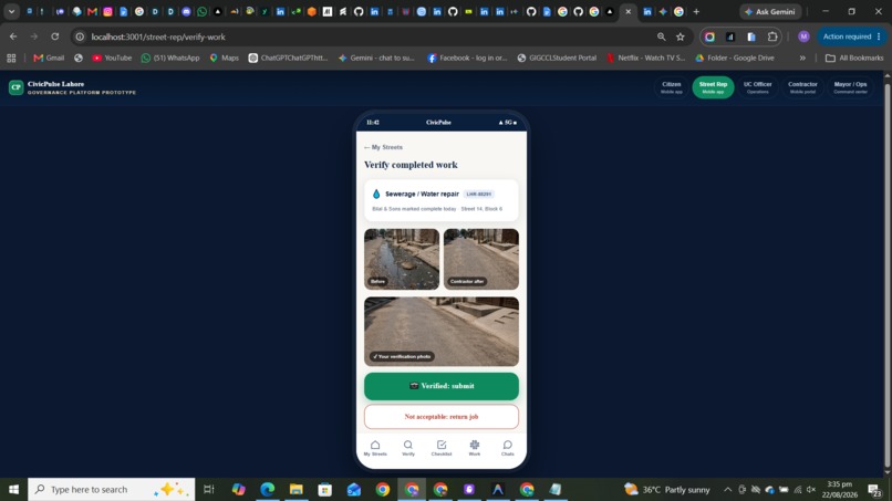
here street representative uploads the picture and if rejects payments keep on hold and the uc get notified
-
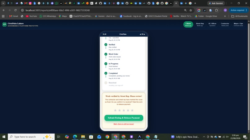
here is the citizen report track he can track report with each step filled date and time and also verify when the job is done
-
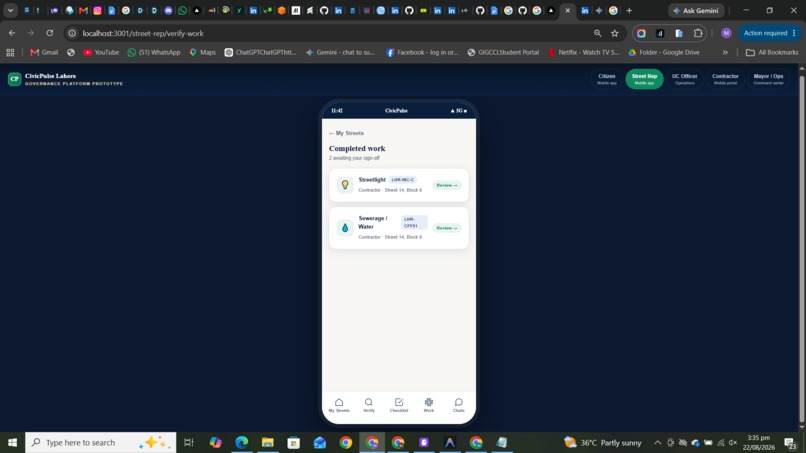
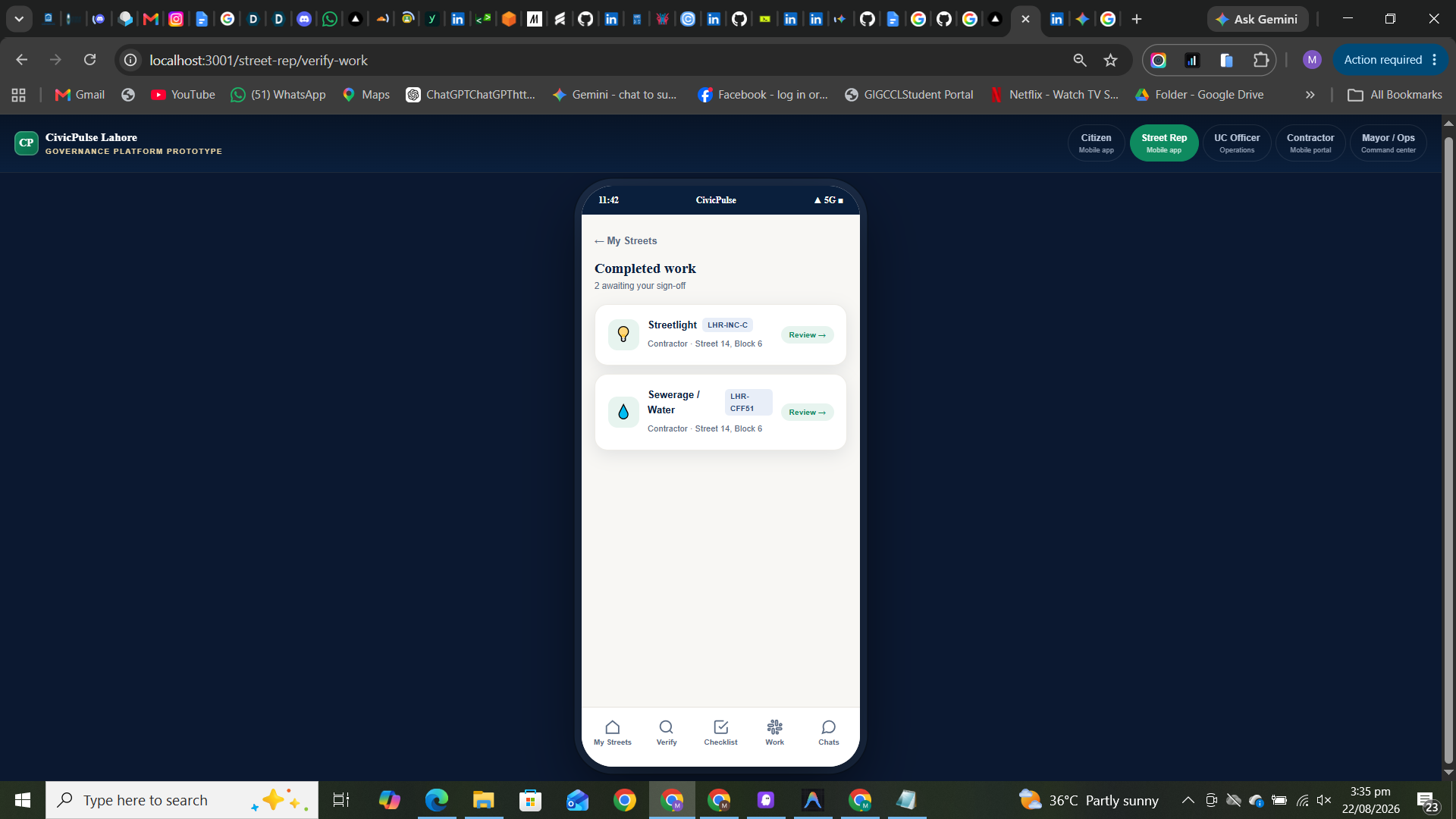
and here is the dashboard where street man can view the jos that are fulfilled
-
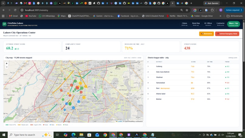
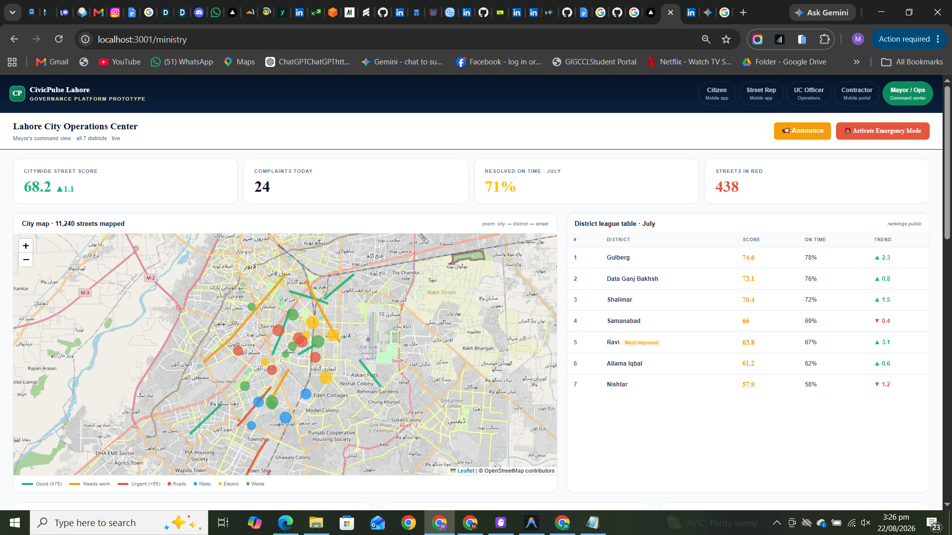
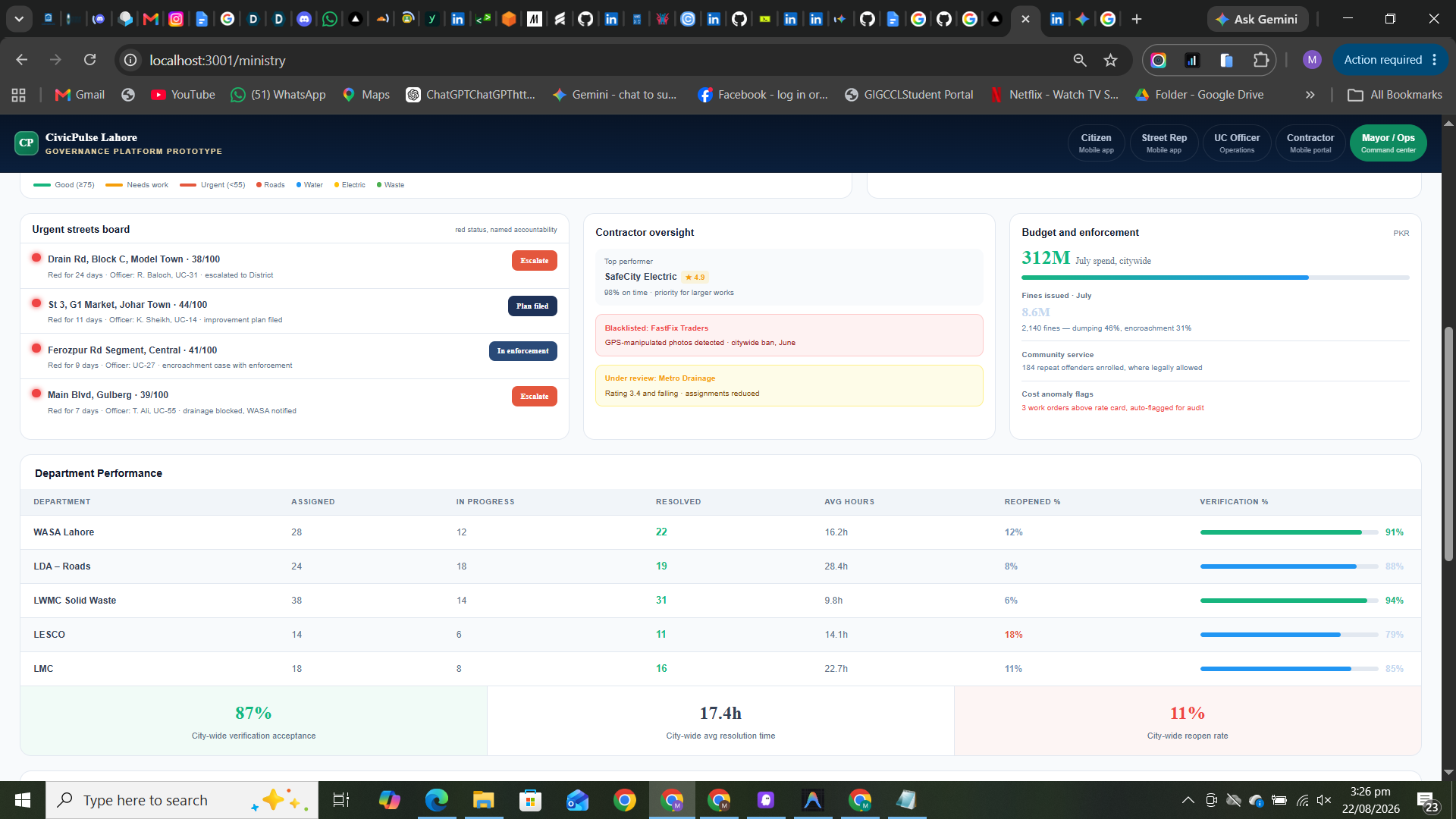
this is the mayor dashboard where mayor can watch all uc scores and all areas score with map and marks pointing the issue and his budget
-
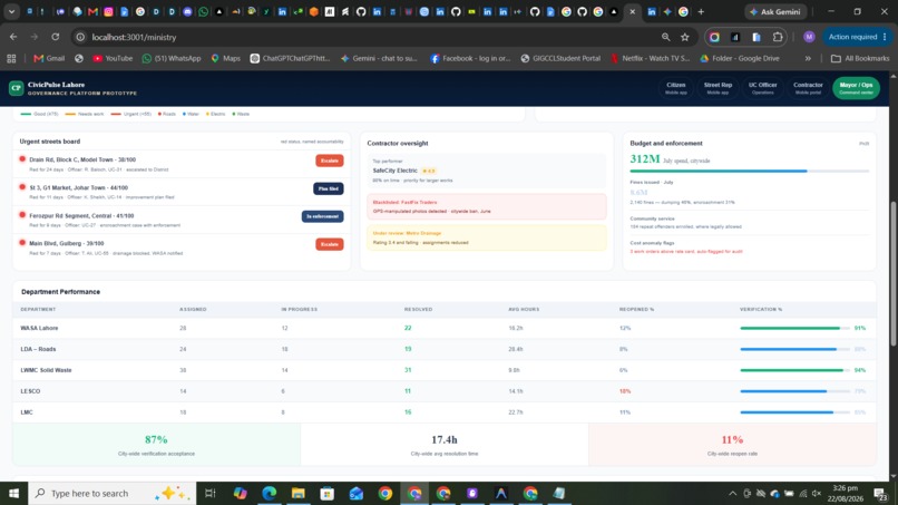
can also which uc solved how many problems and how many solved in process and all contractor oversight


Inspiration
Across rapidly growing urban centers, we noticed a recurring cycle of civic failure: citizens report issues (like potholes or open sewage) into a bureaucratic void, and municipalities waste millions paying third-party contractors for sub standard or entirely fabricated repairs. We realized that civic apathy isn't caused by lazy citizens it's caused by a lack of transparency. Furthermore, we saw that city officials are paralyzed by "information overload" when hundreds of people report the exact same issue. We were inspired to build a system that replaces this broken, siloed process with a transparent, AI-driven, "Zero-Trust" accountability loop.
What it does
CivicPulse is an end-to-end civic maintenance platform that brings transparency, AI triage, and strict financial accountability to city infrastructure.
- Citizen Reporting Tool: Citizens submit geo tagged and timestamped photos of civic issues. They have access to a transparent public record of civic issues and a public feed of open/resolved issues.
- AI Triage & Duplicate Detection: Our AI Engine solves information overload by using duplicate detection so 10 reports of the exact same broken road automatically become one single, actionable "Incident" for the city.
- Geographic Aggregation: Using OpenStreetMap and census boundaries for geographic aggregation, the AI calculates contextual severity (e.g., flagging a sewerage leak as "Critical" if it's within 500 meters of a hospital) and generates a live map of verified reports and "Street Health Scores."
- Zero-Trust Contractor Verification: To combat fraud, contractors are forced to take live, geo-tagged and timestamped completion photos gallery uploads are strictly blocked. Finally, a localized "Street Representative" must perform an independent verification by physically visiting the site and taking a matching photo before any municipal payment is released.
The Role of Artificial Intelligence (AI) The AI component is the backbone of the platform's triage system, directly solving two major problems:
Solving Information Overload (AI Clustering & Duplicate Detection): Instead of overwhelming the Union Council Officer with 50 different reports about the same broken road, the AI analyzes the geographic coordinates and the image context of incoming reports. It automatically merges duplicate reports into a single actionable "Incident." The UCO simply sees: "1 Incident: Broken Road (Reported by 50 citizens)."
Solving Prioritization Failure (AI Contextual Severity): The AI calculates a dynamic priority score for every incident. It cross-references the geographic location of the report with critical city infrastructure. If a sewerage leak is reported within 500 meters of a hospital or a primary school, the AI automatically overrides standard queuing and tags the issue as "High / Critical Severity."
Geospatial Intelligence (GIS) & Live Tracking The platform heavily utilizes OpenStreetMap and census boundaries for geographic aggregation. It generates real-time "Street Health Scores" based on the density and age of unresolved complaints within specific municipal boundaries. The platform features an interactive map of verified reports and a transparent public feed of open/resolved issues, allowing city planners and citizens alike to visually identify neglected blocks and reallocate resources equitably.
Zero-Trust Accountability Protocol (Behavior Change) To combat contractor fraud, the platform utilizes hardware-restricted features. Submissions must be geo-tagged and timestamped using the app's live camera; gallery uploads are disabled. Furthermore, introducing the "Street Representative" role guarantees independent verification. This shifts the behavior of contractors from "doing the bare minimum" to providing high-quality work, knowing that a community member must physically stand at the exact same geographic coordinates to verify the repair before their payment is disbursed.
How we built it
We architected CivicPulse using a modern, scalable tech stack:
- Frontend: Built with Next.js and React, providing a responsive, multi-role progressive web app experience for Citizens, Union Council Officers (UCOs), Contractors, and Street Representatives.
- Mapping & GIS: We integrated Leaflet with OpenStreetMap to handle complex spatial data, plotting dynamic heatmaps and interactive clustering markers based on real-time data.
- Backend & AI: A high performance Python (FastAPI) backend handles the core business logic, including the AI clustering algorithms that calculate priority scores and merge duplicate reports based on proximity and category.
- Database: We utilized Supabase (PostgreSQL) for real-time data syncing, secure authentication, and handling complex relational queries across the different user roles.
Challenges we ran into
One of our biggest hurdles was designing a truly foolproof anti-fraud system for contractors. It wasn't enough to just ask for a photo; we had to dive into browser APIs to force live-camera captures and cryptographically bind exact GPS coordinates and timestamps to the image uploads, ensuring old gallery photos couldn't be used to claim payments. Additionally, implementing the geographic aggregation—where the system dynamically calculates "Street Health Scores" based on the density and aging of unresolved complaints without slowing down the UCO dashboard required significant query optimization.
Accomplishments that we're proud of
We are incredibly proud of our Zero Trust Accountability Protocol. By introducing the localized "Street Representative" role to enforce a mandatory, physical, independent verification, we've created a system that fundamentally changes contractor behavior from "doing the bare minimum" to providing high-quality work. We're also extremely proud of the AI duplicate detection system; watching a cluttered, unmanageable map of 50 reports beautifully merge into a single, highly-prioritized incident is incredibly satisfying and solves a massive real-world municipal headache.
What we learned
We learned that technology alone doesn't fix civic infrastructure human behavior does. By introducing a transparent public feed of open and resolved issues, we realized that citizens are far more likely to engage when they can actually see their tax dollars at work. Technically, we leveled up our skills in geospatial data handling, learning how to effectively use OpenStreetMap boundaries to aggregate localized data into actionable insights for decision-makers.
What's next for CivicPulse
Our next goal is to implement advanced computer vision algorithms directly into the citizen reporting tool. Instead of requiring the citizen to manually categorize the issue, the AI will automatically identify the problem (e.g., "Pothole" vs "Sewerage") from the photo and instantly route the work order to the exact municipal department (like WASA or LDA) without any human dispatcher intervention. We also plan to integrate IoT data, such as smart sensors in garbage bins or drainage systems, to automatically trigger incidents on the map before a citizen even needs to report them.
Built With
- api
- fastapi
- gis
- next.js
- openstreetmap
- postgresql
- python
- react
- rest
- supabase
- tailwind
- typescript


Log in or sign up for Devpost to join the conversation.