-
-
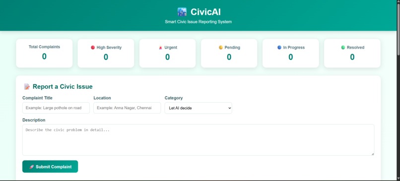
Main Page
-
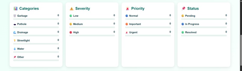
Dashboard Page
-
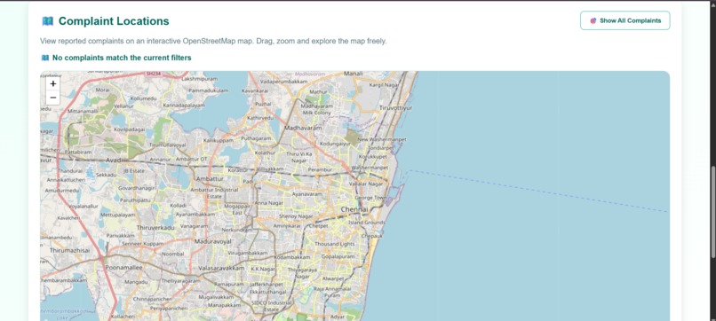
Map Page
-
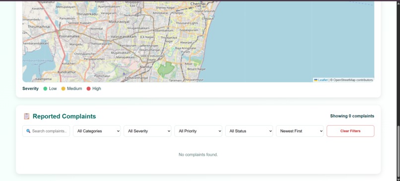
Complaint list Page
💡 Inspiration
Every day, citizens encounter disruptive local issues like dangerous 🕳️ potholes, uncollected 🗑️ garbage, and broken 💡 streetlights. However, reporting these problems is often a frustrating, bureaucratic process, and authorities struggle to triage the massive volume of incoming complaints. We wanted to build a seamless bridge between community members and city management, removing the friction from urban maintenance.
🚀 What it does
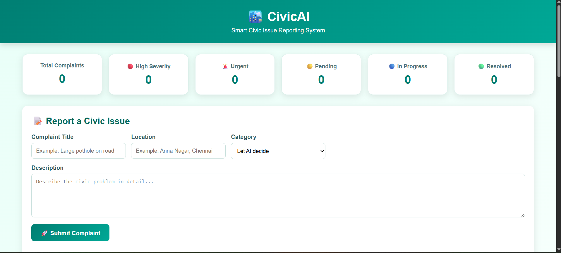
CivicAI is a Smart Civic Issue Reporting System. It allows citizens to quickly log issues via the 📝 Report a Civic Issue form with a simple description and location. Instead of forcing users to guess which department to contact, our platform features a "Let AI decide" tool that automatically categorizes the problem (e.g., 🌊 Drainage, 💧 Water, or 📌 Other).
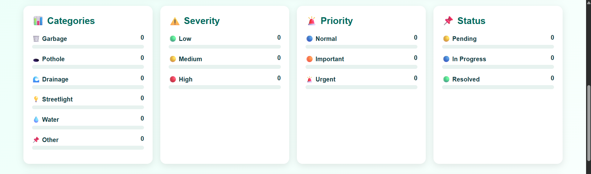
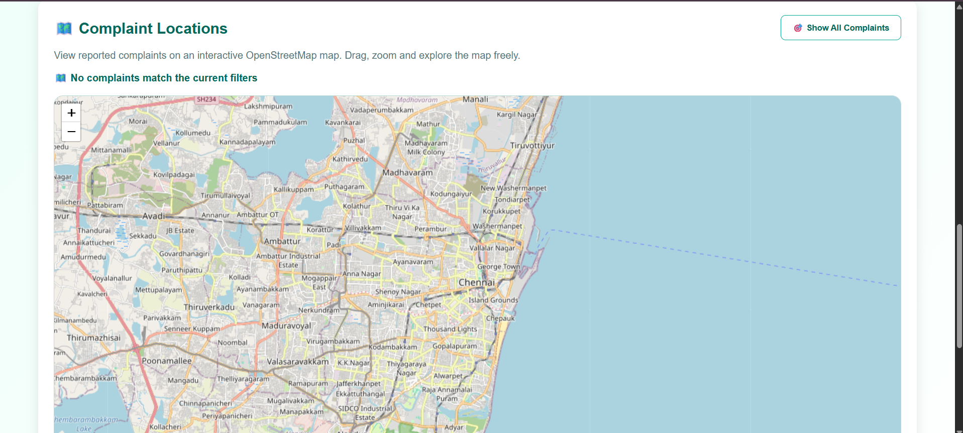
On the administrative side, all reported issues are plotted on an interactive 🗺️ Complaint Locations map. City officials are equipped with a comprehensive 📊 Categories dashboard that automatically filters and tracks complaints by:
- ⚠️ Severity: 🟢 Low, 🟡 Medium, 🔴 High
- 🚨 Priority: 🔵 Normal, 🟠 Important, 🚨 Urgent
- 📌 Status: 🟡 Pending, 🔵 In Progress, 🟢 Resolved
🛠️ How we built it
We focused on creating a clean, user-friendly web interface. For the mapping functionality, we integrated OpenStreetMap with Leaflet to provide real-time, interactive geospatial tracking. The core of the platform relies on an AI integration that processes the user's natural language description to determine the appropriate category and initial severity assessment.
⚠️ Challenges we ran into
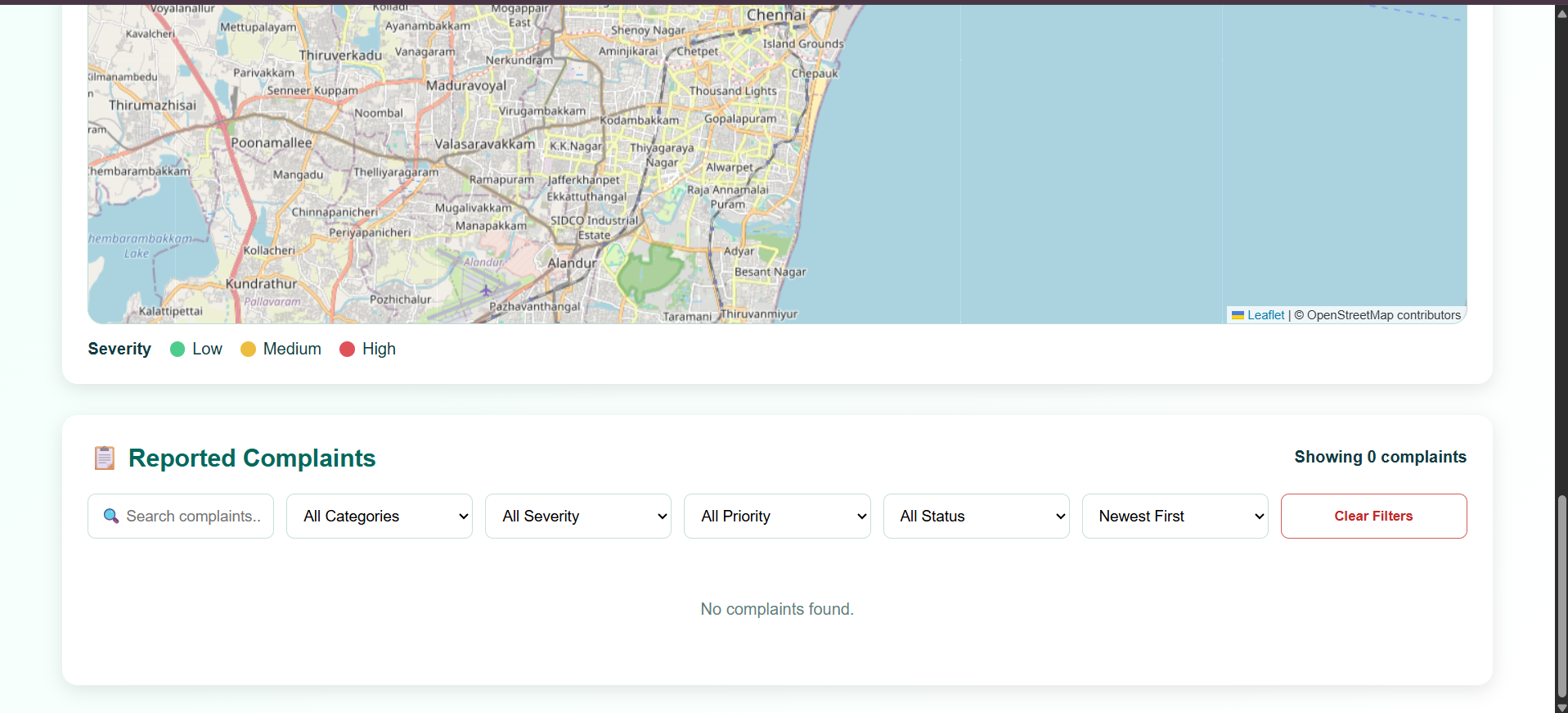
One of the main hurdles was ensuring the AI could accurately categorize complaints based on highly varied and sometimes vague user descriptions. Additionally, syncing the map markers dynamically with the live 📋 Reported Complaints filters (including the 🔍 Search feature) required careful state management to ensure a smooth, real-time experience for city administrators.
🟢 Accomplishments that we're proud of
We are incredibly proud of the seamless integration of the AI categorization feature—it genuinely simplifies the user experience. Seeing the interactive map populate in real-time as new complaints are submitted via the 🚀 Submit Complaint button is highly satisfying, and we are thrilled with how clean and intuitive the analytics dashboard turned out.
📚 What we learned
Building CivicAI deepened our understanding of integrating geospatial data and interactive maps into web applications. We also learned a great deal about handling and formatting AI responses to ensure reliable data categorization in a live, user-facing product.
🎯 What's next for CivicAI
We plan to develop a dedicated mobile application that allows citizens to snap photos of civic issues and upload them directly with GPS coordinates. We also want to explore integrations with actual municipal ticketing APIs to automate the dispatch of maintenance crews based on the AI's priority assessments.
Built With
- api
- artificial-intelligence
- css3
- html5
- javascript
- leaflet.js
- machine-learning
- natural-language-processing
- openstreetmap


Log in or sign up for Devpost to join the conversation.