-
-
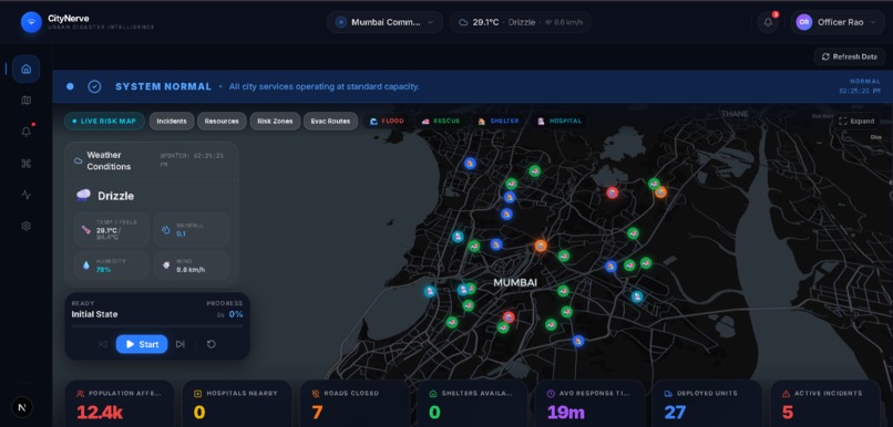
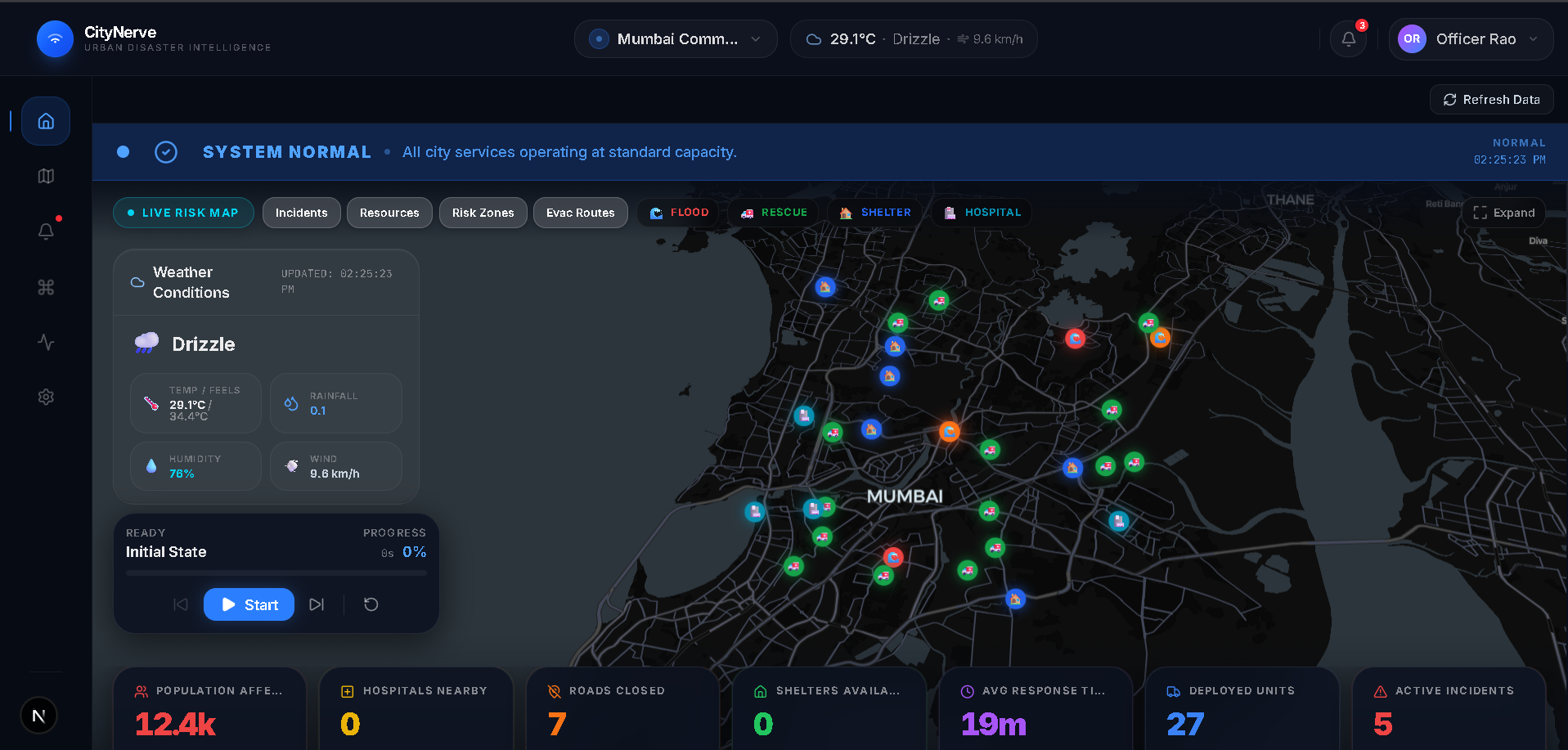
Interactive city map with real-time incident tracking, risk visualization, and AI-powered disaster monitoring.
-
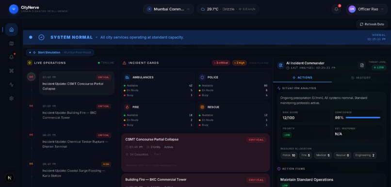
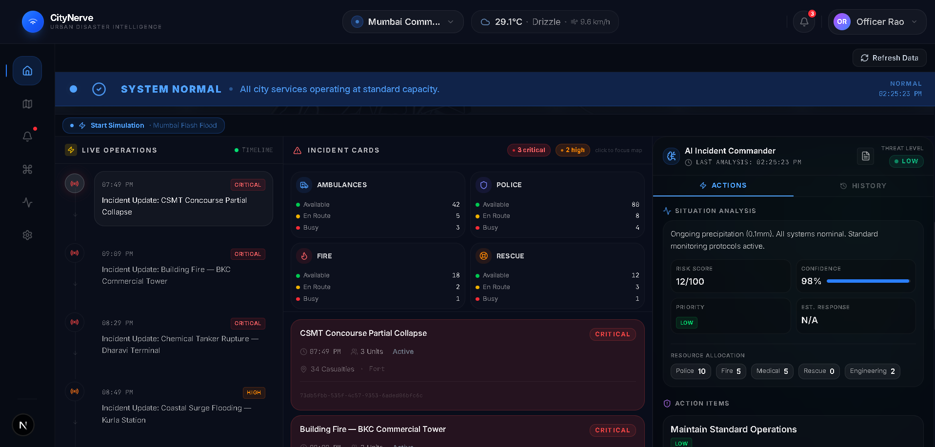
Centralized emergency operations dashboard displaying live alerts, resource management, and AI-driven response insights.
About the Project
Inspiration
Natural disasters such as floods and extreme rainfall continue to affect millions of people every year, while emergency response often relies on fragmented information and delayed decision-making. We wanted to explore how AI, geospatial intelligence, and real-time visualization could be combined into a single platform to help authorities respond more effectively.
CityNerve was created with the vision of building an AI-powered digital twin that provides a live operational view of a city, enabling faster decisions, better resource allocation, and improved public safety.
What It Does
CityNerve is a smart city resilience platform that monitors, predicts, and simulates disaster scenarios through an interactive dashboard. It combines weather information, geospatial mapping, incident tracking, AI-driven risk assessment, and emergency resource management to provide a unified view of critical city operations.
The platform helps visualize risk zones, monitor active incidents, coordinate emergency resources, and simulate disaster response workflows from early warning to recovery.
How We Built It
The application was developed using Next.js, React, TypeScript, Tailwind CSS, and MapLibre GL, with a modular architecture designed for scalability. The frontend focuses on delivering a responsive and intuitive dashboard, while the simulation engine models different stages of a disaster response lifecycle.
We structured the project around reusable components, centralized state management, and map-based visualization to create an experience that is both informative and easy to navigate. Mock datasets were used to simulate real-world scenarios and demonstrate the platform's capabilities.
Challenges
The biggest challenge was designing a system that presents complex operational data without overwhelming the user. Finding the right balance between functionality, performance, and usability required several iterations of the dashboard and simulation flow.
Another challenge was creating realistic disaster scenarios that clearly demonstrate how different parts of the platform interact while maintaining a clean and responsive user interface.
What We Learned
Building CityNerve strengthened our understanding of geospatial visualization, scalable frontend architecture, simulation-driven design, and user-centered dashboard development. More importantly, it reinforced how thoughtful technology can support decision-making in situations where speed and accuracy are critical.
Future Plans
Our roadmap includes integrating live weather APIs, satellite imagery, AI-powered emergency recommendations, multilingual citizen reporting, and predictive analytics to transform CityNerve into a production-ready platform for smart cities and disaster management agencies.
We believe CityNerve demonstrates how AI and digital twin technology can move disaster management from reactive response to proactive preparedness, helping build safer and more resilient communities.
Built With
- ai
- digitaltwin
- disastermanagement
- fastapi
- geospatial
- git
- github
- javascript
- maplibregl
- next.js
- openstreetmap
- python
- react
- responsive-design
- sqlalchemy
- tailwindcss
- typescript
- vercel


Log in or sign up for Devpost to join the conversation.