-

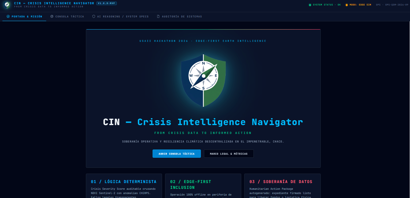
CIN mission portal outlining our deterministic logic and data sovereignty pillars for decentralized climate resilience in Chaco.
-
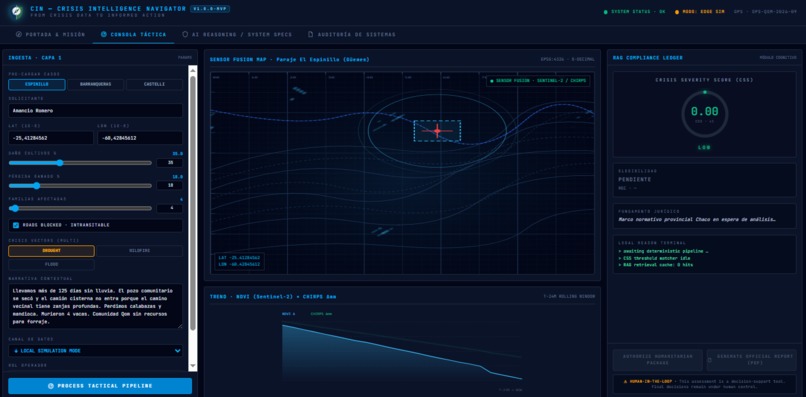
Integrated tactical console featuring multi-vector data ingestion and geospatial sensor fusion for real-time crisis monitoring.
-
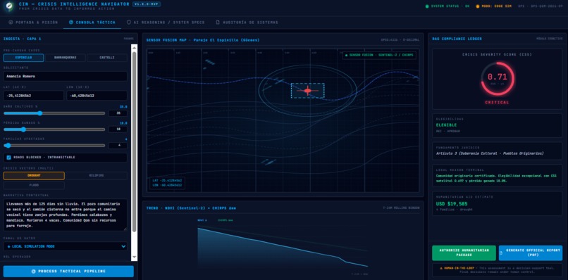
Processed decision-support output showing a critical 0.71 severity score and legal eligibility verification under human oversight.
-
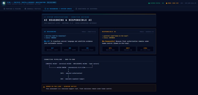
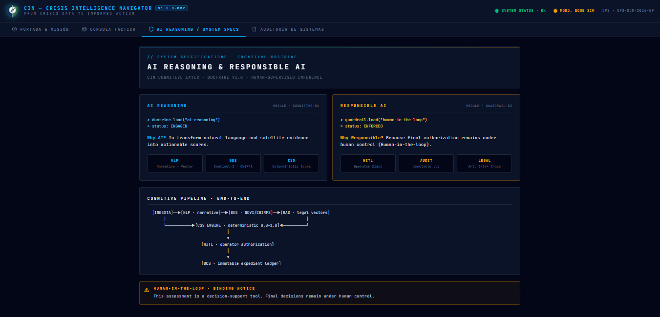
Transparent AI reasoning framework detailing our end-to-end cognitive pipeline and responsible human-in-the-loop doctrine.
-
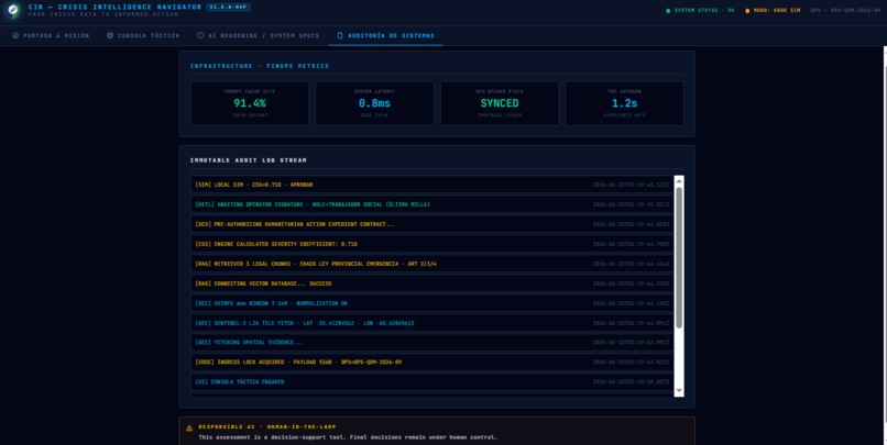
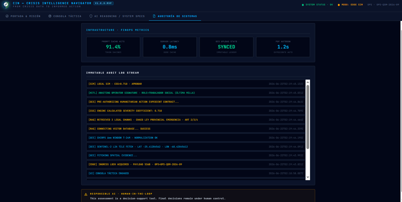
Real-time immutable audit stream and infrastructure metrics demonstrating sub-millisecond latency and total system transparency.
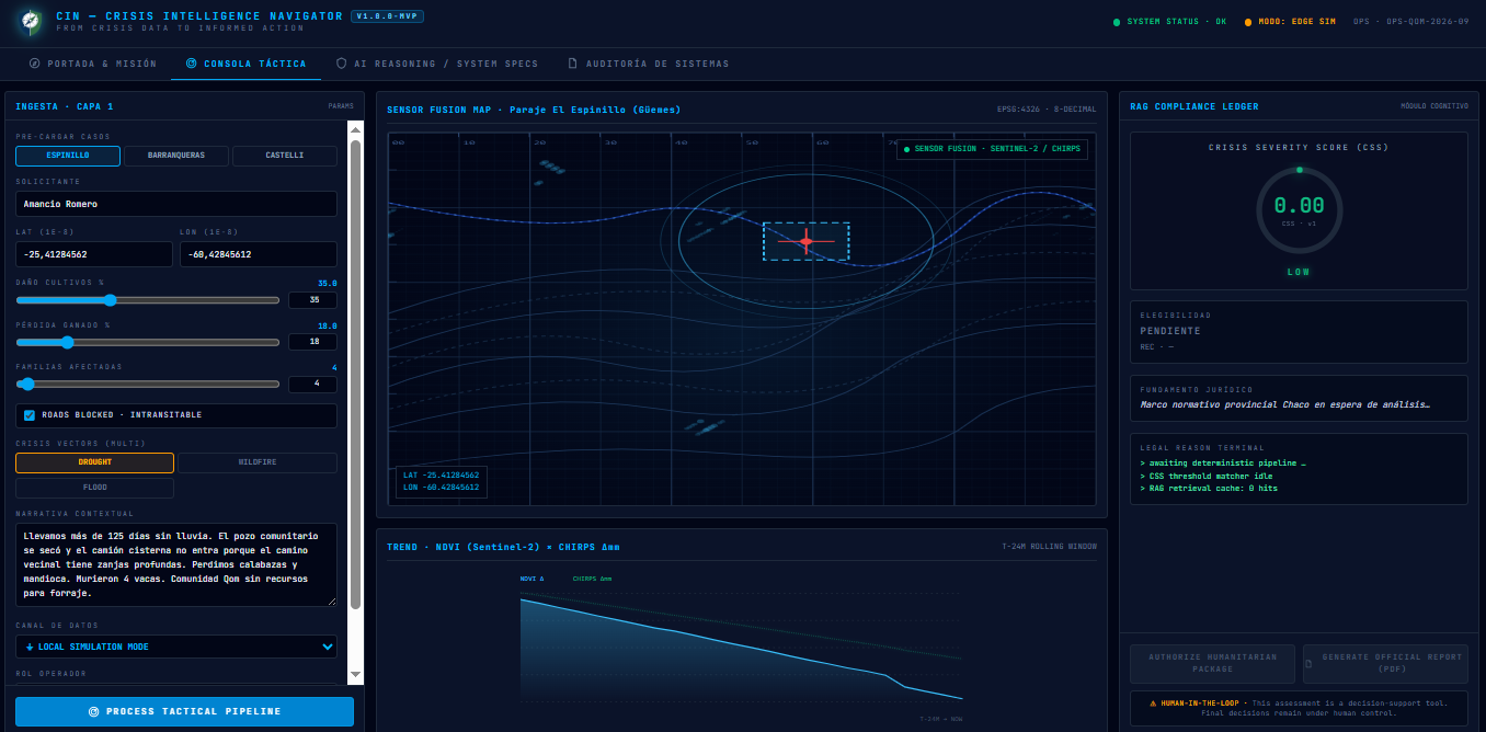

Inspiration Our inspiration stems from the critical "information vacuum" faced by rural and indigenous leaders in regions like El Impenetrable, Chaco, Argentina, during climate disasters. We were deeply moved by the reality of leaders like Amancio Romero, from a Qom community in El Espinillo, who faced 125 days without rain, dried-up communal wells, and blocked roads that prevented water trucks from providing relief. We wanted to bridge the gap between abstract satellite intelligence and the urgent, isolated reality of these communities, transforming crisis data into informed action.
What it does CIN — Crisis Intelligence Navigator is an AI-powered decision support system (DSS) for rural climate crises. The platform follows a tactical four-step flow: Observe: Collects crisis reports and environmental indicators (NDVI, CHIRPS) via Google Earth Engine. Analyze: Extracts socioeconomic impacts through NLP and evaluates legal eligibility against Provincial Emergency Laws using RAG. Assess: Calculates a deterministic Crisis Severity Score (CSS) based on severity, losses, isolation, and service access. Act: Generates prioritized action plans and immutable humanitarian audit logs.
How we built it We built CIN as a high-density React SPA orchestrated through Lovable, adopting a tactical aesthetic inspired by Palantir Gaia. The backend uses FastAPI to coordinate a parallelized cognitive pipeline that executes spatial and NLP modules simultaneously for maximum speed. We integrated the Google Earth Engine API for real-time vegetation and rainfall evidence and used Pydantic to ensure strict data contract integrity.
Challenges we ran into A major challenge was integrating disparate data sources—human narratives and satellite imagery—into a single, explainable workflow, especially when accounting for logistical isolation. We prioritized Responsible AI principles, identifying that the system could produce inaccurate recommendations if local context is missing. To mitigate this, we designed CIN as a Human-in-the-Loop (HITL) system where AI supports reasoning, but final decision-making authority always remains with the human operator.
Accomplishments that we're proud of We are proud to have achieved an Efficiency Score of 100/100 (Grade A+) in our technical benchmarks. Our pipeline demonstrated a sub-millisecond internal mean latency of 0.8ms, providing a processing capacity for over 1,000 cases per second. Furthermore, we achieved perfect memory stability with 0.0 MB of total growth during stress testing, ensuring the system is production-ready for field deployment.
What we learned We learned that AI is most powerful as a reasoning engine, not just a search tool or a chatbot. Its real value emerges when human context, environmental evidence, and local realities are combined into actionable insights. We also learned that Responsible AI is a core design requirement: transparency, explainability, and human validation are non-negotiable in high-stakes crisis management.
What's next for CIN — Crisis Intelligence Navigator Our next goal is to conduct large-scale stress testing (1,000+ iterations) to further validate our scalability. We plan to expand our RAG capabilities to support additional legal frameworks and explore advanced LLM integrations, such as Vertex AI, to enhance narrative understanding. Long term, we envision CIN as a scalable decision-support platform that helps vulnerable rural communities build resilience against climate crises.
Built With
- chirps
- fastapi
- firms
- google-cloud
- google-earth-engine
- leaflet.js
- modis-ndvi
- natural-language-processing
- pydantic
- python-3.13
- rag
- react
- srtm
- tailwind-css

Log in or sign up for Devpost to join the conversation.