Inspiration
With natural disasters rising in both frequency and intensity across North America, from wildfires to floods to extreme heat, the gaps in early-warning systems have become deadly. In 2023 alone, Canada saw over 18.5 million hectares burned, the most destructive wildfire season in its history, and natural disasters displaced hundreds of thousands of people. Despite this growing threat, many communities still receive alerts too late or only through fragmented sources like social media, neighbours, or group chats.
We saw this firsthand with one of our team member’s family in Sacramento, where wildfire smoke and evacuations became a recurring reality. They often learned about nearby fires from neighbours texting updates before any official alert ever reached them. That delay can be the difference between safety and danger.
With natural disasters rising in frequency and intensity — wildfires, floods, storms, and extreme heat — communities often receive warnings too late. We wanted to build a system that detects environmental danger in real time, verifies it using multiple data sources, and alerts people instantly. Our goal was simple: create an accessible, low-cost early-warning network that ordinary communities can depend on.
What it does
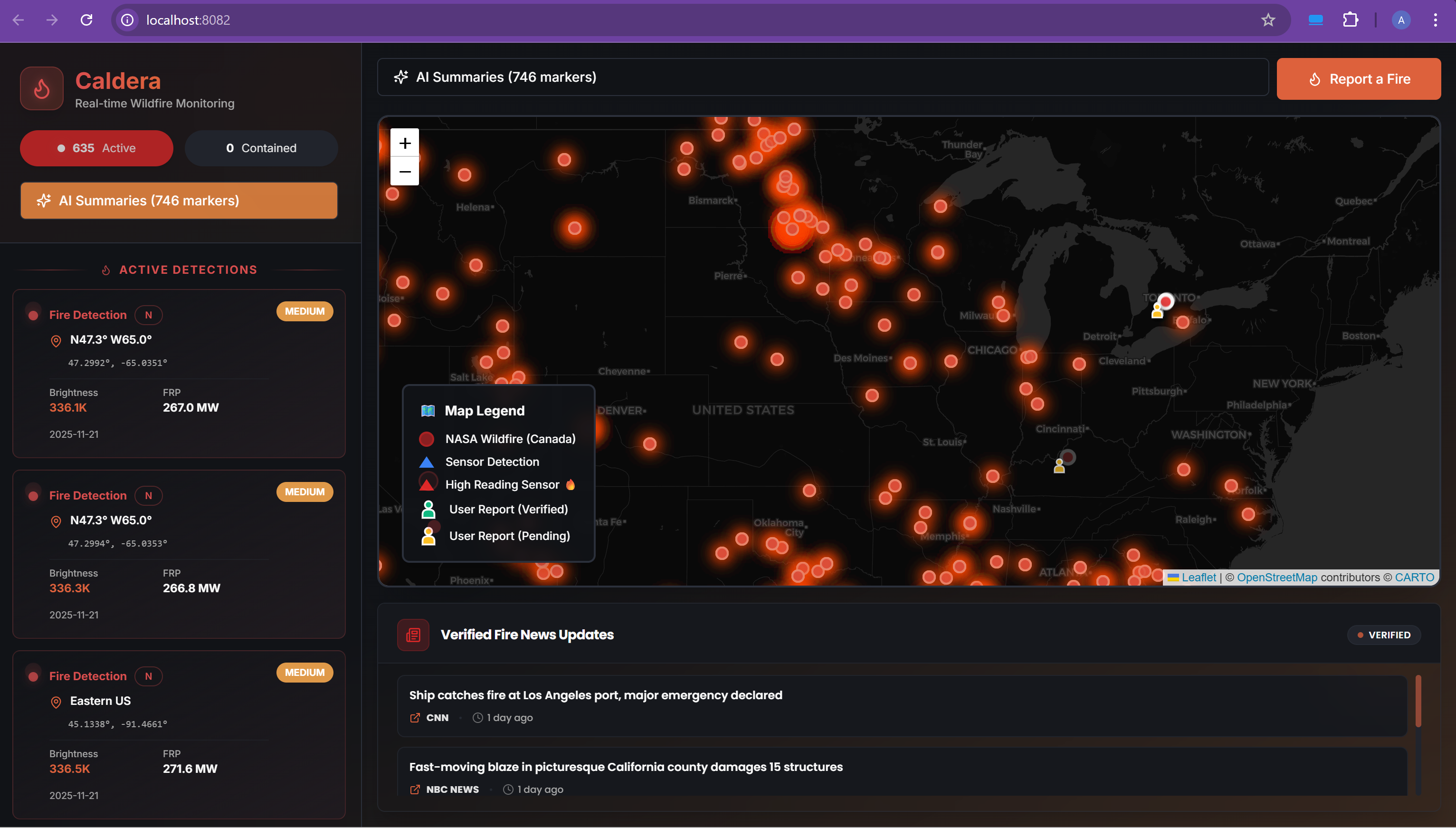
Caldera is a smart, real-time natural-disaster early detection and community alerting platform.
It provides:
- Real-time sensor monitoring for heat, smoke, and air-quality abnormalities
- Automatic SMS warnings when dangerous thresholds are detected
- User-submitted incident reports with photo uploads stored in Supabase
- AI-assisted image verification (future expansion via OpenRouter)
- Interactive Leaflet map showing sensor locations + community reports
- Live disaster news feed pulling the latest articles from trusted sources
- Central dashboard for monitoring alerts, reports, and recent activity
Caldera supports multi-hazard detection — wildfires today, but designed for floods, storms, and future disaster types.
How we built it
Frontend
- React + TypeScript
- Vite build system
- Leaflet.js for interactive mapping
- Nominatim (OpenStreetMap) Geocoding API for location lookup
- Modular UI built with custom components + Radix UI primitives
Backend
Supabase for:
- Authentication
- Real-time database
- Image storage (incident photos)
- Row-level security
- Supabase Functions / Edge Functions for handling sensor alerts and SMS triggers
- SMS alerts using Supabase + external messaging provider (e.g., Twilio integration-ready)
Hardware
- Python microcontroller firmware
- IoT sensors:
- Temperature sensor
- Air-quality sensor
- Temperature sensor
- Threshold logic to detect dangerous environmental patterns
- Sends alerts to backend when hazard is detected
Challenges we ran into
- Hardware reliability: Getting the temperature and air-quality sensors to consistently detect heat spikes was extremely difficult. Noise, calibration errors, and inconsistent readings caused false positives and false negatives.
- Trigger logic: Designing thresholds that correctly identify a real fire without spamming alerts required a lot of tuning.
- Data syncing: Passing sensor data from Python → backend → frontend in real time took multiple iterations.
- Map rendering issues: Integrating Nominatum, markers, popups, and live data feeds created performance and rendering bugs.
- APIs: NASA environmental APIs sometimes rate-limited us or returned sparse data.
- File uploads: Ensuring user-submitted images uploaded correctly to Supabase Storage required rewriting code multiple times.
Accomplishments that we're proud of
- Successfully built a working hardware-to-software pipeline that detects heat, sends alerts, and logs data.
- Created a clean, modern dashboard showing real-time hazard data.
- Integrated external datasets + news feeds for context.
- Built a fully functional SMS alert system.
- Designed a map-based UI that feels intuitive and useful.
What we learned
- How to integrate hardware sensors with cloud databases.
- How unreliable real-world sensor data can be — and how much calibration matters.
- How important real-time streaming + syncing logic is for IoT systems.
- How to build user-friendly interfaces for high-stress situations.
- The value of combining multiple data sources for disaster verification.
What's next for Caldera
- Add AI-powered image verification to confirm whether user-uploaded photos truly show fires or other disasters.
- Expand detection to flood sensors, humidity sensors, and seismic data.
- Add community-driven support features (safe zones, evacuation routes).
- Mobile app version for faster real-time alerts.
- Integrate more global data sources (Google Crisis API, emergency services APIs).
Built With
- api
- apis
- arduino
- db
- kafka
- leaflet.js
- node.js
- nominatim
- openstreetmap
- python
- react
- rest
- sensors)
- storage
- twilio
- typescript
- vite

Log in or sign up for Devpost to join the conversation.