-
-
BlindSpot — See what your map can't.
-
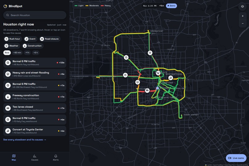
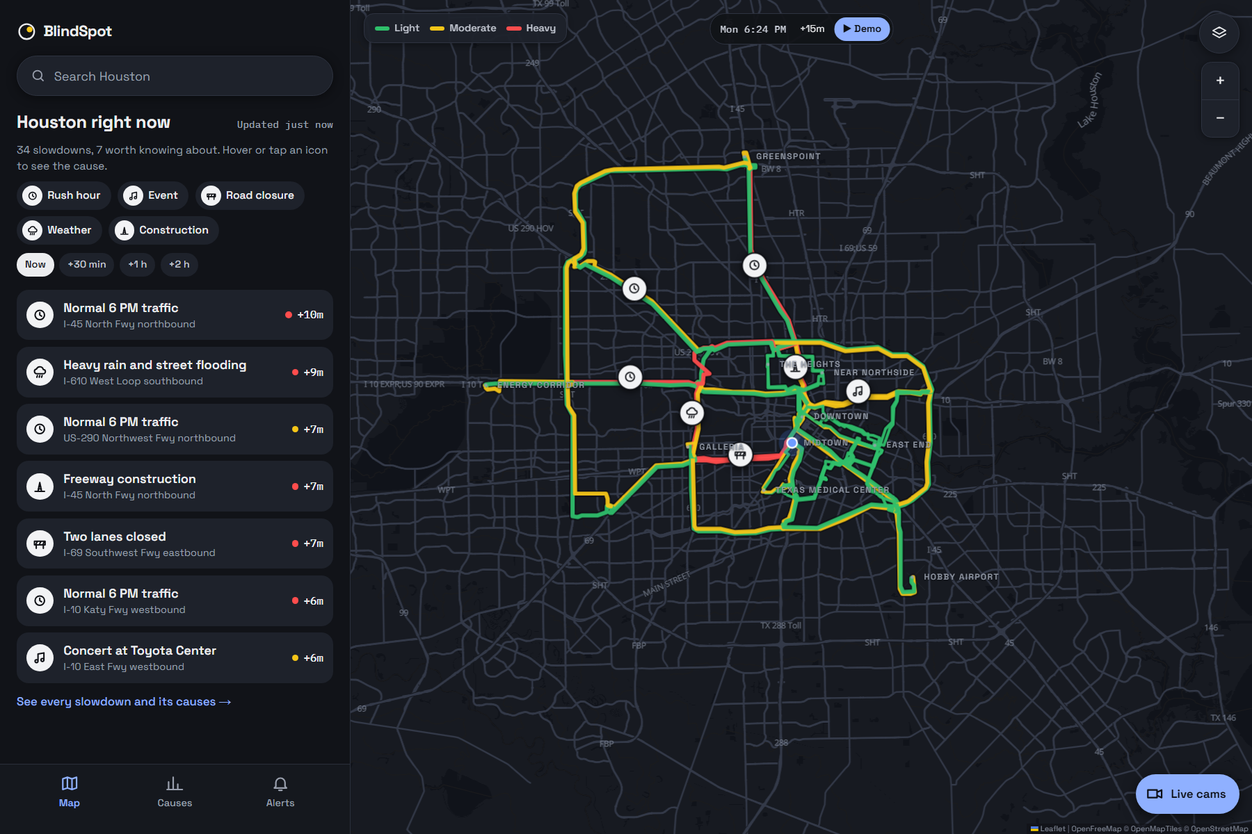
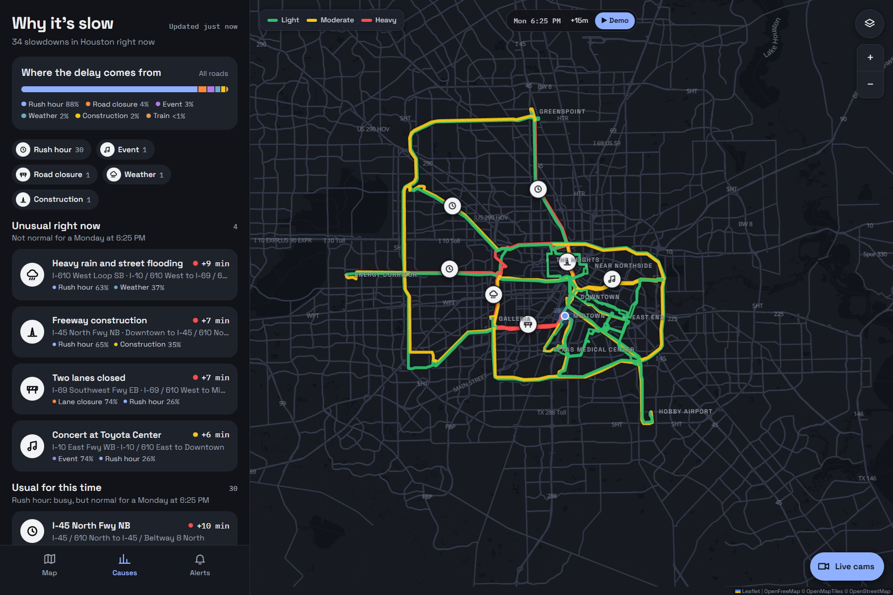
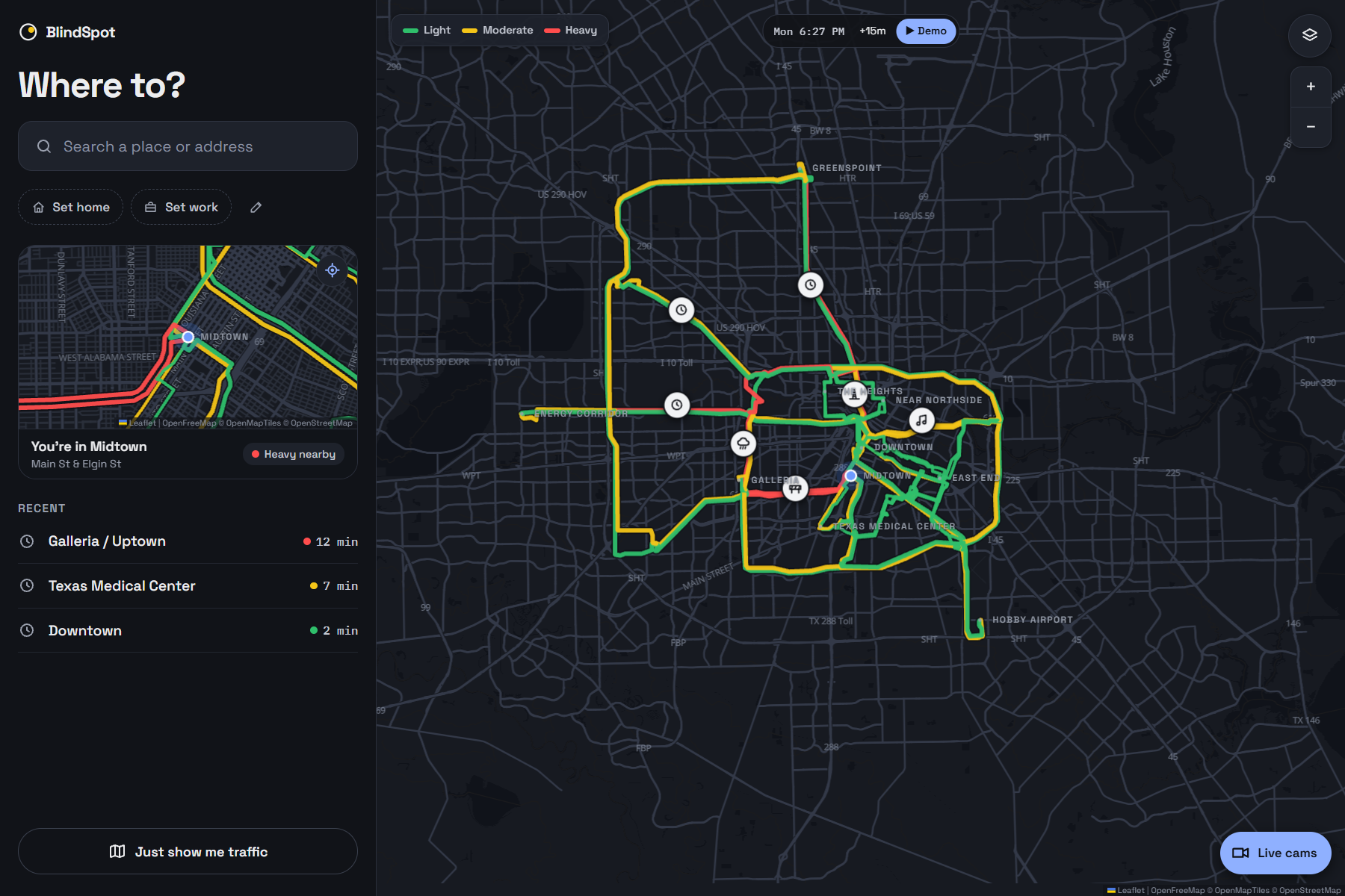
Houston right now: every slowdown with its cause on the map (rush hour, event, road closure, weather, construction).
-
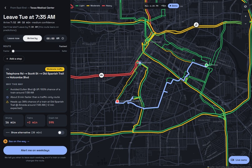
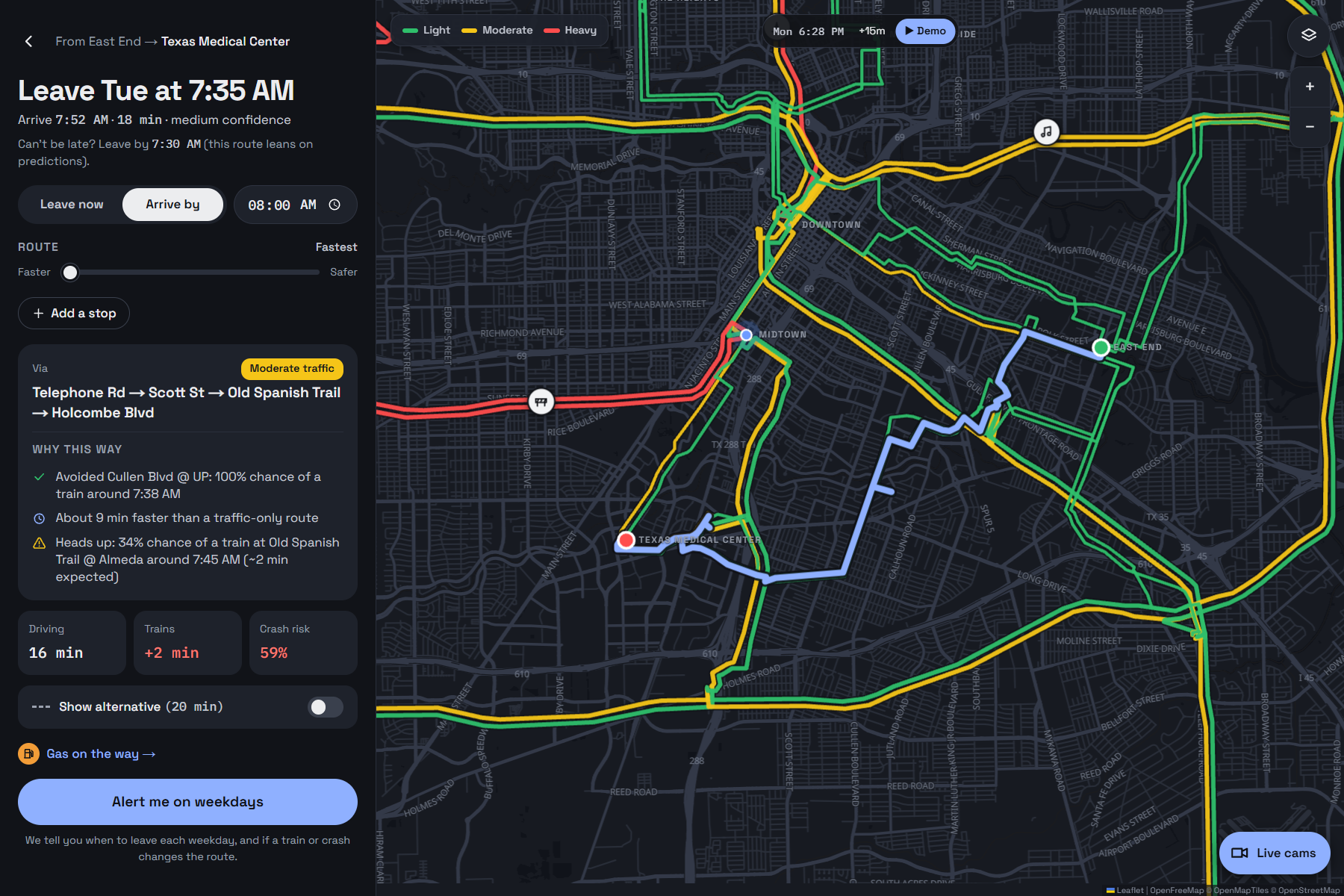
East End → Medical Center: leave at 7:35 AM, avoiding a likely train at Cullen Blvd, about 9 min faster than a traffic-only route.
-
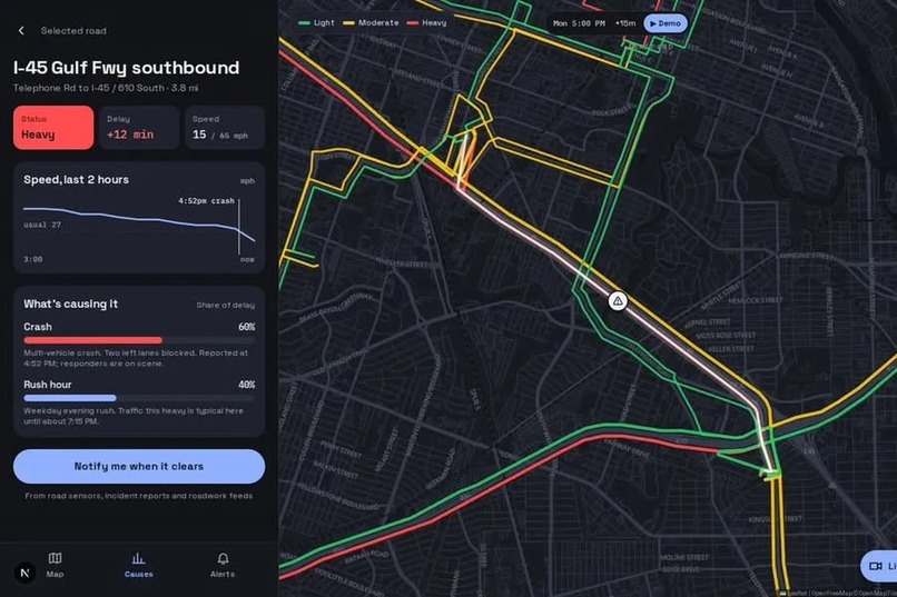
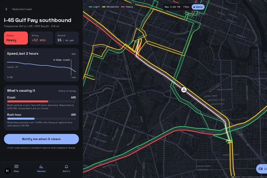
Why it's slow: on I-45 Gulf Fwy, 60% of the +12 min delay is the crash and 40% is rush hour. "Notify me when it clears."
-
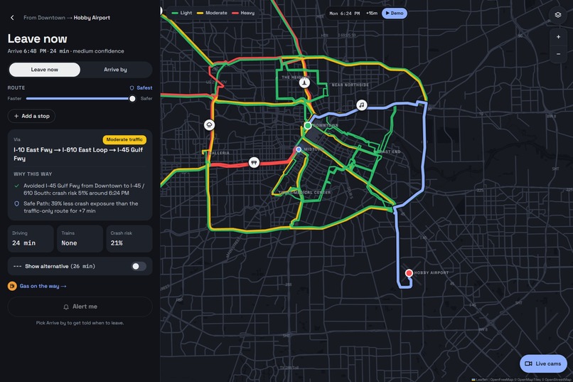
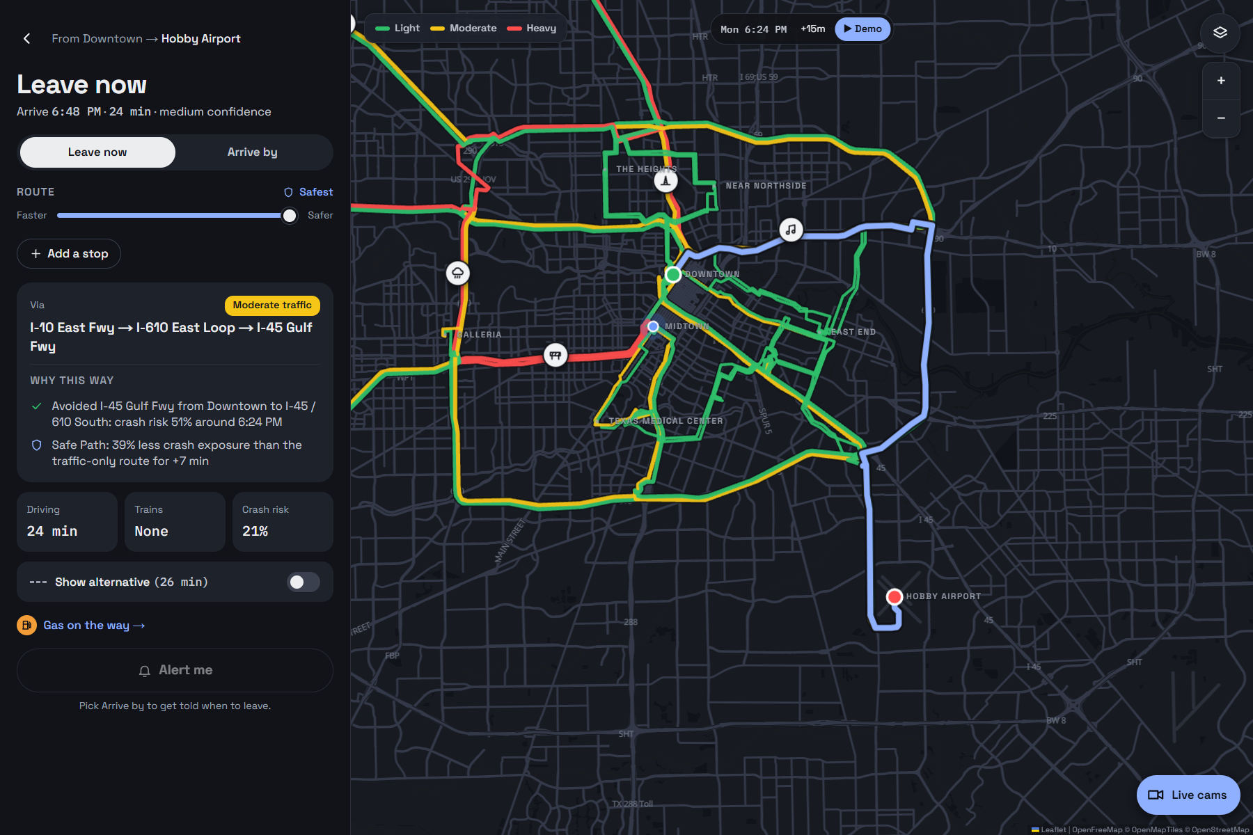
The safest route to Hobby has 39% less crash exposure for +7 min. Street crash risk is calibrated to Houston Vision Zero data.
-
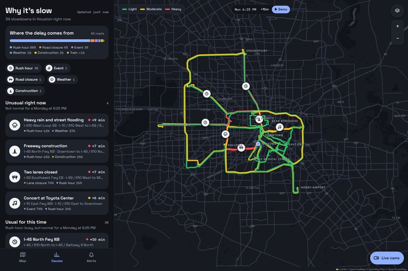
Where Houston's delay comes from, cause by cause.
-
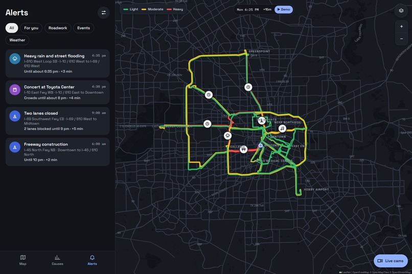
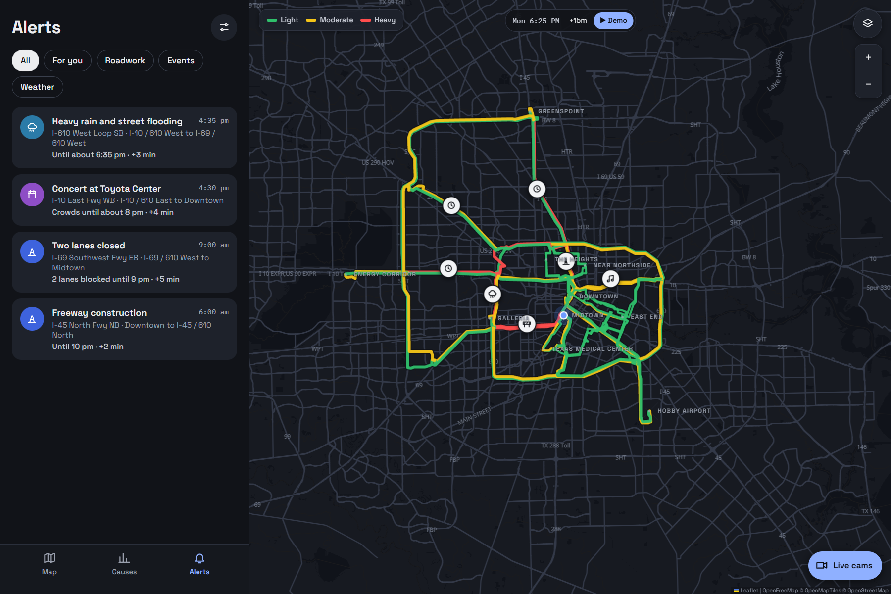
Alerts: flooding, events, lane closures and construction, each with what it costs you.
-
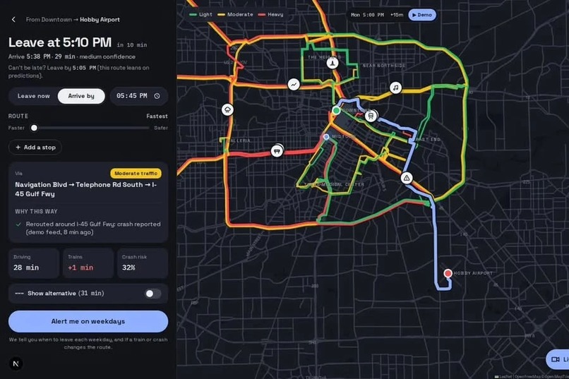
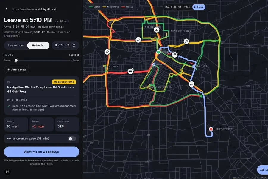
Leave at 5:10 PM: rerouted around the Gulf Freeway crash. "Alert me on weekdays."
-
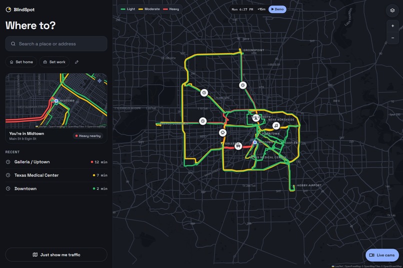
Where to? Search any Houston place; traffic around you right now.
Inspiration
Houston drivers lose 77 hours a year to traffic (TTI Urban Mobility Report 2025), and the city has 700+ at-grade rail crossings. Texas leads the country in blocked crossings, and Houston accounts for at least half of them. A parked freight train can block a street for close to an hour, and fire trucks get stuck behind trains roughly 100 times a month.
Google Maps and Waze are great at live traffic, but they have blind spots here. They don't know a train is blocking your crossing until cars pile up. They can't plan a day with several stops and arrival windows. And they don't use Houston's own data: TranStar's cameras and sensors, the City's Train Watch crossing sensors, or Vision Zero crash records. We wanted to build the app that fills those gaps.
What it does
You tell BlindSpot where you need to be and when, for example leave UH Sugar Land, be at UH main campus by 5 PM, then Ion District by 6 PM. It tells you:
- the best order for your stops and the exact time to leave for each leg,
- which rail crossings, jammed cameras and high-crash segments are on your route,
- and it keeps watching. If a train blocks your route or traffic builds up, it re-plans and sends an alert with the reason, before you're stuck.
One tap on Go opens Waze or Google Maps for turn-by-turn navigation. We don't compete on navigation; we decide when and in what order.
How we built it
- Backend: Python, FastAPI, SQLAlchemy and SQLite. A small Houston road graph with a time-dependent Dijkstra router and a Safe Path option.
- Scoring models: congestion, crash risk and train blockage per road segment (or crossing) and per 15-minute time bucket. Each is updated with an exponential moving average, where \( \alpha \) is the nudge factor: $$ s_{t+1} = s_t + \alpha\,(x_t - s_t) $$
- Route cost for each edge at the time you'd reach it: $$ c = t_{\text{travel}} + \sum_{\text{crossings}} \mathbb{E}[\text{train delay}] + \lambda_{\text{crash}} \cdot r_{\text{crash}} \cdot \text{miles} $$ Safe Path raises \( \lambda_{\text{crash}} \).
- Multi-stop planner: with three stops there are only \( 3! = 6 \) orders, so we try every order and every departure time (every 15 minutes, refined to 5), and keep the lowest-cost plan that meets every arrival window.
- Real Houston data:
- Train Watch (City of Houston ArcGIS layer): live status of 56 crossings.
- Houston TranStar: 1,386 traffic cameras, live incident, lane-closure and travel-time RSS feeds, and 2011–2025 historical travel times per 15-minute departure slot.
- Vision Zero High Injury Network 2025: 1,080 road segments, 4,620 severe crashes.
- Computer vision: YOLOv8 counts vehicles in TranStar snapshots. Each camera is compared with its own normal count, because camera angles differ.
- Frontend: Next.js, TypeScript, Tailwind and react-leaflet, phone-first, installable as a PWA for push alerts.
- Our own history: a logger recorded crossings, camera counts and incidents all weekend. TranStar doesn't archive camera images, so that record exists nowhere else. The demo replays it.
Challenges we ran into
- Live feeds were locked. TranStar's JSON feeds returned 403. We found its public RSS feeds, which carry the same live incidents and travel times.
- Cameras can't see the tracks. We checked all 14 cameras within 200 m of a Train Watch crossing. None clearly shows the rails, so we detect train blockages from Train Watch plus car queues at the nearby intersection instead.
- Broken and frozen cameras. One camera returned a web page instead of an image, one showed "Camera error", and one was frozen on a frame from July 2021. Every snapshot is now validated, and stale cameras are marked as unknown instead of being trusted.
- "Sensor DOWN" crossings still report changes. The meaning isn't documented, so we show those crossings as low confidence instead of hiding them.
- YOLO undercounts small cars on 320×240 frames. Switching to a larger model at a higher input size raised the count on the same frame from 20 to 28 (about 30–35 visible).
Accomplishments that we're proud of
- In our simulation, a 60-minute train blockage on the route added 54 minutes to the normal plan. BlindSpot re-planned around it. On a normal day, reordering stops alone saved about 6 minutes.
- Everything runs on free, public Houston data. No paid APIs.
- Our weekend logger is, as far as we know, the only archive of Houston camera-based congestion and crossing blockages.
What we learned
- The most valuable data was city infrastructure data that navigation apps ignore, not live speeds.
- "Unknown" is a valid answer. Showing low confidence honestly beats a confident wrong answer.
- Freeway routes rarely touch rail crossings. Train awareness matters most for East End and industrial-area trips, so that is where we focus.
What's next for BlindSpot
- Partner with the City and vendors like TRAINFO or RailState for predictive train-arrival data.
- Add flooding (Harris County Flood Warning System) for underpasses.
- Expand the road graph beyond the demo corridors and add a Spanish interface.
- Share our blocked-crossing log with the City to support grade-separation grants.
Built With
- computer-vision
- fastapi
- houston-transtar
- leaflet.js
- maplibre
- next.js
- nominatim
- openfreemap
- openstreetmap
- pwa
- pytest
- python
- pytorch
- react
- react-leaflet
- sqlalchemy
- sqlite
- tailwindcss
- typescript
- uv
- uvicorn
- vision-zero
- yolo


Log in or sign up for Devpost to join the conversation.