
BharatNirman: Real-Time Crowd Intelligence for Smarter, Safer Cities
Our hackathon project reimagines urban awareness by transforming how cities, districts, and talukas visualize and understand crowd movement, public density, and real-time activity. Inspired by the aerial strategic view in Clash of Clans, BharatNirman brings a similar “top-down intelligence layer” to real-world India—turning complex urban spaces into an understandable, interactive, and actionable map dashboard.
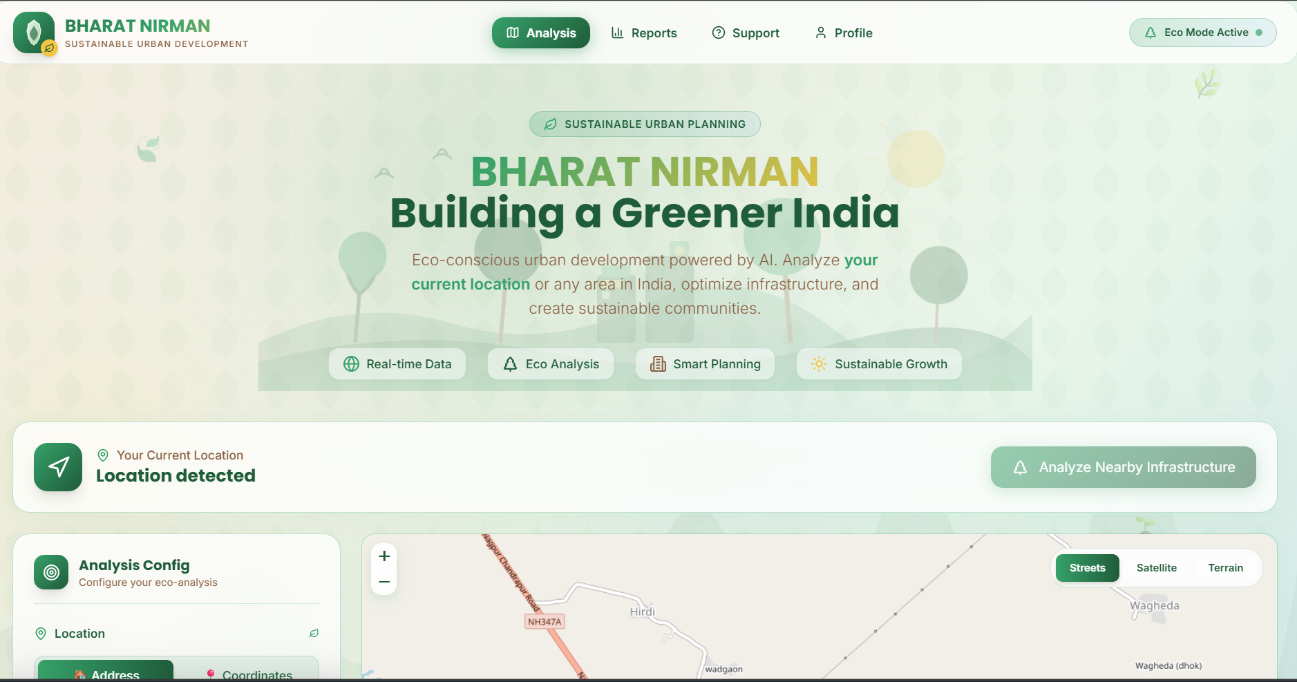
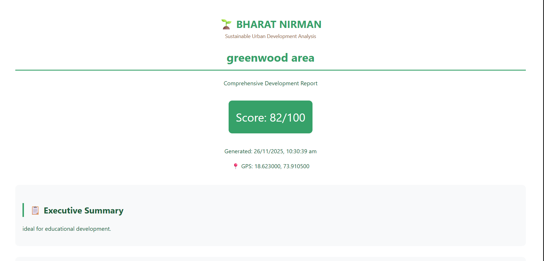
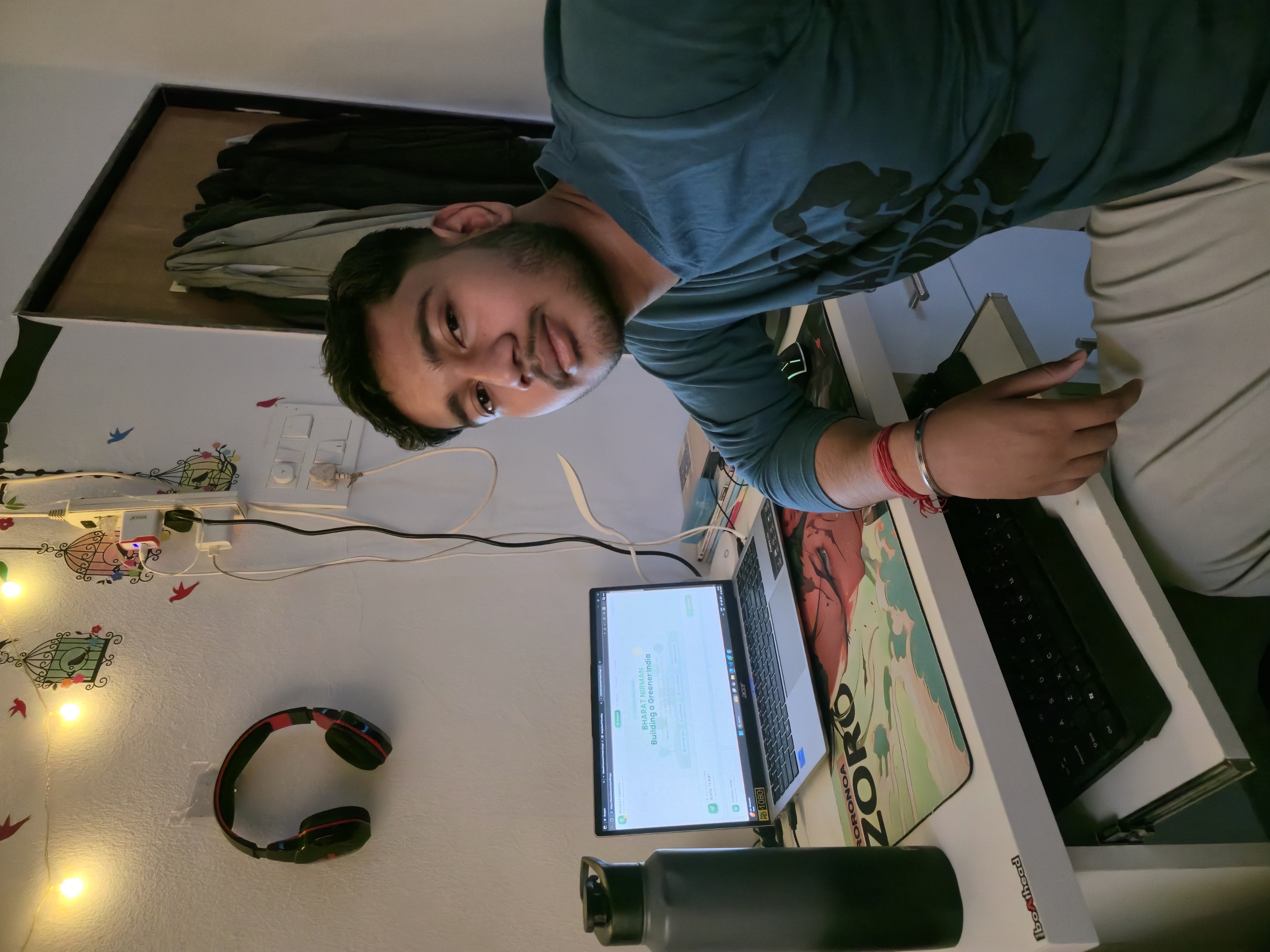
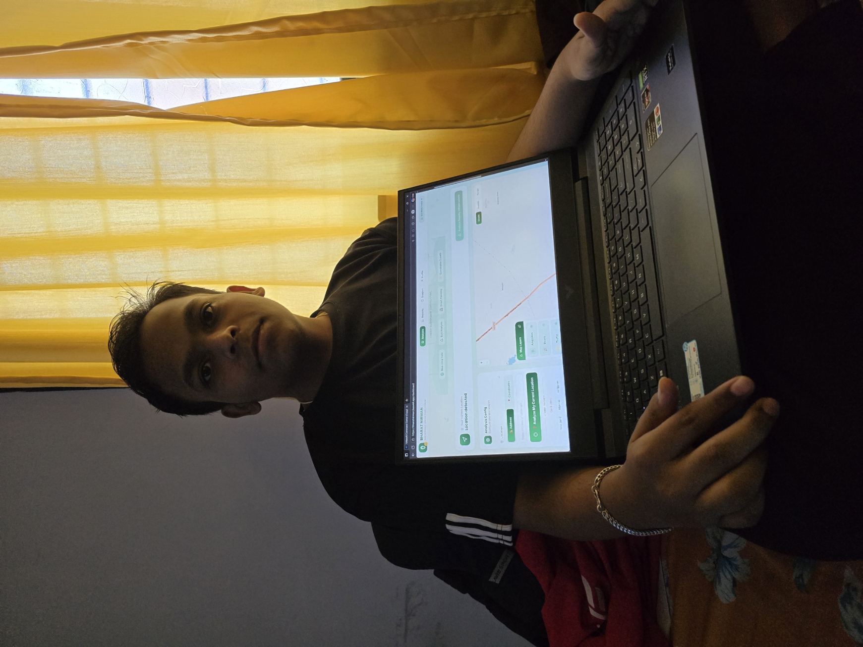
At the heart of our platform is an immersive, animated interface powered by Base44 Maps, accessible at: 🔗 https://bharatnirman.base44.app/
This dashboard provides a live, bird’s-eye view of any region, enabling users to instantly identify: High-density crowd zones Congested streets and hotspots Movement patterns across time Public activity clusters Potential stress points for traffic, safety, or emergency planning
🌍 How It Works
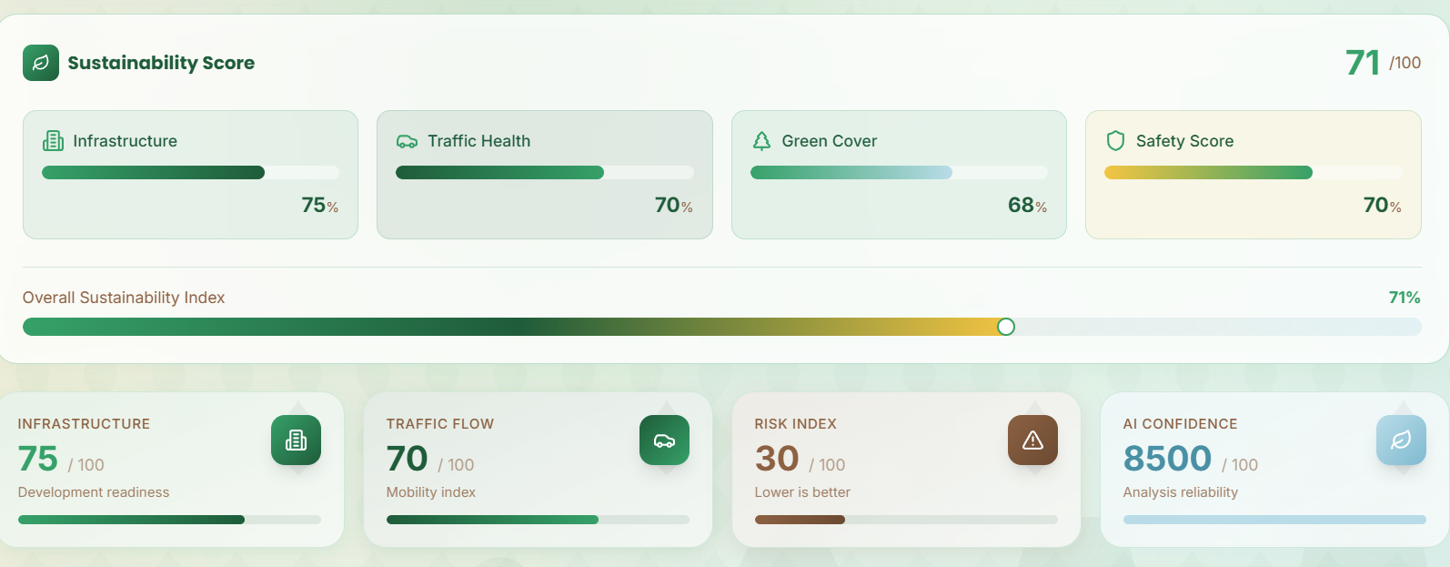
BharatNirman continuously gathers and processes open geographic datasets, combining: Crowdsourced map intelligence (OSM) Public open-data portals (Government of India) Spatial analytics Satellite-based insights Real-time geospatial computation These data streams are transformed into live visual overlays, such as: Heatmaps of public density Movement prediction layers Smart markers for points of interest Path and corridor analysis Zone-wise congestion scoring
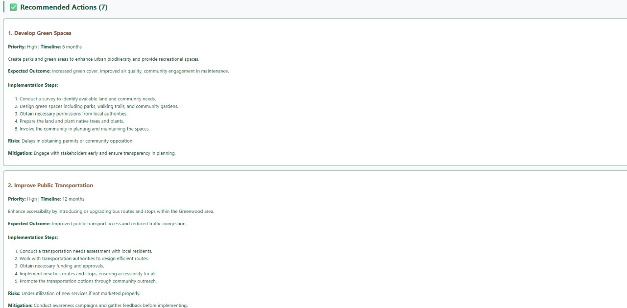
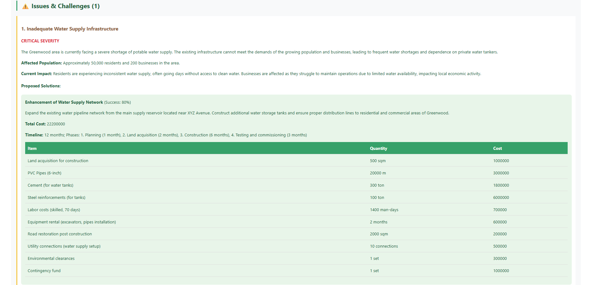
By merging geospatial analysis with a game-like strategic overview, the platform helps users understand what is happening, where it is happening, and why it matters—instantly. ⚙️ Technology Stack & Innovation Our system integrates a modern, high-performance geospatial stack: 🔹 Base44 Maps For rendering animated, real-time map layers with smooth UI interactions. 🔹 Geospatial APIs (OSM, Open Data India, Mapbox) For extracting road networks, settlement patterns, infrastructure, and human activity indicators. 🔹 Spatial Analytics Engine Custom-designed to calculate: Density clusters Movement trends Hotspot detection Potential risk zones Micro-level geospatial patterns at scalable speeds 🔹 AI-Assisted Visualization AI helps refine map overlays, detect patterns, and offer actionable insights.
🎮 Inspiration: Clash of Clans Meets Urban Planning Our idea takes inspiration from how Clash of Clans presents a strategic, top-down layout of villages—allowing players to quickly assess structures, troop movement, crowding, and hotspots at a glance.
We imagined: ✨ “What if urban planners, administrators, and citizens had the same kind of strategic, interactive view for their real-world cities?” So we brought that vision into reality— a Clash-of-Clans-style ‘strategic overview mode’ for Indian cities, powered by real map data instead of game assets.
🏙️ Who Benefits? BharatNirman is designed to support: Government bodies & Smart City teams Disaster response & emergency planning units Traffic control & urban safety departments Event organizers & crowd managers Civic planners & infrastructure developers Citizens who want a live picture of their city Its scalable architecture allows monitoring of: A single taluka A dense metro city Entire districts Multiple regions at once
🇮🇳 Our Vision: With BharatNirman, we aim to contribute to a smarter, safer, and more efficient Bharat by enabling authorities and citizens to make informed decisions through real-time crowd intelligence and next-generation mapping technology. We believe this platform can become a foundational layer for future: Smart mobility Public safety Emergency response Urban planning Infrastructure development —aligned with India’s fast-evolving digital and smart city mission.
Built With
- base44
- cssx
- gis
- html
- javascript
- openstreetmap
- vite

Log in or sign up for Devpost to join the conversation.