-
-

Landing Page
-

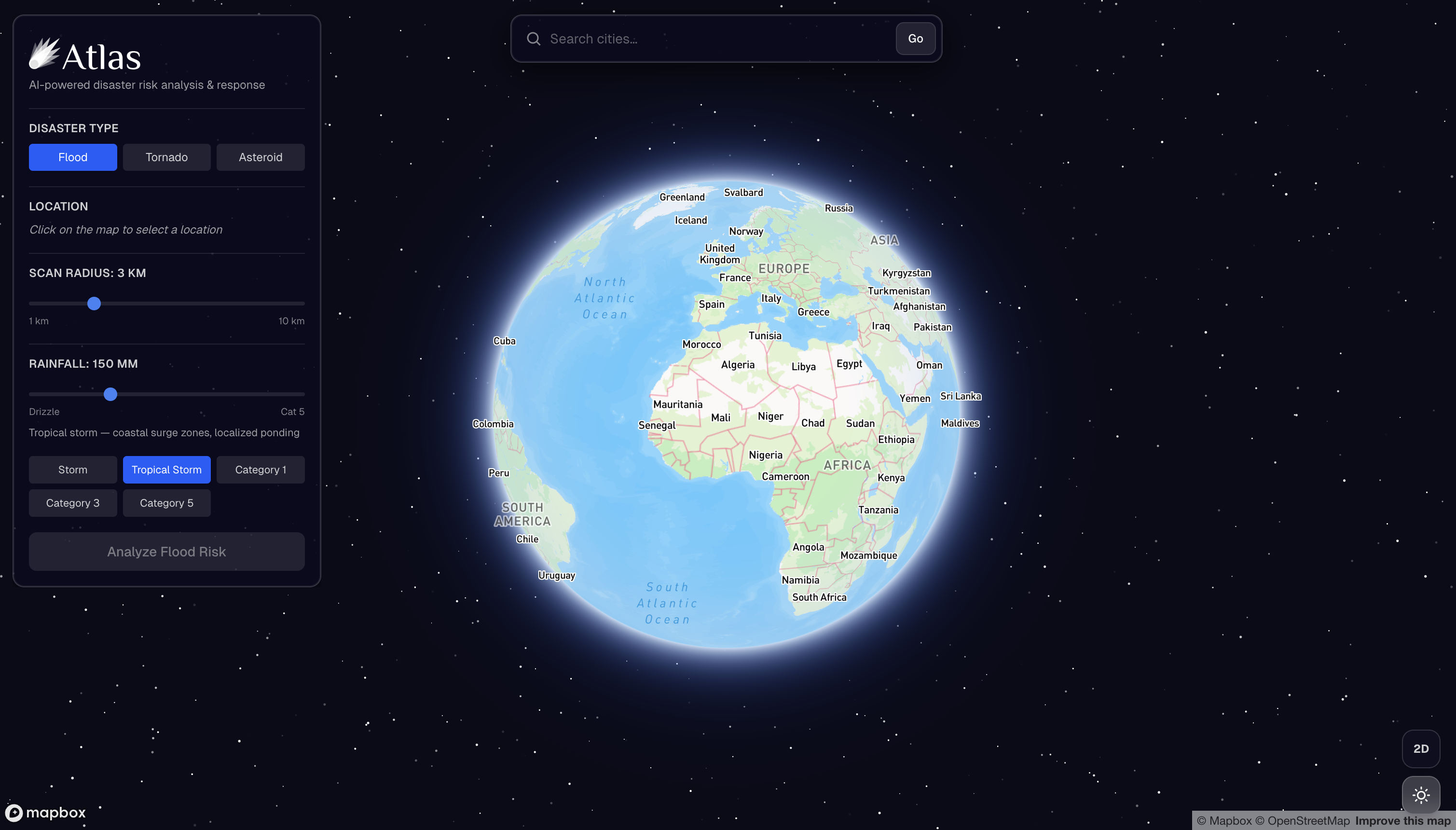
Globe View
-
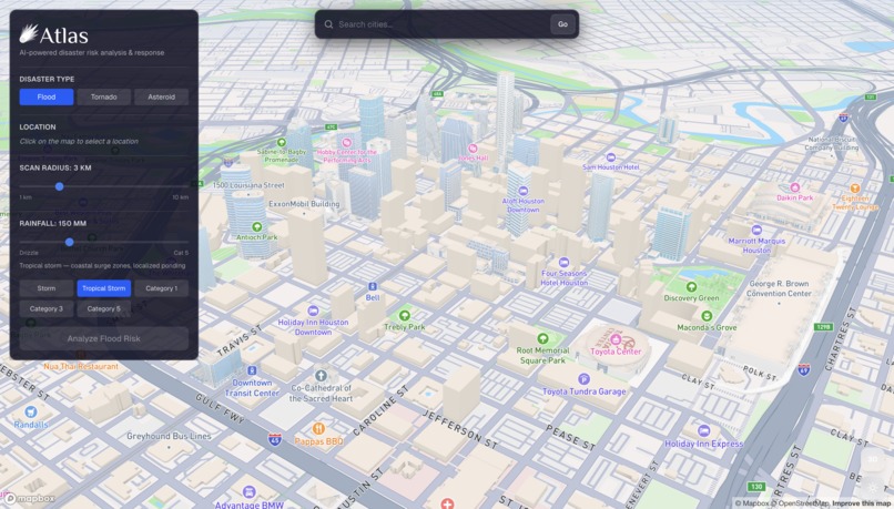
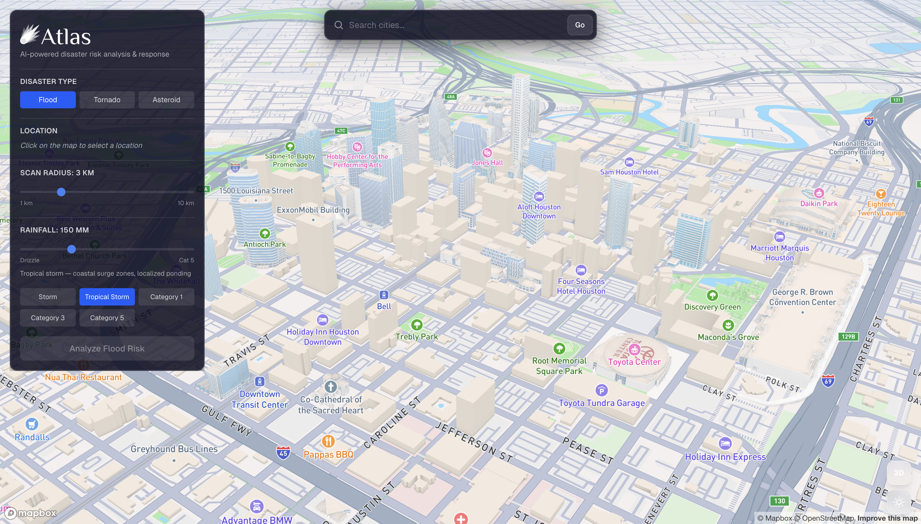
City View
-
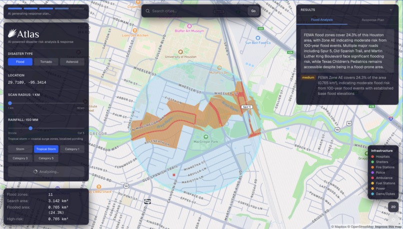
Floor Scenario along a river. Roads likely to be blocked by flood water are marked
-

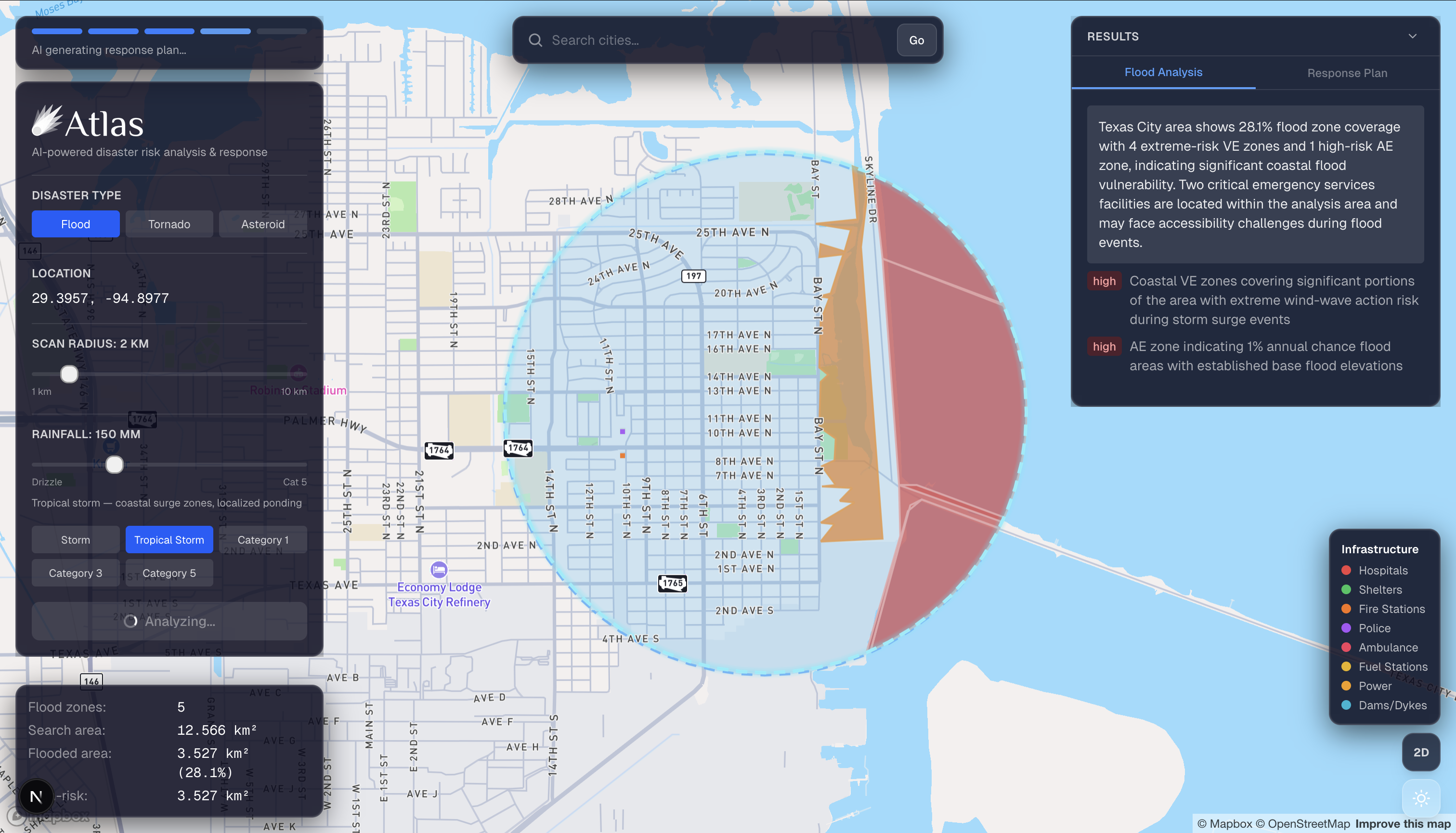
Flood Scenario along the ocean
-
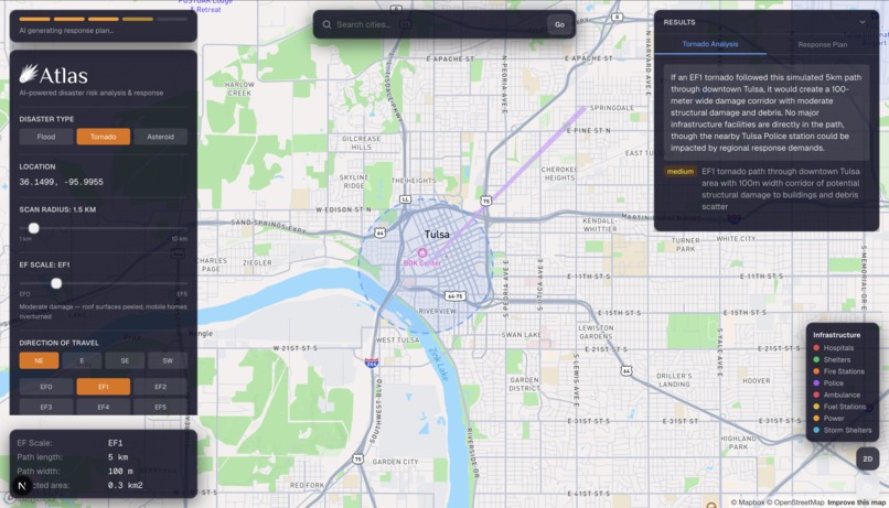
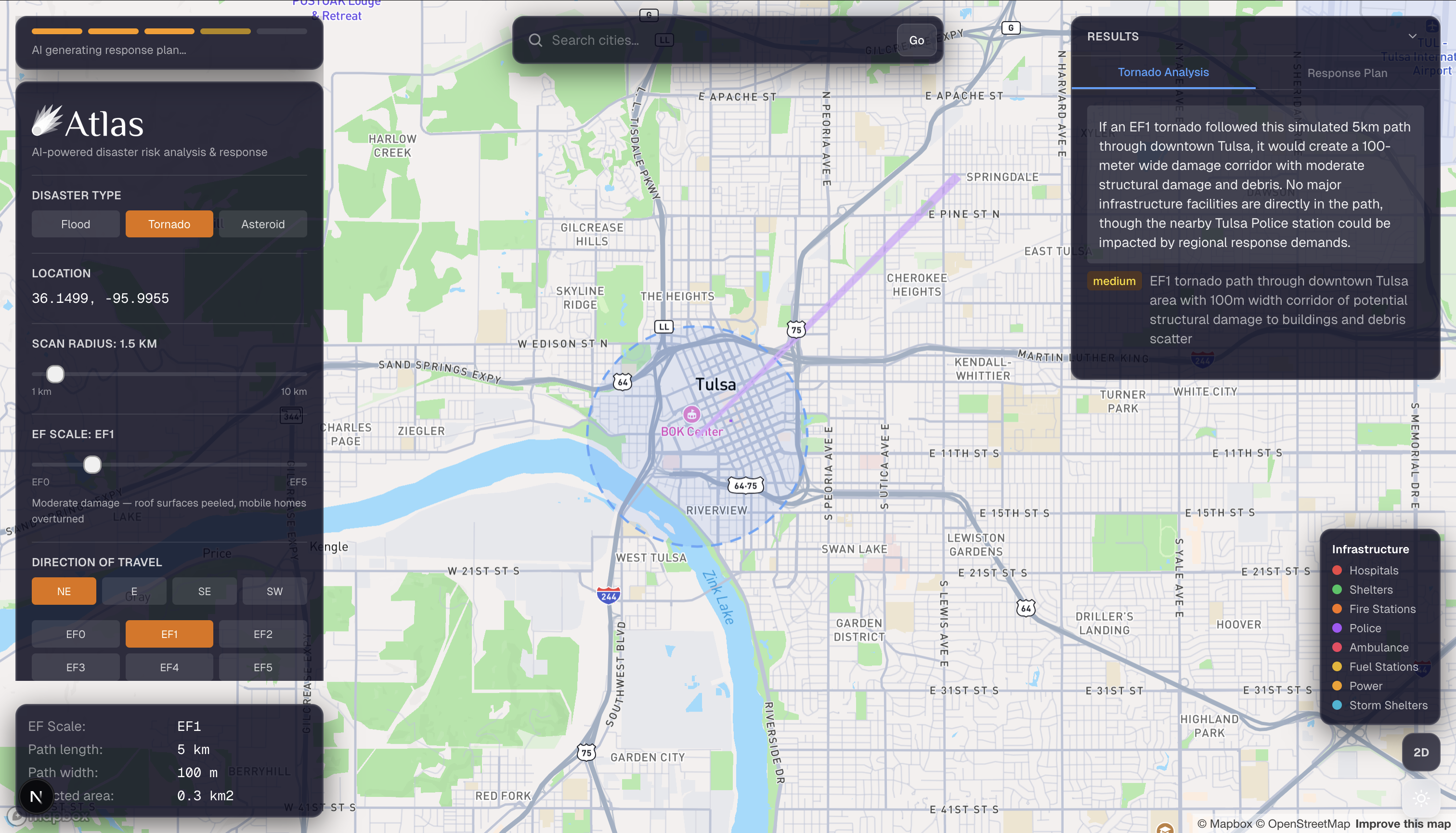
Tornado Scenario
-
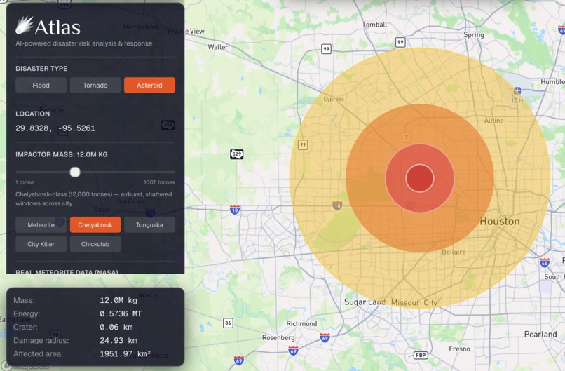
Asteroid Scenario


🌍 Inspiration
Natural disasters caused nearly $242 billion in damage in 2024 alone and the tools emergency teams rely on haven't kept up.
A lot of our team is from Houston. We've seen firsthand what Hurricane Harvey did to entire neighborhoods, and more recently, how a winter storm can knock out power for millions of people overnight. Through our own research, we kept running into the same gap: when a crisis hits, response teams are operating on incomplete information with no unified platform to make sense of it.
They need to know what's at risk, which routes are still passable, and what to do first - all at once. So we built Atlas.
🚀 What It Does
Atlas is an AI-powered disaster simulation and decision-support platform built for emergency response teams.
You start by selecting any location on the globe and choosing a disaster scenario: flood, tornado, or asteroid impact. From there, Atlas pulls real data from OpenStreetMap to render, road networks, hospitals, schools, and shelters directly on an interactive 3D map. For flood simulations, we pull data from FEMA's National Flood Hazard Layer. For asteroid impacts, we retrieve data from NASA datasets. Every disaster zone is color-coded by risk level, and blocked or partially passable roads are flagged.
Once the simulation runs, a two-agent Claude-powered pipeline kicks in. The first agent, our Simulation Analyst, evaluates which infrastructure is threatened and what the overall situation looks like. The second, our Response Planner, produces a prioritized action plan with evacuation routes, shelter assignments, resource deployment, and a step-by-step timeline. Everything streams live over WebSocket so teams see results as they come in.
You can also toggle day/night mode, explore buildings in 3D, and export a full PDF report for offline use.
🛠️ How We Built It

|

|
| Frontend Architecture | Backend Architecture |
Frontend
- React, TypeScript, Vite
- Mapbox GL JS for 3D globe rendering and real-time layer overlays
Backend
- FastAPI (Python)
- WebSocket server for live AI streaming
AI Layer -Claude - dual-agent pipeline (Simulation Analyst + Response Planner)
Data Sources
- FEMA National Flood Hazard Layer API
- OpenStreetMap / Overpass API (roads, hospitals, shelters, schools)
- NASA impact data for asteroid blast modeling
⚠️ Challenges We Ran Into
Getting real geospatial data to behave cleanly in real time was tougher than expected. FEMA and Overpass both have quirks such as rate limits, inconsistent data formats, coverage gaps, and making all of it render smoothly on a live map during an active simulation took a lot of iteration.
The two-agent streaming pipeline was another challenge. Coordinating the handoff between the Simulation Analyst finishing and the Response Planner starting without lag, dropped messages, or a janky UI required careful state management on both the backend and frontend.
🏆 Accomplishments We're Proud Of
- Real FEMA and OSM data powering every simulation, not placeholders or mocks
- A dual-agent AI pipeline that streams live, sequential analysis in real time
- Three fully distinct disaster types, each with its own data model and physics
- A UI that makes dense geospatial information readable for non-technical users
📚 What We Learned
None of us had worked deeply with geospatial data before this project. Learning to wrangle real hazard datasets, build async WebSocket pipelines, and design multi-agent AI workflows under a hackathon deadline was a crash course in all three at once.
The bigger lesson was about what it actually means to build tools for high-stakes environments. The output has to be fast, clear, and trustworthy, not just technically impressive.
🔮 What's Next for Atlas
- Wildfire and earthquake simulation modes
- Live data ingestion from NOAA and USGS feeds
- Shared dashboards for multi-agency coordination
- Mobile view for field teams
- Historical event replay for training and drills
Built With
- fastapi
- mapbox
- nasa-astrophysics-data-system
- nextjs
- openstreetmap
- python
- surf.js
- tailwindcss
- three.js
- typescript


Log in or sign up for Devpost to join the conversation.