-
-
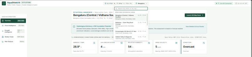
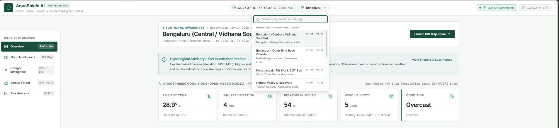
location selector
-
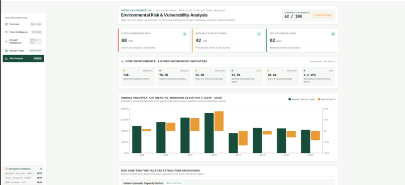
risk Analysis
-
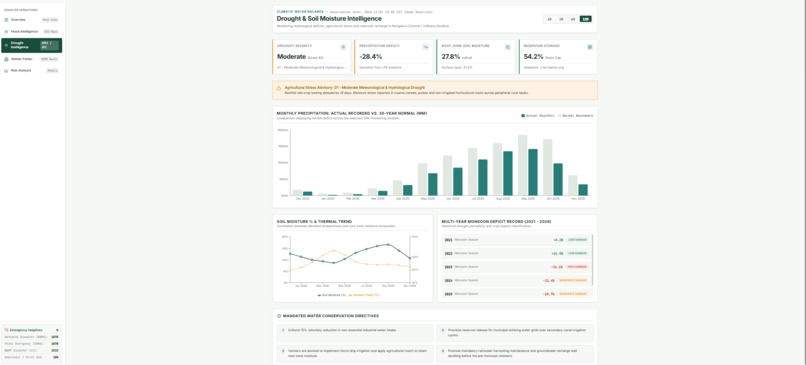
drought intelligence
-
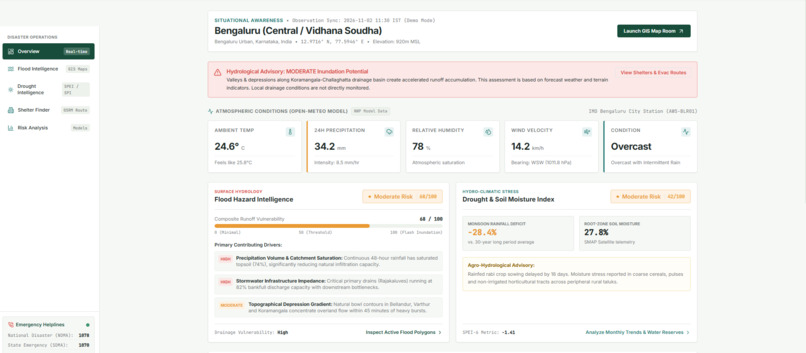
dashboard
-
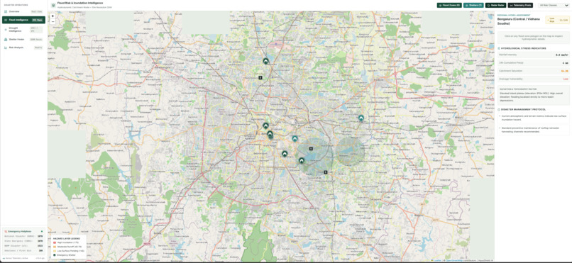
geospatial map
-
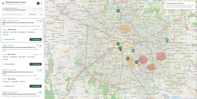
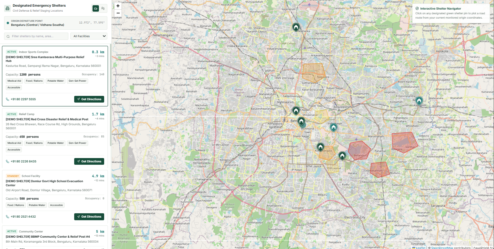
shelter finder
-
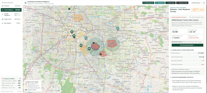
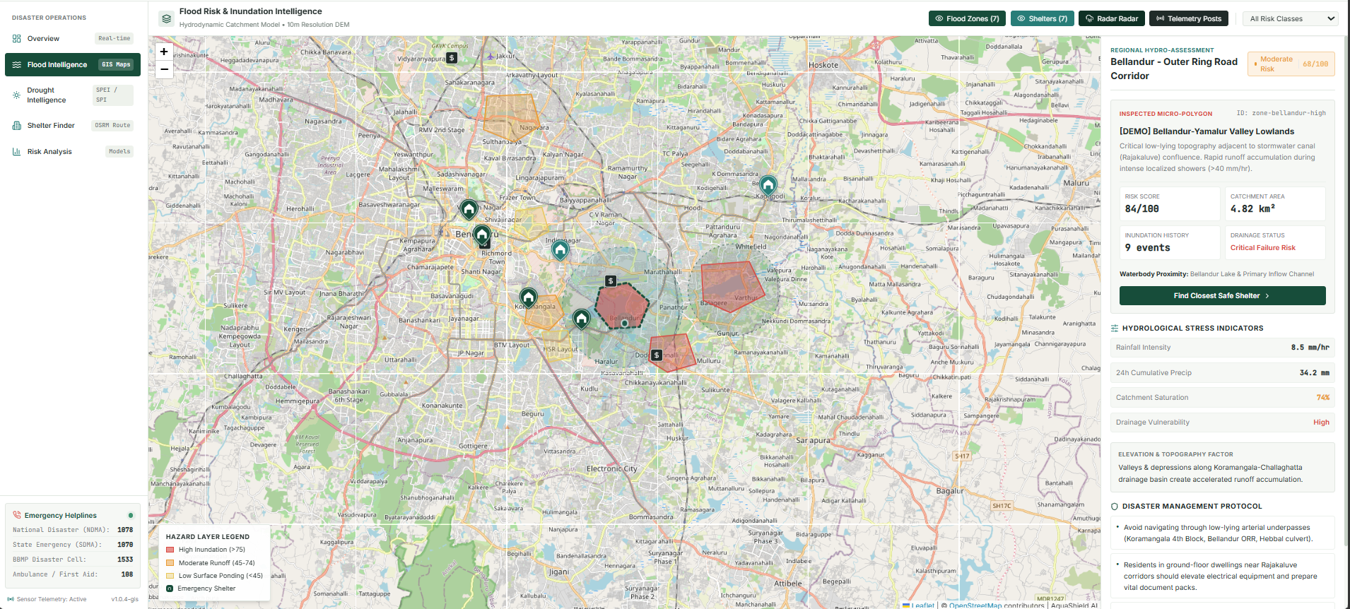
Flood Intelligence
Inspiration
Floods and droughts are two major environmental challenges that affect communities, agriculture, infrastructure, and everyday life. We noticed that although weather information is widely available, understanding what it means for a particular location and how to prepare for potential risks can still be difficult.
This inspired us to build AquaShield AI — a platform that brings flood intelligence, drought intelligence, geographical visualisation, and disaster-preparedness information together in one place.
Our vision was to make environmental risk information easier to explore and understand, helping people become better prepared before a disaster occurs.
What it does
AquaShield AI is a flood and drought early-warning and disaster-preparedness platform.
Its key features include:
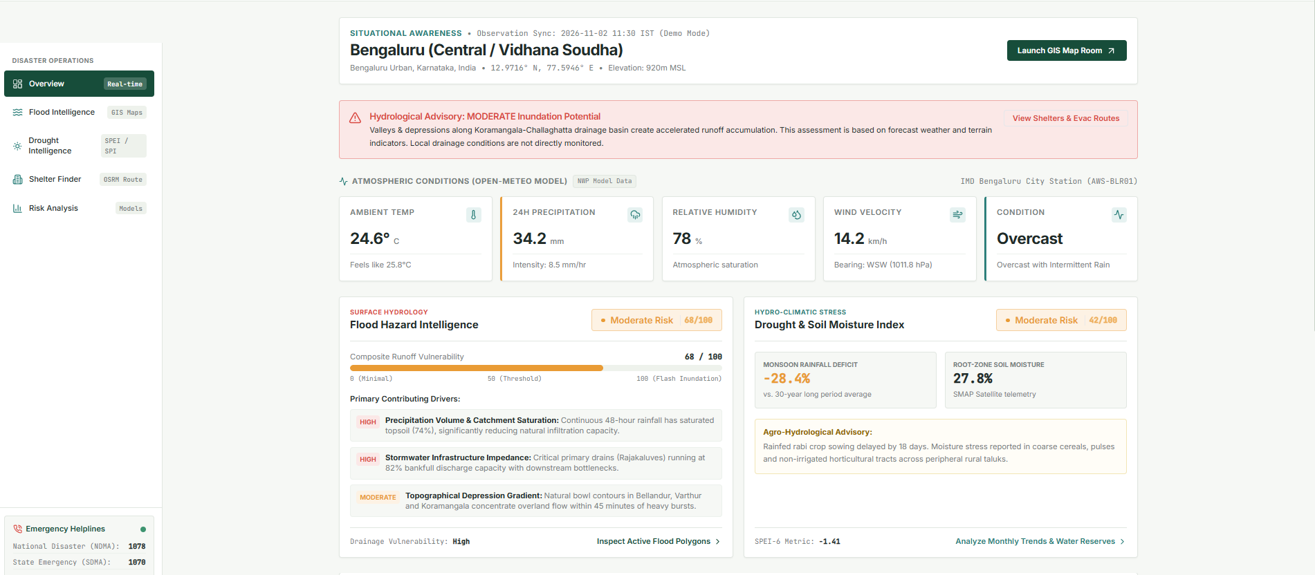
- Interactive Dashboard: Provides an overview of environmental conditions and geographical information for a selected location.
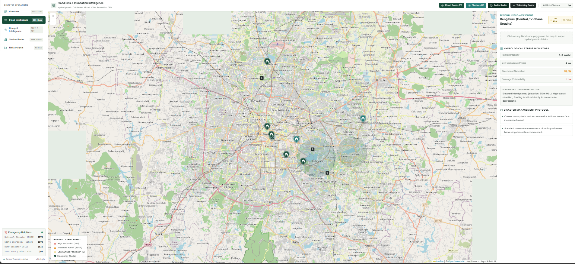
- Interactive Map: Allows users to explore geographical information visually and understand the area being analysed.
- Flood Intelligence: Uses available weather information and risk indicators to provide an indicative flood-risk assessment.
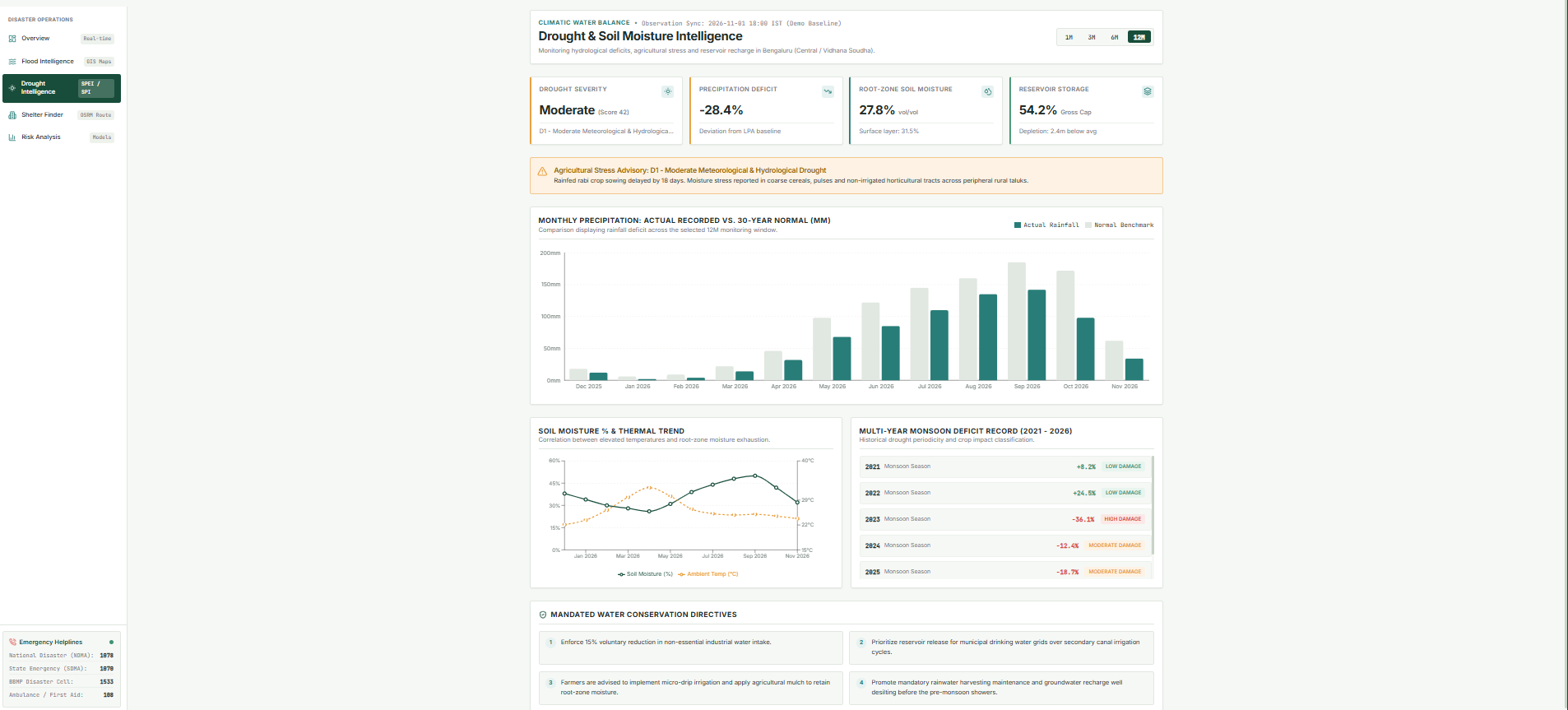
- Drought Intelligence: Presents drought-related environmental indicators to help users understand potential drought conditions.
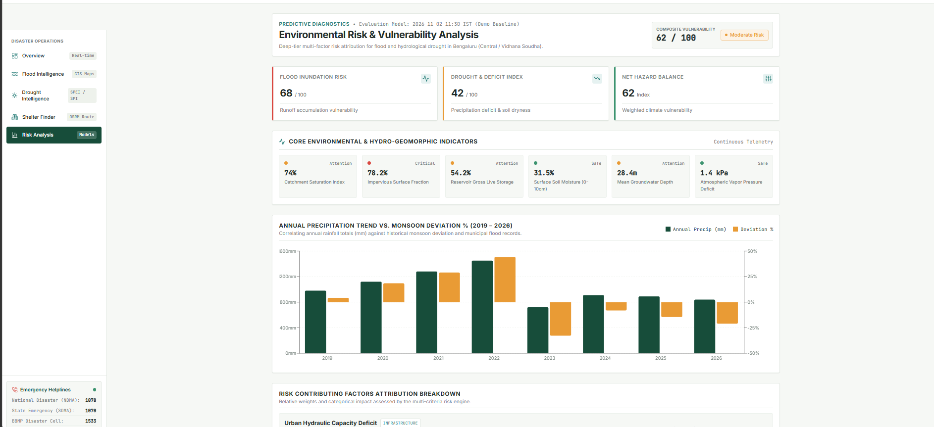
- Risk Analysis: Brings together risk-related information to provide a broader understanding of environmental threats.
- Shelter Finder: Helps users explore available shelter information for disaster preparedness.
How we built it
We built AquaShield AI using a full-stack architecture, combining a responsive frontend with a Python backend.
Frontend:
- React
- TypeScript
- Vite
- Tailwind CSS
- Recharts
- Leaflet and OpenStreetMap
Backend:
- Python
- FastAPI
- REST APIs
Data Sources:
- Open-Meteo API for weather information.
- OpenStreetMap for geographical visualisation.
We started by designing the dashboard and developing individual pages for flood intelligence, drought intelligence, risk analysis, and shelter discovery. We then developed the backend using FastAPI and connected it with the frontend through API endpoints.
Finally, we deployed the frontend and backend separately and worked on connecting them to make the platform accessible online.
Challenges we ran into
Building AquaShield AI within a limited hackathon timeframe came with several challenges:
- Frontend and Backend Integration: Connecting the React frontend with FastAPI and resolving API communication issues.
- Environmental Data Interpretation: Understanding how weather information and environmental indicators could contribute to flood and drought risk assessment.
- Map Integration: Incorporating geographical visualisation while maintaining a clean and user-friendly interface.
- Deployment Issues: Configuring separate frontend and backend deployments and troubleshooting connectivity problems.
- Time Constraints: Prioritising features, testing the application, and preparing the final demonstration within the hackathon deadline.
Working through these challenges helped us understand the practical difficulties involved in developing and deploying a full-stack application.
Accomplishments that we're proud of
We are proud to have developed AquaShield AI from an idea into a deployed, accessible web application within the hackathon timeframe.
Some accomplishments we are particularly proud of include:
- Building a unified platform that focuses on both floods and droughts.
- Developing an interactive dashboard with geographical visualisation.
- Creating separate flood and drought intelligence sections.
- Integrating environmental weather data into the application.
- Developing a FastAPI backend and connecting it with the React frontend.
- Successfully deploying the application and making it accessible through a live link.
Most importantly, we are proud that we were able to turn a real-world problem into a working prototype with scope for further development.
What we learned
This project helped us gain practical experience in full-stack development and problem-solving.
We learned how to:
- Build responsive web applications using React and TypeScript.
- Develop backend services and REST APIs using FastAPI.
- Integrate external APIs and work with environmental data.
- Implement interactive maps and geographical visualisation.
- Connect and deploy frontend and backend services.
- Debug real-world integration and deployment issues.
We also learned that developing a disaster-preparedness solution requires more than collecting data. The information must be presented clearly and responsibly so that users can understand its significance.
What's next for AquaSheild-AI
We see AquaShield AI as a foundation that can be expanded into a more comprehensive disaster-intelligence platform.
Our future plans include:
- Developing more advanced flood and drought prediction models using historical and real-time datasets.
- Improving the accuracy of location-specific risk assessments.
- Adding verified and regularly updated shelter information.
- Introducing location-based early-warning alerts and notifications.
- Enhancing flood-zone visualisation and emergency route guidance.
- Expanding coverage to more cities and vulnerable regions.
- Exploring integration with official disaster-management and weather information systems.
Our long-term goal is to make AquaShield AI a useful platform for improving environmental awareness and disaster preparedness.
AquaShield AI — Predict. Protect. Prepare.
Built With
- api
- artificial
- css
- disaster
- environmental
- fastapi
- geospatial
- html
- intelligence
- javascript
- leaflet.js
- management
- monitoring
- open-meteo
- openstreetmap
- python
- react
- recharts
- rest
- tailwind
- technology
- typescript
- vite
- weather
