-
-
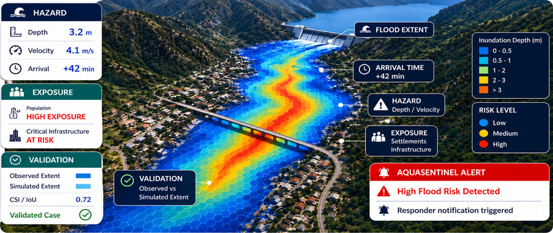
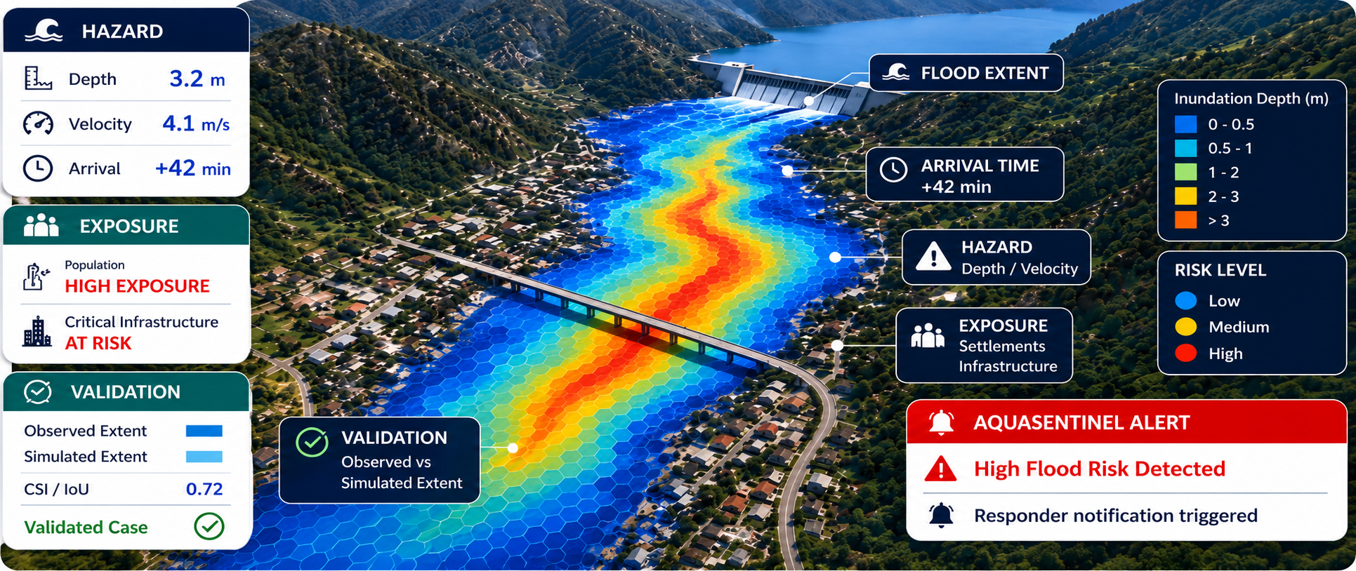
idea description
-
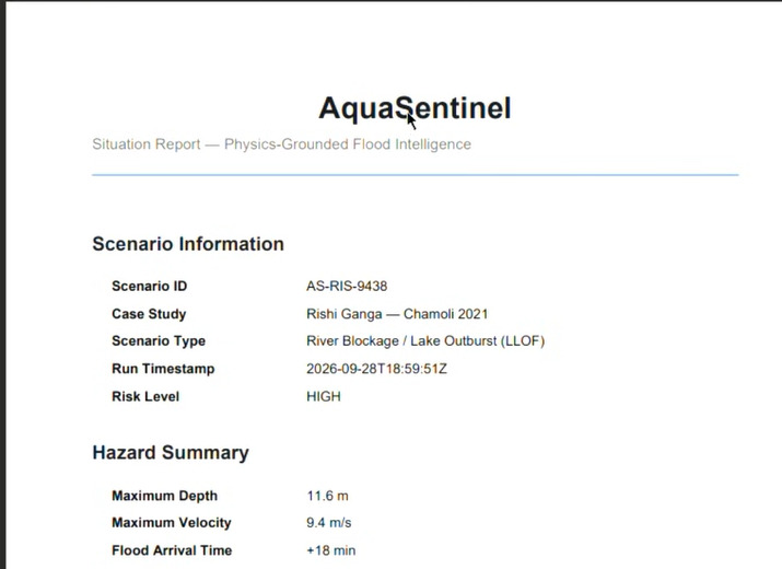
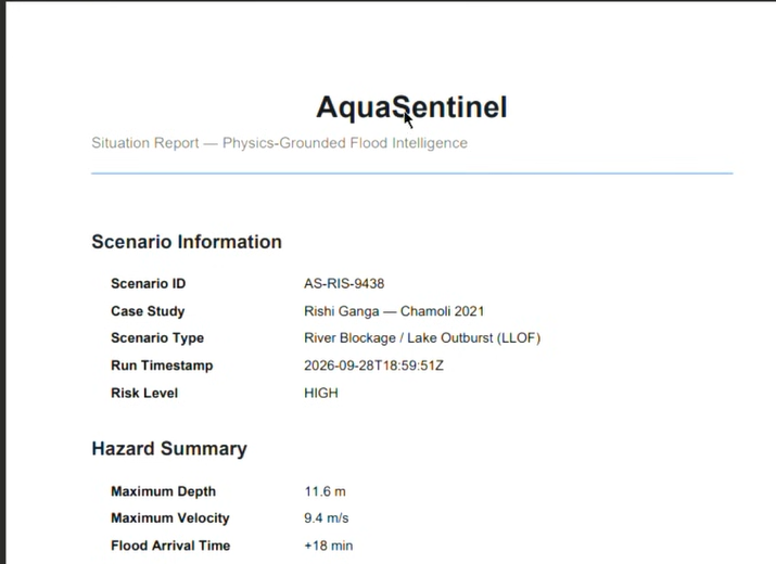
report generated
-
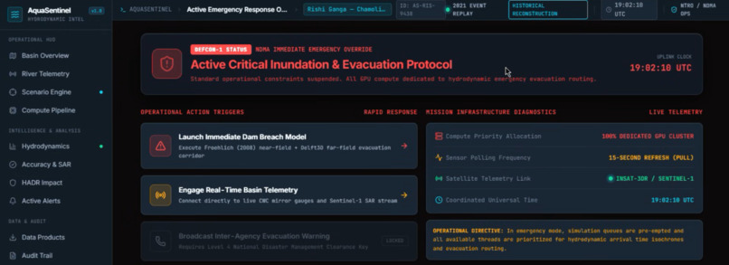
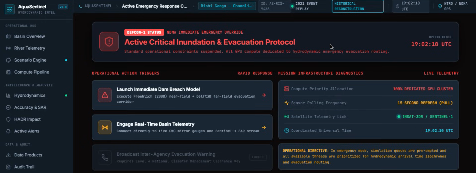
sample ui
-
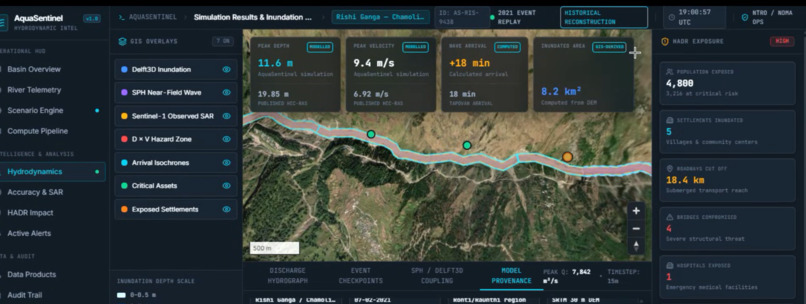
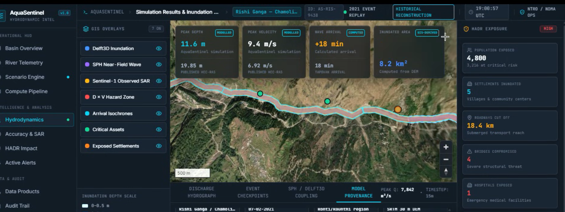
sample ui map
Inspiration
Floods in mountainous regions such as the Himalayas can damage critical infrastructure, disrupt transportation, and isolate entire settlements from essential services. Emergency responders need more than a map showing where flooding occurred; they need to understand which buildings, roads, and bridges may be affected and which communities could lose access to nearby towns or hospitals.
AquaSentinel aims to bridge the gap between satellite observations and disaster-response decisions by combining AI-powered flood mapping, infrastructure exposure analysis, and road-network connectivity assessment in one platform.
What it does
AquaSentinel is a satellite-based flood impact mapping and disaster-response support platform. Given a geographical area and flood event date, it compares pre-event and post-event satellite observations to identify potentially flood-affected regions.
The platform uses Sentinel-1 Synthetic Aperture Radar (SAR) imagery, which is valuable when cloud cover limits conventional optical observations. Sentinel-2 optical imagery can supplement the analysis when suitable cloud-free data is available. An AI-based segmentation component identifies potentially flood-affected areas.
The results are combined with pre-event OpenStreetMap data to estimate potentially affected buildings, roads, and bridges. A road-network graph then helps identify settlements that could lose road connectivity to nearby towns or hospitals under specified road-closure assumptions.
The resulting dashboard is designed to bring together satellite comparisons, affected-area estimates, infrastructure exposure, and potentially disconnected settlements to support situation reporting and response prioritization.
How we built it
AquaSentinel combines satellite-image processing, AI-based segmentation, geospatial analysis, and network modelling in a unified workflow.
- Satellite imagery: Compare pre-event and post-event Sentinel-1 observations, using Sentinel-2 imagery as supplementary evidence when appropriate.
- AI-based flood mapping: Apply a segmentation model to identify potentially flood-affected areas, with evaluation on unseen Himalayan scenes to assess generalization.
- Geospatial processing: Align raster and vector datasets so satellite-derived results can be compared with mapped infrastructure.
- Infrastructure analysis: Use pre-event OpenStreetMap data to estimate the buildings, roads, and bridges that intersect or lie near potentially affected areas.
- Connectivity analysis: Represent the road network as a graph and evaluate potential settlement isolation under defined road-closure assumptions.
- Visualization and reporting: Present the results through a map-based dashboard and organize computed findings into a concise situation report.
- Independent evaluation: Compare generated results with official Copernicus Emergency Management Service reference products only after producing the outputs. These reference products are not used as model inputs.
Challenges we ran into
One major challenge is reliably distinguishing flood-related changes from other surface changes in satellite imagery. Although Sentinel-1 SAR works under cloudy conditions, terrain, vegetation, buildings, and surface characteristics can affect radar backscatter. Floodwater can also be difficult to distinguish from debris or other changes.
Another challenge is comparing observations acquired at different times while accounting for image alignment and changing environmental conditions.
Infrastructure assessment brings additional uncertainty. OpenStreetMap data may be incomplete or outdated, and a road or building overlapping a potentially affected area is not necessarily damaged. Similarly, a road identified as exposed to flooding cannot automatically be classified as blocked or impassable.
Connectivity analysis also depends on assumptions about which roads are closed and which routes remain usable. Potentially disconnected settlements must therefore be treated as locations requiring further investigation, rather than confirmed cases of isolation.
Finally, independent evaluation is essential. Reference damage maps must remain separate from model inputs so that performance assessments remain meaningful.
Accomplishments that we're proud of
AquaSentinel brings together three important elements of post-flood assessment: satellite-based flood mapping, infrastructure exposure estimation, and road-network connectivity analysis.
Instead of stopping at a flood map, the project connects potential flood impacts with the infrastructure and communities that may be affected. This can help responders identify areas that deserve closer investigation and understand possible disruptions to essential travel routes.
We are also proud of the emphasis on responsible AI. By distinguishing potential exposure from confirmed damage and modelled connectivity risks from verified road closures, AquaSentinel is designed to communicate uncertainty instead of presenting every prediction as fact.
What we learned
We learned that effective disaster mapping requires more than an accurate AI model. Reliable results depend on careful satellite-data preparation, consistent geospatial alignment, suitable infrastructure datasets, and evaluation against independent references.
We also learned the importance of separating observed evidence from inferred consequences. Satellite imagery alone may not establish whether a building is structurally damaged or a road is impassable. Likewise, a graph-based connectivity result represents a potential risk under specified assumptions, not direct confirmation of conditions on the ground.
Combining AI with geospatial analysis can provide more actionable insights than segmentation alone. Transparent assumptions, data provenance, validation, and clear communication of uncertainty are essential when developing tools intended to support disaster-response decisions.
What's next for AquaSentinel
Our next steps are to improve flood-segmentation performance across unseen Himalayan scenes, evaluate the workflow on additional flood events, and improve the reliability of infrastructure exposure estimates.
We also plan to refine road-network analysis using more realistic closure scenarios and multiple essential destinations. Downstream flood-path analysis using elevation data could help identify settlements potentially exposed along a river corridor.
Another planned enhancement is a situation-report assistant in English and Nepali, with every reported number grounded in a computed system output.
Ultimately, we envision AquaSentinel as a reusable disaster-response support platform that transforms satellite observations into geographically grounded assessments of potential flood impacts. By connecting flood mapping with infrastructure exposure and community connectivity, the project aims to help responders prioritize further investigation while keeping human verification central to decision-making.
Built With
- copernicus-data-space-ecosystem
- copernicus-dem
- docker
- fastapi
- gdal
- geopandas
- kuro-siwo
- maplibre-gl-js
- networkx
- ohsome-api
- openstreetmap
- postgis
- python
- pytorch
- rasterio
- react
- sentinel-1
- sentinel-2
- shapely
- typescript

Log in or sign up for Devpost to join the conversation.