-
-
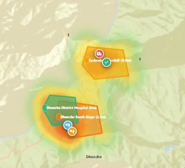
After reporting
-
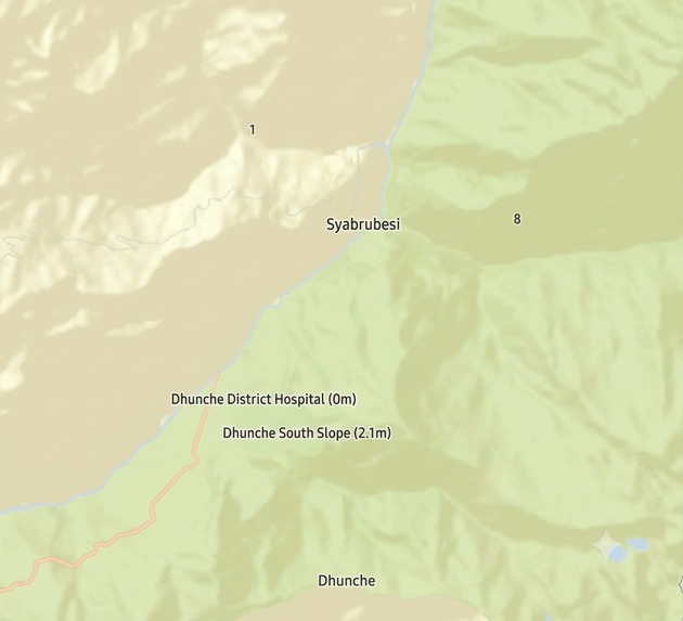
Before reporting
Inspiration
Catastrophic floods develop within minutes. In coastal megacities like Mumbai, monsoon downpours combined with astronomical high tides lock drainage gates, submerging traffic subways under ( > 2.5\text{ m} ) of water. In the steep Himalayan corridors of Nepal (Bhote Koshi – Trishuli), glacial lake outbursts and flash landslides sever critical transit lifelines.
We built Aqualert to bridge the operational divide between stranded citizens needing verified safe-haven routing and tactical command centers needing real-time triage intelligence.
What it does
Aqualert is an operational space-and-ground disaster intelligence and emergency tactical lifeline system designed for sudden- onset flood catastrophes across both coastal megacities (Mumbai Monsoon) and steep Himalayan river corridors (Nepal Trishuli – Bhote Koshi).
The platform separates responsibilities across three dedicated interfaces:
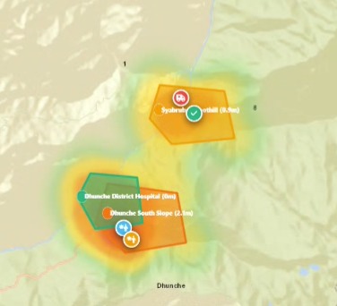
Government Command Server (/gov): • 100+ Live Survivor Triage: Tracks distress signals with clickable map telemetry, zooming directly to survivors' GPS coordinates. • 1-Click Tactical Dispatch: Triggers rapid-response deployments for ALH Dhruv Air-Lift Helicopters, NDRF motorized rescue boats, and Police 112 squads. • Bilingual Situation Reports (SitReps): Compiles certified briefings simultaneously in English and Nepali (नेपाली) for cross border river coordination. • Thermal Hazard Heatmap: Overlays a hardware-accelerated continuous flood intensity gradient calculated via radial Gaussian decay:
N ⎛ (x - xₖ)² + (y - yₖ)²⎞I(x, y) = ∑ wₖ · exp⎜- ─────────────────────⎟ k=1 ⎝ 2σₖ² ⎠
Survivor Emergency Lifeline (/survivor): • 1-Touch SOS Transmitter: Transmits live GPS coordinates, trapped headcount, and acute medical flags. • 1-Time KYC Onboarding: Captures citizen identity, emergency contacts, and medical priorities to prevent duplicate tickets. • Automated Geofenced Hazard Detection: Uses in-browser ray-casting to alert survivors if they are trapped inside Level 4 (Crimson), Level 3 (Orange), or Level 2 (Yellow) hazard zones. • Nearest Safe-Haven Routing: Calculates Haversine distances to guide citizens toward elevated shelters.
Public Citizen Portal (/): • 4-Mode GIS Map Engine: Switches between vector streets, high-contrast dark tactical, 3D topography, and satellite imagery. • Statutory 15-Day Retention Lock: Prevents premature dismissal or archival of Level 4 flooded records for at least half a month:
Δt ≥ 15 days retention
How we built it
We engineered a high-throughput, zero-token platform powered by FastAPI (Python 3.12) and Leaflet GIS, split across three role- separated interfaces:
- Government Command Server (/gov): Manages 100+ live survivor distress beacons, triggers 1-click helicopter and boat dispatches, and generates Situation Reports (SitReps) simultaneously in English and Nepali (नेपाली) for cross-border river coordination.
- Survivor Emergency Lifeline (/survivor): Delivers a 1-touch SOS beacon, 1-time KYC onboarding, automated geofenced hazard alerts, and nearest safe-haven escape routing.
Public Citizen Portal (/): A multi-basemap GIS explorer enforcing a statutory 15-day non-ignorable incident retention rule:
Δt ≥ 15 days retention
We modeled flood intensity as a continuous spatial field using a hardware-accelerated Thermal Hazard Heatmap driven by a weighted radial Gaussian dispersion function:
           N                   ⎛  (x - xₖ)² + (y - yₖ)²⎞
I(x, y) =  ∑  wₖ · exp⎜- ──────────⎟
          k=1                 ⎝          2σₖ²              ⎠
where ( w_k \in [0.0, 1.0] ) represents water depth severity and ( \sigma_k ) is local terrain dispersion.
We also created an automated self-bootstrapping launcher (run_app.bat) that detects Python, provisions dependencies silently via winget, and clears Windows security flags with zero configuration:
python -m uvicorn server:app --host 127.0.0.1 --port 8000
Challenges we ran into
• Zero-API-Key Cartography: Eliminating brittle, token-restricted commercial mapping APIs that fail during crises, replacing them with open, high-availability Esri vector, dark tactical, 3D topo, and satellite tile streams. • Accounting for Orbital Physics: Earth observation satellites (Sentinel-1/2) have revisit intervals of ( 5\text{--}12\text{ days} ) and cannot warn of sub-minute glacial collapses or penetrate thick monsoon clouds with optical sensors. • Cross-Border Interoperability: Structuring formal bilingual reporting in both English and official Nepali (नेपाली) across India (NDRF/SDMA) and Nepal (BIPAD/APF) jurisdictions.
Accomplishments that we're proud of
• 100% Free & Open Cartography: We built an operational command platform completely free of proprietary API tokens or paid services (Google Maps/Mapbox), guaranteeing zero risk of token exhaustion or billing lockouts during an active catastrophe. • Cross-Border Interoperability: Implemented dual-language incident reporting in English and official Nepali (नेपाली), bridging the jurisdictional gap between India's NDRF and Nepal's BIPAD portal standards for transboundary river basins. • Algorithmic Triage Scoring: Replaced chaotic manual emergency logs with an automated priority ranking formula:
P       = min⎛100,  35 · M    + 20 · min⎛H       , 5    ⎞ + 25 · L       + 15 · V     + 5 · τ    ⎞
 triage        ⎝            med                      ⎝ trapped   ⎠         hazard         vuln        wait⎠
ensuring medical emergencies and trapped groups are rescued first.
• Zero-Touch Self-Bootstrapping Launcher: Developed a single-click run_app.bat that automatically detects the runtime, installs Python and dependencies silently via winget, and unblocks Windows Mark-of-the-Web security streams with zero configuration. • Statutory Compliance Safeguards: Enforced server-level HTTP 403 blocks against premature zone deletion, holding emergency records open until water levels recede and structural audits conclude.
What we learned
• Sensor-Fusion is Vital: Satellite remote sensing provides macro-inundation extent mapping, but it must be paired with in-situ river radar stage gauges and acoustic sirens for sub-minute early warnings. • Mathematical Triage Saves Lives: Under crisis load, algorithmic scoring fairly prioritizes emergency air-lifts and boat extractions:
P     = min⎛100,  35 · M    + 20 · min⎛H       , 5    ⎞ + 25 · L       + 15 · V     + 5 · τ    ⎞
 triage      ⎝            med                      ⎝ trapped   ⎠         hazard         vuln        wait⎠
What's next for Aqualert
• Three-Tier Sensor-Fusion Integration: Pair spaceborne satellite surveillance with upstream in-situ bridge radar gauges and acoustic sensors to detect sudden sub-minute debris torrents before satellites can orbitally revisit (revisit cycles of ( 5\text{--}12\text{ days} )). • Offline LoRaWAN / Meshtastic Radio Mesh: Implement decentralized peer-to-peer radio relay nodes (865/433 MHz) so stranded survivors can broadcast SOS signals even when commercial cellular base stations and power grids submerge. • Direct Satellite Uplinks: Integrate NavIC and Iridium short-burst data transceivers for emergency teams operating in deep mountain valleys with zero cellular reception. • Subterranean Drainage IoT Integration: Feed real-time telemetry from storm drain pressure gauges to model underground tidal lockouts and flash backflow surges in low-lying city subways.
Built With
- 13/10/2026]-michael-camill:-fastapi
- 13/10/2026]-michael-camill:-leaflet
- 13/10/2026]-michael-camill:-python
- css3
- css3-[01:46
- fastapi
- html5
- javascript
- leaflet-heat
- leaflet-heat-[01:47
- leaflet.js
- openstreetmap
- python
- uvicorn
- uvicorn-[01:47

Log in or sign up for Devpost to join the conversation.