-
-
Presentation - ignisMap by bolt 11
-
Presentation - ignisMap by bolt 7
-
Presentation - ignisMap by bolt 5
-
Presentation - ignisMap by bolt 8
-
Presentation - ignisMap by bolt 6
-
Presentation - ignisMap by bolt 1
-
Presentation - ignisMap by bolt 9
-

Presentation - ignisMap by bolt 2
-
Presentation - ignisMap by bolt 4
-
Presentation - ignisMap by bolt 3
-

Presentation - ignisMap by bolt 10


🧠 Idea IgnisMap is an intelligent wildfire prevention, monitoring, and resilience system. It integrates satellite data, sensor networks, AI, and visualization platforms to help detect, prevent, and manage wildfires early and effectively.
🎯 Problem Rising frequency and intensity of wildfires due to climate change, extreme droughts, and poor land practices
- Loss of human lives, biodiversity, infrastructure, and massive carbon emissions
- Current monitoring systems are fragmented, poorly integrated, and have low predictive capacity
- Limited community participation in resilience planning and early warning systems
💡 Solution An integrated platform combining AI, remote sensing, and satellite data for wildfire detection and prediction
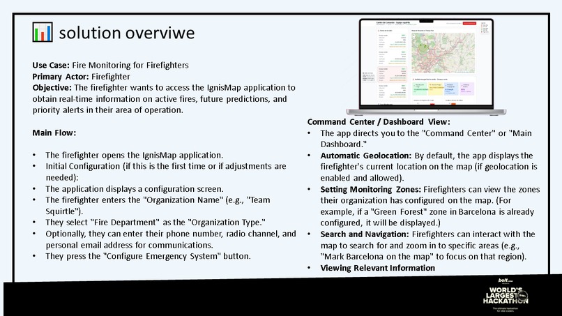
- Real-time interactive geospatial visualization for firefighters, municipalities, and NGOs
- Emergency evacuation planning and community preparedness modules
- Automated early warning alerts through mobile notifications and SMS
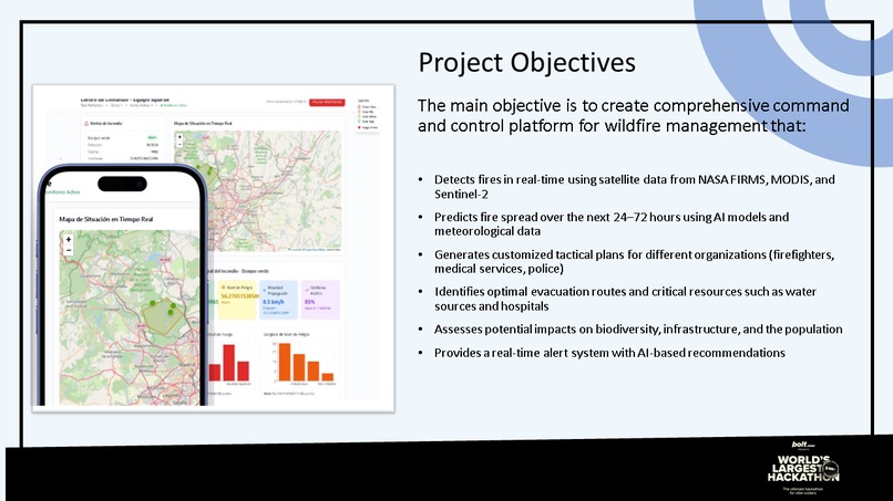
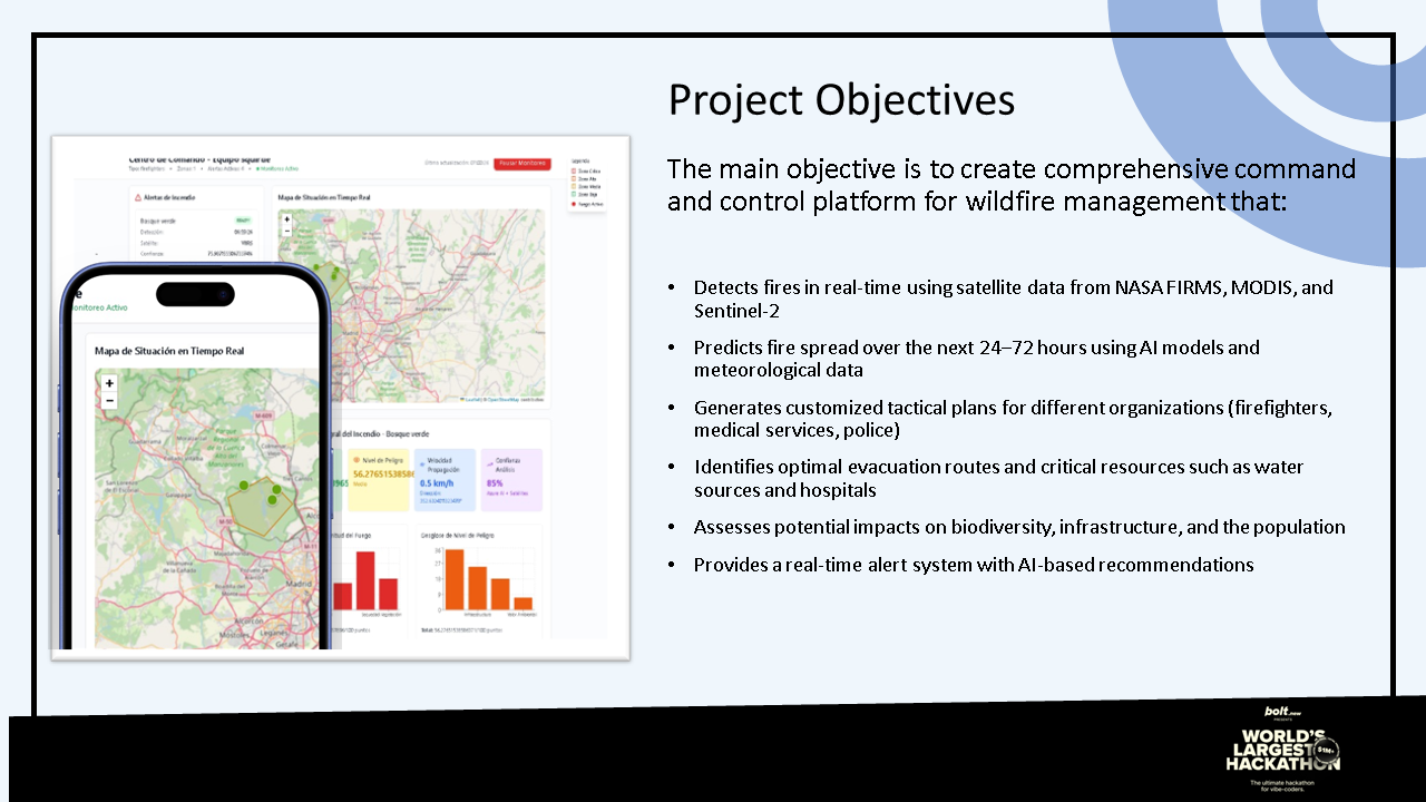
📱 Key Features ✅ Automatic hotspot detection via satellite + IoT sensors ✅ Predictive analytics with AI to anticipate fire spread ✅ Real-time maps with vulnerability layers and evacuation routes ✅ Geolocated multichannel alerts (push notifications, SMS, email) ✅ Coordination dashboards for emergency response agencies ✅ Integration with community resilience plans ✅ Environmental metrics dashboard (temperature, humidity, wind, etc.)
👥 Target Users
- Wildland firefighters and emergency brigades
- Municipal and local governments
- Environmental NGOs
- Rural communities exposed to wildfire risk
- Civil protection agencies
- Climate change researchers
🌎 Social Impact 🔥 Protection of human lives and natural heritage 🔥 Reduction of carbon emissions from wildfires 🔥 Greater public awareness and community engagement 🔥 Strengthening of local community resilience 🔥 Conservation of biodiversity and strategic ecosystems
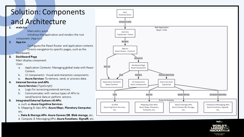
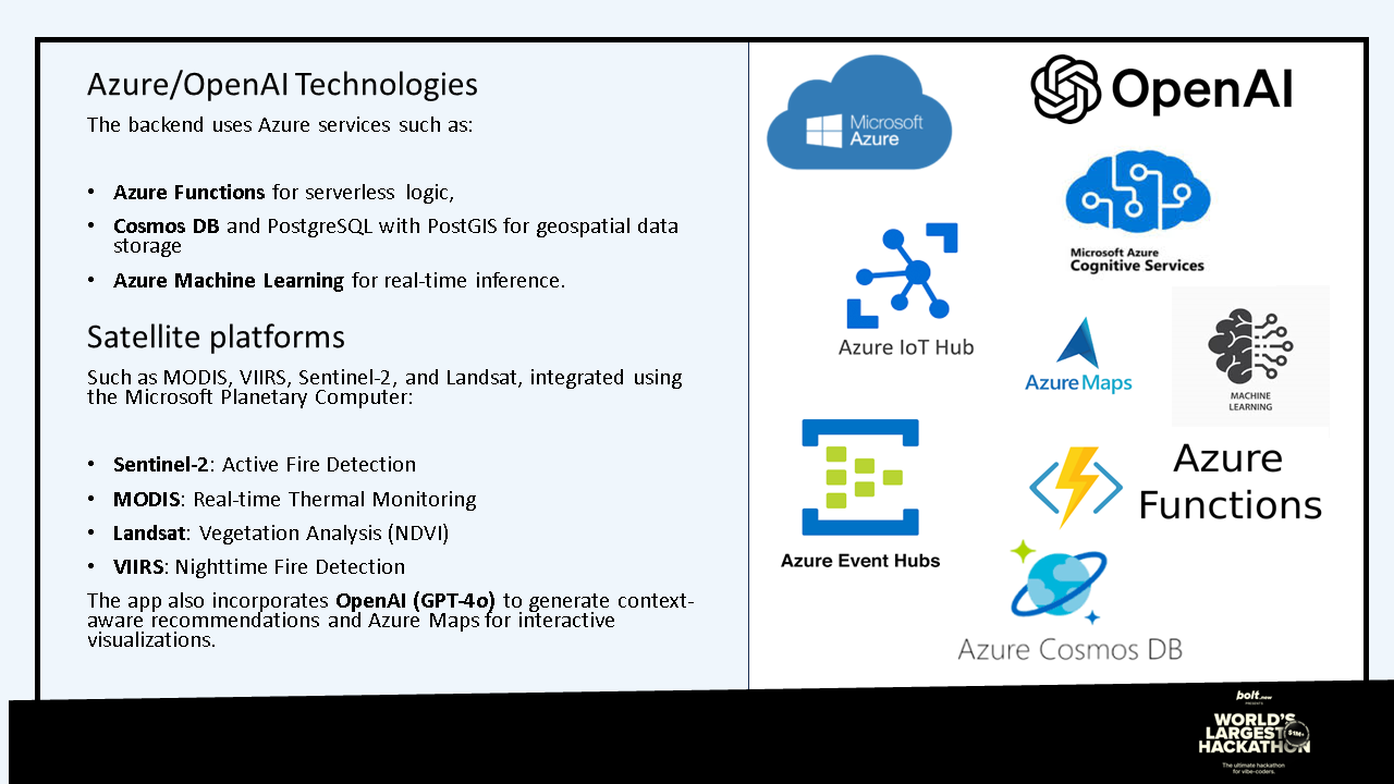
🛠️ Tech Stack
- Frontend
- React 18 with TypeScript
- Vite (optimized builds)
- Tailwind CSS (styling)
- Progressive Web App (PWA) with service workers
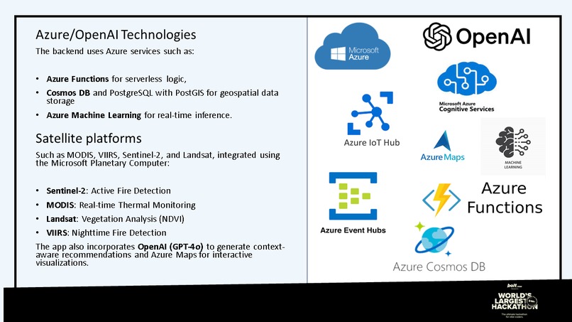
- Azure Services
- Azure Maps (professional mapping services)
- Cosmos DB (distributed NoSQL database)
- Cognitive Services (AI and image analysis)
- Azure Functions (serverless processing)
- Application Insights (monitoring and telemetry)
- Data APIs
- NASA FIRMS (active fire data)
- Open-Meteo (weather data)
- GBIF (biodiversity data)
- Microsoft Planetary Computer (geospatial analysis)
🚀 Current Status ✅ Idea validated and clearly defined ✅ MVP prototype under development ✅ Initial satellite data integration in testing ✅ Seeking partnerships with NGOs and civil protection agencies ✅ Exploring funding opportunities (public grants, international funds)
Built With
- azure
- cosmos
- openstreetmap
- pwa
- react
- tailwind
- typescript
- vite

Log in or sign up for Devpost to join the conversation.