-
-
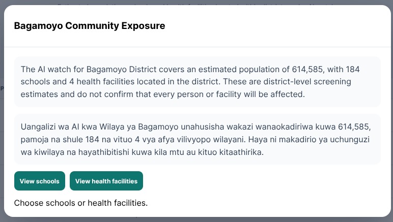
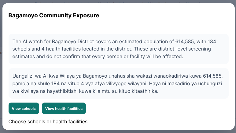
English and Swahili exposure summary for Bagamoyo, including population, schools and health facilities.
-
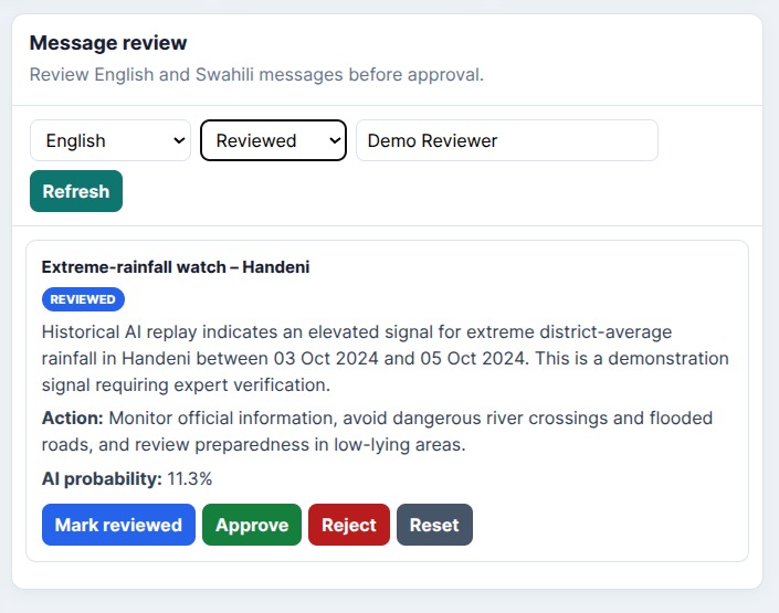
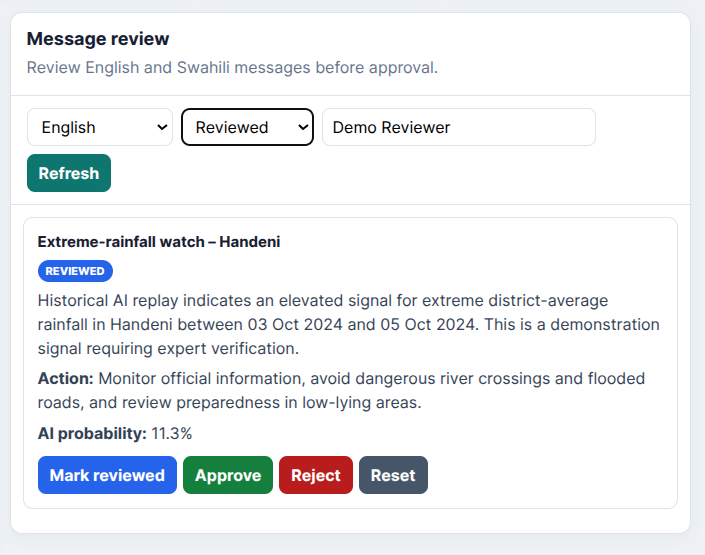
Reviewed English rainfall alert for Handeni showing status, recommended actions and AI probability.
-
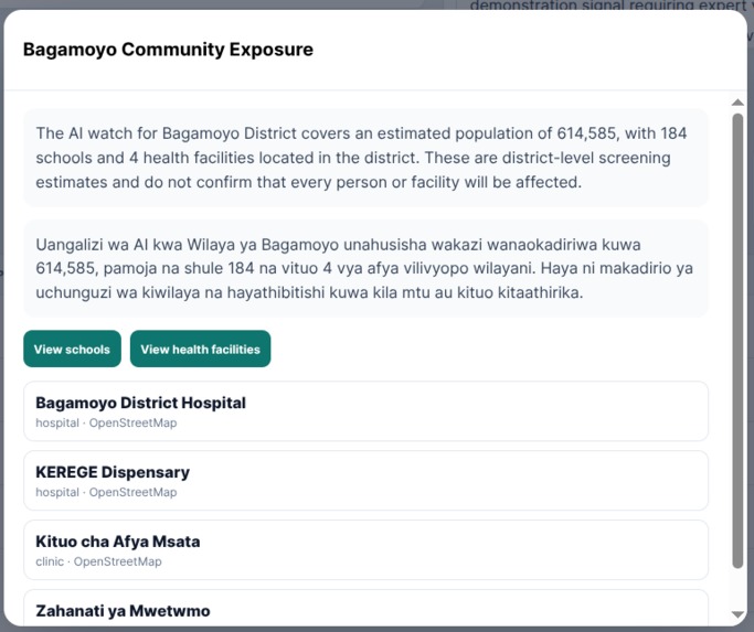
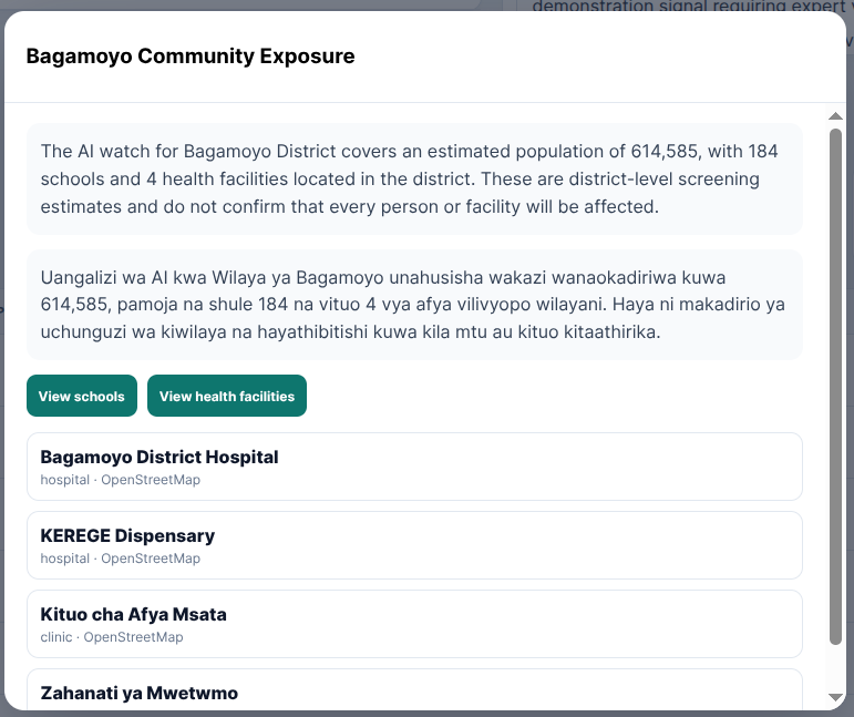
List of hospitals, clinics and dispensaries in Bagamoyo District for critical-facility preparedness.
-
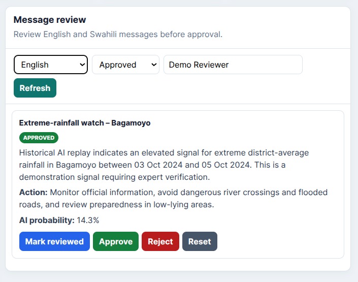
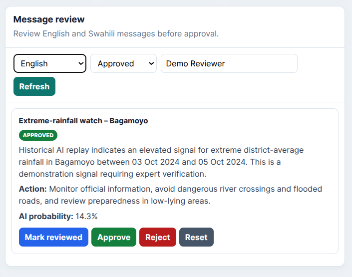
Approved English rainfall alert for Bagamoyo with recommended actions and AI probability.
-
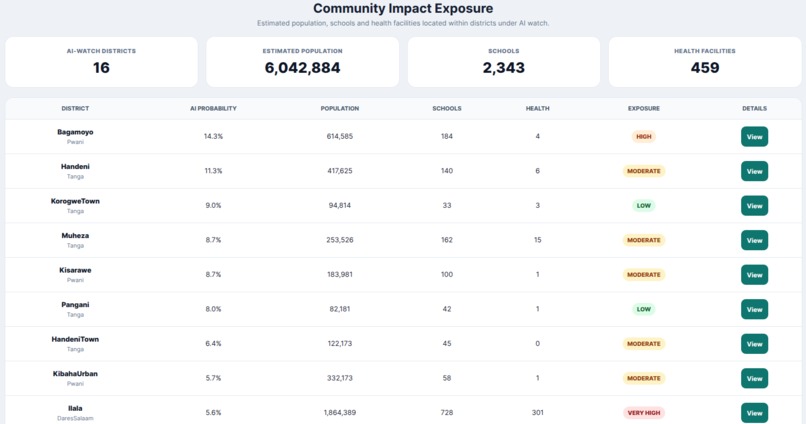
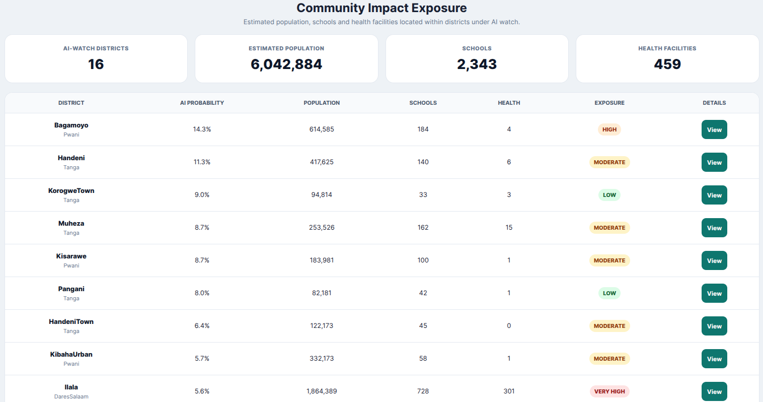
Community exposure table showing populations, schools and health facilities in districts under AI watch.
-
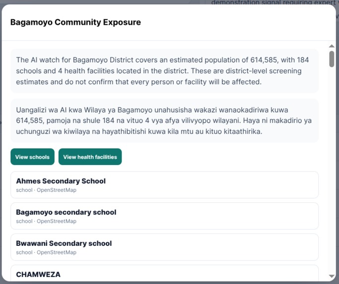
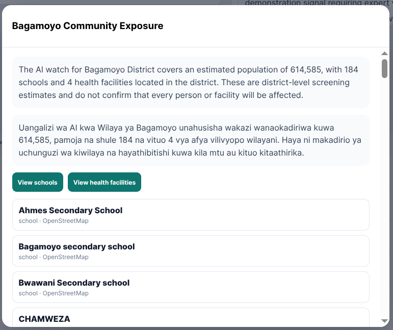
List of schools in Bagamoyo District to support preparedness planning for exposed education facilities.
-
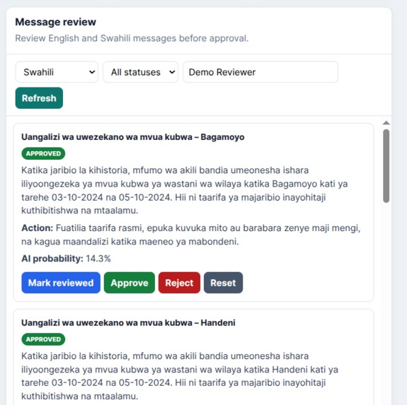
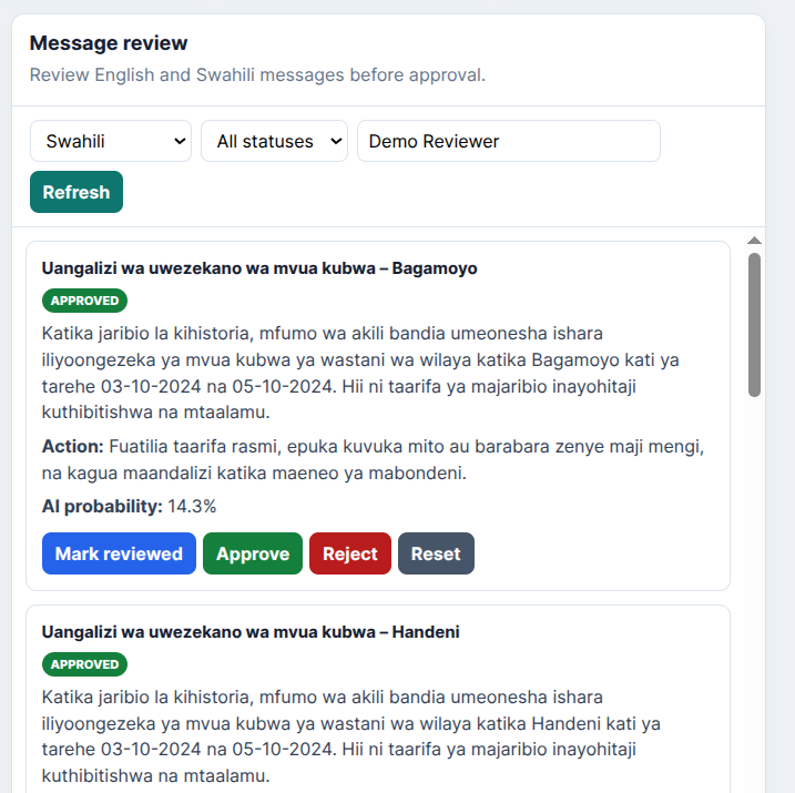
Swahili alert review interface for approving, rejecting or resetting AI-assisted warning messages.
-
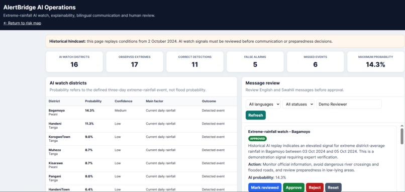
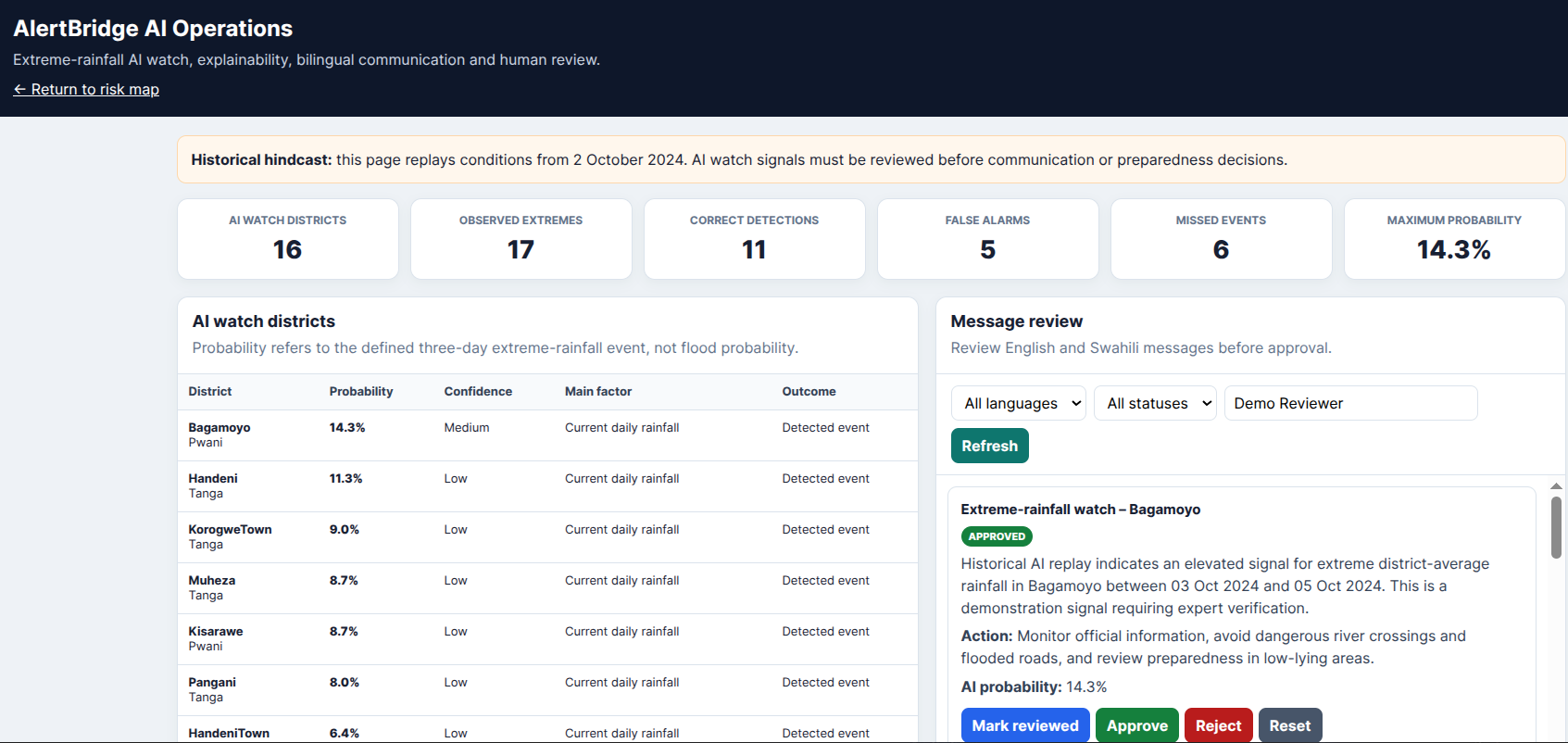
Operations dashboard showing AI-watch districts, model performance and expert review of warning messages.
-
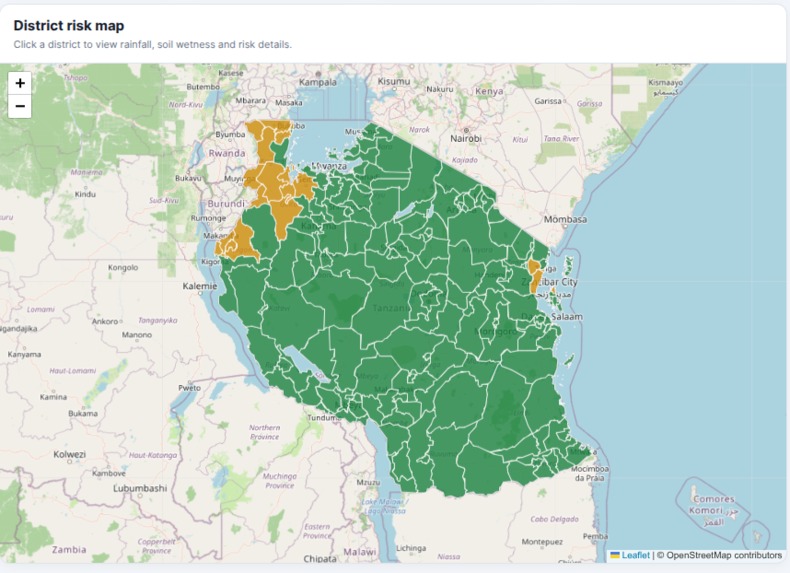
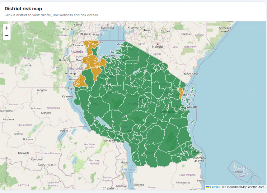
Interactive Tanzania district map showing rainfall, soil condition and risk details for selected areas.
-
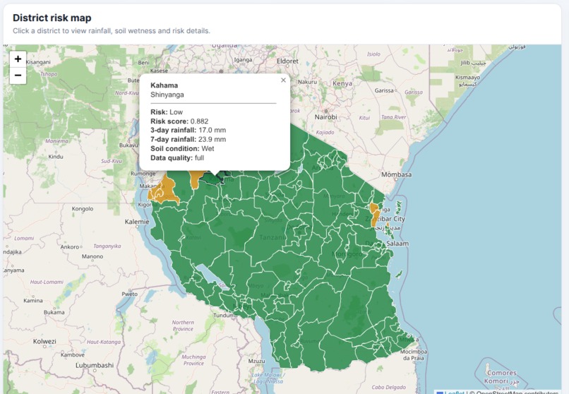
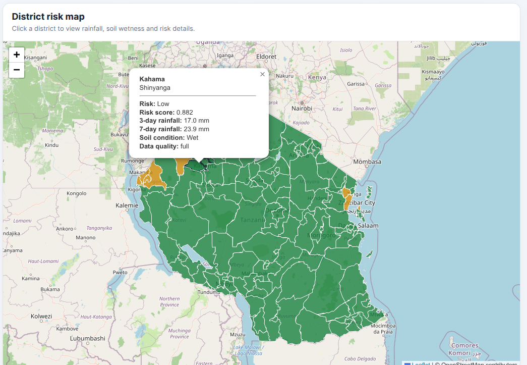
Kahama district popup showing low risk, recent rainfall, wet soil conditions and full data quality
-
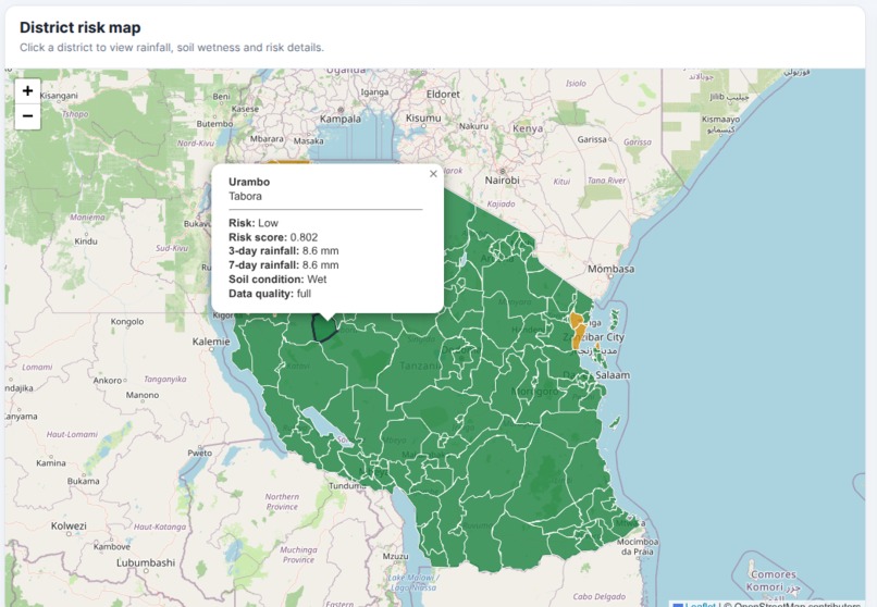
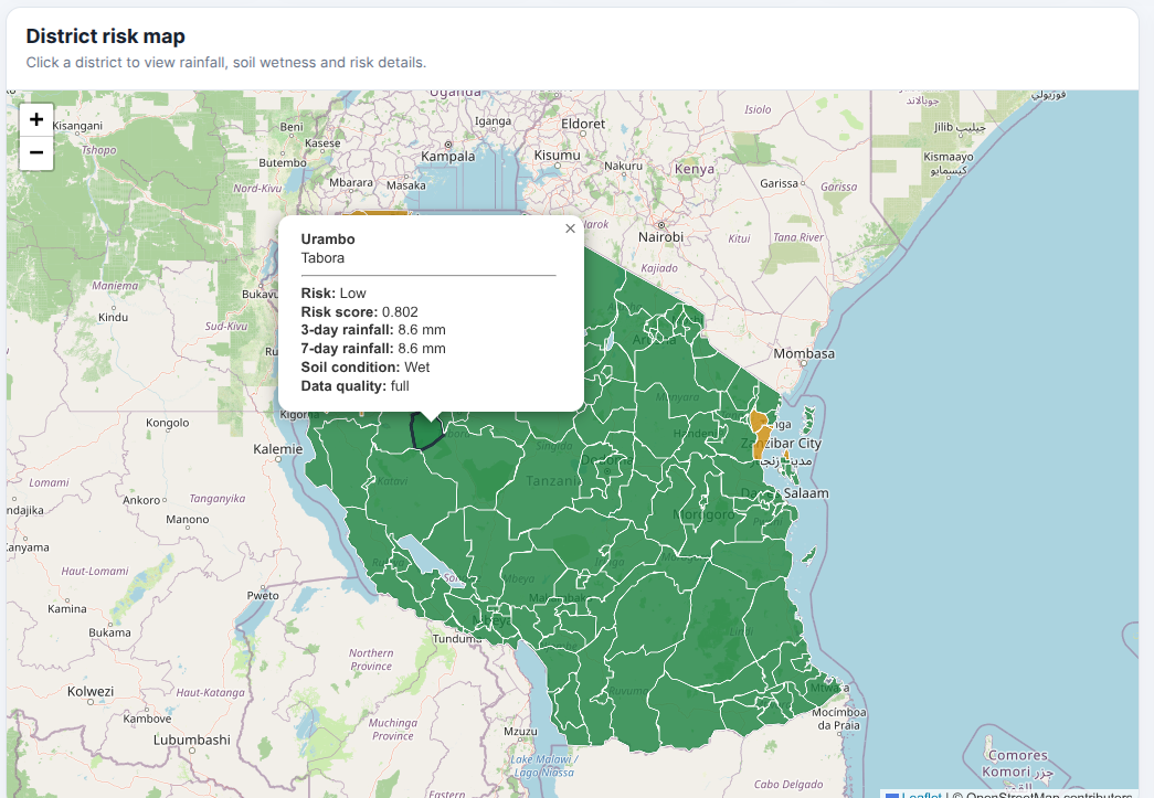
Urambo district popup showing low risk, recent rainfall, wet soil conditions and full data quality.
-
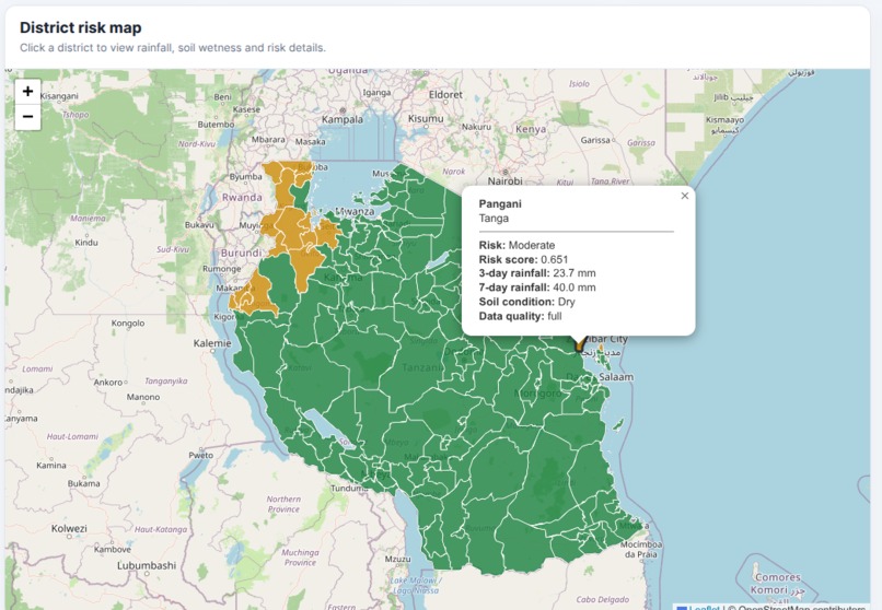
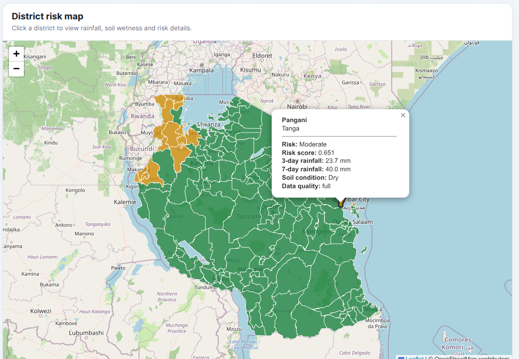
Pangani district popup showing moderate risk, rainfall totals, dry soil conditions and full data quality
-
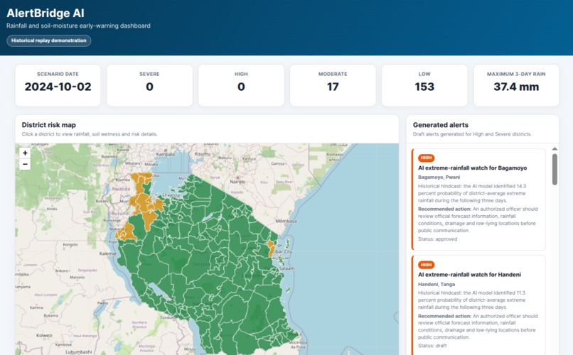
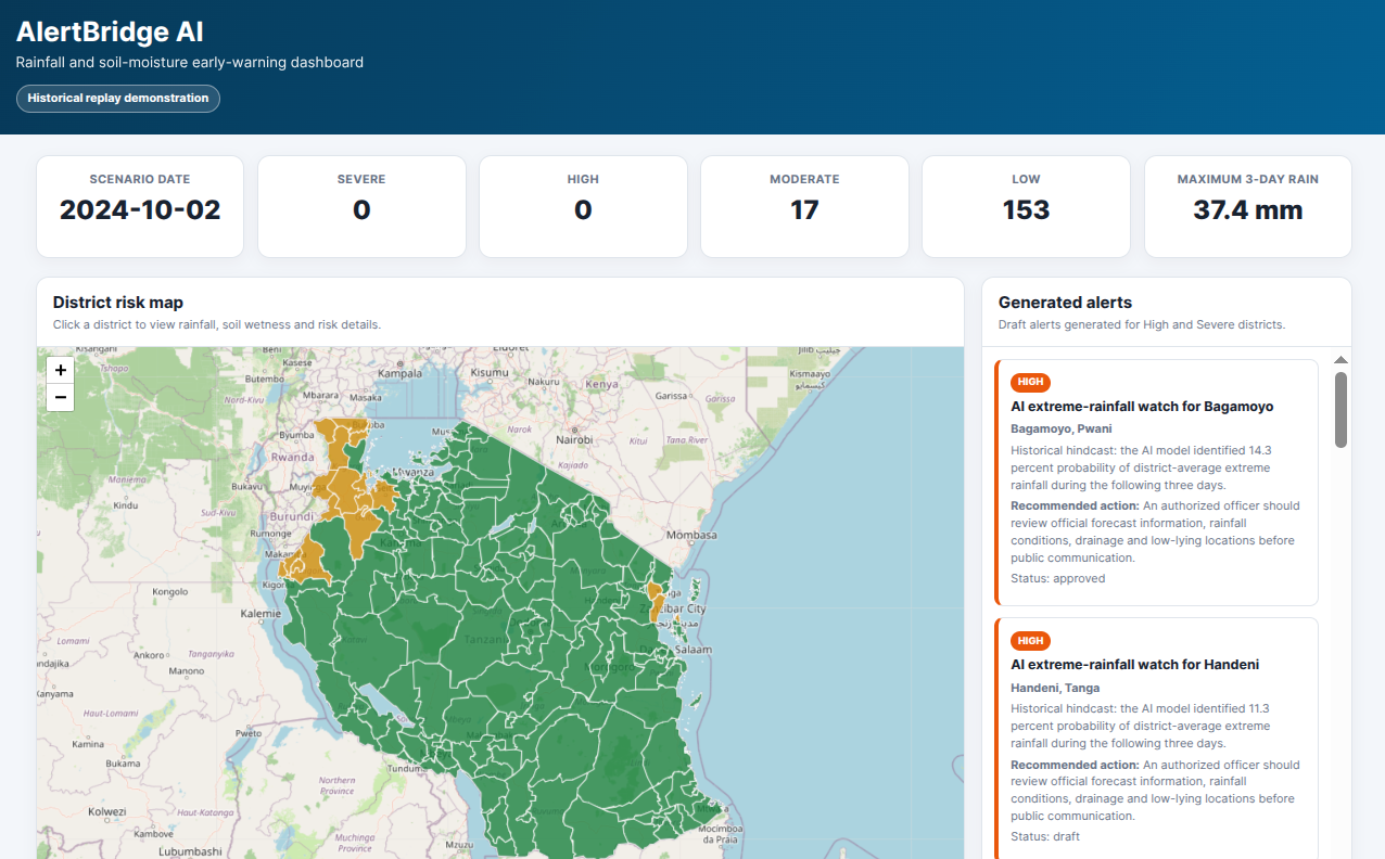
AlertBridge AI dashboard showing district risk levels, rainfall statistics, an interactive map and generated alerts.
-
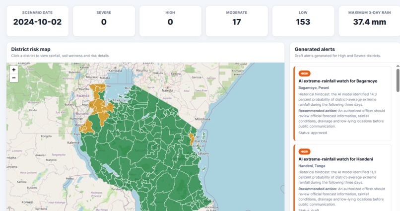
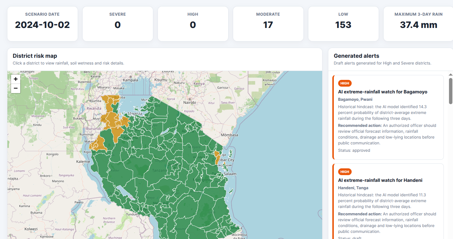
District risk map linked with generated alerts and their current human-review status.
Inspiration
Across East Africa, floods and droughts continue to affect communities, infrastructure and livelihoods. Although large volumes of rainfall, soil-moisture and exposure data are available, converting them into timely, understandable and locally relevant warnings remains difficult.
AlertBridge AI was inspired by the need to bridge the gap between climate science, forecasting institutions, disaster managers and vulnerable communities. The goal is to help experts analyse risk faster and communicate warnings in language that people can understand and act upon.
What it does
AlertBridge AI is an AI-assisted early-warning platform that transforms climate and exposure data into district-level risk information.
The platform:
- Analyses rainfall and soil-moisture conditions.
- Classifies district risk as Low, Moderate, High or Severe.
- Displays affected districts on an interactive risk map.
- Explains the factors contributing to each risk level.
- Generates draft warning messages in English and Swahili.
- Estimates the exposure of communities, schools and health facilities.
- Supports historical event analysis and model hindcasting.
- Allows authorised experts to review, edit, approve or reject alerts before dissemination.
AlertBridge AI supports meteorologists and disaster-management professionals rather than replacing them. Human experts remain responsible for validating risk information and approving warnings.
How we built it
We built AlertBridge AI using climate-data processing, geospatial analysis, machine learning, database technologies and web development.
The main inputs include:
- CHIRPS daily rainfall data
- ERA5-Land Volumetric soil water layer 1 data
- Administrative district boundaries
- Historical district risk thresholds
- Population and critical-facility exposure information
Python workflows process the climate datasets and calculate district-level rainfall and soil-moisture indicators. The results are stored in PostgreSQL, with PostGIS supporting spatial analysis and TimescaleDB supporting time-series data.
A FastAPI backend manages risk assessments, explainability results, bilingual alert generation and the human-review workflow. The web interface presents risk maps, district summaries, historical events, exposure information and alert drafts.
The AI component combines rainfall, soil moisture and historical thresholds to estimate district risk. It also presents the main factors influencing each classification so that experts can understand and verify the result.
Challenges we ran into
One major challenge was integrating datasets with different spatial resolutions, time periods and file formats. Rainfall, soil moisture, district boundaries and exposure information had to be cleaned and standardised before they could be analysed together.
Another challenge was efficiently processing and managing millions of historical district-risk records. We addressed this through structured data-processing workflows, indexed database tables and API-based access.
We also had to translate technical climate indicators into clear messages without removing important uncertainty. Producing meaningful warnings in both English and Swahili required more than direct translation; the messages had to communicate the hazard, location, expected impact and recommended action clearly.
A further challenge was ensuring that AI would support professional decision-making without automatically issuing high-impact warnings. We therefore introduced explainability, user roles, audit information and mandatory human review.
Accomplishments that we're proud of
We successfully developed:
- A district-level rainfall and soil-moisture risk-assessment workflow.
- An interactive map displaying Low, Moderate, High and Severe risk areas.
- Explainable AI-assisted risk classifications.
- English and Swahili draft warning messages.
- A human review and approval workflow.
- Historical event and hindcast analysis.
- Community and critical-facility exposure summaries.
- A PostgreSQL, PostGIS and TimescaleDB data architecture.
- An operational FastAPI backend and web dashboard.
We are especially proud that AlertBridge AI connects scientific climate information with practical early-warning decisions while keeping qualified experts in control.
What we learned
We learned that an effective early-warning system requires more than an accurate model. It also needs reliable data, understandable explanations, local context, exposure information and a trusted process for expert validation.
We learned that explainability is essential when AI is used to support high-impact decisions. Experts need to understand why a district has been classified as high or severe risk before approving a warning.
We also learned that bilingual communication must be designed around meaning and action rather than word-for-word translation.
Most importantly, we learned that AI provides the greatest value when it strengthens existing forecasting and disaster management institutions rather than attempting to replace them.
What's next for AlertBridge AI
The next phase will focus on:
- Integrating real-time operational weather forecasts and observations.
- Expanding data verification using additional climate, hydrological, and hazard datasets.
- Improving AI model accuracy and uncertainty communication.
- Enhancing exposure information for populations, infrastructure, agriculture, and health facilities.
- Supporting additional hazards such as floods, droughts, heatwaves, landslides, disease outbreaks, and air quality events.
- Expanding multilingual support to additional local languages.
- Strengthening multi-channel dissemination through SMS, WhatsApp, Email, Mobile Applications, APIs, CAP, and social media.
- Introducing community feedback mechanisms to evaluate warning effectiveness and improve future alerts.
- Extending deployment to additional countries across East Africa.
- Collaborating with national meteorological and disaster management agencies to support operational implementation.
Our long-term goal is to make AlertBridge AI a practical bridge between climate data, forecasting institutions, disaster managers and communities, helping warnings reach the right people early enough for meaningful action.
Built With
- ai
- analysis
- api
- chirps
- css
- era5
- explainable
- fastapi
- geopandas
- geospatial
- html
- javascript
- learning
- machine
- numpy
- openstreetmap
- pandas
- postgis
- postgresql
- python
- rest
- series
- time
- timescaledb

Log in or sign up for Devpost to join the conversation.