🌾 The 6:40 AM Test
Know what the field needs before the crop has to ask.
It is 6:40 AM. A grower stands beside a dry-looking stretch of field and opens AgriSense before opening the irrigation pump. The map says vegetation is weakening. The weather says the next five days stay hot. The soil profile says water should still hold below the surface. The rules engine blocks the thirsty crop Gemini wanted to recommend.
The answer is simple: Don't water the whole field today. Scout the west edge. Shift the next planting plan toward a lower-water rotation.
That's the moment AgriSense is built for — not another dashboard, but a practical answer at the exact moment a farmer has to decide.
🌵 The Gap
The information to prevent crop losses already exists. The problem is where it lives.
| Signal | Where it sits | What the farmer needs |
|---|---|---|
| 🛰️ Sentinel-2 imagery | EO platforms, GIS tools | "Is my crop stressed this week?" |
| 🪱 SoilGrids | Research-grade soil APIs | "Can this field hold water?" |
| 🌦️ Weather history | One more app, one more chart | "Did the season turn against my plan?" |
| 🤖 AI crop advice | Confident, sometimes wrong | "Plan that survives common-sense checks." |
Most precision tools ask farmers to become data specialists. AgriSense asks a better question:
Can a person draw the field — and let the software do the translating?
🧭 The Tool
AgriSense turns a field boundary into a complete, plain-language crop plan.
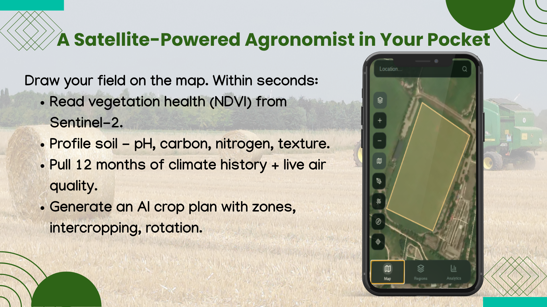
- ✅ Draw the field on a live satellite map, from phone or laptop
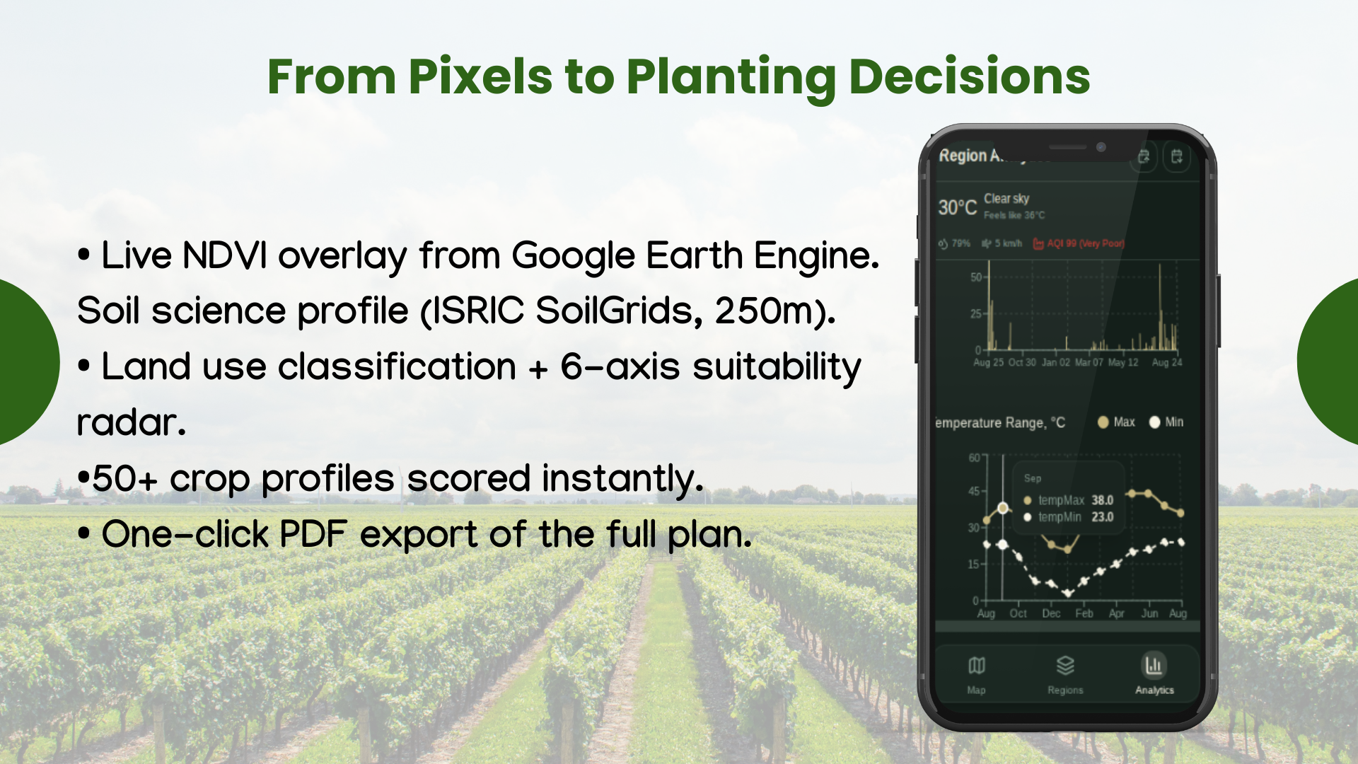
- ✅ Read vegetation health with Sentinel-2 NDVI and anomaly signals
- ✅ Check the soil — pH, carbon, nitrogen, texture, CEC, water retention
- ✅ Rebuild the season — precipitation, temperature, ET₀, air quality
- ✅ Score land suitability with WorldCover, terrain, local constraints
- ✅ Compare 68 crop profiles with a deterministic agronomy rules engine
- ✅ Let Gemini 2.5 Pro explain the plan only after rules decide what is sensible
- ✅ Export a field-ready PDF
- ✅Built in NextStep Hacks 2026 window (Aug 21 – Sep 13, 2026).
The output isn't "here is a chart." It's what to plant, where to plant it, when to rotate it, and what risk to watch next.
⚡ The Dual Engine
This is what makes AgriSense feel different from a generic AI wrapper.
| Engine | Job | Why it matters |
|---|---|---|
| 🧠 Rules first | Scores 68 crop profiles against soil, climate, water, land use, stress | Fast, explainable, hard to fool |
| 🤖 AI second | Gemini 2.5 Pro turns approved candidates into zones, rotation, calendar, tips | Human-readable planning, not constraint lists |
| 🛡️ Guardrails always | Rejects wrong crop / wrong climate / altitude / land cover | Trust is a product feature |
Field signals → 68-profile rules → valid crop set
                    │
                    ▼
        Gemini explains & sequences → Guardrails re-check
                    │
                    ▼
            Map zones → Calendar → PDF plan
The wow factor isn't "we used AI." It's AI that must pass agronomy before it is allowed to speak.
📈 The Proof in One Field
Sample walkthrough: 9.1-acre wheat farm in Lahore, Pakistan.
| What changed | Result |
|---|---|
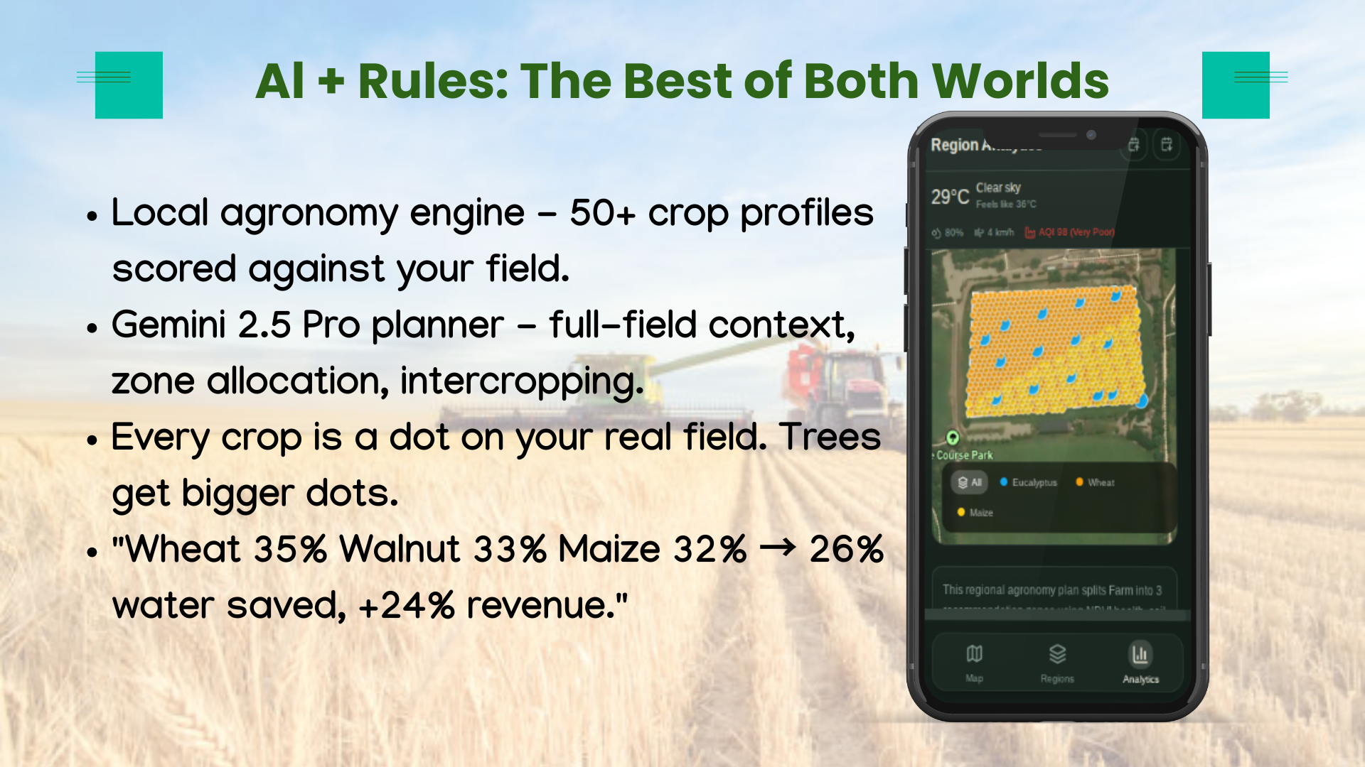
| 💧 Water strategy | 26% lower projected water use |
| 🌱 Crop mix | Wheat 35% · Walnut 33% · Maize 32% |
| 💰 Farm economics | +24% projected revenue |
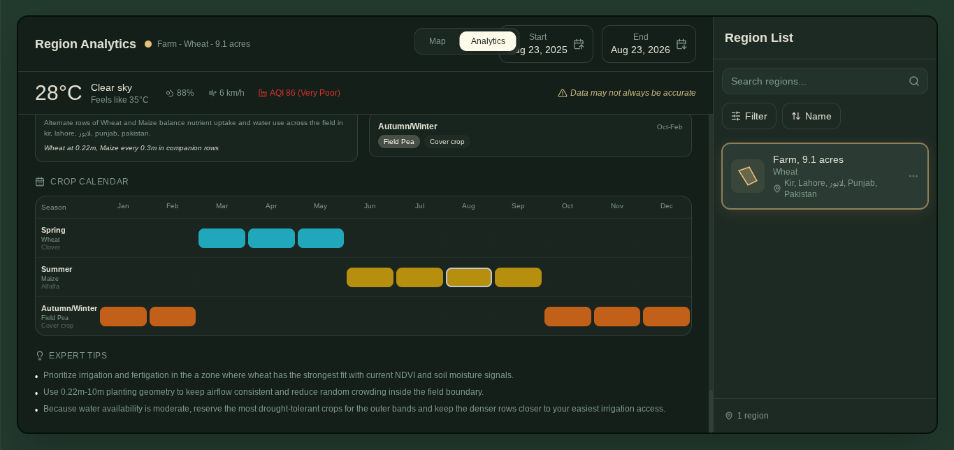
| 🗓️ Season planning | Spring / summer / autumn-winter rotation |
| 📄 Field usability | Map + zones + calendar + tips exported to PDF |
Less water. Better allocation. A plan worth taking into the field.
🧱 What Makes the Product Hold Up
| Layer | Stack | Purpose |
|---|---|---|
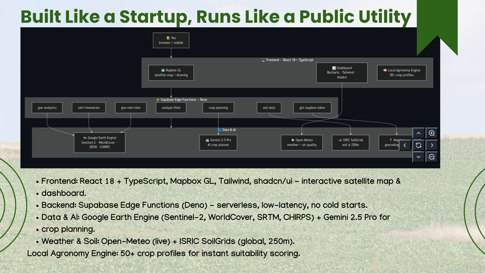
| 🖥️ Frontend | React 18 · TypeScript · Vite · Tailwind · shadcn/ui | Mobile-first field workflow |
| 🗺️ Mapping | Mapbox GL JS | Satellite basemap, drawing, plan viz |
| 📊 Visualization | Recharts | NDVI, climate, soil, suitability |
| ⚡ Backend | Supabase Edge Functions · Deno | Serverless API + retries |
| 🛰️ Earth data | Google Earth Engine · Sentinel-2 · WorldCover · SRTM · CHIRPS | Global field observation |
| 🪱 Soil + weather | ISRIC SoilGrids · Open-Meteo | Chemistry, texture, climate, air |
| 🤖 AI + rules | Gemini 2.5 Pro · deterministic engine | Speed plus validation |
| 📄 Delivery | jsPDF | Exportable plan for offline use |
PHONE / BROWSER
      │
      ▼
Draw field → Edge Functions → Earth + Soil + Weather
      │                              │
      │                              ▼
      │                  68-crop rules
      │                              │
      │                              ▼
      │                  Gemini + guardrails
      │                              │
      ▼                              ▼
Map zones · Charts · Calendar · PDF
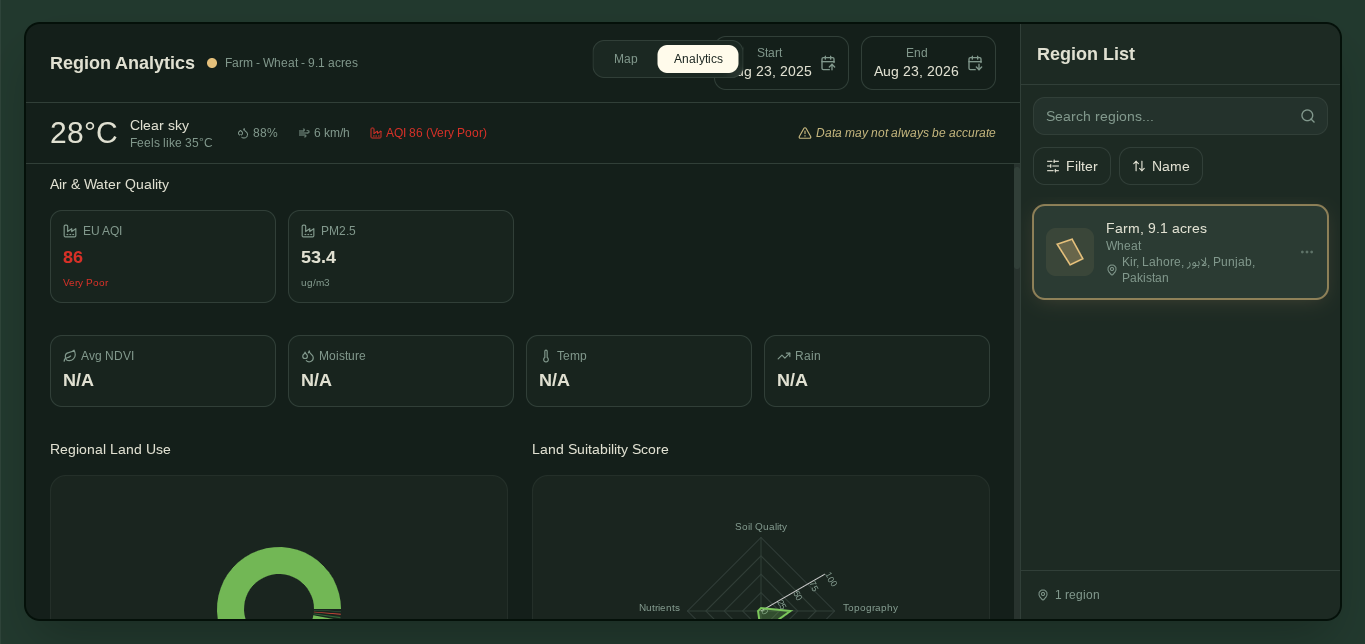
📸 Field Notes from the Walkthrough
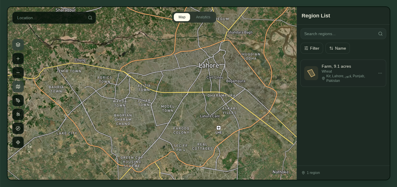 |
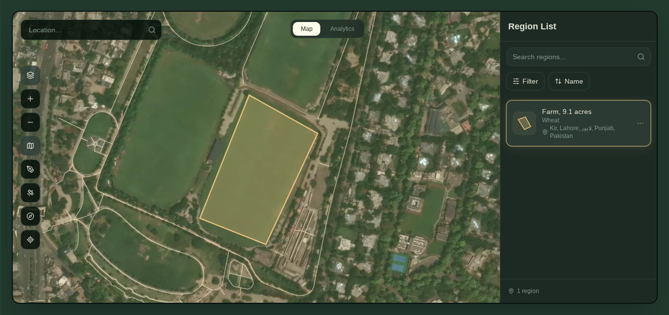 |
| 🌾 Field dashboard | 🖊️ Draw the field |
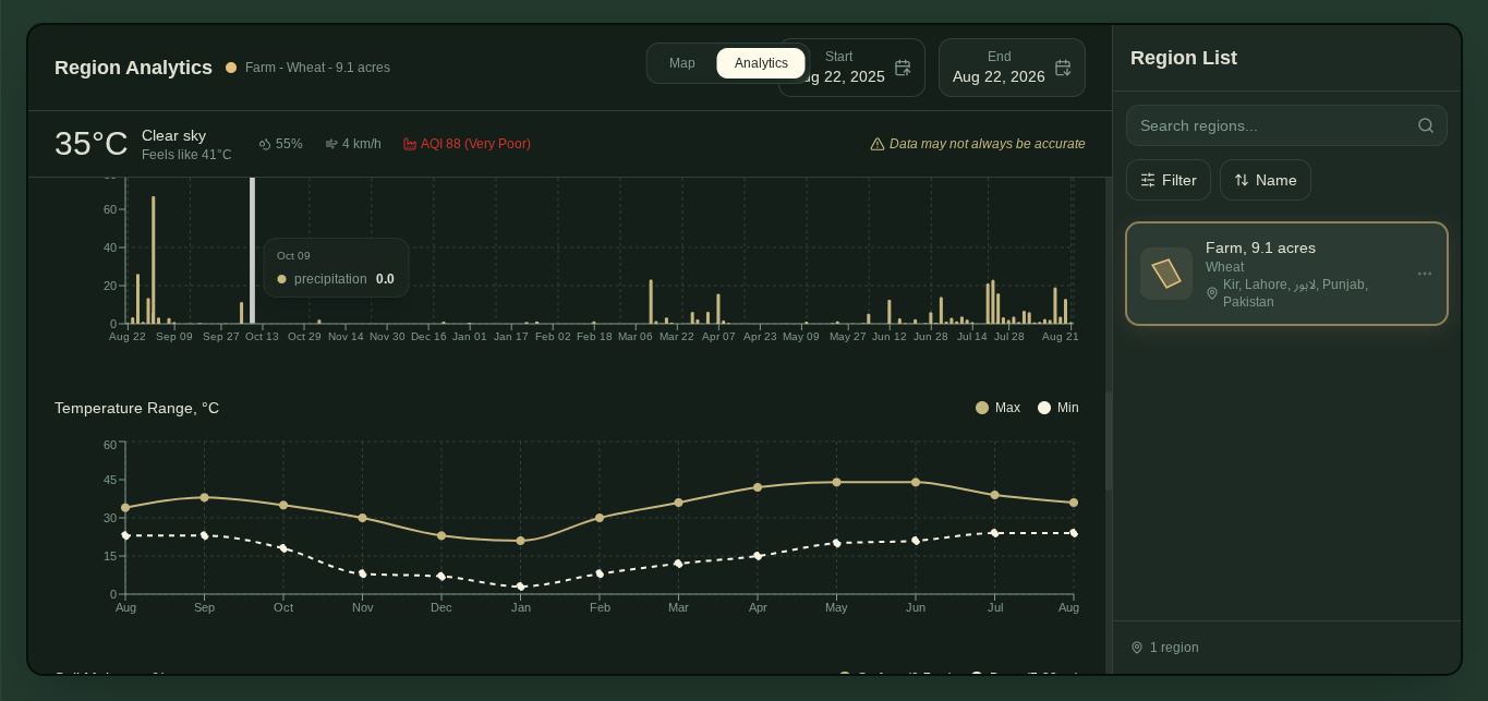 |
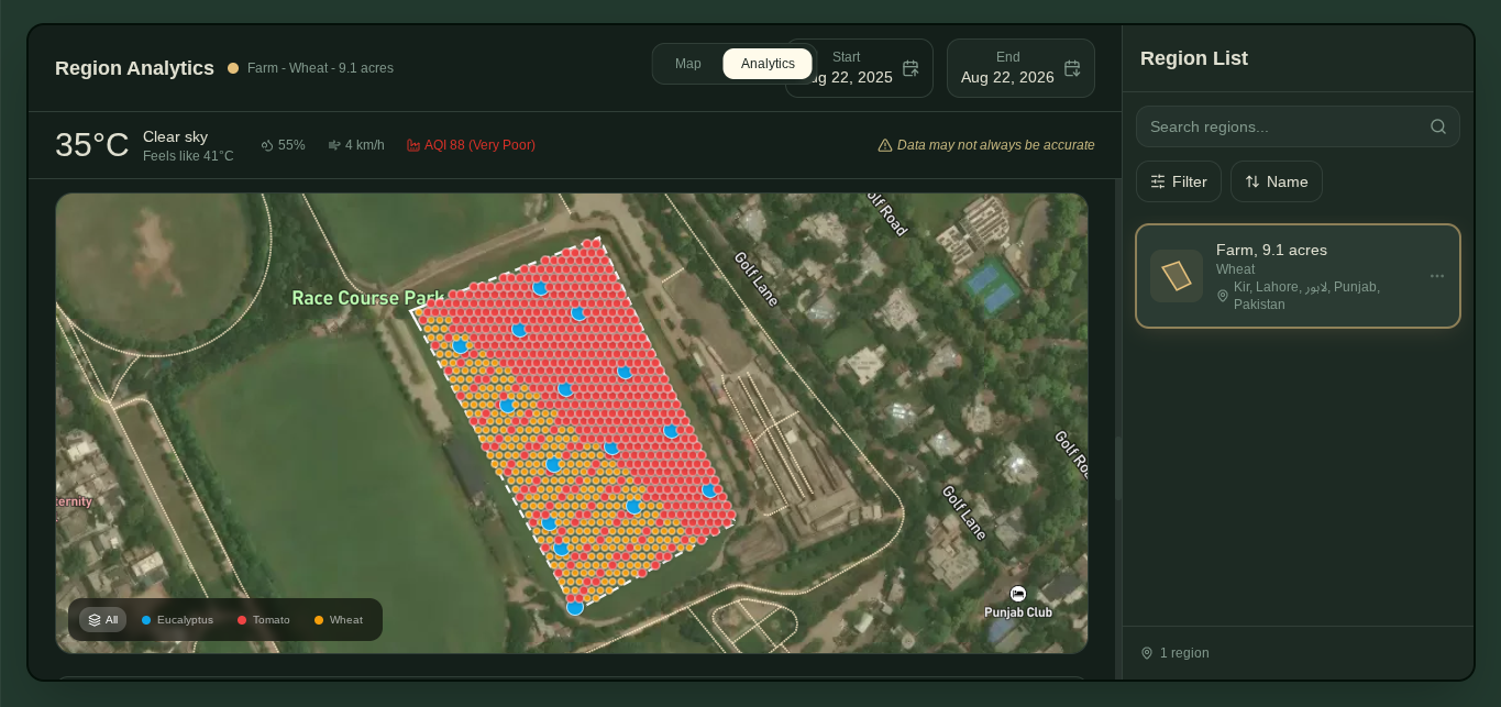 |
| 🌦️ Season context | 🤖 Plan on the map |
 |
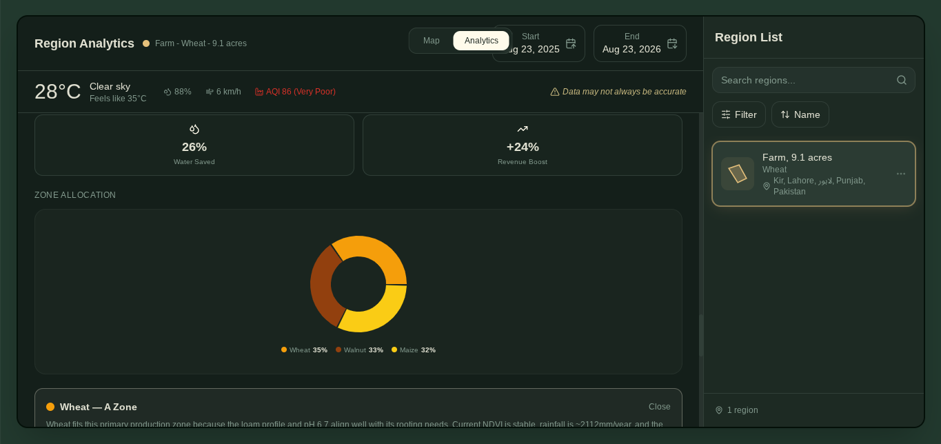 |
| 📊 Full analytics | 🥧 Allocation + impact |
 |
🌍 The Earth Forward Ledger
| Pillar | Mechanism | Direction |
|---|---|---|
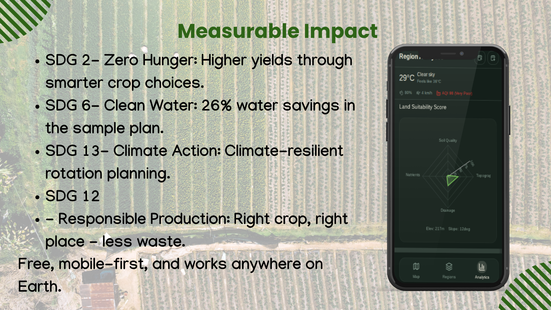
| 💧 Water conservation | Water balance, drought, lower-water allocation | 26% water savings in the sample plan |
| 🌡️ Climate resilience | Weather history, ET₀, heat/stress | Better timing before the season turns |
| 🌱 Sustainable agriculture | Soil + land use + rules-checked choices | Right crop, right place, fewer inputs |
| 🌍 Land stewardship | WorldCover + terrain guards | Avoid nonsense plans |
| ⚖️ Access | Browser-first, global open data | Precision agriculture without enterprise contracts |
UN SDGs: 🎯 SDG 2 · 💧 SDG 6 · 🌍 SDG 13 · 🌾 SDG 12
🛰️ AgriSense: The Ultimate Evaluation
🌾 AgriSense stands out by delivering a farmer-first crop planning application driven by a true combination of AI and rules engines. 🌍 It fully implements Earth Forward principles by prioritizing water management, climate resilience, soil health, and equitable access. 🚀 The product is entirely complete, offering users a seamless workflow that includes field drawing, real-time analytics, planning tools, operational guardrails, interactive maps, and PDF generation. 📚 It serves as an exceptional learning framework, bridging the gap between Earth observation data, agronomic rules, edge functions, large language models, and mobile UX. 🎨 The design focuses entirely on utility, translating complex data into a clear, actionable decision path. ⚙️ This is all built on a robust technical foundation leveraging Google Earth Engine, Gemini, deterministic rules, Mapbox, Supabase, Open-Meteo, and SoilGrids.
✨ AgriSense is not trying to make farming look high-tech. It is trying to make good decisions feel available.
🧗 The Hard Things We Did
- 🛰️ Earth observation is easy to demo, hard to operationalize. We moved GEE complexity behind edge functions so the UI stays fast.
- 🤖 AI advice must be constrained. Rules check Gemini before recommendations reach the map.
- 🗺️ Field drawing must feel effortless. Polygon flow works on desktop and mobile — farms aren't desktop-only.
- 🌍 Absurd edge cases need explicit guards. Lakes, deserts, cities, glaciers, waterlogged zones.
- 📄 Advice must survive leaving the app. PDF export = useful in the field, not just impressive in the browser.
📚 What We Learned
We combined EO data, rules engines, edge functions, LLM reasoning, and mobile UX — and learned that the most valuable feature is a decision path a farmer can follow.
🚀 The Next Goal
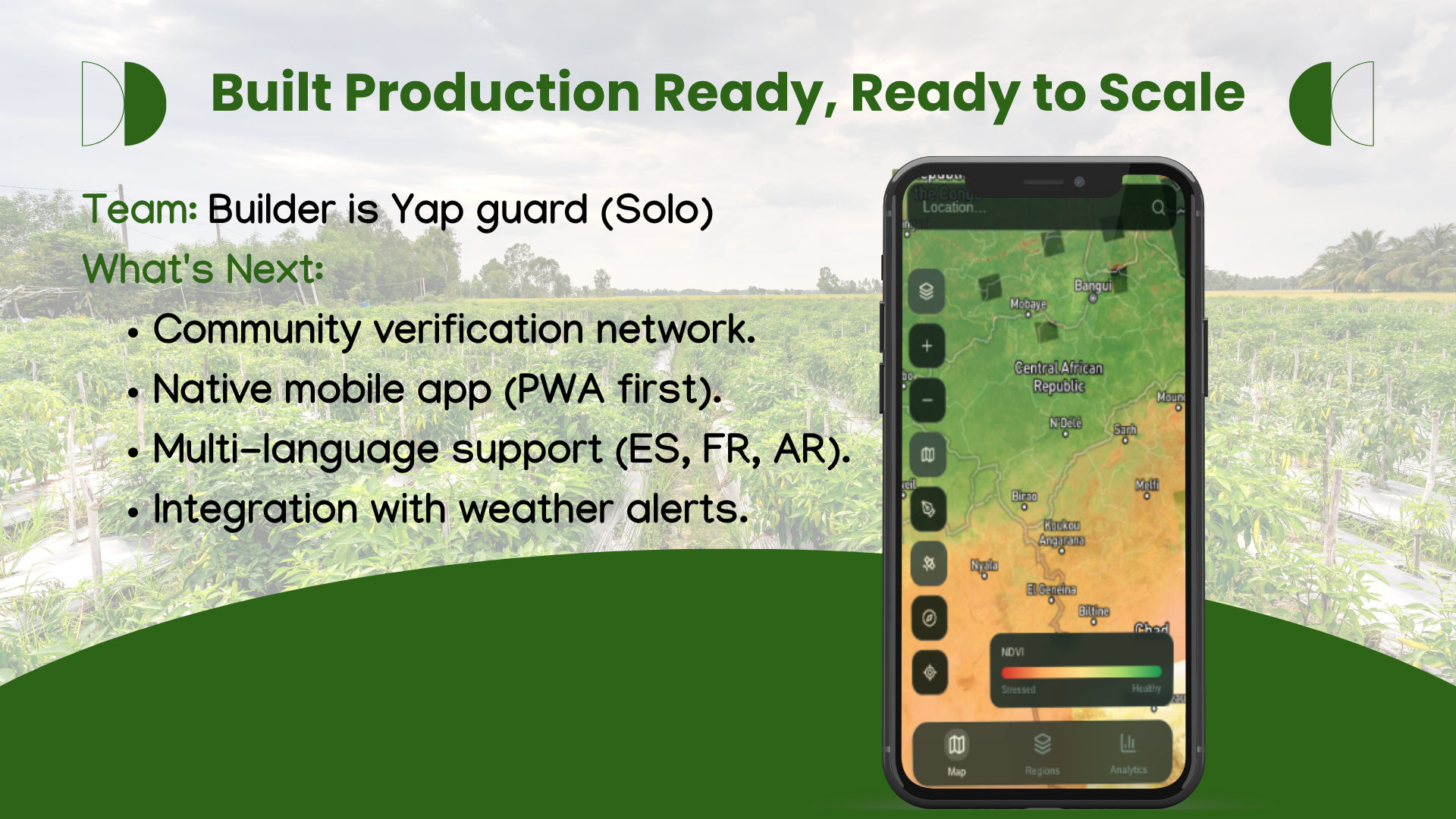
- 🌾 Whole-farm planning across fields and seasons
- 📡 Push alerts on NDVI drops or weather windows closing
- 🌱 Pest & disease early warning from spectral anomalies
- 🗣️ Offline mode and local-language templates
- 🤝 Extension-program partnerships so agronomists review plans
AgriSense — because every field deserves more than a guess. 🌾
Built With
- chirps
- css
- deno
- earth
- edge
- engine
- esa
- functions
- gl
- isric
- javascript
- mapbox
- react
- recharts
- sentinel-2
- shadcn/ui
- soilgrids
- srtm
- supabase
- tailwind
- typescript
- vite
- worldcover

Log in or sign up for Devpost to join the conversation.