-
-
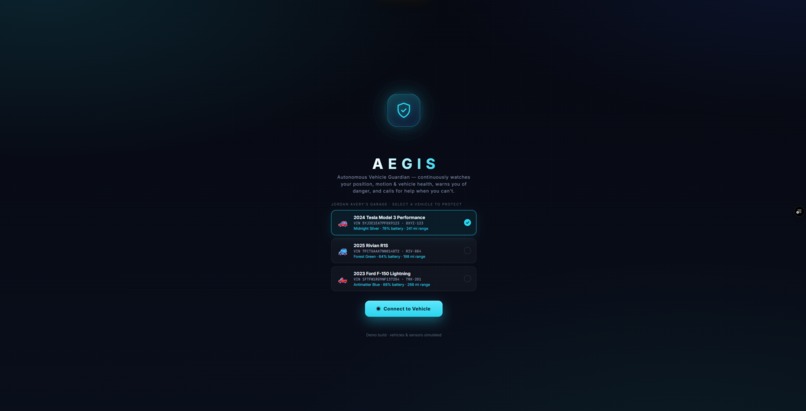
Start
-
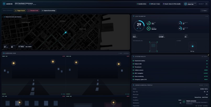
Dashboard
-
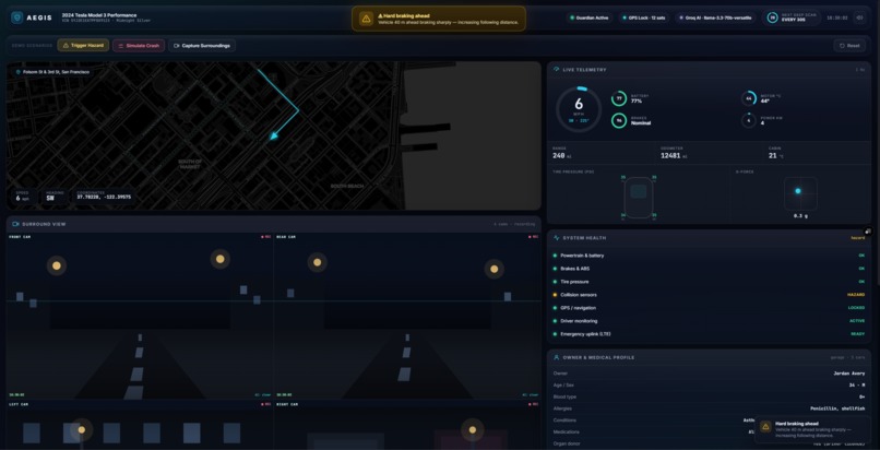
Warning
-
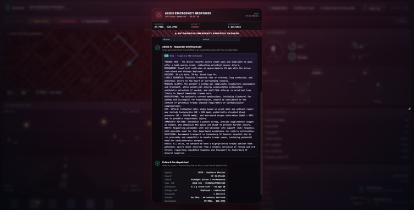
Emergency 1
-
Emergency 2
💡 Inspiration
I was once playing a video game where the player is driving a car and crashes (part of the game's story), and it made me wonder — what if that was real, and no one could help them? What if you crashed alone on a quiet road at night, knocked out, with a phone you can't reach and no one around to even notice? The game moved on to the next cutscene. But in real life, that's where a lot of stories quietly end.
That thought wouldn't leave me. The most dangerous moment in a crash often isn't the impact — it's the minutes afterward, when an injured person can't call for help and no one knows they need it. I wanted to build the thing that notices, even when no human can. That's AEGIS.
🚨 Why is it important
This isn't a rare edge case — it's a global crisis hiding in plain sight:
🌍 ~1.19 million people die on the roads every year worldwide (WHO, Global Status Report on Road Safety 2023). 🧒 Road crashes are the #1 killer of people aged 5–29 (WHO). 🌏 About 92% of road deaths happen in low- and middle-income countries, where help often arrives slowest (WHO). In India, for example, ~168,000 people died in road accidents in 2022 (India MoRTH). The U.S. loses over 40,000 lives a year (NHTSA). ⏱️ Survival is a race against the "golden hour" — the sooner a trauma victim reaches care, the more likely they live. Delay kills. 📞 This is exactly why the EU made automatic crash alerts ("eCall") mandatory in new cars. Their own estimates: faster automatic alerts can cut emergency response times by 40–50% and save up to ~2,500 lives a year in Europe alone (European Commission). A huge number of these deaths aren't caused by the crash being unsurvivable — they happen because no one knew in time. AEGIS exists to close that gap.
🚗 What it does
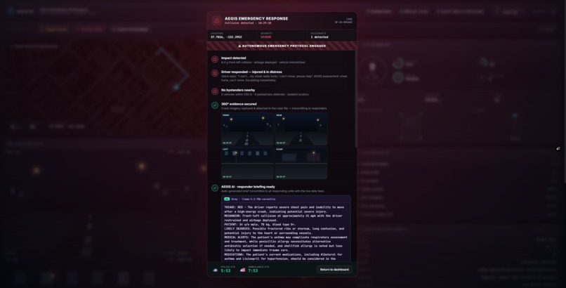
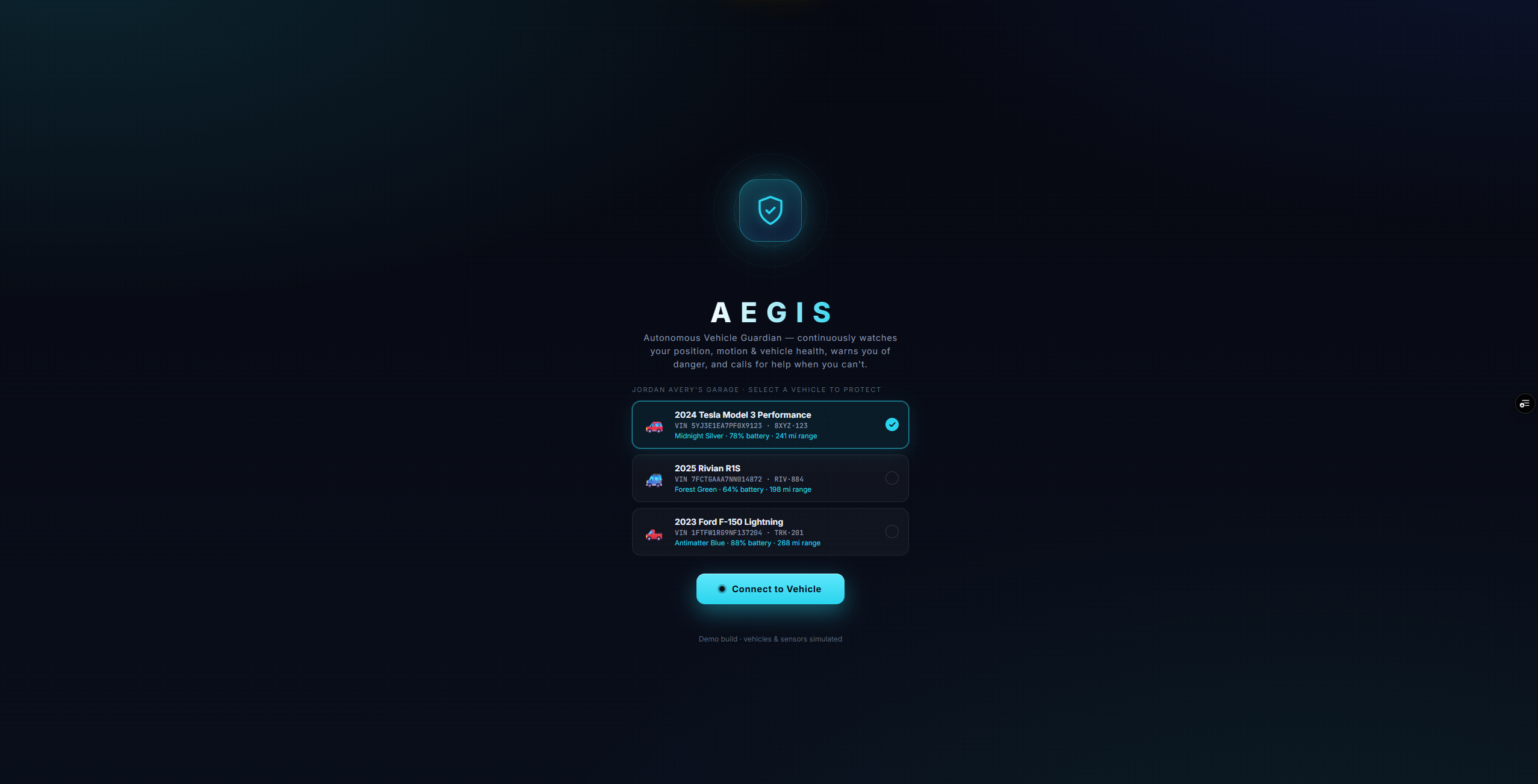
AEGIS is an in-car AI guardian for the person who can't call for help themselves. It connects to your vehicle and continuously watches your position, motion, and vehicle health. When something goes wrong, it acts:
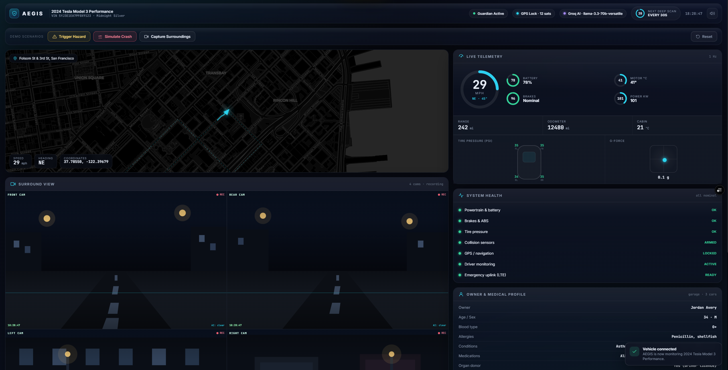
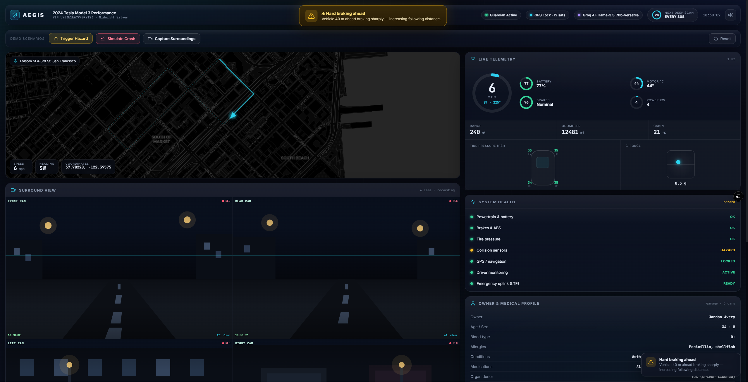
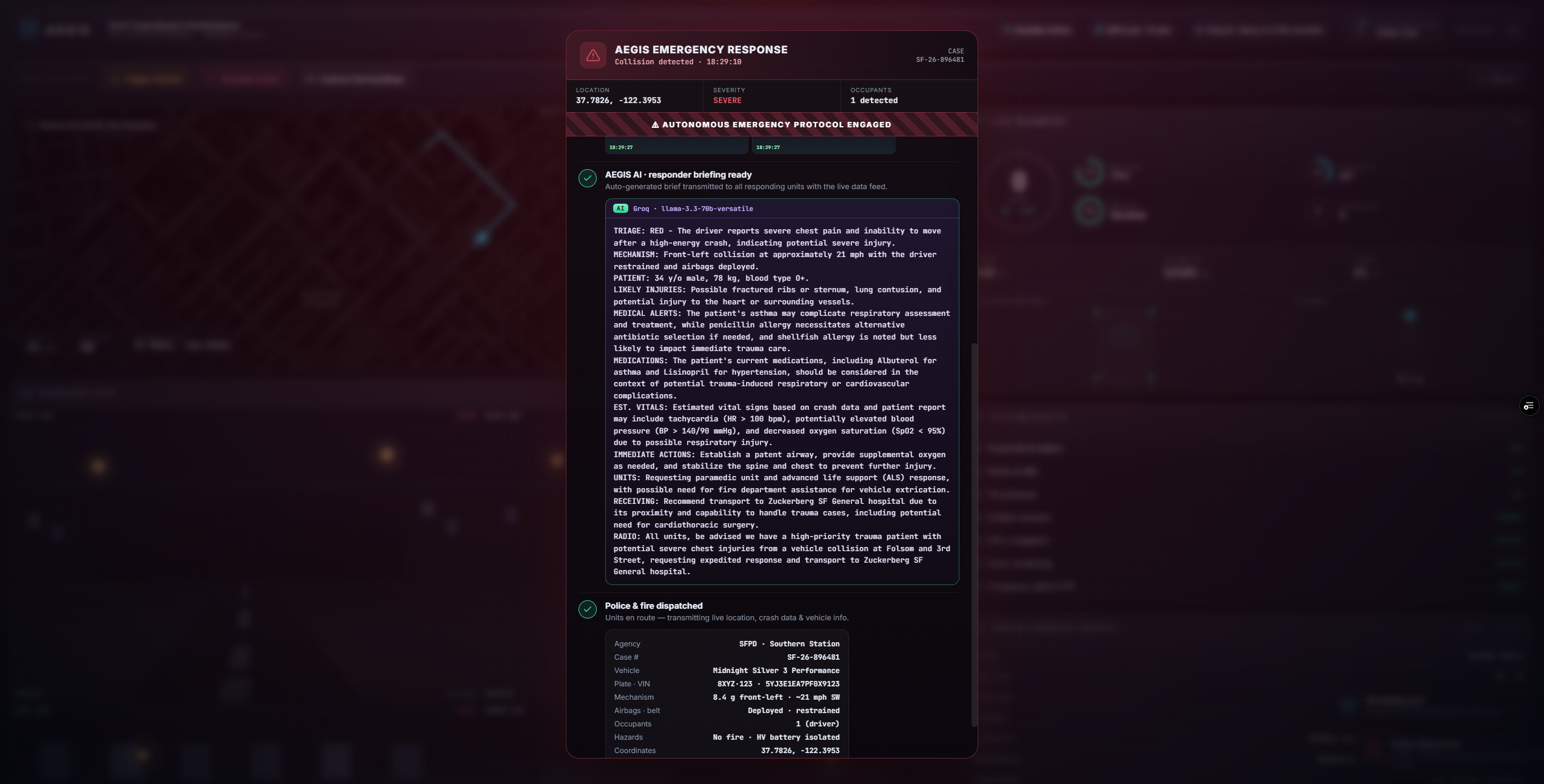
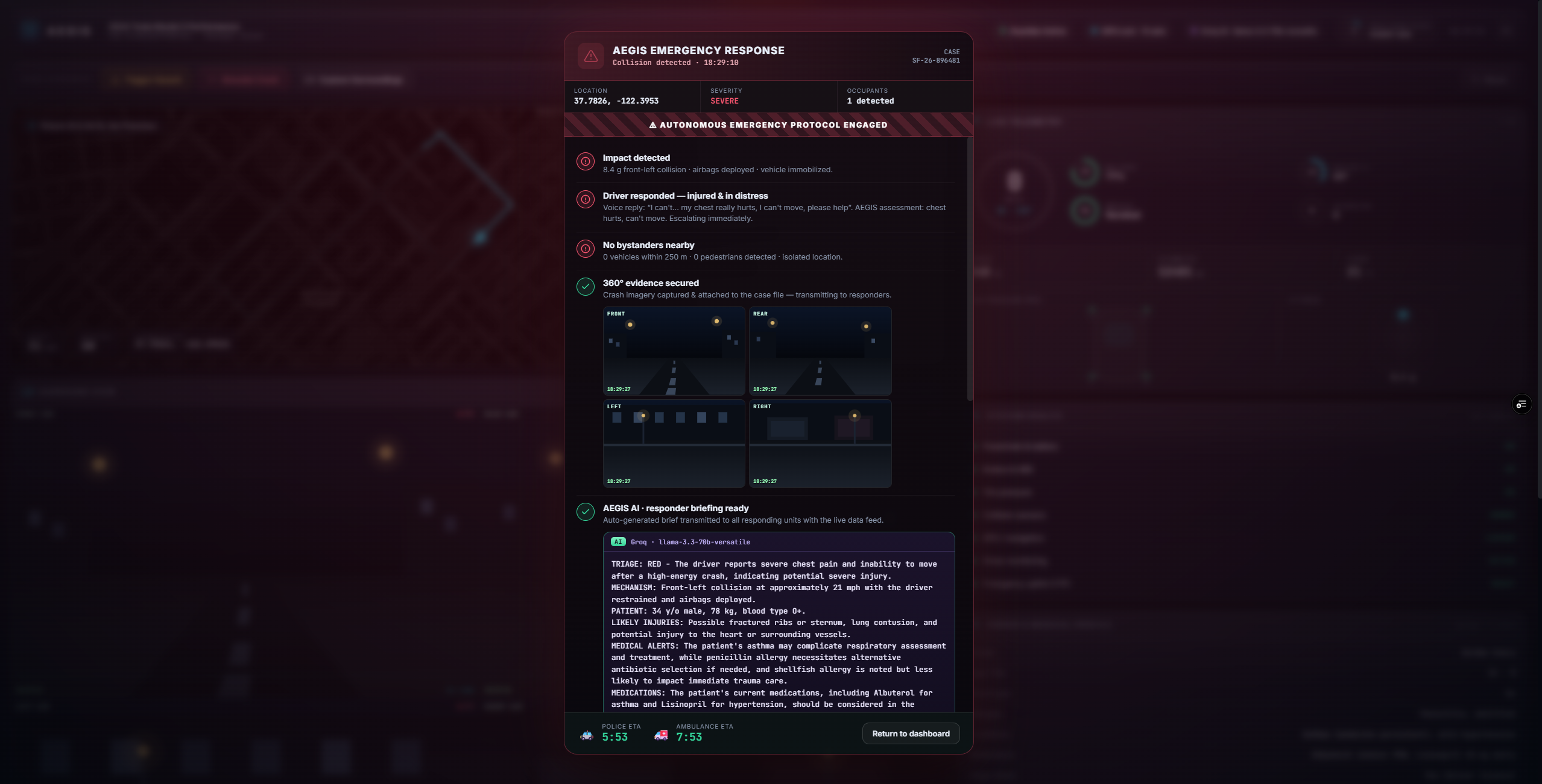
🗺️ Live guardian dashboard — real road-following GPS, telemetry (speed, battery, tire pressure, G-force), and a 360° surround-view feed. ⚠️ Hazard alerts — warns the driver about dangers ahead. 💥 Crash detection — senses a high-G impact and immediately starts an emergency protocol. 🗣️ AI voice check-in — because an injured driver can't text, AEGIS speaks to you ("Can you hear me? Are you hurt?"), listens to your reply, and the AI decides whether you're okay, hurt, or unresponsive. 🧠 AI responder briefing — if you can't respond, an AI reads your crash data + medical profile and writes a full first-responder brief (triage level, likely injuries, allergies, medications, estimated vitals, recommended units, and a radio call) — so paramedics know everything before they arrive. 📸 360° evidence capture — saves surround-view snapshots to the case file for responders. 🚑 Autonomous dispatch — alerts police, the nearest hospital, and emergency contacts with your live location, case number, and medical record.
🤝 How can it help
🧓 People who physically can't call — unconscious, elderly, disabled, or driving alone. �middle-of-nowhere Isolated & night crashes — where no bystander will ever see you. ⏱️ Buys back the golden hour — cuts the delay between impact and help, which is where lives are won or lost. 🩺 Gives responders a head start — arriving paramedics already know your blood type, allergies, and what they're walking into, instead of losing precious minutes figuring it out.
🛠️ How I built it
I built AEGIS as a single, self-contained web app (one index.html with the entire UI and logic) backed by a tiny Node server — no heavy frameworks, no build step.
The map uses Leaflet with dark CartoDB tiles, and the car follows real streets — I pulled actual road geometry from the OSRM routing engine and baked it in so the vehicle drives the road grid instead of cutting across blocks. The AI runs in tiers so it works anywhere: on-device Ollama (llama3.2) for free/private local use, Groq (llama-3.3-70b-versatile) in the cloud, and a built-in offline template fallback so it never fully breaks. The voice check-in uses the browser's Web Speech API (text-to-speech to talk, speech recognition to listen), with the AI interpreting the reply. I deployed it on Vercel, moving the AI calls into serverless functions so the API key stays server-side and never touches the browser.
🧗 Challenges I ran into
🛣️ Making the car follow real roads — my first routes cut diagonally through buildings. I ended up pulling genuine road-snapped geometry from a routing engine and cleaning out the messy backtracking by hand. 🔄 A spinning-car bug — at every corner the map arrow whipped the long way around. I fixed it with shortest-arc heading smoothing. 🧩 One insight that reshaped the design — I realized an injured driver can't type a reply, so the check-in had to be voice, not a button. 🤖 Making the AI work everywhere — local AI isn't available on a deployed server, so I built the Ollama → Groq → offline tier system so it degrades gracefully. 🔐 Not leaking my API key — keeping it server-side and out of Git took real care.
🏆 Accomplishments that I'm proud of
It genuinely talks to you and understands your answer — that moment feels like the future. The AI writes a real, medically-aware briefing from the crash data, not a canned message. It runs with real AI but zero required API keys locally, and still works fully offline. It looks and behaves like a real product, not a school project — and every piece actually works.
📚 What I learned
How to make an LLM do something genuinely useful (triage + briefing) instead of just chatting. How serverless backends work, and how to keep secrets out of the client and out of Git. Real geographic/routing data, heading math, and smoothing. That the best ideas come from a constraint — "they can't text back" forced the whole design to get better.
🚫 What AEGIS can't do (being honest)
It's a working prototype/simulation — it doesn't yet plug into a real car's CAN bus or real crash sensors, and no real emergency calls are placed. The surround-view frames are representative, not live camera feeds (yet). The cloud AI and live map need an internet connection; the in-browser speech recognition works best in Chrome/Edge. It assists responders — it doesn't replace human judgment or professional medical care.
🔮 What's next for AEGIS
🔌 Integrate with real vehicle data (OBD-II / CAN bus) and real crash/IMU sensors. 📷 Real camera + computer-vision for live hazard and scene analysis. 📲 A companion app + smartwatch check-in (tap or heartbeat) for non-verbal confirmation. 🌐 Multi-language voice so it helps drivers anywhere. 🏥 Real, permissioned integrations with emergency dispatch (e.g., eCall/911) and hospitals. ⌚ Expand beyond cars — bikes, e-scooters, and lone workers.
🙏 Credits
Code: ALL code presented in this project was solely done by Claude code; however, the idea was entirely mine. Data: World Health Organization (Global Status Report on Road Safety 2023), the European Commission (eCall), India's Ministry of Road Transport & Highways, and the U.S. NHTSA. Tech & open source: OpenStreetMap & OSRM, Leaflet, CartoDB, Ollama, Groq, and Anthropic. Built solo for the hackathon, with AI pair-programming assistance for development. All telemetry, vehicles, locations, dispatch, and contacts in the demo are simulated — no real calls are placed.
Built With
- cartodb
- css3
- groq
- html5
- javascript
- leaflet.js
- node.js
- ollama
- openstreetmap
- vercel
- web-audio-api
- web-speech-api


Log in or sign up for Devpost to join the conversation.