-
-
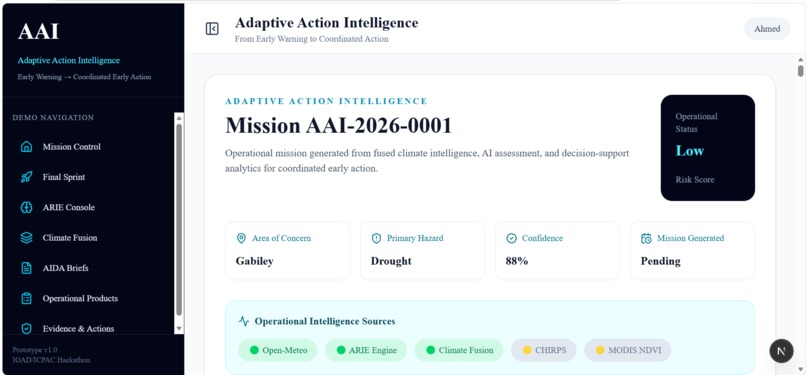
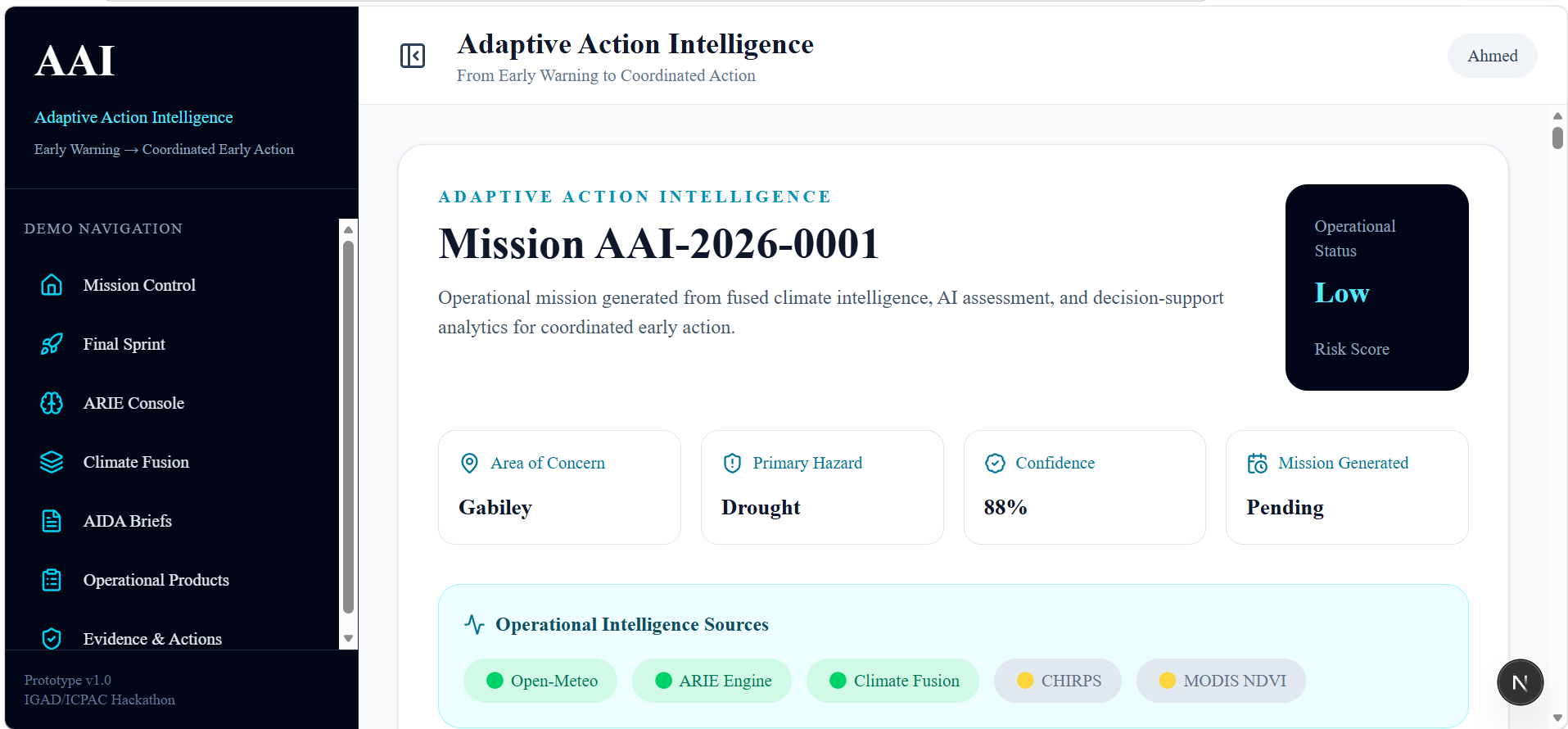
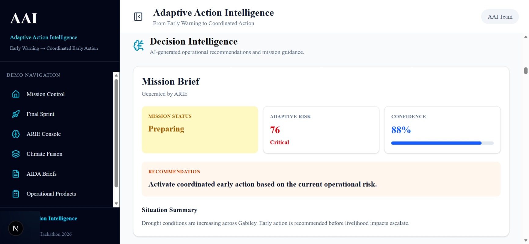
Mission Control provides a shared operational picture for the Gabiley drought-watch mission.
-
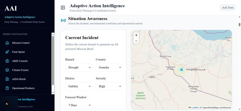
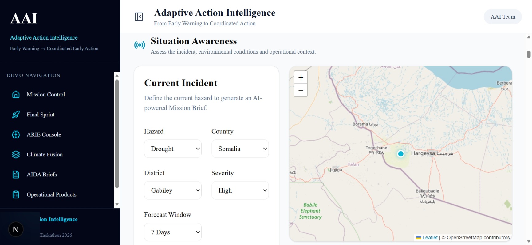
Situation Awareness connects the incident, location, weather context, severity, and priority-action map.
-
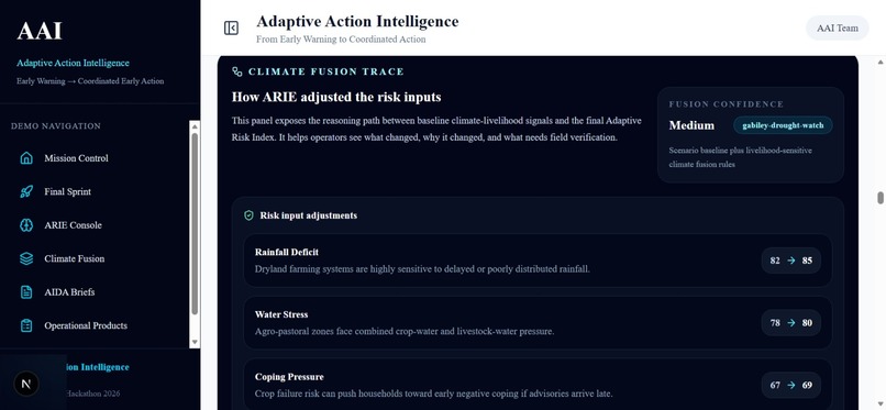
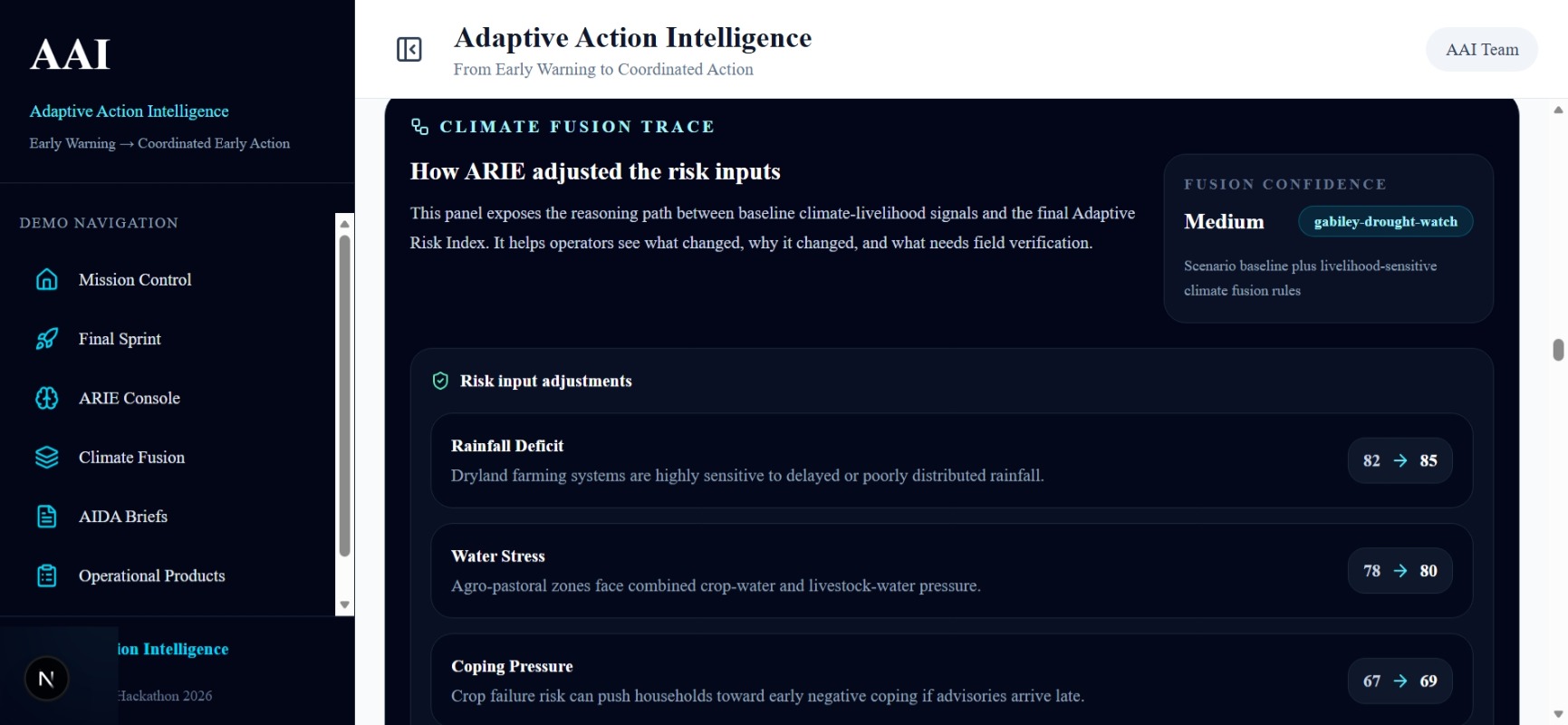
Climate Fusion shows how climate and livelihood signals influence the assessment and where field verification is still needed.
-
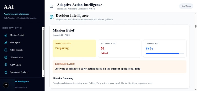
ARIE connects risk, confidence, justification, consequences, priority actions, and expected impacts.
-
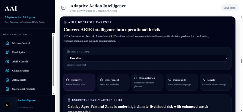
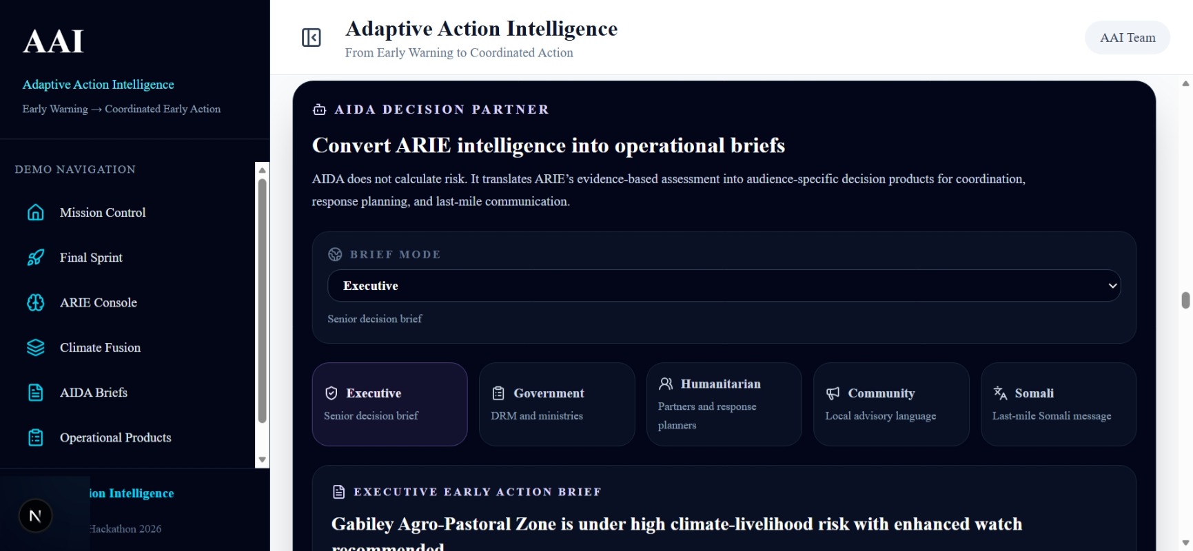
AIDA translates one structured assessment into briefs for different decision-making audiences.
-
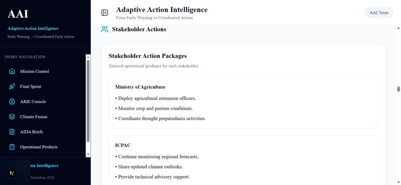
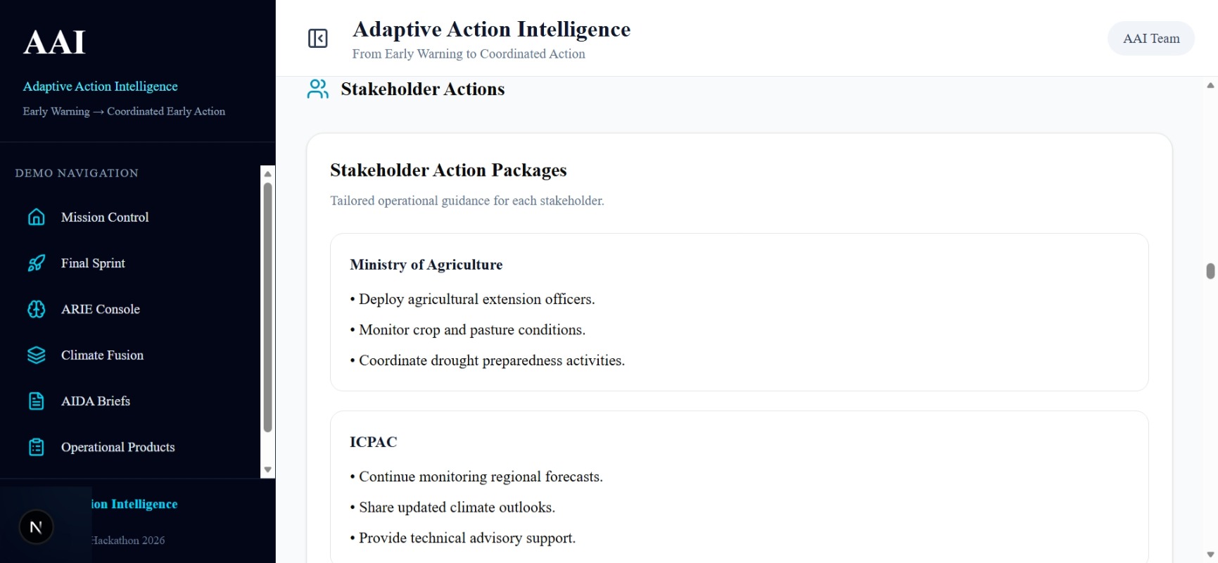
Recommended actions are connected to responsible stakeholders and intended operational outcomes.
-
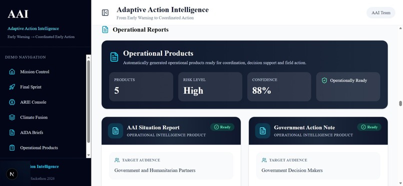
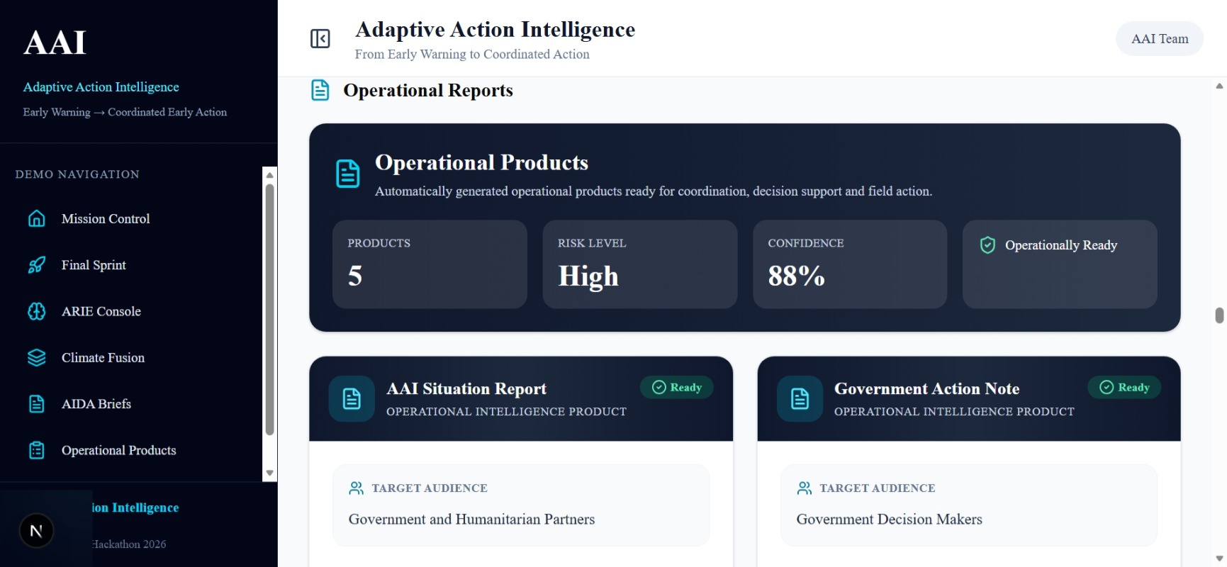
Operational Products generates reports, government briefs, coordination notes, community advisories, and PDF outputs.
-
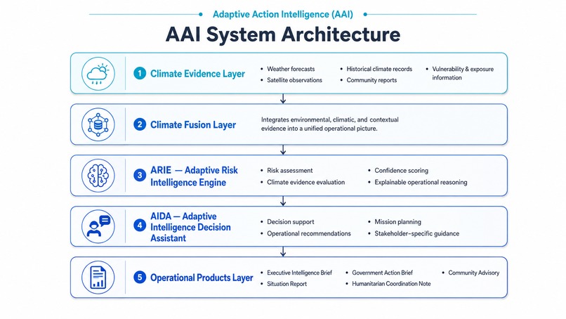
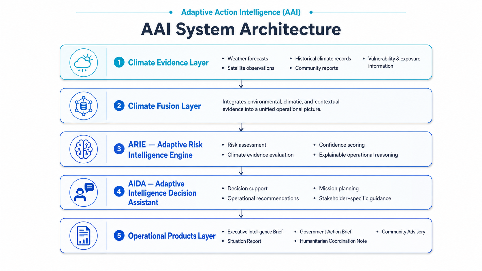
AAI architecture separates evidence processing, risk intelligence, decision communication, and operational products.
-
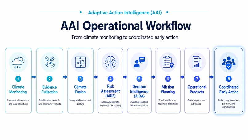
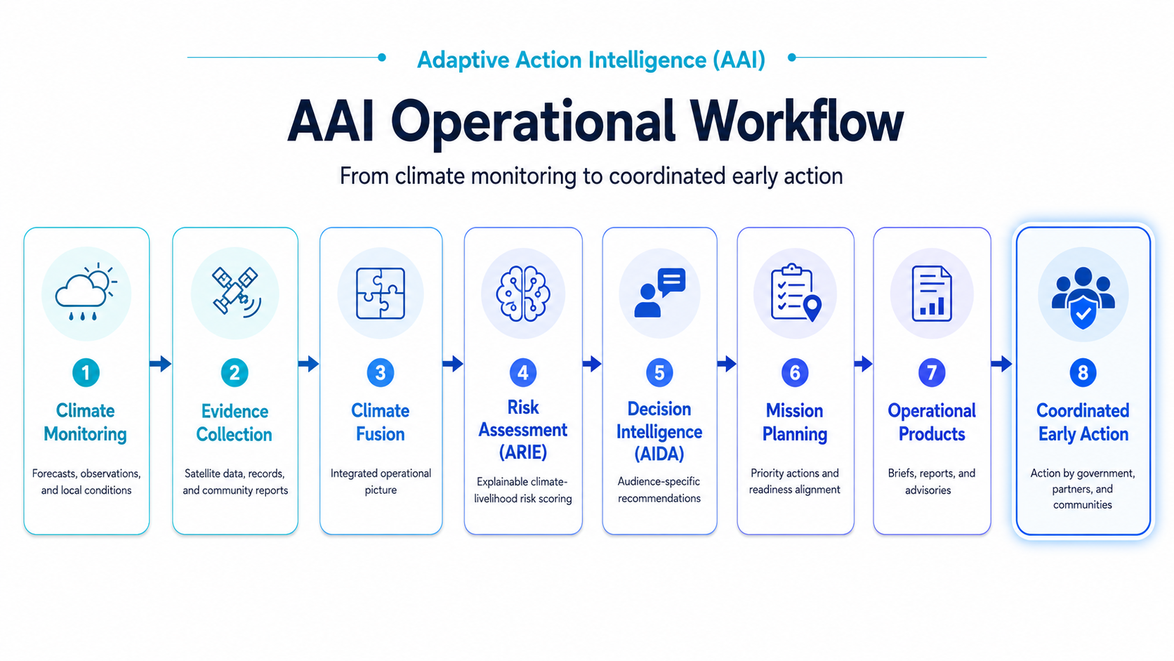
The workflow moves from incident definition and evidence fusion to decision, action assignment, communication, and expected impact.
Inspiration
Climate early warning has improved across the Greater Horn of Africa, but warnings do not always become timely action.
A district officer may receive a seasonal outlook, a humanitarian partner may see a drought alert, and a farmer may hear a short radio message. Yet each person is still left with practical questions:
- What is happening?
- Why is the risk increasing?
- How serious is it?
- What should be done now?
- Who should take responsibility?
- What result should the action achieve?
We built Adaptive Action Intelligence (AAI) to help close this gap between early warning and early action.
The prototype is demonstrated through a drought-watch mission for Gabiley, Somaliland, where farming and agro-pastoral livelihoods are sensitive to rainfall deficits, water stress, pasture pressure, market conditions, and delayed response.
What it does
AAI brings climate, livelihood, vulnerability, and operational-readiness information into one decision workflow.
The platform guides users through:
- Mission Control — a shared view of the location, hazard, risk level, confidence, and mission status.
- Situation Awareness — incident definition, weather context, severity, forecast window, and map-based information.
- Climate Fusion — an explanation of which climate and livelihood signals matter, how they influence the assessment, and what still requires field verification.
- ARIE Decision Intelligence — an Adaptive Risk Index, decision confidence, risk justification, likely consequences, priority actions, responsible actors, and expected impacts.
- AIDA Decision Partner — audience-specific briefs for executives, government institutions, humanitarian partners, communities, and Somali-speaking last-mile users.
- Operational Products — situation reports, action briefs, community advisories, coordination notes, and downloadable PDF reports.
AAI is not intended to replace meteorologists, disaster-risk managers, field teams, or local knowledge. It is designed to help them work from a clearer and more consistent operational picture.
How we built it
We developed AAI as a modular web application using Next.js, React, TypeScript, and Tailwind CSS.
The platform uses Open-Meteo for live weather context and OpenStreetMap, Leaflet, and React Leaflet for geographic visualization. Reports are generated and exported using pdf-lib, while the application is deployed through Vercel.
A central design decision was to separate risk assessment from communication.
ARIE, the Adaptive Risk Intelligence Engine, structures the evidence and produces the operational assessment. It considers factors such as climate stress, livelihood exposure, coping pressure, water and pasture conditions, market sensitivity, and coordination readiness.
AIDA does not calculate or change the risk score. It translates the structured ARIE assessment into formats suitable for different users. This allows the executive brief, government note, humanitarian message, community advisory, and Somali message to remain connected to the same evidence base.
Ahmed Hussein Ismail led the project vision, system architecture, climate-risk framework, geospatial thinking, operational logic, and platform development.
Rehana Hassan Muhumed led frontend implementation and UI/UX development, translating the operational concepts into a responsive and usable interface.
Challenges we ran into
The hardest challenge was not displaying weather information. It was translating risk into an operational sequence that could be understood and acted upon.
We had to decide how to show uncertainty without making the platform difficult to use. A risk score alone was not enough, so we added confidence, justification, evidence traces, consequences, field-verification needs, responsible stakeholders, and expected outcomes.
Another challenge was designing for very different users. A senior decision-maker needs a concise summary, while a technical officer may need the reasoning behind the assessment. Communities need direct and understandable guidance, including communication in Somali.
We also worked through practical engineering challenges involving map rendering, responsive layouts, state management, live API integration, report generation, PDF export, deployment, and maintaining a clear connection between the different sections of the platform.
Accomplishments that we're proud of
We are proud that AAI developed into a working end-to-end prototype rather than remaining only a concept or dashboard design.
The platform now connects the full operational chain:
Incident definition → climate and livelihood evidence → explainable risk assessment → decision confidence → priority action → responsible stakeholder → expected impact → audience-specific communication.
Our main accomplishments include:
- Building Mission Control as a shared operational view of the hazard, location, risk level, confidence, and mission readiness.
- Developing Climate Fusion to show how climate, livelihood, vulnerability, and operational signals influence the assessment.
- Creating ARIE, which produces an Adaptive Risk Index together with decision justification, consequences, action priorities, responsible actors, and expected impacts.
- Creating AIDA, which translates the same structured assessment into executive, government, humanitarian, community, and Somali-language briefs.
- Integrating live weather context, geospatial visualization, report generation, and downloadable PDF products.
- Deploying a working public prototype and documenting the system architecture, workflow, source code, limitations, and future direction.
We are especially proud that the platform treats Somali last-mile communication as part of the decision process, rather than something added after the technical analysis is complete.
What we learned
The most important lesson was that early warning is not completed when a forecast or risk score is produced. It becomes useful only when people understand what the information means, what decision is required, and who is expected to act.
We also learned that explainability is essential. A decision-maker should not only see that risk is high; they should be able to understand the contributing signals, the confidence of the assessment, the possible consequences, and the evidence that still needs field verification.
Another lesson came from designing for different users. Senior officials, technical officers, humanitarian teams, farmers, pastoralists, and community communicators do not use information in the same way. AAI therefore needed one consistent evidence base but several communication formats.
From the engineering side, we learned how closely interface design affects operational usefulness. Risk intelligence can be technically sound but still difficult to use when navigation, information hierarchy, responsiveness, or report presentation is unclear.
Working as a two-person team also taught us the value of connecting climate-domain knowledge with frontend and user-experience development. The strongest parts of AAI emerged when operational questions and interface decisions were developed together.
What's next for Adaptive Action Intelligence (AAI)
The next stage is to move AAI from a validated prototype toward a field-tested operational platform.
Our immediate priorities are to:
- Integrate ICPAC and national meteorological forecast products.
- Add CHIRPS rainfall, MODIS or Sentinel vegetation indicators, water-point information, exposure layers, and market signals.
- Test the assessment framework with disaster-risk authorities, climate-service providers, agriculture and livestock agencies, humanitarian partners, farmers, and pastoralist communities.
- Strengthen district-level configuration and support additional hazards, including floods, heat stress, and combined climate-livelihood shocks.
- Expand Somali-language products and introduce SMS, WhatsApp, radio, and community-feedback channels.
- Add user roles, assessment histories, validation records, and monitoring of whether recommended actions were completed.
- Evaluate whether early actions produced the intended livelihood and protection outcomes.
Our long-term direction is to build a locally grounded but regionally scalable early warning-to-early action system for the IGAD region—one that helps institutions act while vulnerable households still have choices.
Built With
- artificialintelligence
- climatedata
- datavisualization
- decisionsupport
- earlywarningsystems
- geospatial
- gis
- javascript
- leaflet.js
- next.js
- open-meteo
- openaiapi
- openstreetmap
- pdf-lib
- react
- tailwindcss
- typescript
- vercel
- weather-decision-technologies


Log in or sign up for Devpost to join the conversation.