Joy Wang · Sophia Lu
Inspiration
Sophia is a poor navigator, and looking at a map while walking doesn't fix that. For blind and low-vision walkers a map on a screen isn't an option at all.
We wanted walking directions that arrive by voice and touch: the app says when to turn, notices when you drift off the route, and answers questions, with the phone in a pocket.
What it does
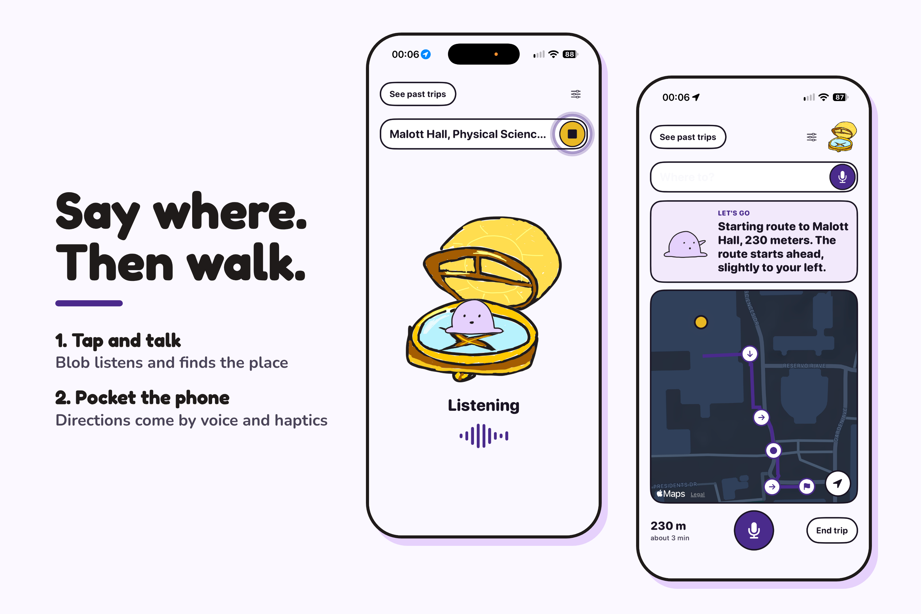
- Voice input. Tap anywhere and talk. "Take me to Malott" and "somewhere I can get coffee" both work.
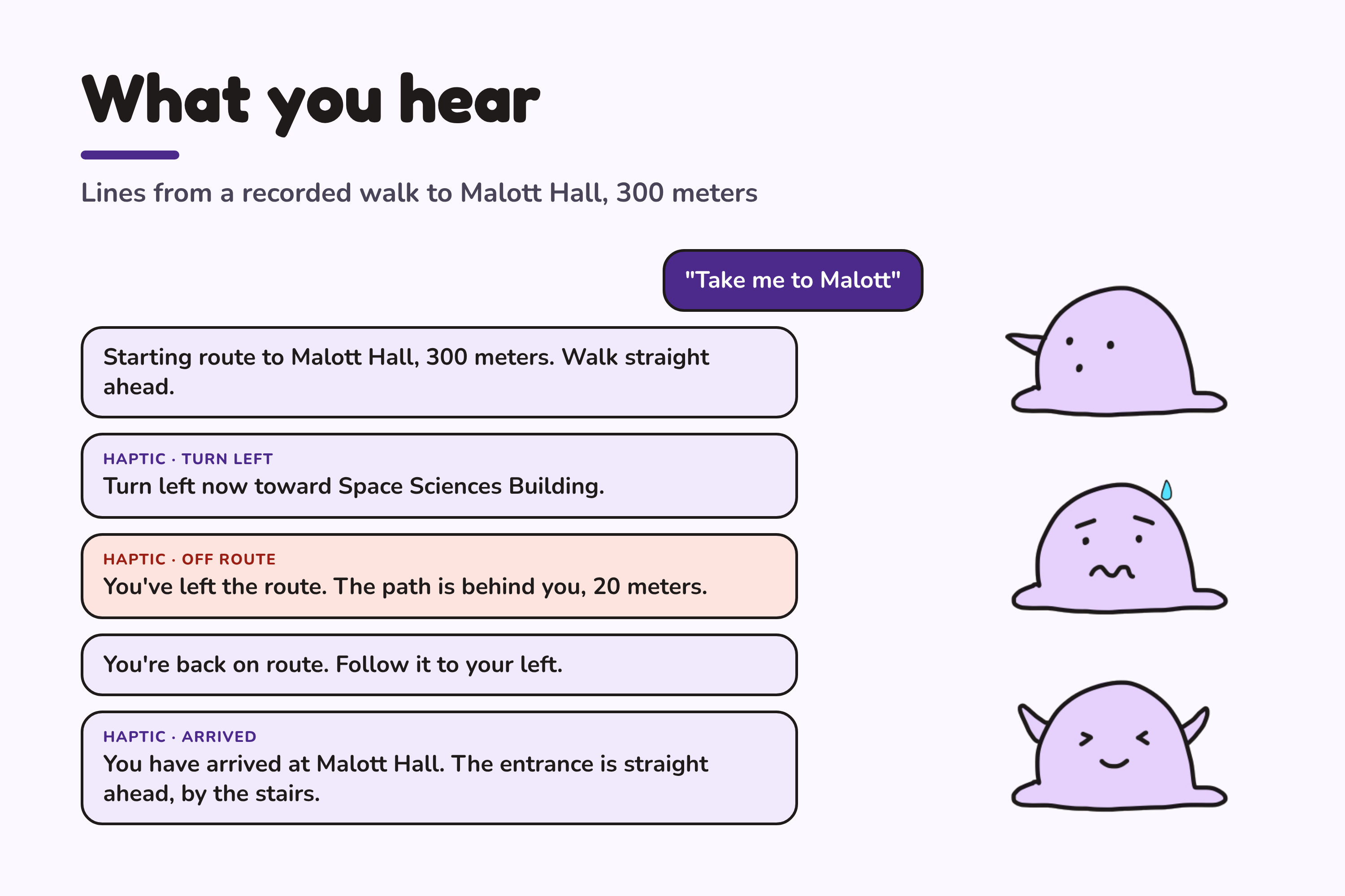
- Spoken directions. Short instructions using left, right, ahead and behind.
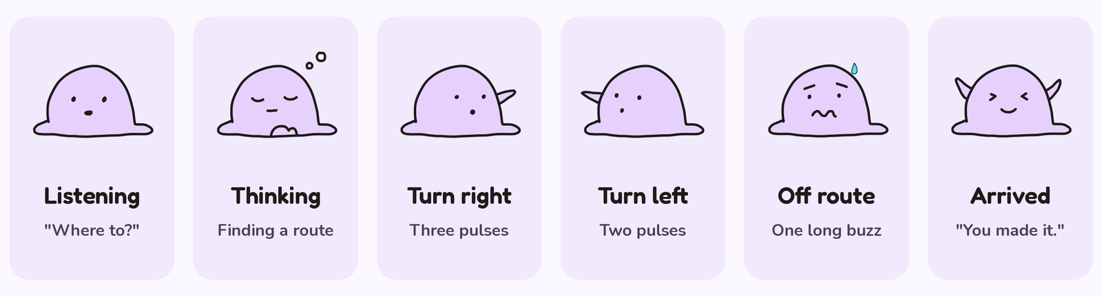
- Haptics. Two pulses for a left turn, three for a right, one long buzz when you're off route.
- Corrections. If you walk the wrong way, it says which way the path is and how far.
- Questions. "What's around me?" names nearby buildings and where they are.
- Blob. Our mascot sits in a compass and shows the trip's state on screen.
How we built it











iPhone app
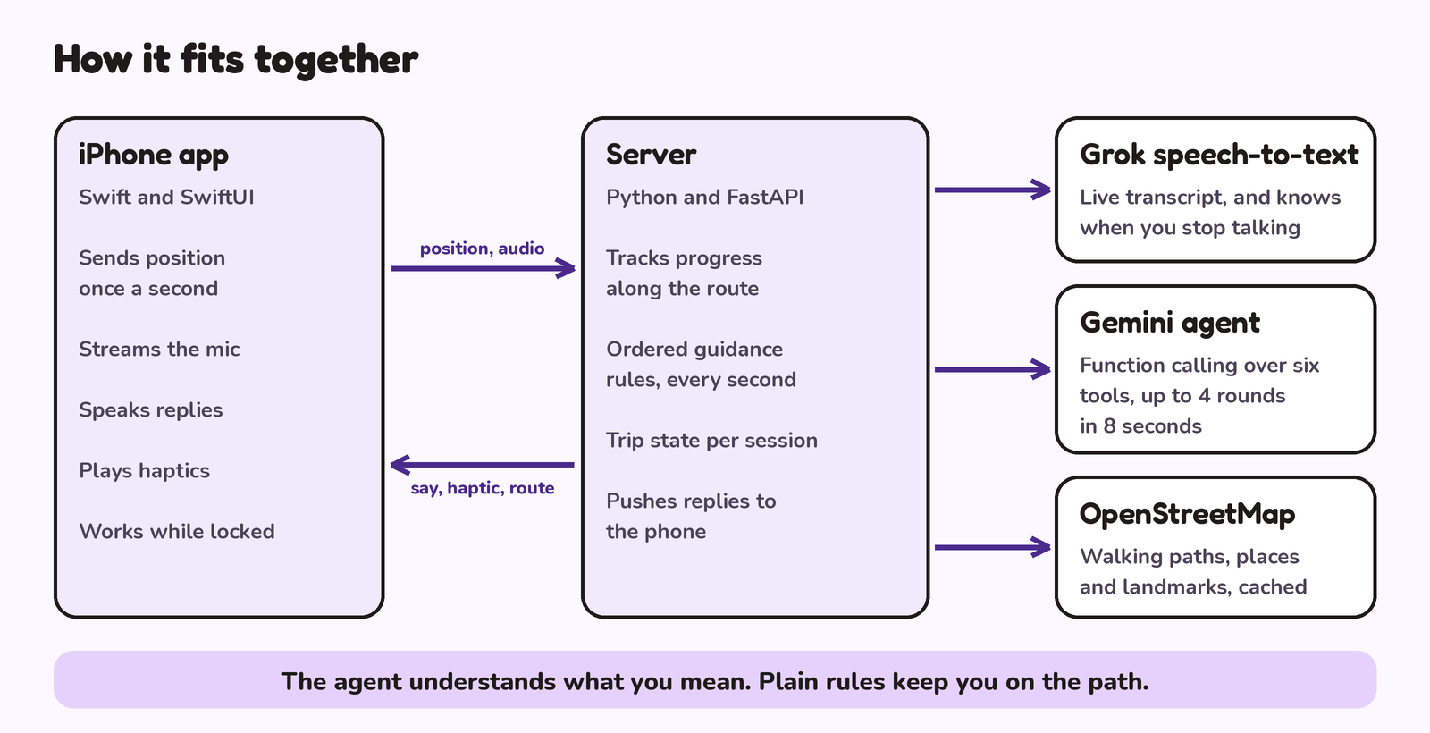
Swift and SwiftUI, deliberately thin. It sends position once a second, streams microphone audio, speaks replies, and plays haptics. It keeps working with the phone locked in a pocket.
Server
Python and FastAPI, where all the logic lives. Every second it runs an ordered list of checks (weak GPS, arrived, off route, turn now, wrong way, turn ahead) and the first one that fires is what you hear.
Grok speech-to-text
Audio streams from the phone to our server and on to Grok, which transcribes live and decides when you've stopped talking, so there is no stop button.
Gemini agent
Handles anything open-ended. It runs function calling in a loop of up to 4 rounds within 8 seconds, over six tools backed by real data:
search_places: Cafés, libraries and so on near you, from OpenStreetMapplan_route: Distance, turns and minutes to a place, without startingstart_navigation: Starts the trip and sends the route to the phonecancel_navigation: Ends the triptrip_status: Distance left, the next instruction, and which way back to the route if you're off itdescribe_surroundings: Named buildings within 60 m, with left, right or behind directions
Gemini also rewords our instructions so they sound natural.
OpenStreetMap
Walking paths, places and landmarks, cached so a trip doesn't wait on a slow API.
Testing
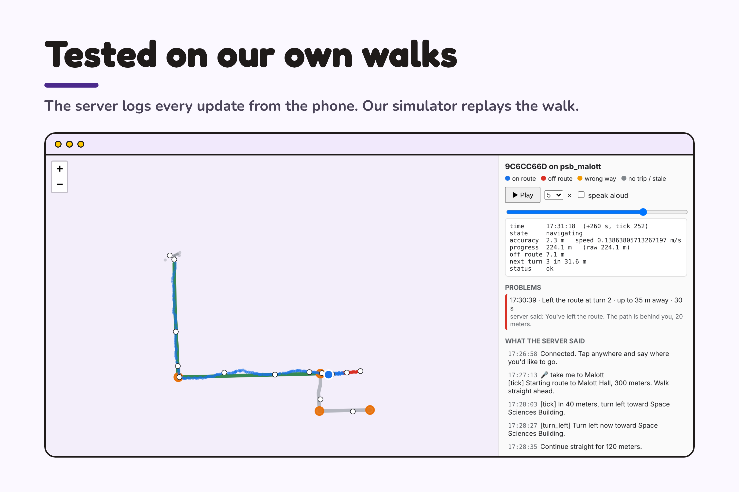
A fake phone walks any route with GPS noise, detours and reversals, and we replay recordings of our real walks through the server.
Challenges we ran into
Navigation
- Curved paths. Straight-line distance is wrong on a bend. We measure distance along the route instead. On a quarter-circle test route of 20 segments, that gives 78.5 m where the straight line gives 70.7 m.
- Knowing a turn was passed. Our first rule was "the distance to the turn stopped shrinking." It broke when someone cut a corner, when a route passed the same spot twice, and when GPS jumped. We now track progress as distance along the route, which only moves forward.
- Repeated GPS readings. The phone sends an update every second, but GPS doesn't always have a new reading, so the phone re-sends the last one. The server compares each reading's timestamp and skips repeats, so one bad fix can't count several times.
- GPS that is plainly wrong. Readings with poor accuracy are ignored for tracking, and a correction needs three bad updates in a row before the app speaks.
- Junctions with similar paths. Where two paths leave a junction at close angles, "turn left" doesn't say which one. The instruction names a landmark and uses words like "slight left," and the same wording guides someone back onto the right path if they take the wrong one.
iPhone
- Connecting a physical iPhone to Xcode.
- Getting app signing, developer trust and permissions working.
- Reading live location, heading and walking speed.
Voice
- Streaming audio from the microphone to our server and on to Grok.
Accomplishments that we're proud of
- The full trip works: speak a place, pocket the phone, and walk there.
- Gemini handles open requests and fixed rules handle guidance, so directions never wait on a model.
- We collected our own data. The server logs every update from the phone, so each real walk is saved as a recording.
- A simulator that replays those recordings, so we can test a walk without leaving the building.
- We corrected the guidance from real walks, not guesses: when a recording showed a wrong instruction, we replayed it until the fix held.
- Blob, drawn by hand.
What we learned
- Real GPS behaves differently from a simulator, and we only found the problems by walking the routes.
- Which parts suit a language model and which are better as a few
ifstatements. - Writing for someone who can't see the screen: no visual references in speech, and every state needs a sound or a haptic.
What's next for AcousticMaps
- Starting a trip with Siri, without opening the app
- Alternative entrances, so a route ends at the door you want
- Accessible routes that account for stairs and elevation change
- Indoor guidance
- Testing with blind and low-vision walkers
- Apple Watch haptics
- Running on the phone with no server
- Learning where GPS is unreliable from past walks
Built With
- cloudfaretunnel
- fastapi
- gemini
- geminiapi
- grok
- openstreetmap
- python
- swift
- swiftui


Log in or sign up for Devpost to join the conversation.