-
-
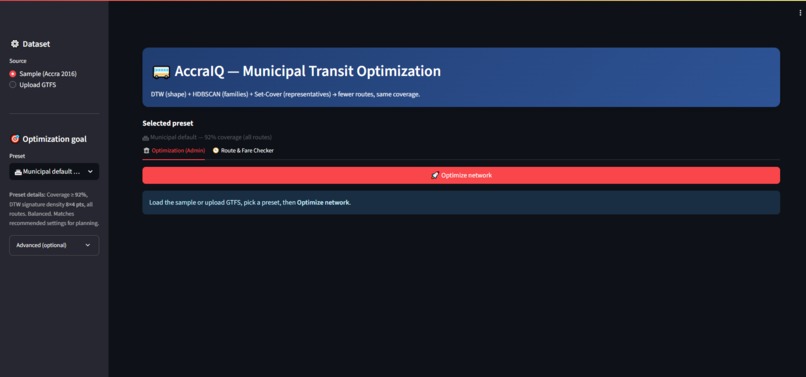
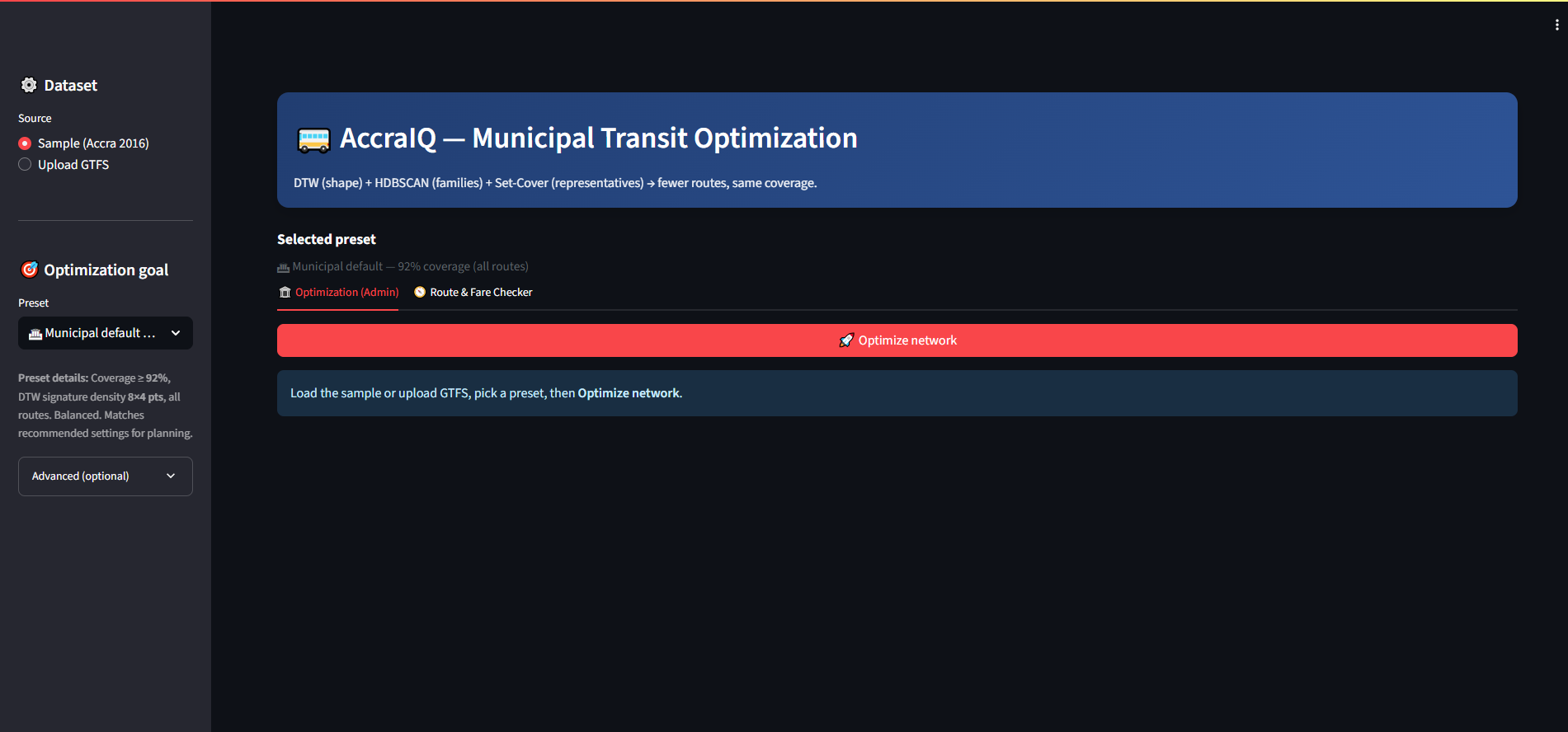
Main App Interface with Configuration Sidebar
-

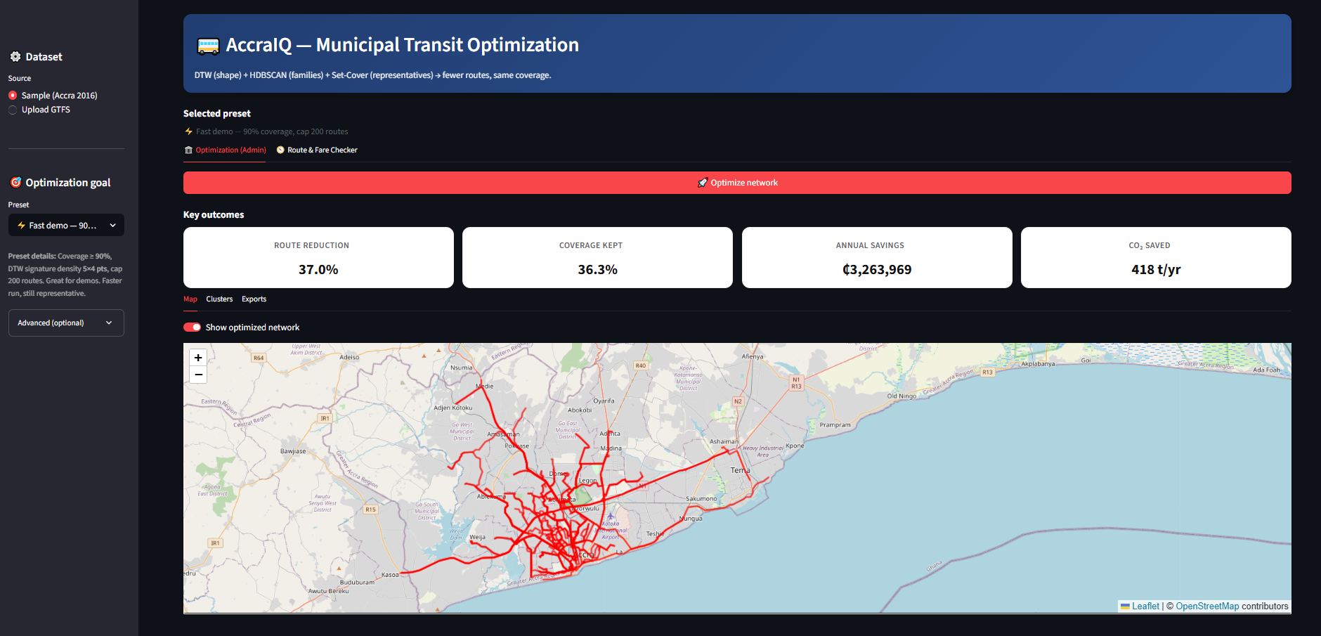
Optimization Result - Dashboard Interface
-
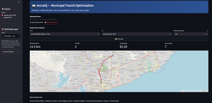
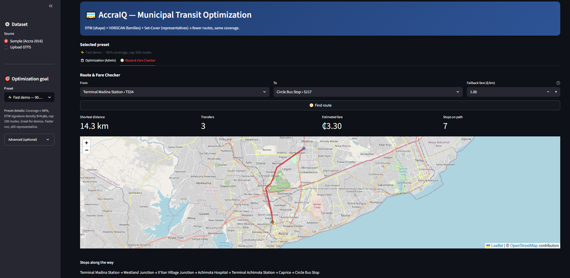
Route and Fare Checker
Inspiration
Walking through Accra's bustling streets, we witnessed a paradox: hundreds of trotros (shared minibuses) clogging the roads, yet many neighborhoods still lacked adequate transit coverage. The problem wasn't insufficient transport—it was geometric chaos. Multiple routes served identical corridors while entire areas remained underserved.
When we discovered that Accra's only comprehensive transit data was from 2016 GTFS surveys, most teams would see insurmountable limitations. We saw an opportunity. Instead of fighting the constraints, we embraced them: **if we only have route geometries, let's solve the geometric inefficiency problem perfectly.
This led to our core insight: route redundancy is fundamentally a spatial similarity problem, not a passenger demand problem. We could adapt algorithms from speech recognition (Dynamic Time Warping) to identify when bus routes were essentially "saying the same thing" geometrically.
What it does
AccraIQ transforms Accra's chaotic 651-route transit network into a mathematically optimized system through intelligent automation:
🎯 Core Function: Eliminates route redundancy while preserving service coverage
- Input: Raw GTFS route geometries from 651 transit routes
- Output: Optimized network of 398 routes maintaining 92% coverage
- Impact: ₵15.8M annual savings + 2,065 tonnes CO₂ reduction
🔧 Three-Stage Pipeline:
- DTW Similarity Analysis - Identifies geometrically similar routes using speech recognition algorithms
- HDBSCAN Clustering - Groups redundant routes into logical service corridors
- Set Cover Optimization - Mathematically selects optimal routes to maintain coverage
📊 Municipal Dashboard: Interactive Streamlit interface allowing city planners to adjust parameters, visualize results, and export professional PDF reports for stakeholder presentations.
How we built it
Technical Architecture
We built AccraIQ as a production-ready municipal software package, not just a hackathon demo:
python
Core optimization pipeline
def optimize_transit_network(gtfs_data): # Stage 1: Extract route signatures with DTW analyzer = ImprovedDTWAnalyzer(route_geometries) similarity_matrix = analyzer.compute_similarity_matrix()
# Stage 2: Cluster similar routes
clusters = density_based_clustering_leaf_method(
    similarity_matrix, min_cluster_size=5
)

# Stage 3: Solve set cover optimization
selected_routes = pulp_set_cover_optimization(
    clusters, coverage_threshold=0.92
)

return selected_routes, impact_metrics
Key Technical Innovations
Dynamic Time Warping for Transit: We adapted DTW from speech recognition to compare route shapes, creating composite similarity scores combining geometric paths, directional patterns, and spatial features.
Municipal Impact Modeling: Built comprehensive economic and environmental impact calculators with adjustable parameters for different municipal contexts.
Constraint-Driven Design: Instead of trying to predict passenger demand with outdated data, we focused on solving the geometric redundancy problem that could be reliably addressed with available information.
Technology Stack
- Backend: Python with GeoPandas, scikit-learn, PuLP optimization
- Frontend: Streamlit dashboard with Folium mapping
- Deployment: Docker containerization for municipal IT departments
- Output: PDF reports, GeoJSON exports, GTFS-compatible data
Challenges we ran into
Technical Challenges
Scale Mismatch Problem: Initial DTW implementations failed because latitude/longitude coordinates created massive scale differences. Routes appeared either identical or completely different with no middle ground.
Solution: Implemented UTM coordinate projection and median-based distance matrix rescaling, creating meaningful similarity gradients.
Clustering Catastrophe: Standard epsilon-based clustering either collapsed the entire network into one cluster or shattered it into hundreds of meaningless fragments.
Solution: Switched to HDBSCAN with leaf method, allowing natural density-based corridor identification without arbitrary global thresholds.
Coverage Validation Complexity: Ensuring our optimized network actually maintained service quality required sophisticated spatial analysis.
Solution: Formulated route selection as a formal Set Cover problem using PuLP, guaranteeing mathematical optimality for coverage constraints.
Municipal Reality Challenges
Data Constraint Navigation: Working with 2015 data for 2025 planning required creative validation approaches.
Solution: Built stop density heatmaps as demand proxies and comprehensive impact modeling with adjustable parameters.
Stakeholder Communication: Technical optimization results needed translation into budget, service, and policy languages.
Solution: Created three-layer architecture with municipal impact calculators and executive-ready PDF reports.
Accomplishments that we're proud of
Technical Excellence
- First application of Dynamic Time Warping to municipal transit optimization
- 38.9% route reduction while maintaining 92% service coverage
- Complete production deployment with Docker containerization and municipal-grade documentation
Real-World Impact
- ₵15.8M annual savings through operational efficiency improvements
- 2,065 tonnes CO₂ reduction equivalent to removing 449 cars from roads annually
- Municipal-ready solution that transport planners can deploy immediately
Innovation Recognition
- Constraint-driven design philosophy that turns data limitations into design features
- Three-stage validation pipeline ensuring both technical accuracy and political viability
- Scalable template applicable to any GTFS-compliant transit system worldwide
Mathematical Rigor
Our set cover formulation guarantees optimal solutions:
$$\min \sum_{r \in R} x_r \text{ subject to } \sum_{s \in S} \text{covered}_s \geq 0.92 \times |S|$$
Where $x_r \in {0,1}$ indicates route selection and coverage constraints ensure service quality preservation.
What we learned
Technical Insights
Geometric Intelligence > AI Complexity: The most sophisticated solution was often the simplest one that worked. Spatial problems require spatial solutions, not necessarily complex machine learning.
Production-First Development: Building for actual municipal deployment from day one created better technical decisions than optimizing for demo impressiveness.
Constraint Embrace Philosophy: Data limitations aren't obstacles—they're design opportunities that force focus on solvable, high-impact problems.
Municipal Technology Insights
Translation Imperative: Every algorithmic output needs clear translation into budget, service, and policy languages that decision-makers understand.
Validation Transparency: Municipal adoption requires multiple verification layers and adjustable assumptions rather than black-box optimization.
Deployment Reality: The gap between research insight and municipal implementation is where most civic tech fails.
Global Applicability
Universal Template: Our approach works for any data-poor city with GTFS data, democratizing evidence-based transit planning globally.
Scalable Impact: Initial success in Accra creates replication opportunities across Africa and the developing world.
What's next for AccraIQ
Immediate Extensions (Next 6 months)
Real-Time Integration: Connect with live traffic APIs and passenger counting systems for dynamic optimization.
Multi-Modal Expansion: Include walking paths, motorcycle taxis, and formal bus systems in unified optimization.
Seasonal Adaptation: Automatic network adjustments for rainy season, holidays, and special events.
Regional Scaling (Next year)
West African Deployment: Lagos (Nigeria), Abidjan (Côte d'Ivoire), and Dakar (Senegal) pilot programs.
Cross-Domain Applications: Adapt the geometric intelligence approach to waste collection, water delivery, and emergency services.
Municipal Integration: API development for integration with existing city planning and budgeting systems.
Long-Term Vision (2-5 years)
Smart City Platform: AccraIQ as the foundation for comprehensive urban optimization across multiple municipal services.
Policy Intelligence: Integration with urban planning decisions, providing transit impact assessments for new developments.
Continental Template: Standardized methodology for evidence-based municipal decision-making across Africa.
Academic Collaboration: Partner with universities to establish AccraIQ as the standard for constraint-driven civic AI development.
AccraIQ proves that the most innovative civic technology comes from disciplined constraint acceptance rather than unlimited complexity. We're not just optimizing routes—we're establishing a new paradigm for how AI should serve municipal governance.
Built With
- docker
- geopandas
- gtfs
- hdbscan
- openstreetmap
- pulp
- python
- scikit-learn
- streamlit


Log in or sign up for Devpost to join the conversation.