Inspiration
Last year, my friend Alex shattered her foot and had to use a wheelchair to get around campus. I knew it would be hard for her, but I didn't realize how hard until I saw how many buildings at Cornell have stairs right at the front door, and how many narrow doors there are. Every time she reached one, she had to go around to the back of the building and hope there was another way in, and she usually didn't find out until she was already at the door.
Accessibility maps do exist, but they're hard to find, hard to read, and very outdated, so Alex mostly relied on asking friends or just guessing. It was very stressful and time-consuming for her to find a door that was accessible.
That's what inspired me to build AccessScan. I kept thinking that if just one person had already checked that entrance and shared what they saw, Alex would have known if the building she was going to had accessible entrances (and where they were) before she even left. My hope is that one day, every student who uses a wheelchair, crutches, or any other mobility aid can check whether a building is accessible before they leave, so no one has to find out at the door.
What it does
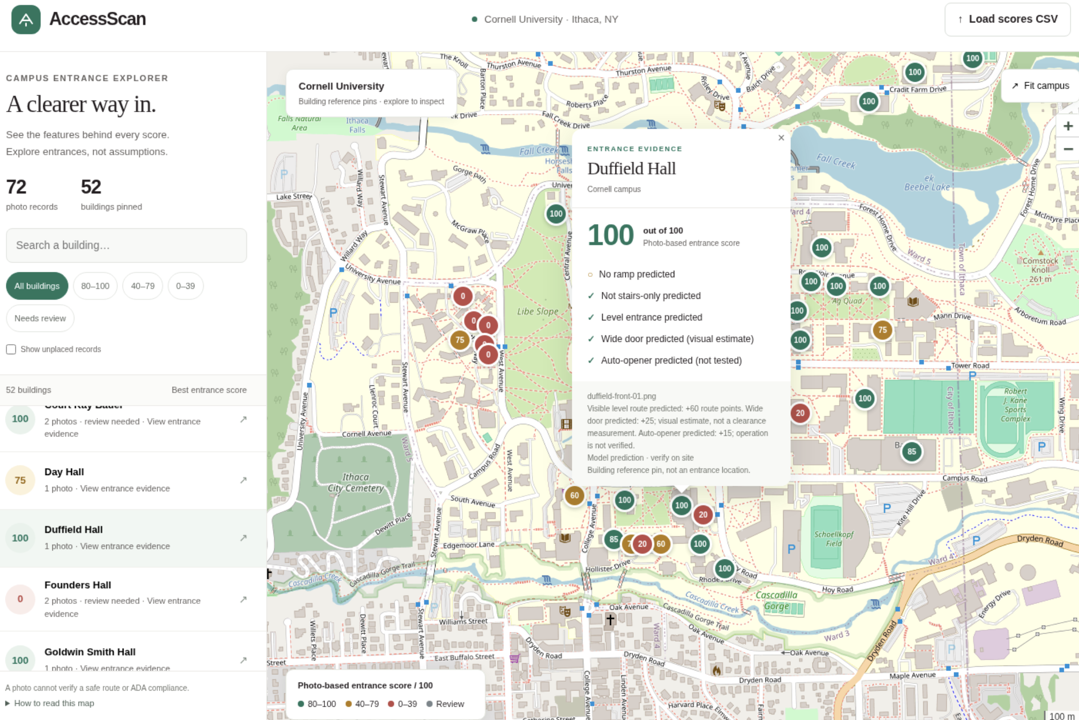
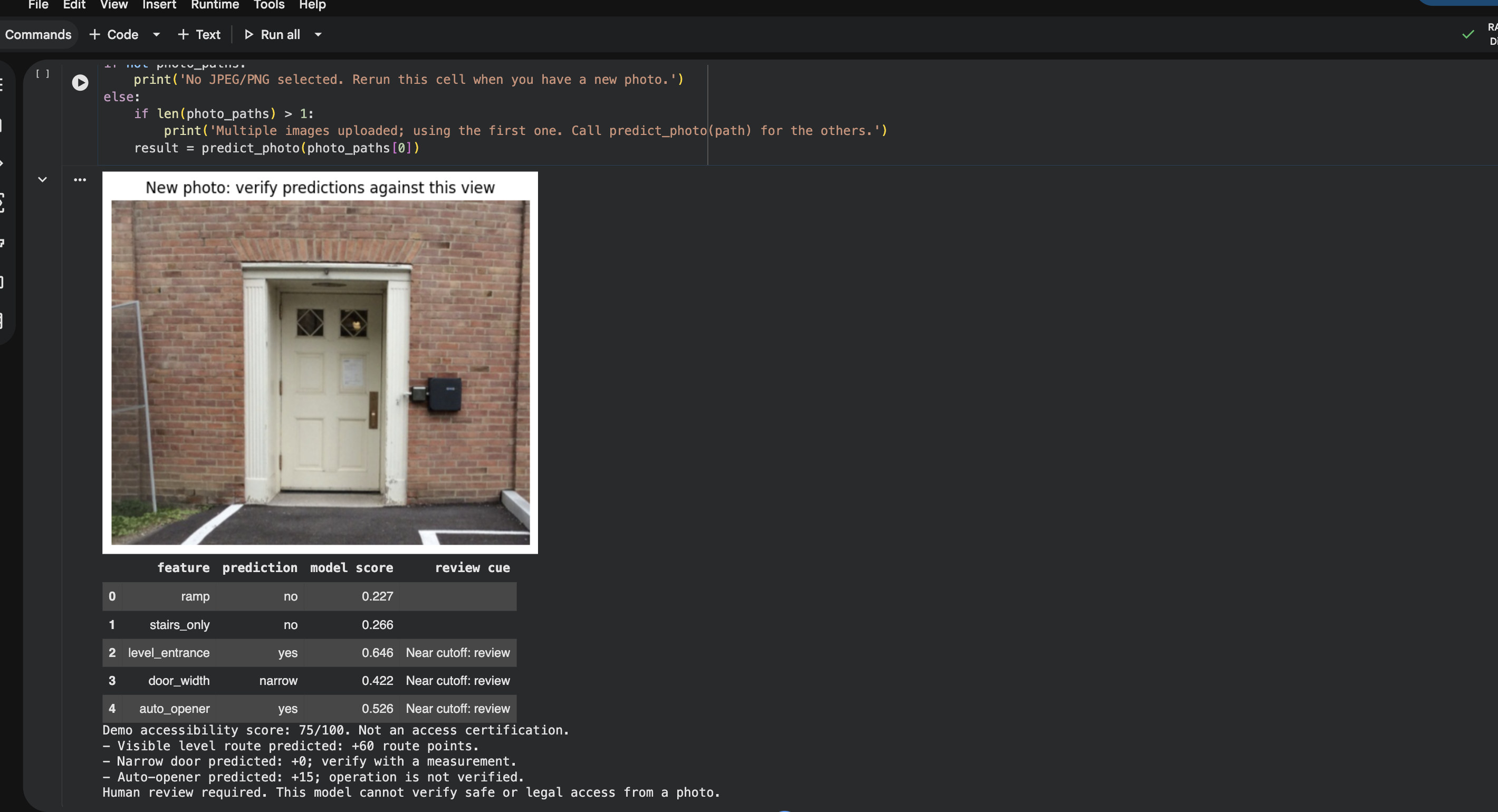
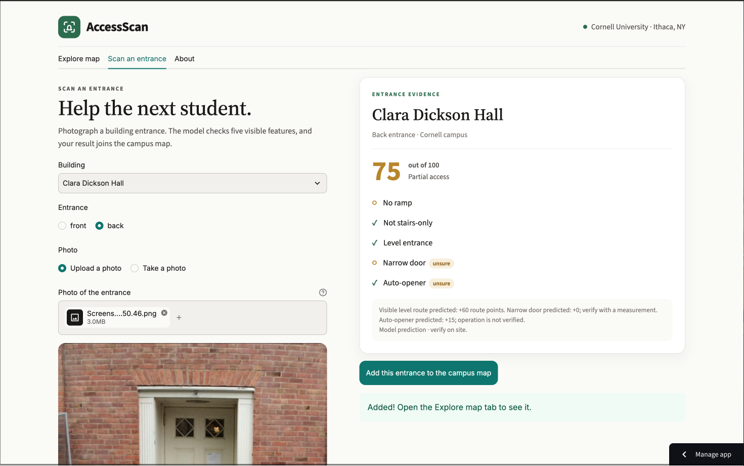
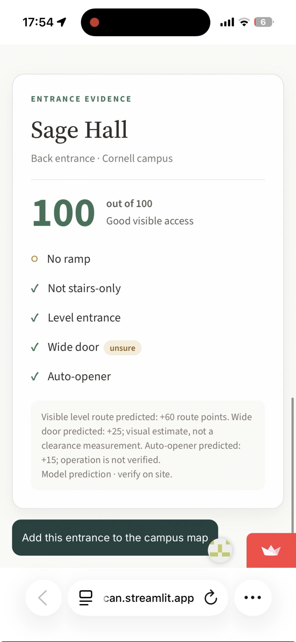
AccessScan is a web app that lets students map how accessible campus entrances really are. Anyone can take or upload a photo of a building entrance, and in seconds, AccessScan checks it for five visible features: a ramp, stairs with no other way in, a level entrance, a wide door, and an automatic door opener. It then gives the entrance a score from 0 to 100, with a checklist explaining exactly how the score was calculated and flags for any feature the model isn’t sure about.
Students can then add their scan to a shared campus map, where every building gets a color-coded pin based on its best entrance. Green means good access, yellow means partial access, and red means there’s likely a barrier. Buildings nobody has scanned yet show up as white dots, so the map keeps filling in as more students use it. You don’t need an account or an app to download, and photos are never saved, only the building, the features the model found, and the score.
How I built it
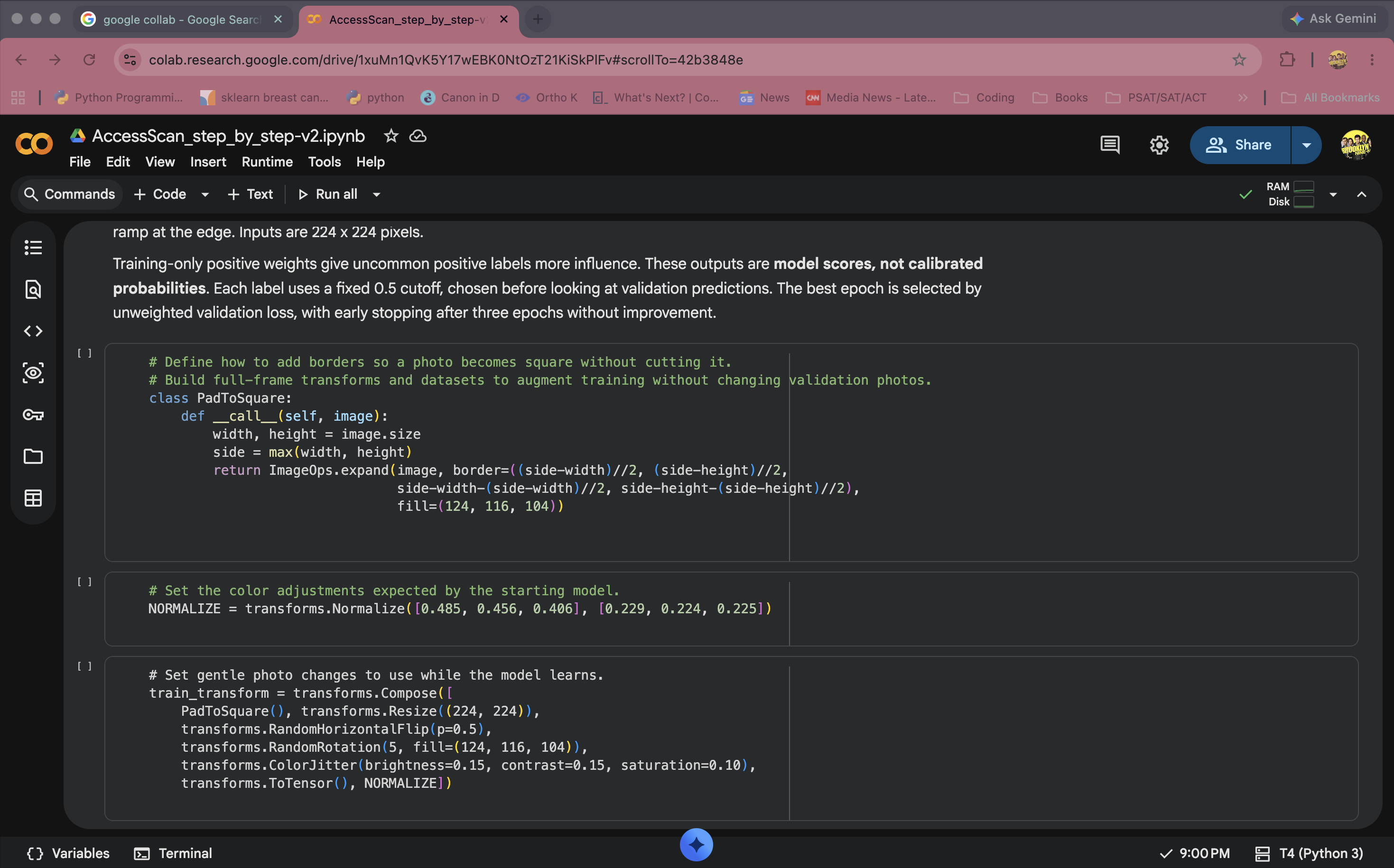
I started by building my own dataset. I labeled 88 photos of building entrances, most of which I took around Cornell, marking whether each one had a ramp, stairs only, a level entrance, a wide or narrow door, and an automatic opener. I then fine-tuned a pre-trained MobileNetV3-Small model in Google Colab using PyTorch. I chose MobileNetV3 because it’s small and fast, which makes sense for an app people use on their phones, and starting from a pre-trained model let me get good results from a small dataset. To make sure my results were accurate, I split my training and test data by building, so the model was always tested on buildings it had never seen before, and I compared it against a simple baseline.
The app itself is built with Streamlit and deployed on Streamlit Community Cloud. Each scan is saved to a Google Sheet through the Google Sheets API, which lets everyone share one live map, and the map uses Folium with building locations from OpenStreetMap.
Challenges I ran into
My biggest challenge was finding ramps. I couldn’t find many ramps on campus, so most of my ramp examples ended up coming from off-campus buildings. I learned that this can cause the model to learn the wrong thing, like recognizing where a photo came from instead of what’s actually in it.
Deploying was also completely new to me. I had to learn how to use GitHub, set up a virtual environment, connect to Google Sheets with a service account, and keep my API key secret so it never ended up in my public repo. I also ran into a lot of small bugs along the way, like building names that didn’t match across files and a single missing line break in my theme file that turned the whole app dark.
Accomplishments that I am proud of
I’m really proud that AccessScan is a real, working app that anyone can open on their phone right now, and not just an idea. I built and labeled my own dataset from scratch, trained a model on it, and connected everything into a live map that updates as people use it. I’m also proud that I was honest about what the model can and can’t do, instead of making it seem more accurate than it is. Most of all, I’m proud that I built something that could actually make a difference for students like Alex.
What we learned
I learned a lot about machine learning beyond just training a model. I learned how transfer learning makes it possible to work with a small dataset, and why it matters to test a model on data it has never seen. I also learned that a model can look accurate while learning the wrong patterns, which taught me to think much more carefully about where my data comes from. On the building side, I learned how to deploy an app, connect it to a database, and keep credentials secure. I also realized how important it is to design with the people who will actually use it in mind, from pairing every color with a text label to keeping the app simple enough to use in a few seconds.
What's next for AccessScan
Right now, AccessScan only covers Cornell’s campus, but I’d love to bring it to other universities in the future, since students with disabilities everywhere run into the same problem Alex did. I also want to let students confirm or correct each other’s scans, so the map stays accurate over time and reflects real conditions, like a broken door opener or a blocked ramp. Another goal is to improve the model itself by collecting more photos of on-campus ramps, since that’s the feature it currently struggles with most. And because AccessScan doesn’t need an account or an app to download, anyone can start helping right away, which makes it easy to grow quickly.
Built With
- computer-vision
- folium
- github
- google-colab
- google-sheets-api
- gspread
- leaflet.js
- machine-learning
- mobilenetv3
- numpy
- openstreetmap
- pandas
- pillow
- python
- pytorch
- streamlit
- streamlit-community-cloud
- torchvision
- transfer-learning
