-
-
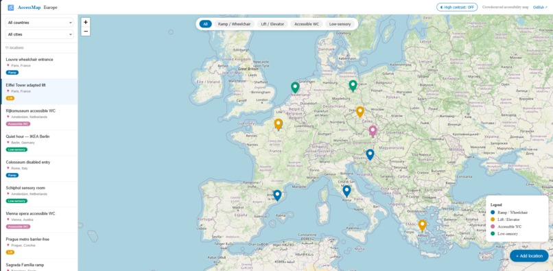
Main page - map and reviewed locations
-
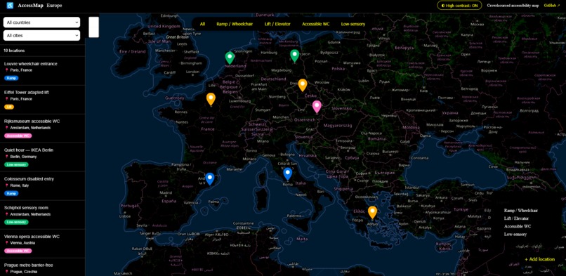
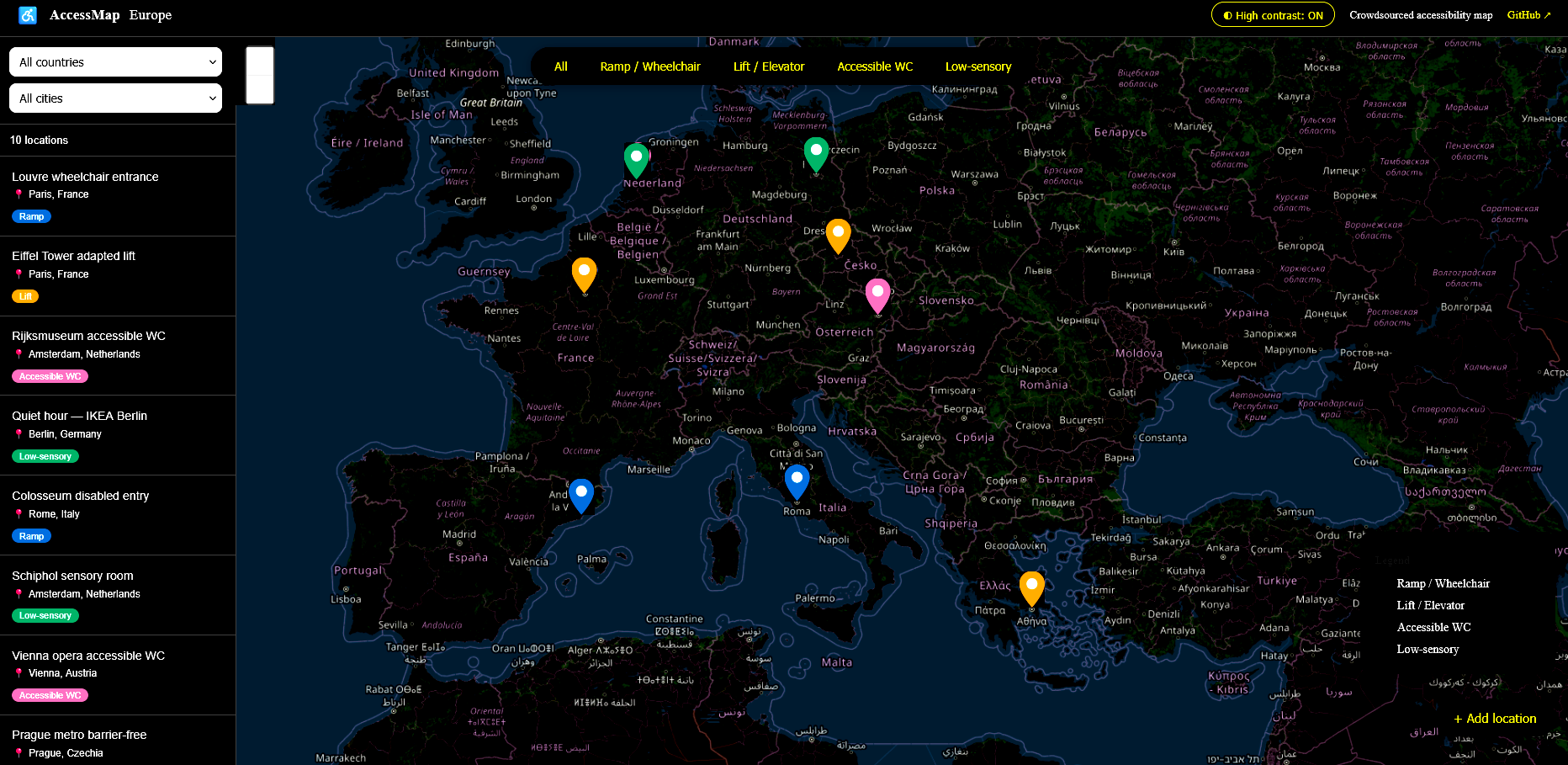
Main page - high contrast mode

Inspiration
Over 100 million people in the EU live with a disability, yet reliable information about accessible locations remains scarce and scattered. People with disabilities often have no way to know whether a place is accessible before they arrive. The European Accessibility Act (2025) sets clear standards — but practical, community-driven tools to navigate accessible spaces are still missing. AccessMap Europe was built to fill that gap.
What it does
AccessMap Europe is an interactive, crowdsourced web application that helps people with disabilities find and share accessible locations across European cities. Users can discover wheelchair ramps, elevators, accessible toilets, and low-sensory spaces on an interactive map. Locations can be filtered by category, country, and city. Anyone can contribute by adding a new location — the app automatically finds the correct coordinates from the address.
How I built it
The app is built with React and Vite, using Leaflet.js and React-Leaflet for the interactive map with OpenStreetMap tiles. New locations are geocoded automatically using the Nominatim API. The project was developed and deployed within 24 hours as a solo submission.
Challenges I ran into
Geocoding user-submitted locations accurately was the biggest challenge — early versions placed markers at random coordinates. Integrating Nominatim solved this, but required careful handling of ambiguous place names. Keeping the app itself accessible — while building a tool about accessibility — also required extra attention to detail.
Accomplishments that I'm proud of
The app practices what it preaches. It uses the Wong color palette for color-blind users, includes a high contrast mode with inverted map tiles, ARIA labels on all interactive elements, keyboard navigation support, and semantic HTML throughout. Building a fully functional, deployed app solo in under 24 hours is also something I'm proud of.
What I learned
Accessibility is not a feature you add at the end — it shapes every design decision from the start. I also learned how powerful open data can be: the entire app runs on free, open tools (OpenStreetMap, Nominatim, Leaflet) with no proprietary APIs or costs.
What's next for AccessMap Europe
- User accounts so contributors can manage their submissions
- Verification system so the community can confirm or flag outdated locations
- Mobile app for on-the-go reporting
- Integration with official EU accessibility databases
- Support for more accessibility categories such as hearing loops and visual guides
Built With
- leaflet.js
- nominatim-geocoding-api
- openstreetmap
- react
- react-leaflet
- vite


Log in or sign up for Devpost to join the conversation.