
Inspiration
Traditional cadastral maps are primarily 2D, making it difficult to represent complex urban properties such as multi-storey buildings, apartments, and vertically divided ownership. We wanted to build a system that brings land records into the 3D era by combining geospatial data, LiDAR, cadastral information, and digital twins.
What it does
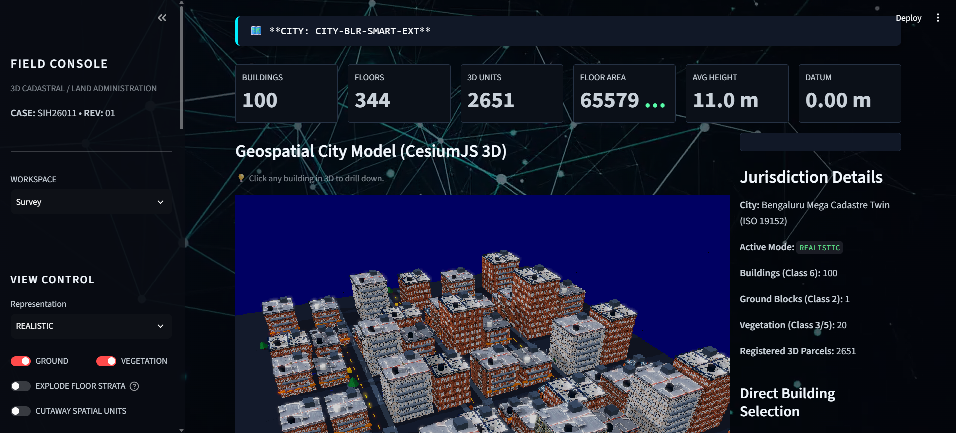
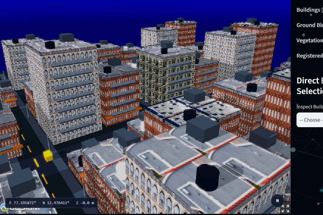
Our 3D Cadastral System converts geospatial and LiDAR data into an interactive 3D representation of urban properties. It enables visualization of buildings, floors, and individual property units while associating them with cadastral and land-record information such as ULPIN and LADM concepts. The system provides different visualization modes for elevation, cadastral boundaries, structural information, and urban density.
How we built it
We developed a geospatial processing pipeline that combines LiDAR/elevation data, cadastral boundaries, building footprints, and property information. The processed data is converted into structured 3D building representations and visualized through an interactive web-based interface using Cesium. The architecture is designed to support LADM-based property relationships and future integration with government land-record systems.
Challenges we ran into
The biggest challenges were integrating heterogeneous geospatial datasets, handling differences in coordinate systems and data formats, and converting 2D cadastral information into meaningful 3D property structures. We also had to balance visualization quality and computational performance while working with large spatial datasets.
Accomplishments that we're proud of
We successfully created a working prototype that demonstrates the transition from conventional 2D cadastral mapping to an interactive 3D cadastral digital twin. Our system can represent buildings and their spatial hierarchy while providing multiple visualization modes for understanding urban land and property data.
What we learned
We learned how challenging real-world geospatial data integration can be and how important coordinate systems, data preprocessing, spatial relationships, and efficient visualization are. We also gained practical experience with LiDAR processing, 3D GIS, digital twins, cadastral concepts, LADM, and web-based geospatial visualization.
What's next for 3D CADASTRAL SYSTEM
The next step is to move from prototype to a scalable platform by integrating real cadastral and survey datasets, automated building/floor/property-unit extraction, ULPIN linking, LADM-compliant data models, and cloud infrastructure. We also plan to add automated change detection, ownership/tenancy visualization, spatial queries, and APIs for integration with existing land-record systems.
Built With
- 3d
- cadastral
- cesiumjs
- data
- digital
- geojson
- geospatial
- gis
- javascript
- ladm
- land
- lidar
- management
- mapping
- photogrammetry
- planning
- python
- shapefile
- spatial
- twin
- ulpin
- urban
- visualization
- web

Log in or sign up for Devpost to join the conversation.