-
slide 2
-
slide 3
-
slide 1
Inspiration
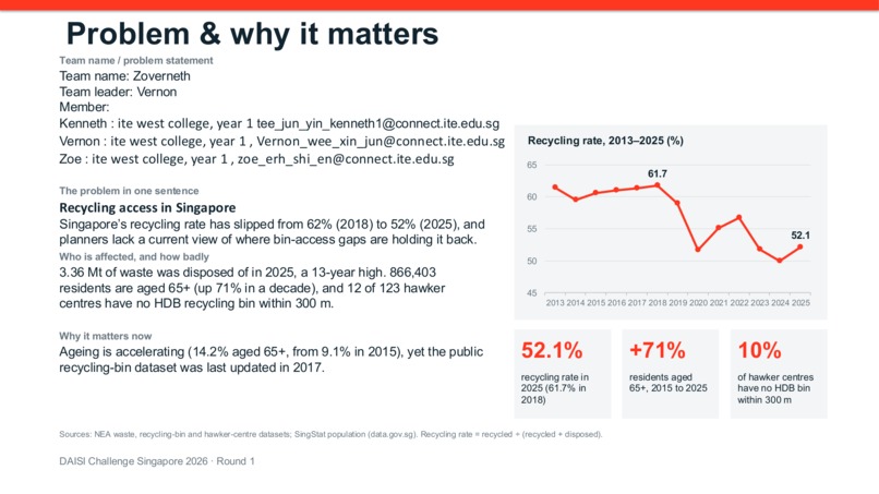
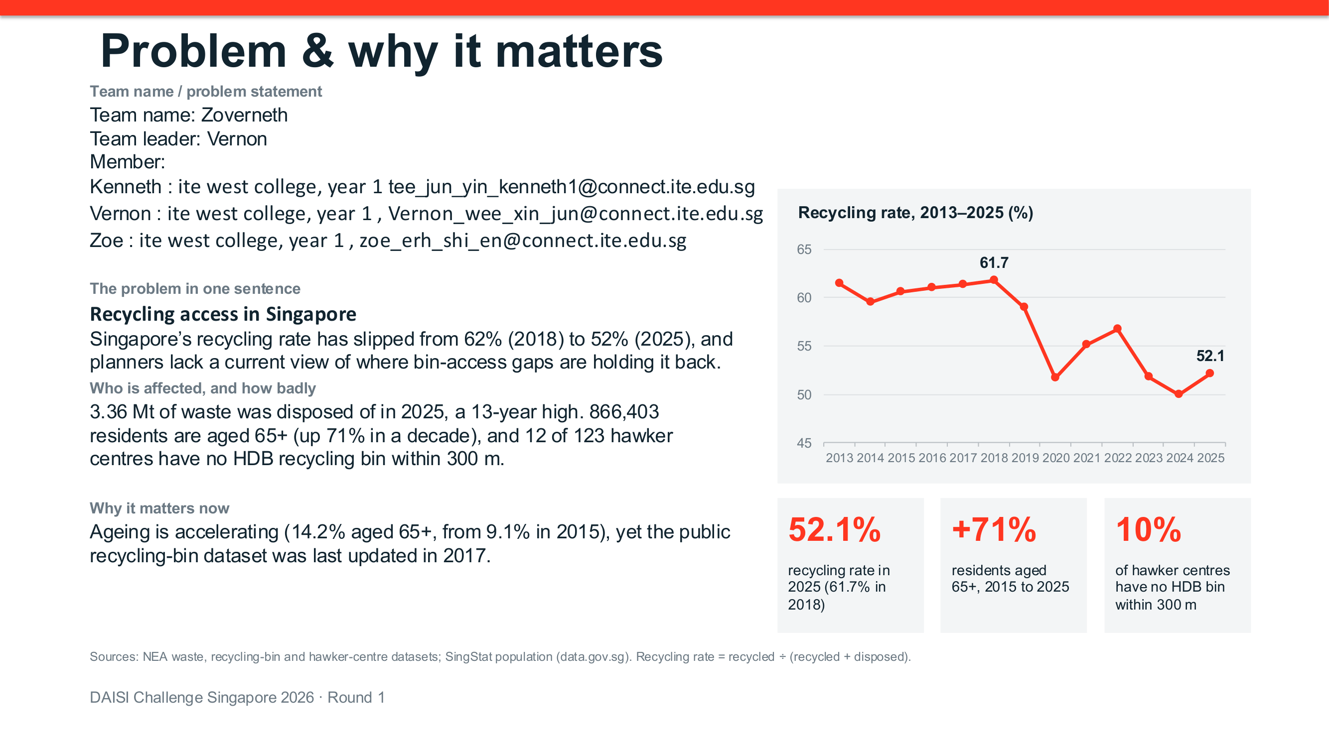
We were inspired by the importance of hawker centres in Singapore and the challenges they face, such as rising costs, declining hawker numbers, food waste and accessibility issues. We wanted to use data to better understand these problems and help communities and policymakers make informed decisions.
What it does
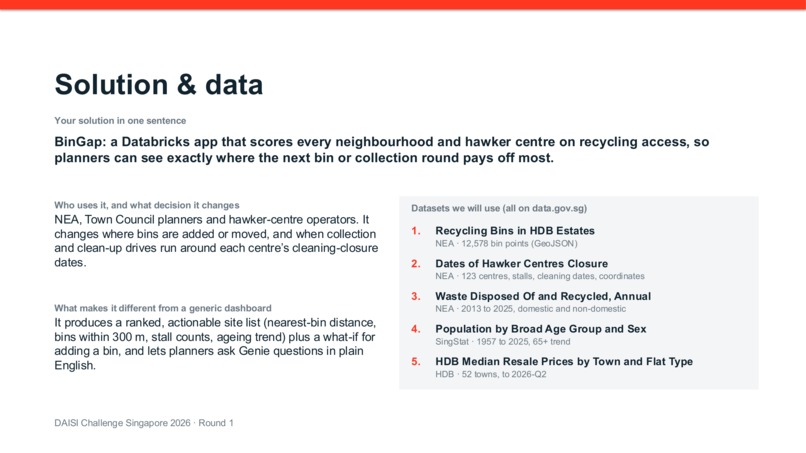
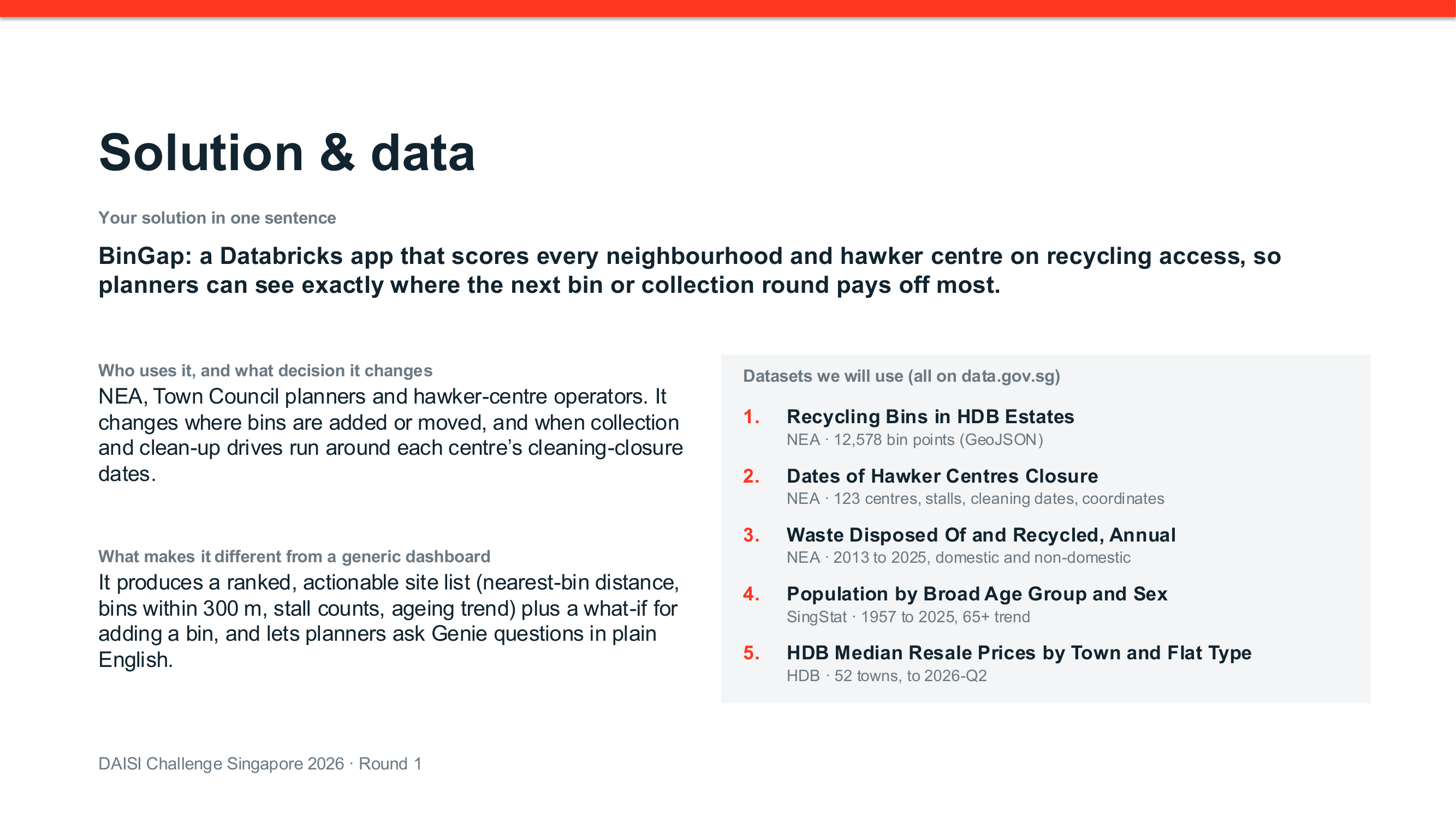
KopilamAI analyses hawker centres across Singapore to identify food access gaps, hawker centre closures and sustainability patterns. It combines information such as hawker centre locations, population, closures, food waste and recycling infrastructure to show which areas may be underserved or facing greater sustainability challenges.
How we built it
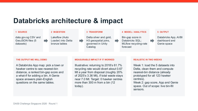
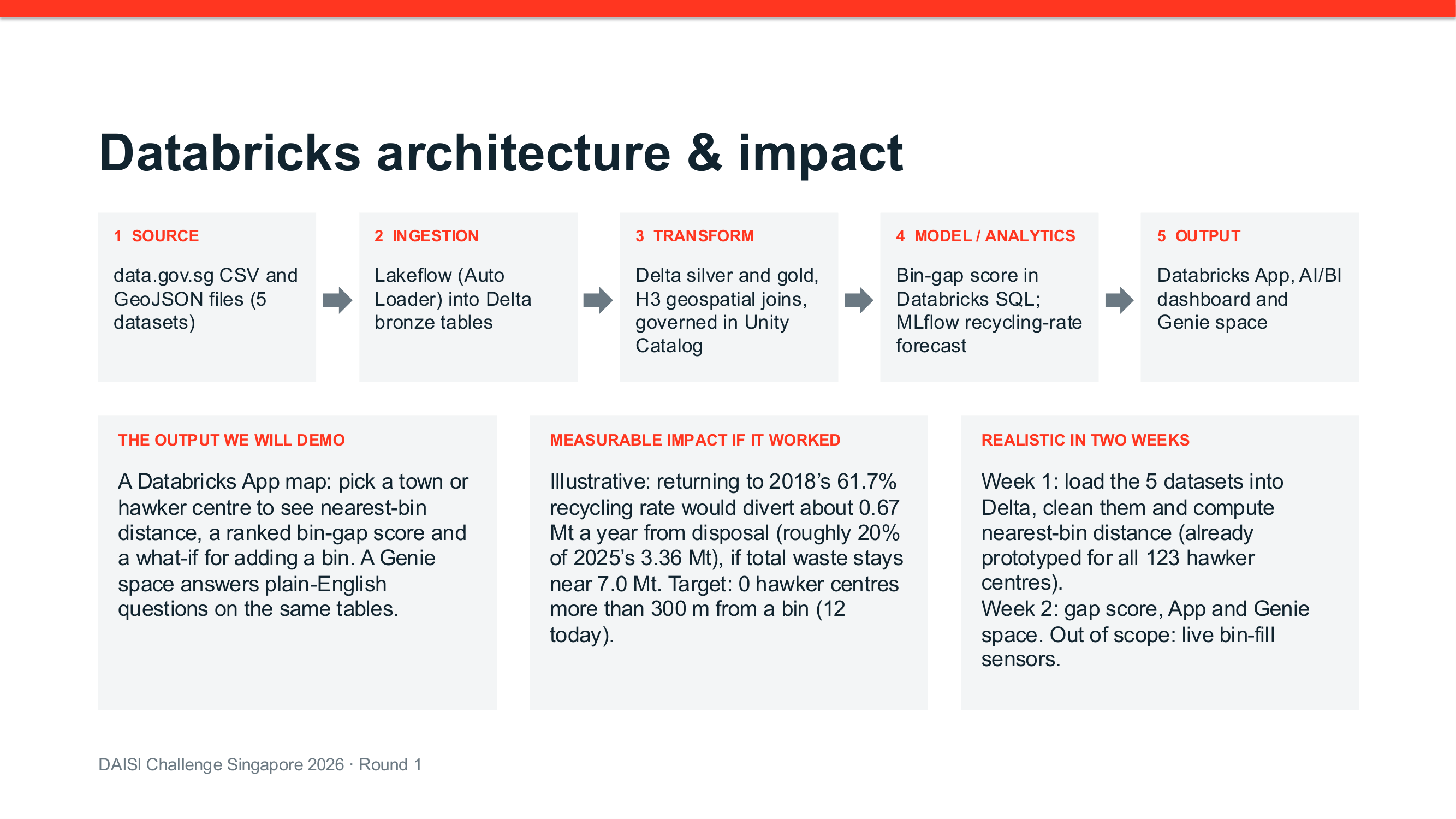
We collected datasets from sources such as NEA, SingStat and HDB. We cleaned and combined the datasets based on locations and planning areas. We then used geospatial analysis to compare hawker centres with population and sustainability data, allowing us to identify areas with potential food access gaps and other patterns.
Challenges we ran into
One of our main challenges was combining datasets that used different formats and geographical information. Some datasets were based on planning areas while others contained exact locations. We also had to deal with missing or inconsistent data and determine how to fairly compare food access between areas with different population sizes.
Accomplishments that we're proud of
We are proud that we were able to turn multiple public datasets into a single view of Singapore's hawker network. Instead of looking at food access, closures and sustainability separately, KopilamAI connects these factors to identify patterns that could be useful to communities and policymakers.
What we learned
We learned that data engineering is not just about collecting data. Cleaning, connecting and understanding the context behind different datasets is equally important. We also learned how geospatial data can be used to solve real-world problems and how data can be presented in a way that is easier for people to understand.
What's next for Zoverneth
Next, we want to make KopilamAI more accurate and useful by incorporating more real-time and detailed data, such as individual stall information, operating hours, food prices and footfall. We could also improve the geospatial analysis to identify underserved areas more precisely and develop recommendations that communities and policymakers can act on.

Log in or sign up for Devpost to join the conversation.