Inspiration
We wanted to make Toronto’s food access challenges easier to explore as part of a living city. Access depends on how streets, travel time, household resources, and food services interact. The Sims: 6ix brings those pieces into an interactive Toronto setting, with “6ix” reflecting the city and “Sims” its simulation approach.
What it does
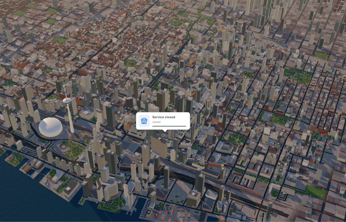
Explore a frozen 3D downtown Toronto scene as synthetic residents travel during a six-hour food-access scenario. Follow trips, inspect modeled household food and cash, review service activity and event history, compare baseline and emergency-site runs at several population sizes, and export run data.
The site anchors use City-listed locations from Toronto’s supermarket, food-support, and school GIS layers. The emergency site is hypothetical.
A separate local Council workspace accepts proposal revisions and stores organization and stakeholder-input records. Reviewers can define a scope, review a bounded plan, record a decision, and compare matched runs. These records support review; they do not represent official City decisions or verified public consultation.
How we built it
The browser uses TypeScript, React, Three.js, and Vite. Python generates the scenario and settles food and money; a local Python service stores Council workflow records in SQLite. The browser replays committed traces, so seeking through the timeline does not settle purchases again.
The downtown geometry comes from a frozen OpenStreetMap snapshot, whose data is available under the ODbL. City GIS records supply selected site names and locations; the City of Toronto Open Data licence page is included in the project’s source records. A local OpenAI integration can draft a structured plan when a reviewer explicitly chooses to share the listed context; Python validates supported actions, and a person reviews and approves a plan before a run.
Challenges we ran into
We had to connect an animated city to an economic simulation without letting replay change the results. The browser therefore reads committed events instead of recalculating purchases as the timeline moves.
We also had to distinguish mapped places from verified services. The Toronto layers provide location records, but they do not establish current operations, hours, stock, prices, or capacity. We keep those values labeled as assumptions or unknowns and cite the source layers alongside the OpenStreetMap data.
Accomplishments that we're proud of
We brought together a navigable 3D downtown scene, synthetic resident movement, a Python-settled food-access scenario, and a dashboard for household and service activity. People can inspect event histories, follow a resident, compare scenarios, and export a run.
We also built a local Council review workflow for proposal revisions, evidence records, bounded plans, decisions, and paired simulation runs. The source-linked location snapshot makes it possible to see which mapped places informed the scenario.
What we learned
A detailed map makes a scenario easier to explore, but mapped locations do not establish how a service operates. The City GIS layers and OpenStreetMap data support the setting and selected site locations; prices, hours, capacity, household behavior, and operating conditions remain illustrative or unknown. Our results describe the modeled scenario, not measured Toronto outcomes.
What's next for The Sims: 6ix
We want The Sims: 6ix to become a civic laboratory where people can follow a proposal from idea through implementation and see how its effects might unfold. Toronto’s municipal grocery pilot decision gives us a concrete place to start: what would it take to make a service work, and who might benefit?
We’ll build toward a persistent, multi-day city model grounded in verified information about service hours, capacity, prices, supply, and costs. We’ll expand on the current OpenStreetMap setting and Toronto GIS location data, while making each input’s source, age, and uncertainty visible. Community and partner input will have its own provenance and limits; synthetic residents will help explore scenarios, never stand in for public voices.
Our long-term vision is a place where residents and decision-makers can compare proposals side by side, examine trade-offs in affordability, access, cost, and who remains underserved, and ask better questions before real-world choices are made. The simulation should make those discussions clearer while leaving decisions with people.
Sources that we used to mock up our simulation
- OpenStreetMap copyright: https://www.openstreetmap.org/copyright
- Open Database License (ODbL): https://opendatacommons.org/licenses/odbl/1-0/
- Toronto supermarket locations: https://gis.toronto.ca/arcgis/rest/services/cot_geospatial26/FeatureServer/4
- Toronto food-support locations: https://gis.toronto.ca/arcgis/rest/services/cot_geospatial26/FeatureServer/50
- Toronto school locations: https://gis.toronto.ca/arcgis/rest/services/cot_geospatial28/FeatureServer/17
- City of Toronto Open Data licence: https://open.toronto.ca/open-data-licence/
- Toronto City Council item 2026.MM39.27: https://secure.toronto.ca/council/agenda-item.do?item=2026.MM39.27


Log in or sign up for Devpost to join the conversation.