
Inspiration
Our inspiration for WYA (Where you at?), came from our brainstorm session at the start of this Hackathon, where we considered the obvious presence of the COVID-19 pandemic and the urge to travel or explore outside after being locked in for so long. From this, we came up with the web application WYA, which would provide our users with the information to aid in exploring and experiencing popular destinations safely in the midst of a pandemic.
What it does
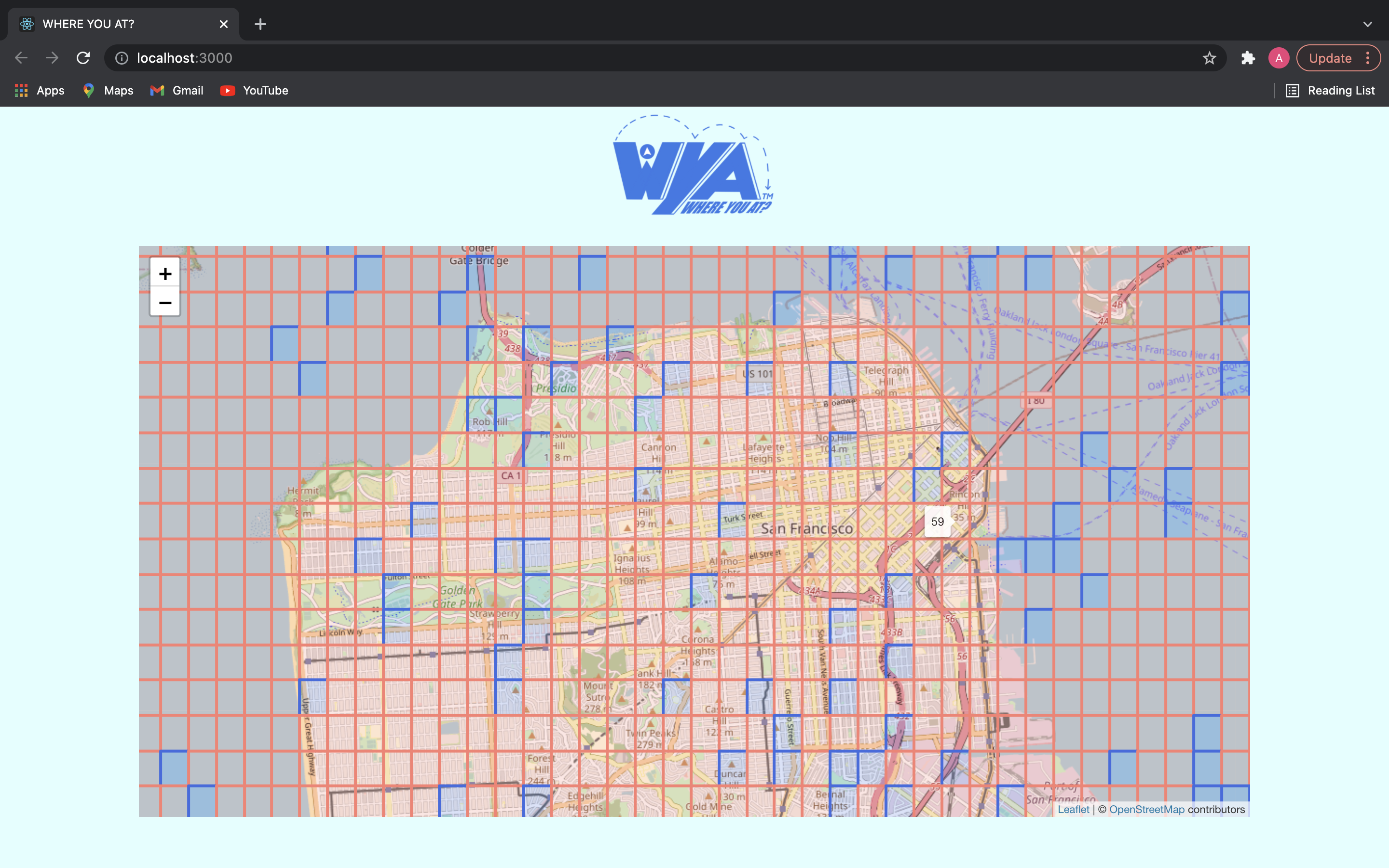
Our website allows the user plan a visit to “well-known” places in an efficient and safe manner. The user will first locate the select number of locations they would like to plan to visit which will, in turn, give them an estimated idea of the density of individuals in that area for COVID-19 concerns. With our website, we would hope it will allow our users to have more awareness of their settings in these trying times as well as the opportunity to get out of their house.
How we built it
We built our website using Javascript, HTML, and CSS. We used the platform React to implement the code and display the output on a website.
Challenges we ran into
A few of the challenges our team ran into were learning the languages we used to create the app. We were able to pick up Javascript, HTML, and CSS as well as the platform React in order to build this project from scratch. We also were introduced to APIs, where we faced some difficulties accessing the data in the API's using Javascript.
Accomplishments that we're proud of
Two accomplishments we are all proud of is creating a website with little experience using Javascript and React. Many of us learned JavaScript, React, HTML, and APIs within 24 hours which made this Hackathon a significant learning experience. We are also proud of the map feature, which we were able to implement on our website in order to create a more user friendly experience. Many of us are also more experienced as backend developers than frontend, so delivering a project containing a frontend design is something we are also proud about.
What's next for "Where you at?"
For the next steps of WYA, we plan to implement the estimation of distances of/between destinations, estimated time of arrival, data of locations and population density in certain areas, as well as auto suggested routes for individuals. We were successful displaying the popular regions on the map and we plan to enhance this by implementing additional features that will plan out the most efficient way to navigate to the user's selected locations as well as the estimated time of arrival.


Log in or sign up for Devpost to join the conversation.