WTDD: About the project
Inspiration
Our friend Ming is building a $5 million immersive exhibit, part of a development in Malaysia, 8,758 miles from where he lives. As the owner and PM, he spends about 3 hours a day asking people on site for details, and his staff spend another hour a day taking progress photos that are in a different position each time, so he can't compare progress. A robot dog could walk the site for him, but that means a $74,500 robot and someone trained to drive it. We wanted him to see and measure his site without being there, and without learning to operate anything.
The problem
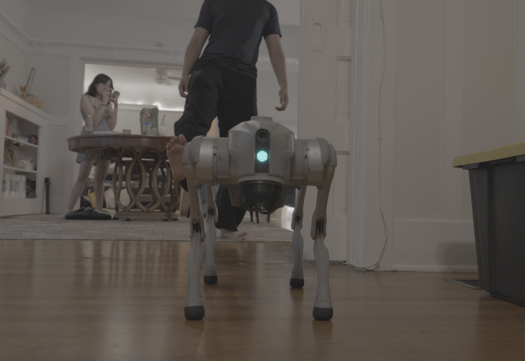
Owners who build far from their sites spend hours a day chasing photos and answers, and the photos never come from the same place twice. Robot dogs could do the walking, but today that means a $74,500 robot and a trained operator. WTDD is an operating system for a site: an AI agent in a Unitree Go2 that maps the site from its own LiDAR, walks saved routes on a schedule, photographs every stop, and reports in the group chat the site already uses. Before it acts on a person, it asks the group, and every step it takes lands in one record, read back from the device, that a person signs.
Primary research
Two interviews, two industries, the same problem.
- Ming (owner and PM, immersive exhibit, Malaysia; Sep 27): estimates ~3 hours a day asking for details, and his staff ~1 hour a day taking photos that are in a different position each time, so he can't compare progress. What he wants: the same stops checked every day, a photo when a lead asks him a question, and no robot to drive himself. "You would want it to be from the same angle in the same place every day so that you can keep an actual, precise timeline."
- Alex Wan (business analyst, Crown Castle, which owns ~40,000 cell towers across the US): his team sends a certified drone operator to each tower, about a week per site and roughly 50 sites a year per person, then layers the drone images by hand to get measurements. Before drones, people climbed the tower with a measuring tape. "This is infrastructure. It's really important to have the most up-to-date, credible information."
Outreach: 30 emails to owners and PMs this weekend using Replit.
Secondary research
- Missing information is expensive: construction professionals spend 14+ hours a week chasing information and fixing mistakes, costing US construction $177.5 billion a year in labor. 5.5 of those hours go to hunting for project data, which by our estimate is about $69 billion a year. 48% of US construction rework comes from poor project data and miscommunication (FMI/PlanGrid 2018, ~600 leaders, Autodesk).
- Robots are expensive: a Boston Dynamics Spot is $74,500 before add-ons ($1,275–$34,570 per module), plus a trained operator.
- Today's options: staff photos (hours a day, never the same spot) · 360° capture (from ~$10K, a person still walks it) · buying a robot dog ($74.5K + modules + operator) · a drone in a box ($21K–23K per dock, plus a licensed remote pilot, and built for outdoor sites).
- The gap: nothing takes the walking off the owner's plate and reports in plain language in the tools they already use.
What we learned
We started out believing owners wanted more photos. Ming taught us they want the same photo from the same spot, and Alex added precise measurements. We thought robots were too hard to use; both taught us the barrier is the operator: someone to drive it, certify for it, and travel with it. And we thought this was a construction problem. It's a remote-sites problem: exhibits, towers, any site far from the people responsible for it.
What it does
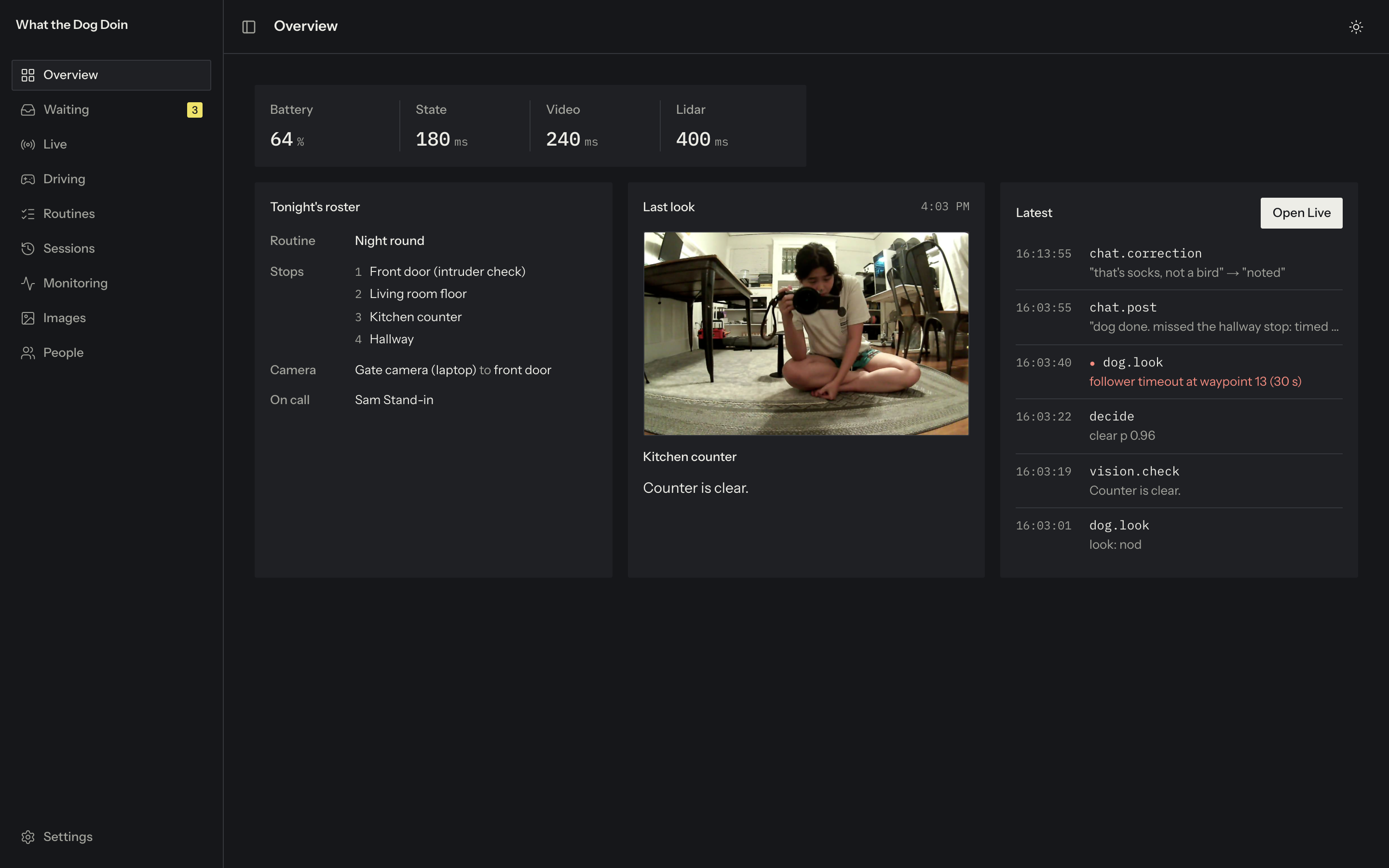
The dashboard, one page per job:
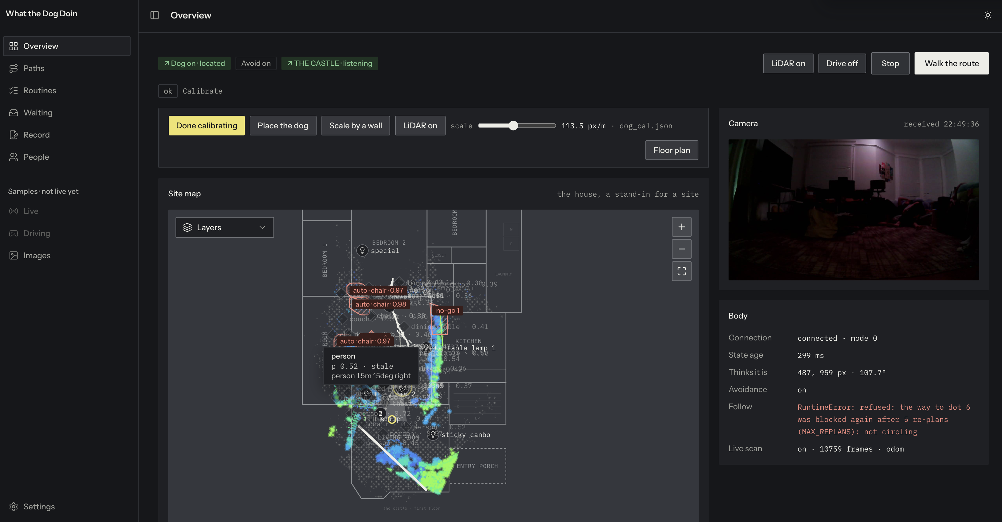
- Overview: the live camera, the dog on the site plan, and its status. Calibrate once: drag the ring onto the dog and the tip the way it faces, then set the scale by dragging a scanned wall onto its line. Reset map gives a clean canvas.
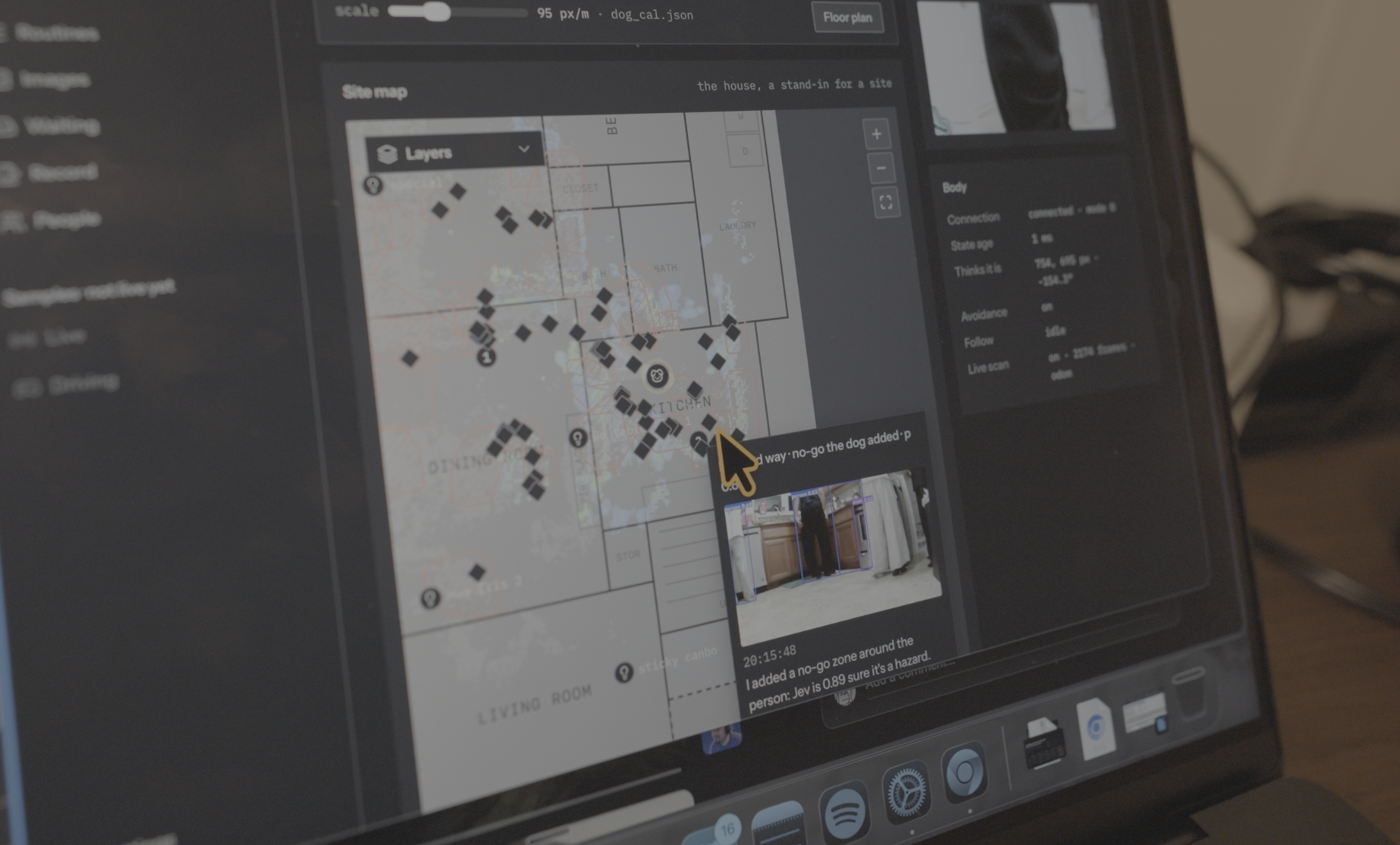
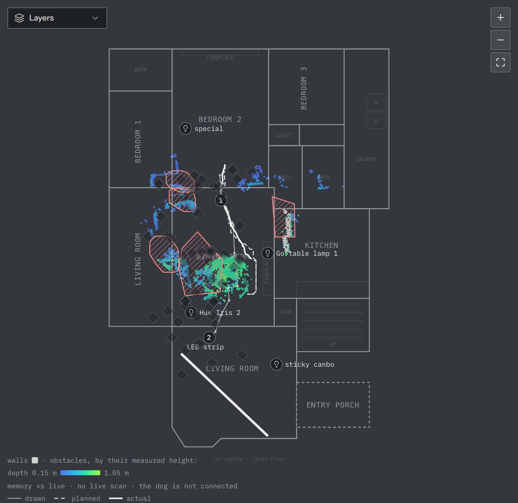
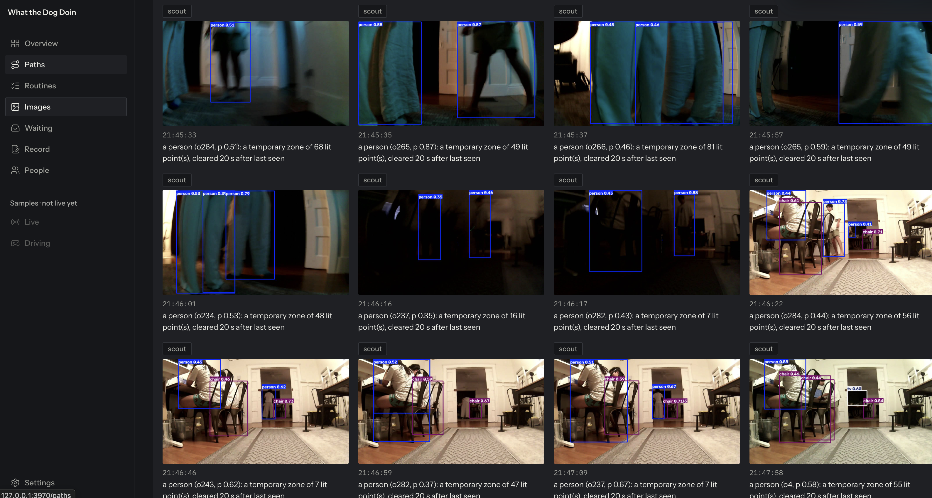
- The map: one slow 360° turn and the walls draw in from the LiDAR. 2.5D raises every surface to its measured height. Pins name what the camera sees, placed on the LiDAR cluster at the depth the camera sees it. Red zones mark furniture it has confirmed is in the way; yellow zones mark people and clear when they leave.
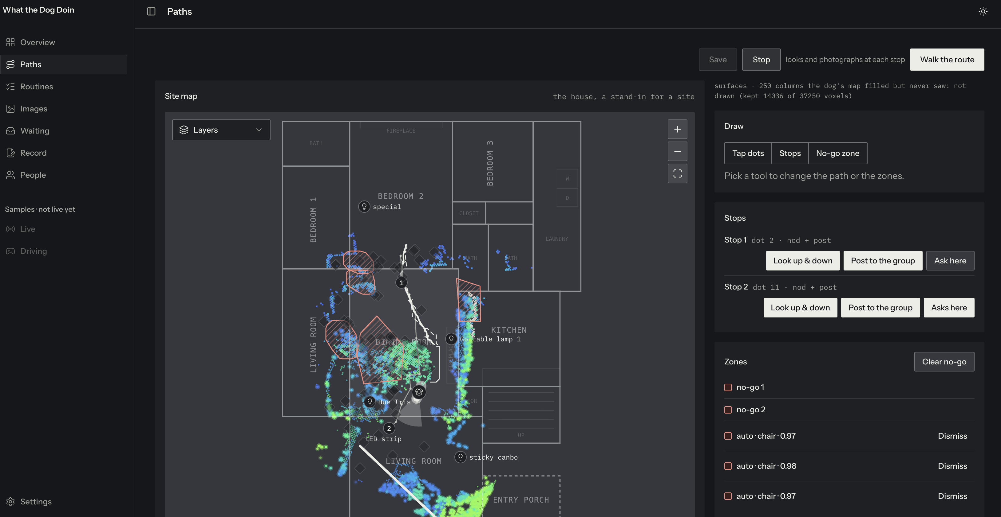
- Paths: tap dots to draw a route and make any dot a stop. Per stop: look up and down and photograph, post to the group, and ask here. It plans around what it sees; the map shows the plan dashed and the path it took solid.
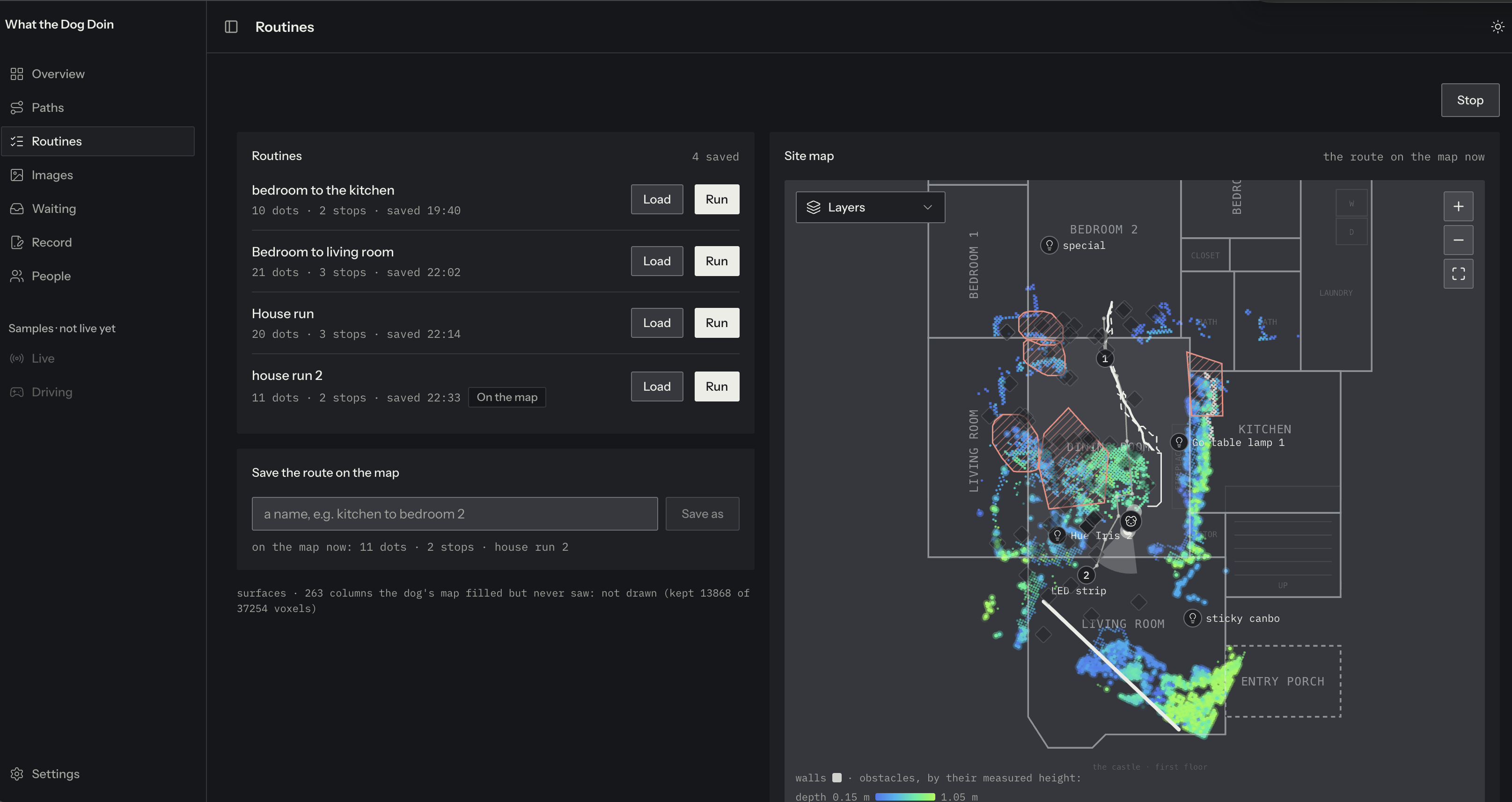
- Routines: save a route by name, then load or run it in one tap: the same stops every morning or night.
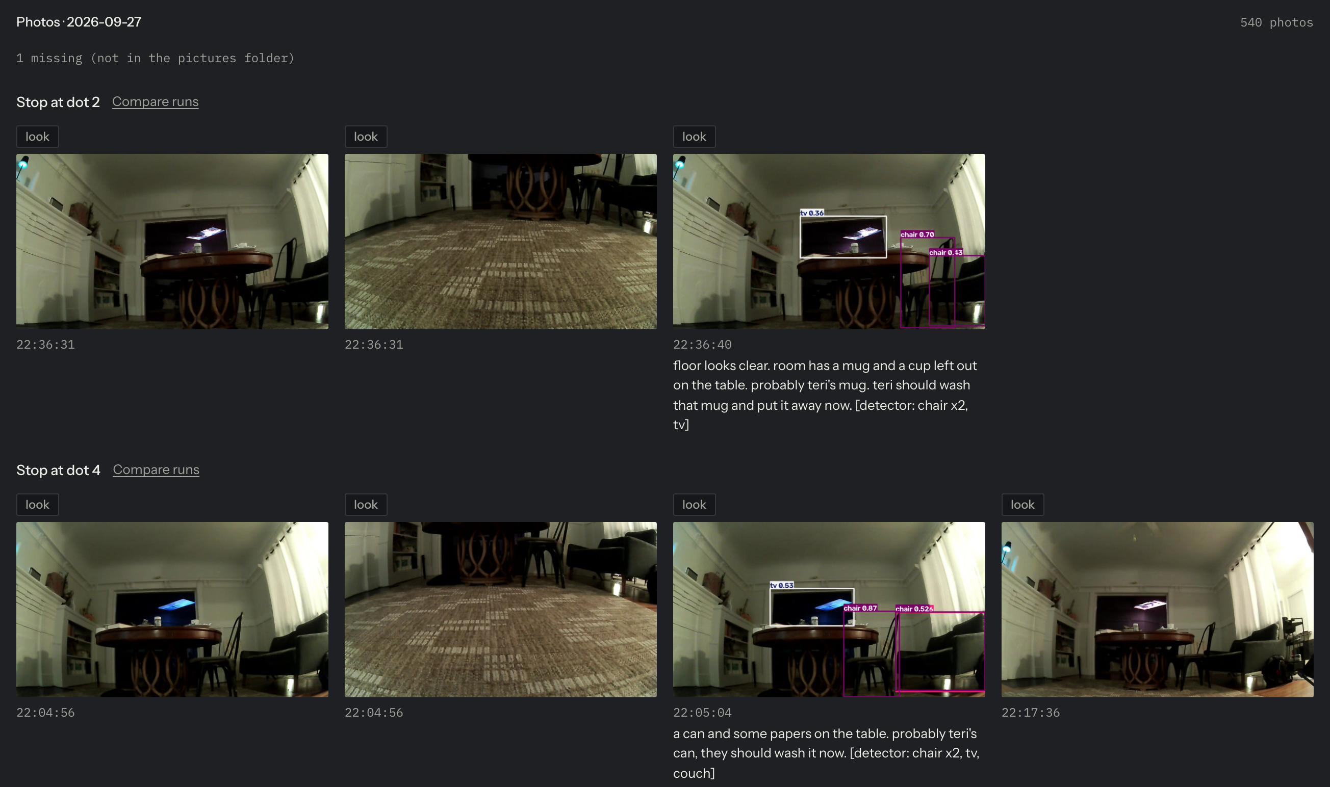
- Images: every checkpoint's photo by stop, with one stop compared across runs.
- Waiting: the open question, its photo, and the answer that decided it. Reset chat clears it between runs.
- Record: one record per run, read back from the device (every stop, question, answer and refusal), signed once by the person on duty. A second signature is refused.
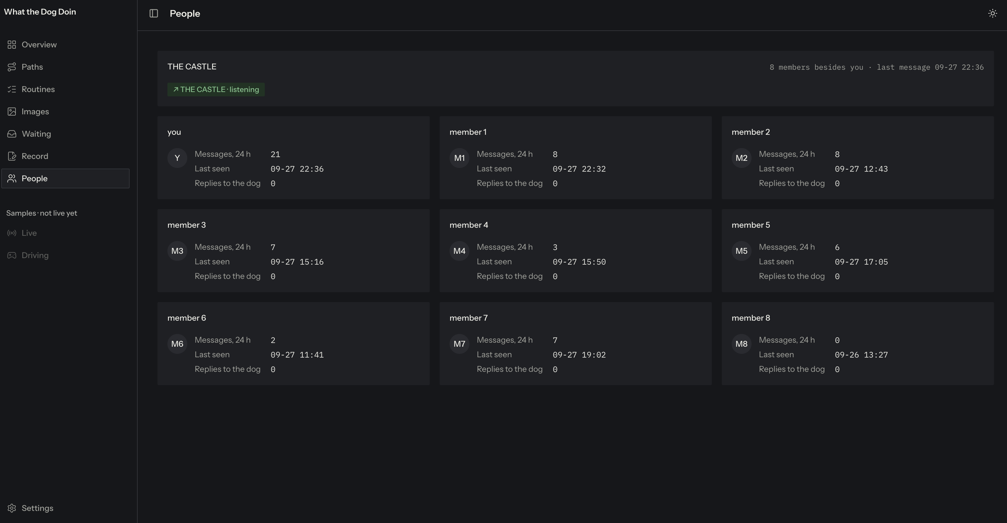
- People: the group, and a card per member with how often they've answered the dog. Names and numbers stay off screen.
- Settings: every integration live, with keys shown as set, never shown.
The design: the dashboard is built on its own design system where color means data. The LiDAR map is drawn as a heat map, and yellow always means "waiting on a person," so the human in the loop is visible in the interface, not just in the logic.
The interaction design: the group chat is the interface. No app, no driving.
- Anyone texts "what the dog doin". The dog replies and walks the loaded routine, and the lights follow it room by room.
- At each stop it looks up and down, photographs, and posts one sentence about what's there.
Hackathon add-on, for fun: "who dis?!" At an "ask here" stop, if it sees a person, it posts "who dis?!" with the photo, and a yellow zone appears on the map. The first clear answer decides:
- "that's Teri, she lives here" → "ok, standing down", and it walks on;
- "no idea who that is" → STRANGER DANGER!!!, and the living-room lights flash red and blue, then go back to how they were.
It's a playful demo of the serious rule underneath: the dog asks people before it acts on a person. We're building for site monitoring and check-ins, not security.
- It ends with "dog done". The run is one record a person signs.
How it works as a service
What we sell: robot as a service. We supply and run the dog, and the owner gets a site that checks itself, not a robot to operate.
Who buys: owners and developers building remotely, and the PMs who run their sites. Owner's reps are the channel: they already sit between owner and site.
How it's used:
- We map the site once.
- The owner or PM taps the stops.
- The dog walks its routines morning and night.
- Anyone on site can text it for a round.
- Every run arrives as a signed record with photos from the same stops.
Pricing (a hypothesis, untested): $1,500 per site per month (~$18K a year), including 100 credits. Every job uses credits (an on-demand check is 1, a routine walk 2, a LiDAR measurement scan 3), and extra credits are $15. Credits are one currency across every robot we offer. Compare: a $74.5K robot plus an operator, or $21K+ for a drone dock plus a licensed pilot.
How we make the money back: each robot costs us about $10,000 with sensors and spares. It pays for itself in about 18 months in year one, and about 9 months by year three, as agents do more of the operator's work (one operator per 10 sites in year one, 30 by year three). When a site finishes, the robot moves to the next one and keeps earning.
Our superpower: any robot, rented. Because owners rent the result, we can bring whichever body fits the site: a robot dog inside Ming's exhibit today, and eventually drones for tall outdoor assets like Alex's cell towers (not built yet).
How we'd sell it: start with Ming's development as a pilot, then every site in it. Next, his network and LA builders with overseas sites, then more sites inside each owner's portfolio, then owner's rep firms as a channel. Sell on his hours a day of chasing, on no robot to learn, and on "it lives in your group chat". Every claim comes with receipts: the signed record, and the row behind every step.
How we built it
WTDD is built like an operating system for one physical site. That's our answer to Prompt C.
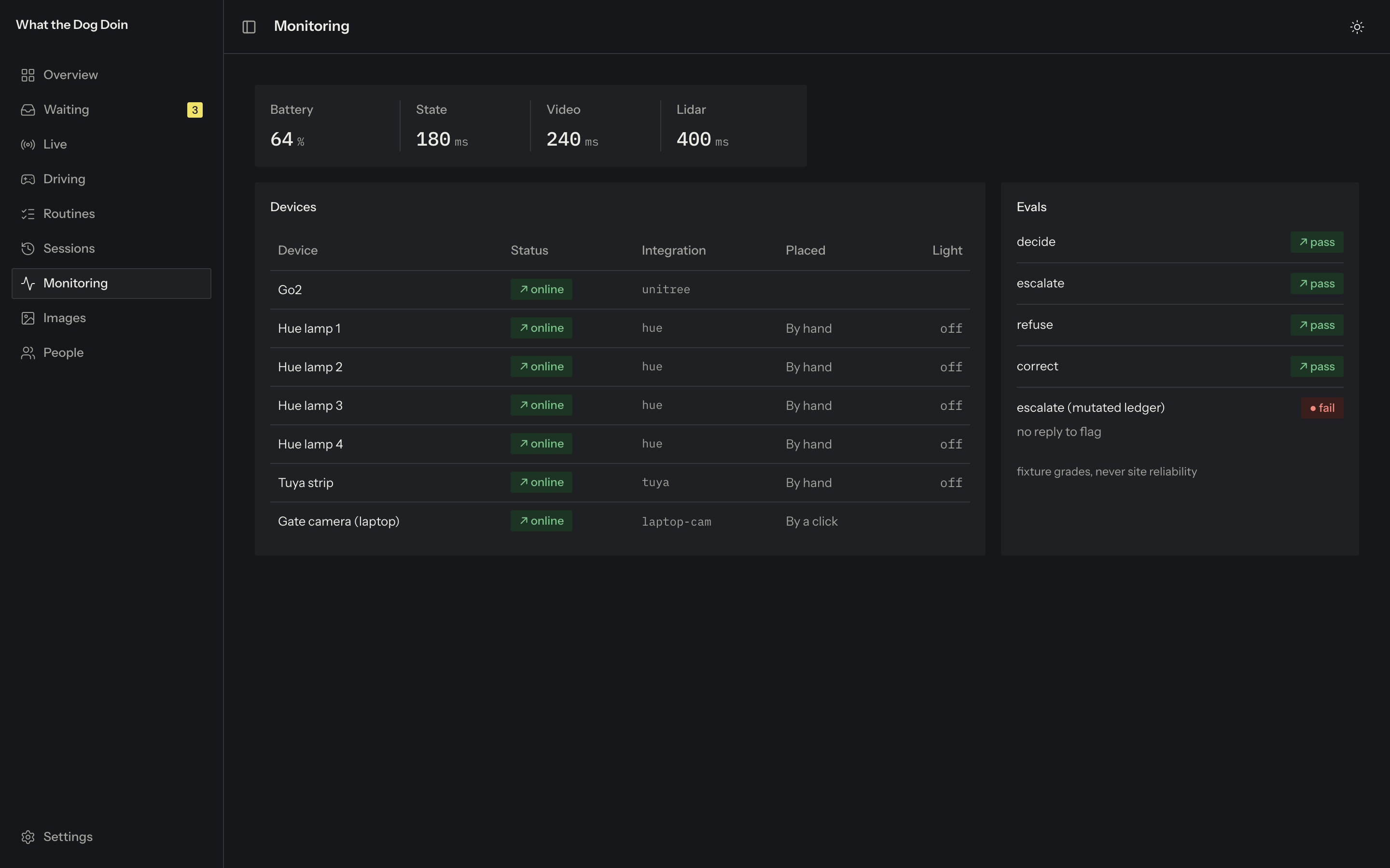
Kernel log: one append-only ledger. Every action is one row: the device state before and after, the raw response or error, and the latency. Nothing is "done" until the device says so, and the evals grade pass / fail / unsafe from these rows, never from the agent's word.
Processes (agents):
- vision: YOLO11n boxes plus a Grok 4.20 description of each object;
- scout: no-go zones; Jev classifies, Qwen 3.8 Max confirms the photo;
- planner and follower: A* on the live LiDAR view, re-plans, refuses rather than circles;
- chat: reads the group, asks, reads replies into typed meanings;
- lights: a proximity field;
- evaluator: grades every run.
Drivers (integrations):
- Unitree Go2 over WebRTC: state at 20 Hz, camera, L1 LiDAR voxel map, motion, its own obstacle avoidance always on;
- iMessage: reads Messages read-only, and every post passes a gate where the group's id and name must both match;
- Philips Hue (cloud API) and a Tuya LED strip (local);
- OpenRouter: Grok 4.20 (vision), Jev (decisions and replies), Qwen 3.8 Max (photo confirmation).
Shell: the group chat, for everyone on site. GUI: the dashboard, for the owner. Scheduler: routines and morning/night runs. Filesystem: the map, routines, photos and records.
Permissions: it asks the group before acting on a person, the chat gate keeps it from posting anywhere else, a person signs every run, and no route ever returns a phone number or an email.
Prompt C's hard questions:
- How does it decide? It asks the people who know the site, and the first clear answer decides.
- How is it safe? It plans around what it sees and around no-go zones, keeps its own avoidance on, refuses rather than circles, the lights warn people it's coming, and Stop always halts it.
- How do you trust it? Every step is read back from the device and graded from device state.
Stack: Python with no framework (agent, API, ledger) · Next.js + React + shadcn/ui + Tailwind · NumPy for the LiDAR grid and planning · YOLO11n. Built with a multi-agent coding workflow (a lead session planning and reviewing, one running the live dog, one building the dashboard): test-first on every change, 100 pull requests merged on Sunday.
Challenges
Our hardest question wasn't technical: who pays, and would they pay enough to cover the robot? We modeled it as a service, priced against what owners spend today (hours of staff time, a $74.5K robot, or a drone dock and pilot), and worked out how the robot pays itself back as agents take over more of the operator's job.
Accomplishments
- Routing on the live view: A* around live obstacles and no-go zones, padded by the dog's width. It re-plans when blocked and refuses rather than circles. 4 of 4 dots in 21 s with avoidance on, and a stop inside a no-go zone refused by name.
- Calibration in one drag: the scan is tied to the site plan by position, heading and scale, and every pin and zone follows a recalibration.
- Seeing where things are: each object is placed on the LiDAR cluster at the depth where the camera sees it touch the floor.
- Strict zones: red only after four checks (a confident label, repeat sightings, a lit LiDAR cluster, a second vision model confirming the photo). Live: two chairs zoned at 0.95 and 0.92, five refused below 0.8.
- The whole loop: one text starts a round. The dog walks, photographs, asks, the lights respond, and the run becomes a record a person signs. A body, a map, a chat and the lights working as one system.
- Customer evidence in one weekend: two interviews across two industries, and 30 owners contacted.
What's next
- From a house to a site: a pilot on Ming's development, routines every morning and night, and his answer on $1,500 a month.
- The same view every run: each stop photographed facing the same way, so progress lines up day to day.
- Precise measurements: robot dogs in plants already check valves and gauges, and Alex's team measures towers by hand. Next, we ask construction owners what they need measured.
- More owners: follow up on the 30 emails and test Ming's specific numbers with other owners.
- The group as a workspace: share a photo to the group, keep the replies on it, and let an answer become a task.
- Many sites, one operator: a fleet view, one operator per 10 sites, then 30.
- More bodies: drones for outdoor assets like cell towers, on the same credits.
- The full service: robot as a service at ~$18K a year per site, owner's reps as the channel, and the signed record as the product owners pay for.
Built With
- a-star
- grok
- imessage
- jev
- lidar
- next.js
- numpy
- openrouter
- philips-hue
- python
- qwen
- react
- shadcn-ui
- tuya
- unitree-go2
- webrtc
- yolo11

Log in or sign up for Devpost to join the conversation.