-
-

Thumbnail
-
Sample Picture


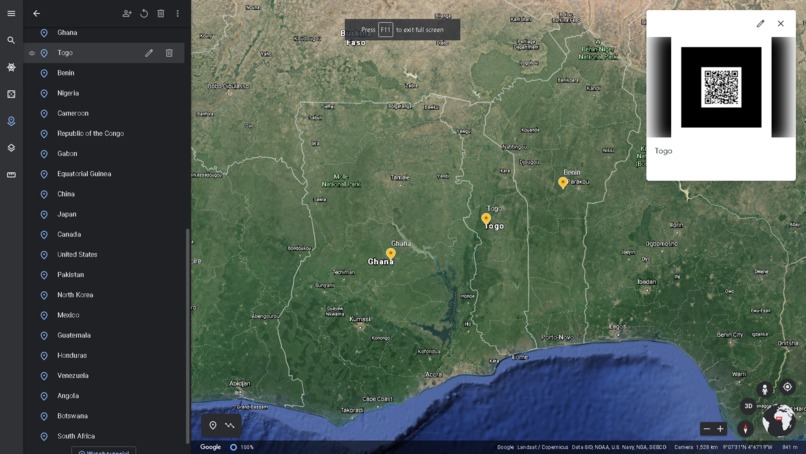
How to try it out?
1. Open the link on your computer, or tablet.
2. Open the link on any device that possesses a rear camera.
3. With the second link, point your camera at the QR codes once you press one of the countries and you should see a graph in an AR format.
Forewarning Loading in the echoAR page could take a bit of time. Please remain patient.
Inspiration
The idea just came to mind when we were pitched with the idea of food security.
What it does
It shows the percentage, the amount and the progression of food insecurity and countries that are undernourished.
How I built it
We built it using Google Earth and echoAR.
Challenges I ran into
We at first weren't able to display all the qr codes within a single use of a camera without scanning them individually, but we fixed that problem.
Accomplishments that I'm proud of
We acquired and managed quite a bit of data that we were able to sort and display in Google Earth using a AR system which, honestly, is pretty cool.
What I learned
That there are a lot of countries in the world that are undernourished and food insecure. We usually wouldn't think too much about it since we live in a "rich" country, so this kind of shined light into our eyes. We were quite shocked by the numbers when we first reviewed them.
What's next for World Hunger AR
If we learn how to do the thing in the demo video, that would be our next step.
Team Members :
- Xing Wei
- Lin Wei Li


Log in or sign up for Devpost to join the conversation.