-
-

-
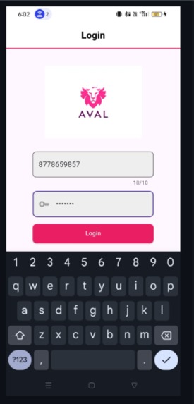
Login page
-
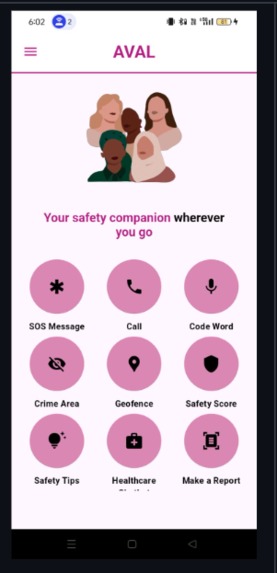
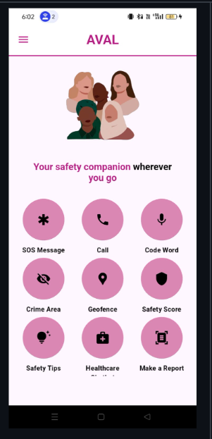
Home page
-
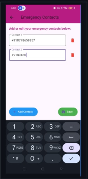
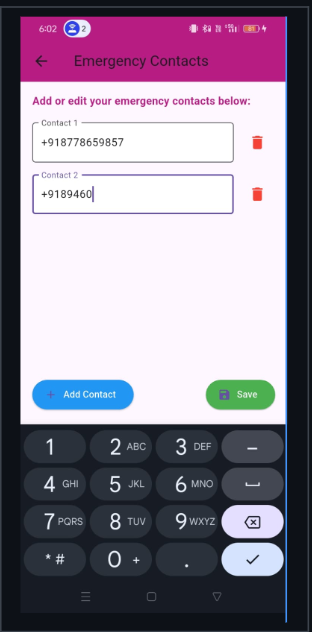
Adding Emergency contact
-
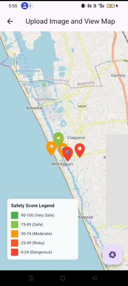
-
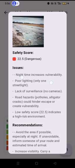
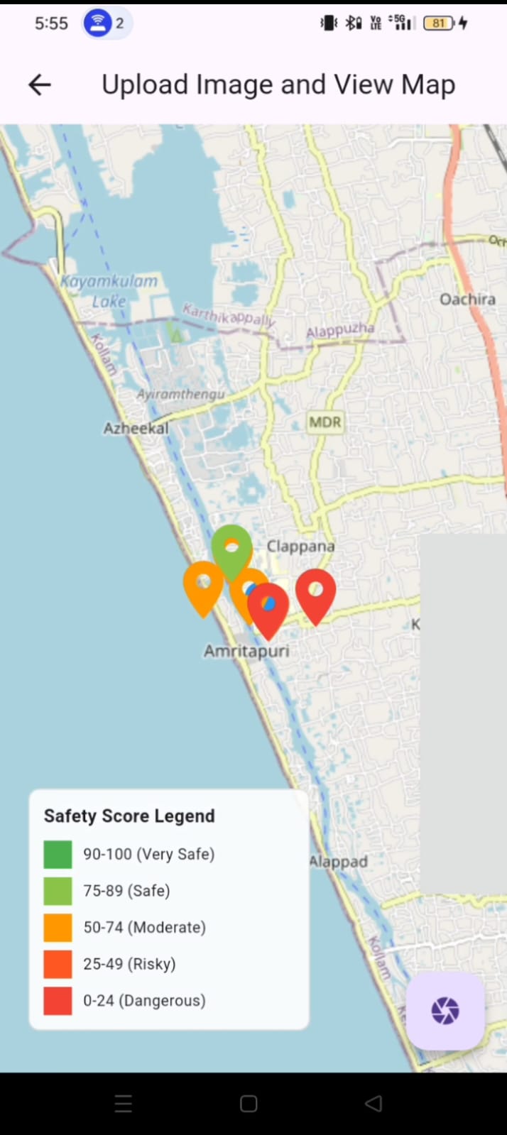
Provides safety scores for all places
-
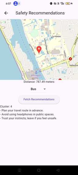
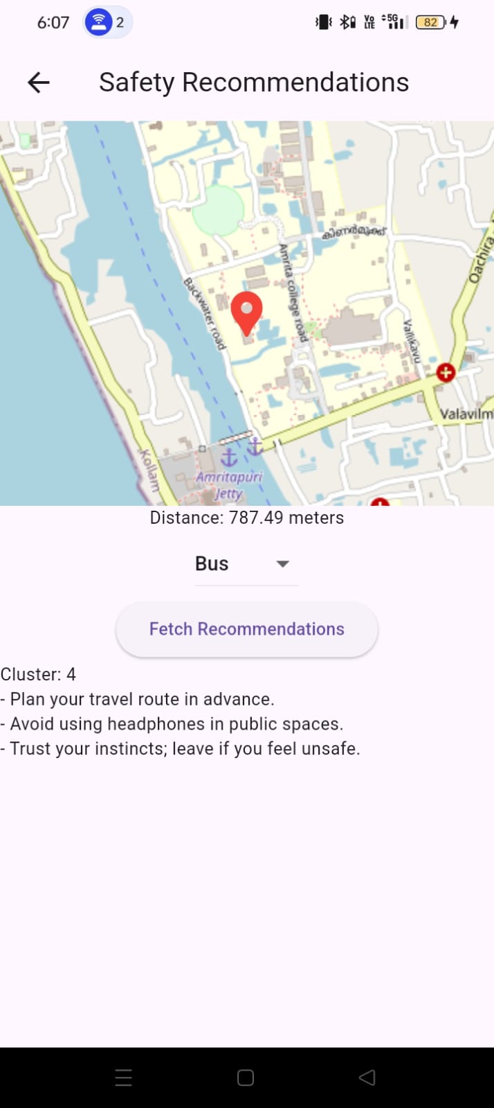
Recommend safety tips based on user's environment
-
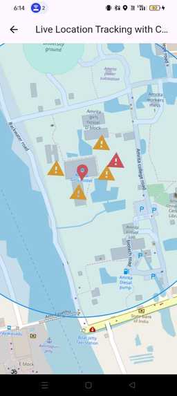
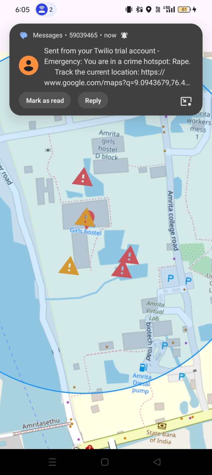
Alerts user using TWILLIO if she is in dangerous spot
-
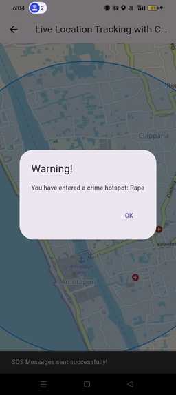
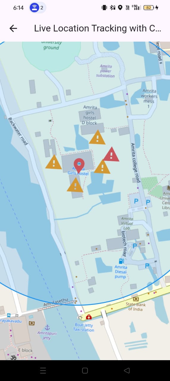
User waring if she is in dangerous spot
-
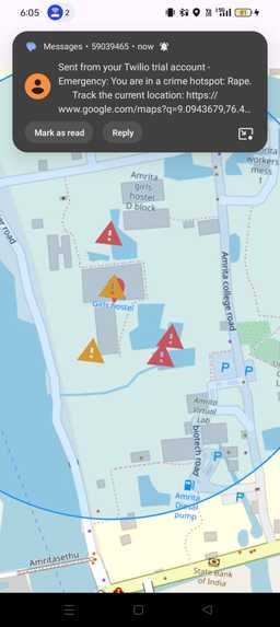
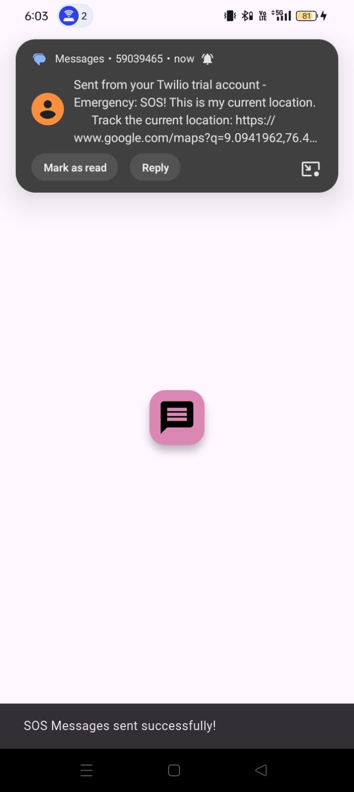
When a user enters a dangerous area, the system sends an SOS message with live location to their emergency contact via Twilio
-
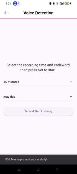
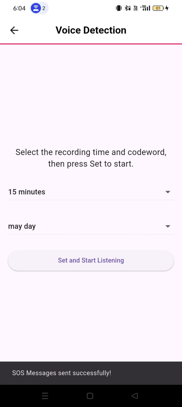
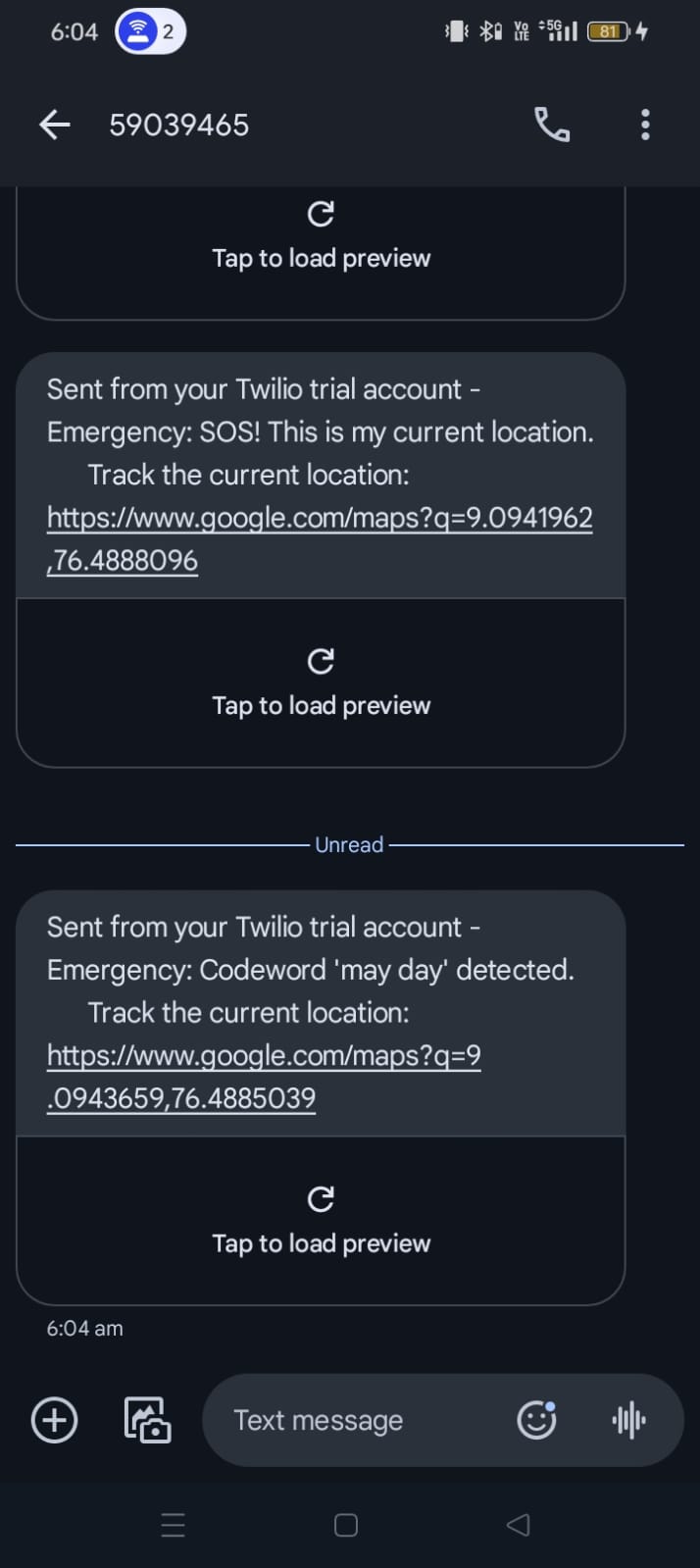
Code Word Detection: Users can set a secret code word to alert authorities/emergency contacts discreetly in emergency situations
-
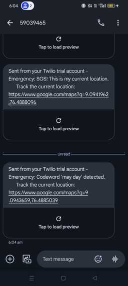
sends SOS message to the user using TWILLIO
-
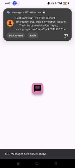
sends SOS message to the emergency contact
-

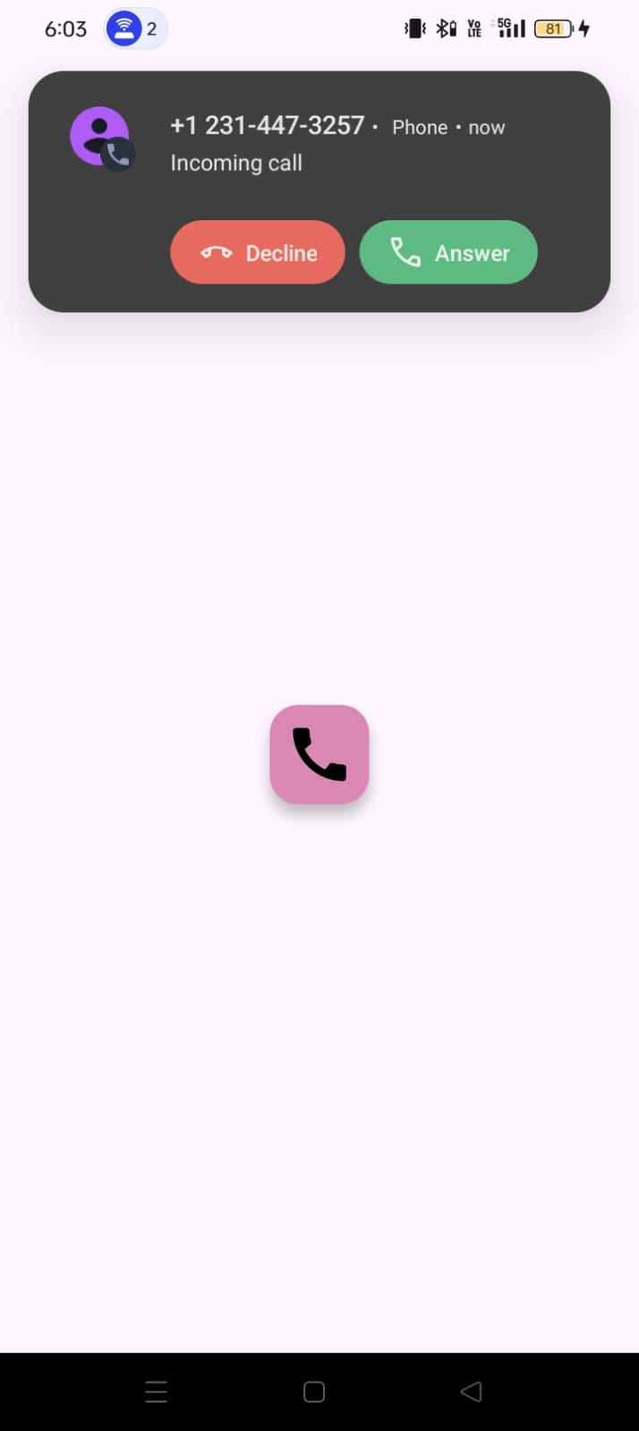
makes SOS call to the emergency contact
-
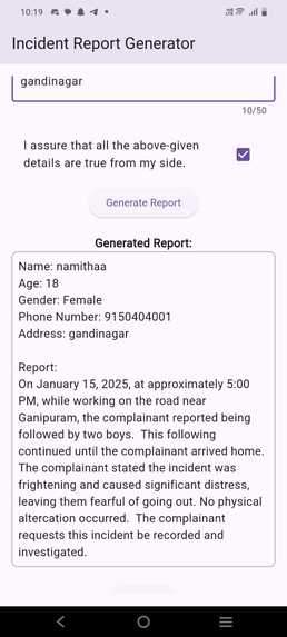
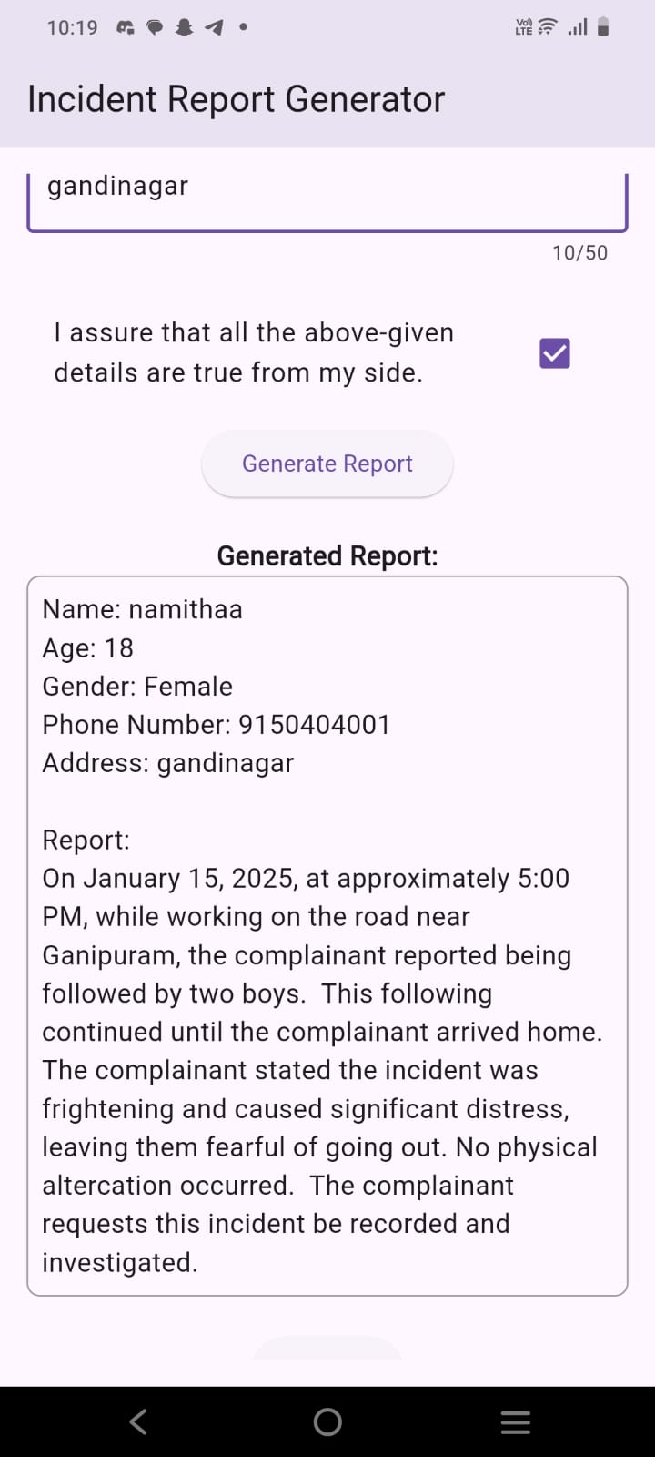
We use AI to generate personalized reports based on the information and details provided by our users
-
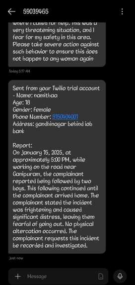
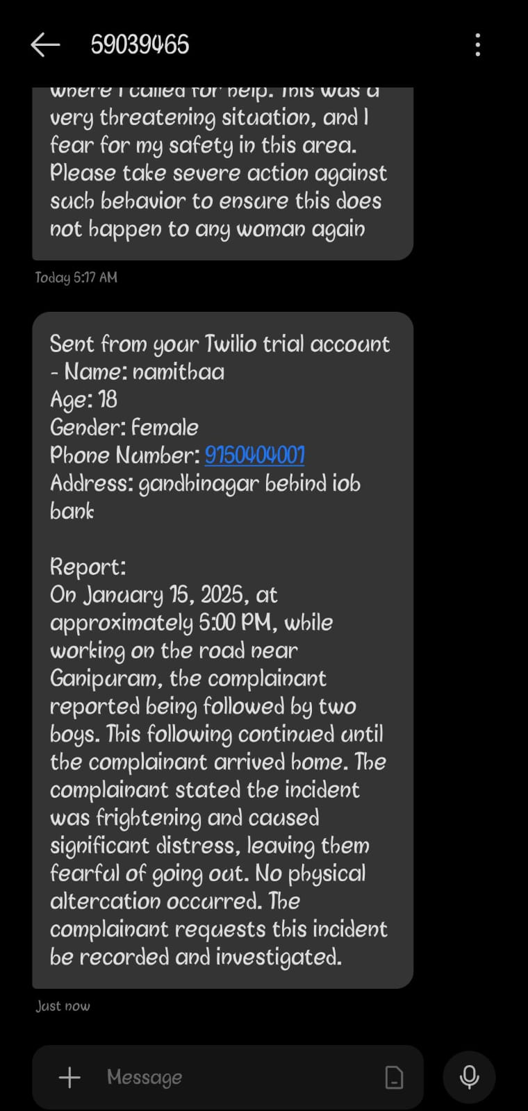
sends the report to the higher official's



About the Women Safety App
Inspiration
The idea for this app was inspired by the increasing concern about women’s safety, especially in high-risk areas. Many women face challenges in ensuring their personal safety, and we wanted to create an app that could help prevent potential threats. Our goal was to build a solution that not only ensures safety but also provides peace of mind through real-time monitoring and proactive measures based on this we have implemented 9 unique features using google api , twilio etc..
What We Learned
During the development of this app, we learned how to integrate real-time location tracking using GPS and how to handle emergency alerts effectively. We gained practical knowledge about APIs, especially Twilio, for SMS and call functionality, as well as how **AI can be used to assess safety through image analysis. Additionally, we learned the importance of data privacy and secure communication in building a user-centric application.
How the Project Was Built
The Women Safety App was built using a combination of technologies:
- Frontend: We developed the user interface using Flutter and Dart, ensuring a smooth experience across mobile platforms.
- Backend: The backend was powered by Firebase and Flask, providing a reliable system for managing user data, sending alerts, and processing location information.
- AI Integration: We integrated an AI model that analyzes images for assessing safety, using machine learning techniques.
- Twilio API: For SMS and emergency calls, we used the Twilio API, ensuring reliable communication during emergencies.
- Geofencing & Crime Hotspot Detection: By integrating real-time crime data and geofencing features, the app warns users when they enter high-risk zones.
Challenges Faced
Building a real-time, location-based app with such intricate features was challenging. Some of the hurdles included:
- Handling Real-Time Location Tracking: Ensuring continuous, accurate location updates while managing battery life and data usage was a challenge.
- AI Image Analysis: The AI-powered safety score required a considerable amount of fine-tuning to provide accurate results based on various environmental factors.
- Geofencing: Implementing dynamic geofencing that would trigger alerts based on user movement was tricky, especially in urban areas where GPS signals might be inconsistent.
- Emergency Alerts: Ensuring timely delivery of emergency alerts via SMS and call was essential, and integrating the Twilio API smoothly was a crucial step.
Features included
*1. User Registration & Profile Setup The user registers an account using a phone number and sets up an emergency contact list. Personal details, including name and emergency contacts, are stored securely.
*2. Real-time Location Tracking The app continuously tracks the user’s real-time location using GPS. If the user enters a high-risk area, the app sends a warning notification.
*3.Emergency SOS Activation Users can manually trigger an SOS alert by pressing a button or using a voice command. The app sends an emergency SMS and call to registered contacts with the user's live location. The backend system ensures timely delivery of messages using the Twilio API.
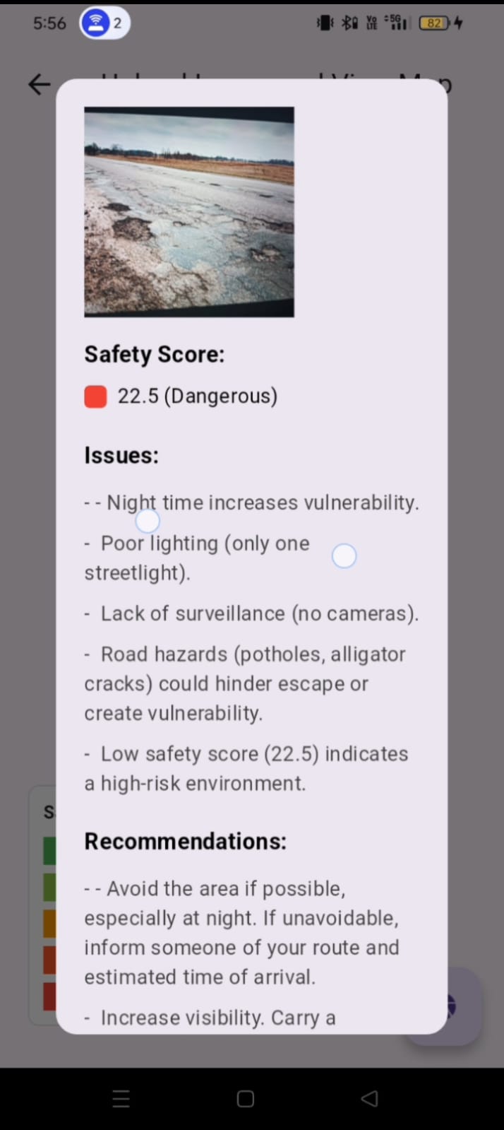
*4.AI-based Safety Score & Report Users upload an image to assess the safety of their surroundings. The app generates a safety score based on AI analysis. A heatmap is created using aggregated safety scores. Clicking on a heatmap marker provides a detailed report with issues and recommendations.
*5. Smart Safety Advisor Provides safety tips for traveling from one place to another based on crime rates. Helps users make informed decisions about their routes.
*6.Crime Hotspot Detection Uses real-time crime data to highlight high-risk areas. Users receive alerts if they enter a crime hotspot.
*7.Geofence Monitoring & Boundary Alerts Users can define custom geofence areas (such as home, school, or workplace). If they move outside the safe zone unexpectedly, an alert is triggered.
*8.Safer Route Suggestions The app calculates a secure path by analyzing real-time crime data. It provides route recommendations to avoid high-risk zones.
*9.Multiple Emergency Contacts Users can add multiple contacts to receive alerts during emergencies. Contacts can be selected from the phonebook or entered manually.
Conclusion
This project was not just about developing an app but about creating a tool that can have a real-world impact on safety. It taught us a lot about integrating real-time data, user-focused design, and emergency management solutions. We are proud of how the app can empower women with the knowledge and tools to stay safe in an unpredictable world.


Log in or sign up for Devpost to join the conversation.