
Mobility, accessibility and commuting time are among the most important urban features, both, from the perspective of the citizen and their quality of life and from that of the city designers and planners. A sustainable, healthy and innovative city is one that maximizes mobility and accessibility while minimizing commuting time and carbon footprints. An efficient and extensive public bus system is one way to achieve these goals, but integrating alternative carbon-free transportation modes into existing infrastructure may greatly enhance them.
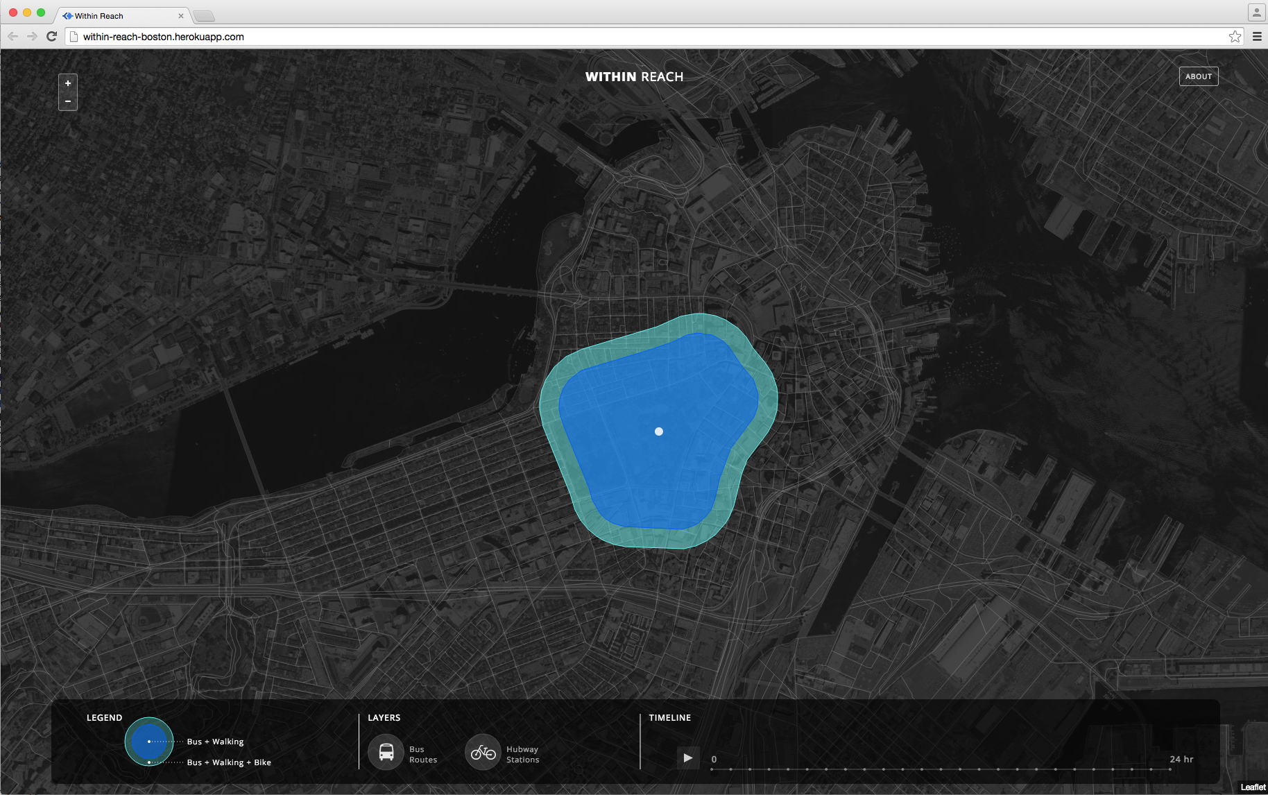
Here, we provide an interactive visualization map to reveal how the integration of bikes, specifically the Hubway Bike System, can substantially enhance the area of the city that can be reached within a half hour, throughout all hours of the day.
POTENTIAL BENEFITS AND APPLICATIONS
This visualization tool, exploiting the real world spatial and temporal attributes of the City of Boston Bus Service (MBTA) and the Hubway Bike system, has benefits to Boston citizens and city and service planners alike:
Citizen Applications:
• visualizes the area of the city that is reachable from, any point in the city and within one half hour, by bus; shows how this reachability may be extended by adding a bike as your mode of transportation • integrates historical bus data and stop times, such that the user can see how their reachability changes throughout the day due to traffic and congestion • a innovative planning and decision making tool where citizens may use the application to examine preferred neighbourhoods to live in, commute to work from or plan their day of leisure • can be integrated with additional supplementary data (craigslist housing listings, distribution of city parking tickets, spatial demographics such as commercial centres) to help users make informed decisions that suit their lifestyles.
Designer, Planner and Manager Application:
• a quick and simple, yet dynamic visualization of MBTA and Hubway system data • aid in planning where additional Hubway stations will have the most benefit to the users or aid the most to alleviate traffic congestion • help to increase and promote the adoption of biking as a mode of transportation in the city of Boston • aid in the development and planning of a truly integrative bike-bus public transit system • identify spatial gaps and temporal problem points (i.e., delayed trips) in the MBTA system
BACKGROUND
How: • Used the MBTA bus routes and stations to create a city-wide network of all bus routes and stops in addition to a complete city street network • Used the historical MBTA bus geo-location data to compute the velocities achieved along all routes by every bus, for every day in the week and every hour in the day • From the above two steps we then modelled the service area achievable by walk and bus within 30 minutes, for any given starting location in the city (i.e., city block) • Likewise, build a biking network and, from the Hubway bike station and historical trip data, compute the average biking velocity between all station combinations • Integrate the walk, bus and bike networks and velocities to model the area reachable in 30 minutes for every hour of the day, for an integrated bus + bike transport mode
Why: • Enhance the user experience, mobility and quality of transport of the Boston public transit system using an intuitive, simple yet dynamic visual tool • Help answer the question, should the city of Boston build a fully integrated bike + bus system? • Enable a visualization of how using the Hubway bike system, or biking in general, may increase the area of the city one can access in 30 minutes throughout the day • Potentially decrease commuter time • Reveal how biking increases opportunities to reach new places in the city • Explore the mobility relationships between areas of the city and time of day to help aid in transportation decisions and to make the healthy, sustainable choice: where should I live? Given the time of day and my location should I drive, bus, bike or both? I want to avoid traffic or parking ticket risks, can I take the bus or bike or both to get to where I want to go? Can I reach the event or park I want to attend or visit by bus or bike?
Built With
- acrgis
- arcpy
- d3.js
- fiona
- java
- javascript
- mapbox
- python
- qgis

Log in or sign up for Devpost to join the conversation.