WiseTreeMap can be used in a single municipality or cover a larger geographic area including many communities or organizations. Our Solution contain:
- Internet web site
- Android mobile application
- IOS mobile Application (soon)
- custom service extensions WiseTreeMap allows individuals, governments, neighborhood organizations and other groups to collaborate on mapping and exploration of the urban forest and agricultural fields.
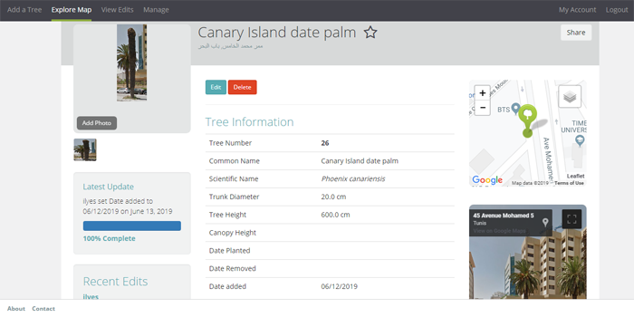
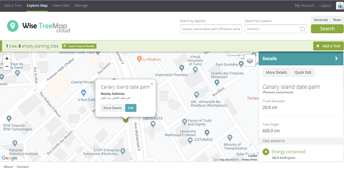
Using the mobile app, community members can view maps of trees created as part of the WiseTreeMap subscription system, then search for trees or add information to them.
By working together, we can create a map of the urban forest and explore the many environmental and economic benefits provided by trees in our communities.
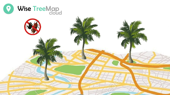
Red Palm Weevil
WiseTreeMap platform can be used to identify and locate palms infected with red weevil. -> follow-up of cases and planning actions -> interaction and sharing on social networks for awareness -> Filter species on tree characteristics and localization -> Editing added trees (photo ..) -> Ecological profit calculation for each tree
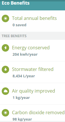
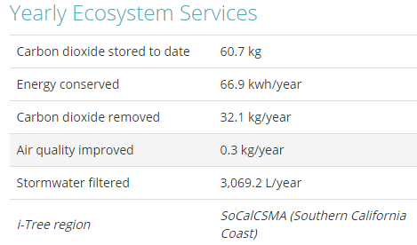
- Automatically calculate ecosystem services (greenhouse gases, water, energy, air quality) based on species and tree diameter
What's next for WiseTreeMap
Scope of remote sensing, IA and IOT
- Growth estimation (need in water, nutrition ..)
- Production estimate
- Detection of irrigated or non irrigated areas
- Detection and mapping of varieties
- Detection of diseases
- Mapping plots, points of interest (appliances, wells ..)
- Security & detection of offenses (theft and cutting of trees ...)
Built With
- gis
- iot
- mobile
- remote
- sensing
- web

Log in or sign up for Devpost to join the conversation.