-
Main Webpage Demo
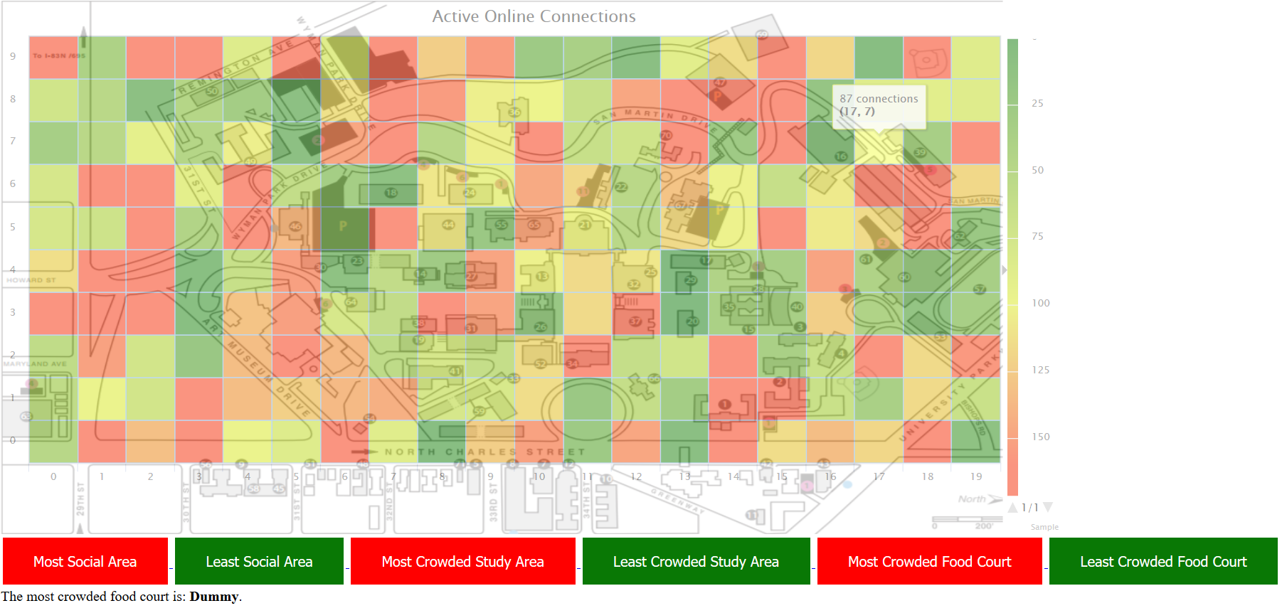
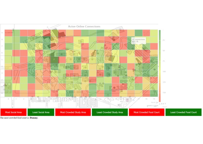
Wireless Activity Heatmap README Authors: Benjamin Bao and Darian Low
This is an idea to detect location popularity/human activity based on the connection of wireless devices to the wifi, as even when devices are put into sleep mode or airplane mode they generally remain connected to the wifi.
This is a scalable model to be potentially used in any location with mass public wifi (could potentially be used in small private connections, but with less usefulness). The ideal locations for use could be universities, large company wireless networks, and city-wide wireless networks for the public.
We can probably estimate the amount of people in a location based on connectivity to wifi based on a number of factors - perhaps 0.3 connections per person in a place such as a mall but 1.5 per student in a university (based on people that have cell phones and laptops and how likely they are to connect to the wifi).
We assigned subnets corresponding to location from jhars.nts.jhu.edu. In actual practice, it seems that there are far more accessible subnets from any particular location than the ones listed (for instance, while checking the IP connections from our own devices, we were connected on different subnets despite being in Hodson). Some of the subnets were also inactive/offline.
This issue is easily solved with access to more information on the subnets and how they correspond to each location, or further testing in other areas that was not possible with this competition’s restrictions (testing ping/subnet access from other locations in the school)
It is also possible to store the gathered information in a database for other uses, such as analysis and research (which we have done through the use of a csv file). Human activity and dynamics could potentially a topic of interest for not only academics, but companies that do marketing research.
A way this could be well implemented in practice is if a large operating system produced such as Apple, Microsoft, or Google included an app with their OS that establishes a connection to a server that provides sporadically updated GPS data whenever a user has either mobile data or wireless/wired network access.
This information could easily be available and put out to the public with a heatmap of population density online, which we have provided an example of.

Log in or sign up for Devpost to join the conversation.