Problem Statement
Accessibility has long been an underaddressed challenge in municipal planning. The winter season compounds these barriers significantly: icy sidewalks, accumulating snow, reduced visibility, and cold-sensitive medical conditions all restrict mobility for people with disabilities, seniors, and other vulnerable residents. Traditional patrol-based inspection models are labour-intensive, reactive rather than preventive, and cannot scale to cover the region’s full pedestrian network in real time.
There is a clear need for a low-cost, data-driven solution that can detect hazardous surface conditions as they develop and communicate that intelligence directly to city operations staff.
How we built it
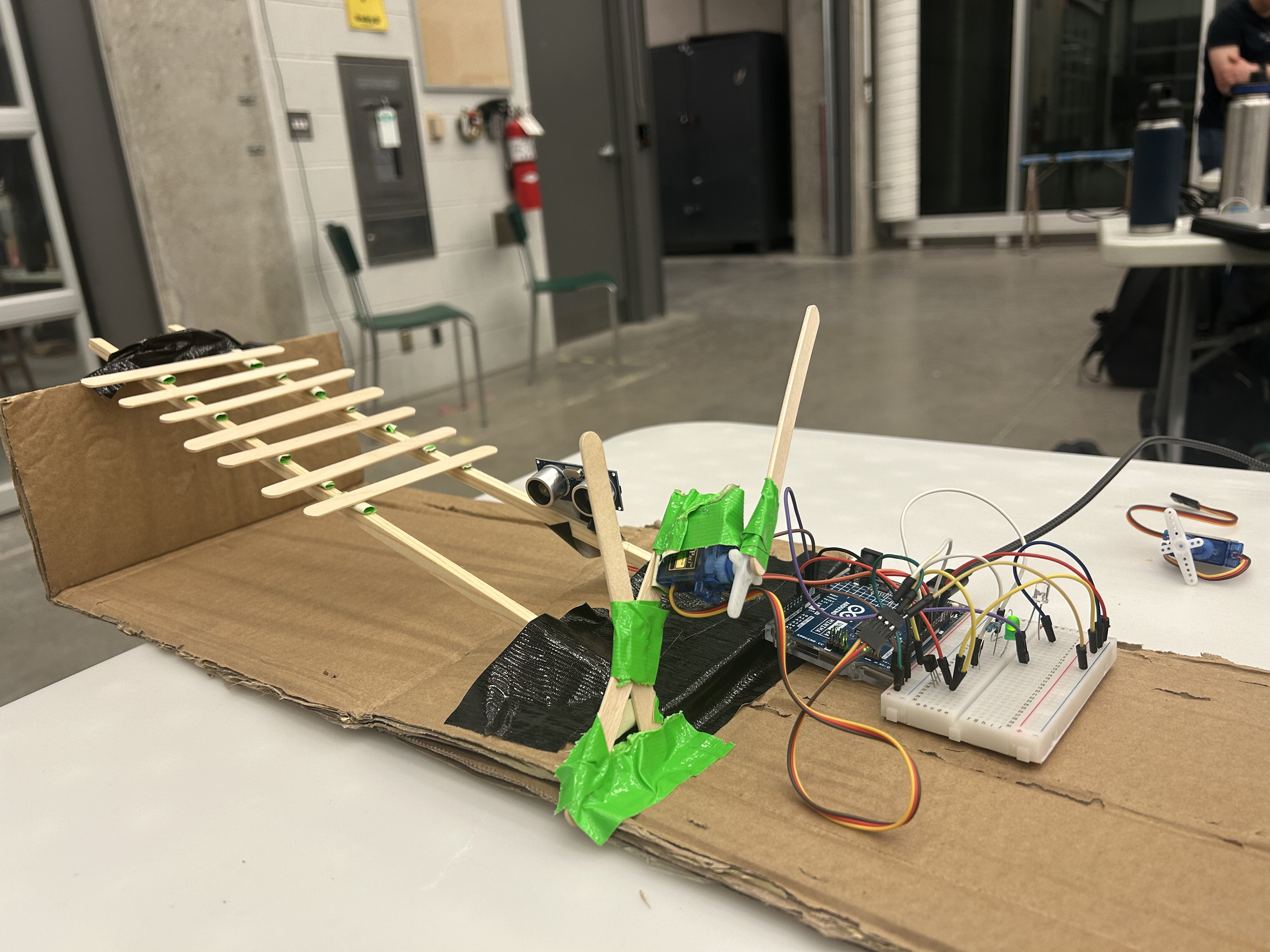
Embedded Hardware (Arduino)
- HC-SR04 ultrasonic sensor measures distance to surface obstructions in real time, outputting readings every 100 ms
- DHT11 / temperature sensor captures ambient temperature for ice-risk correlation
- LED warning system provides on-device visual alert — green (safe) or red (hazard)
- Servo-based barrier protection for preventing entry into hazardous zones
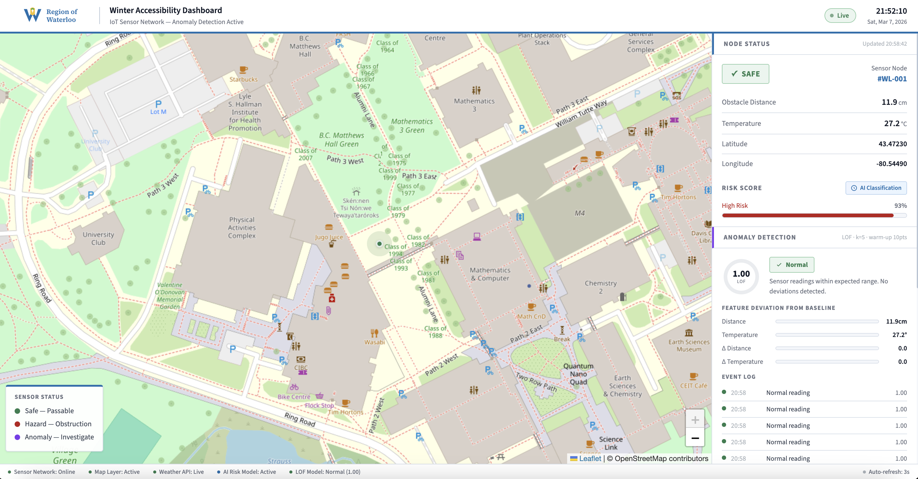
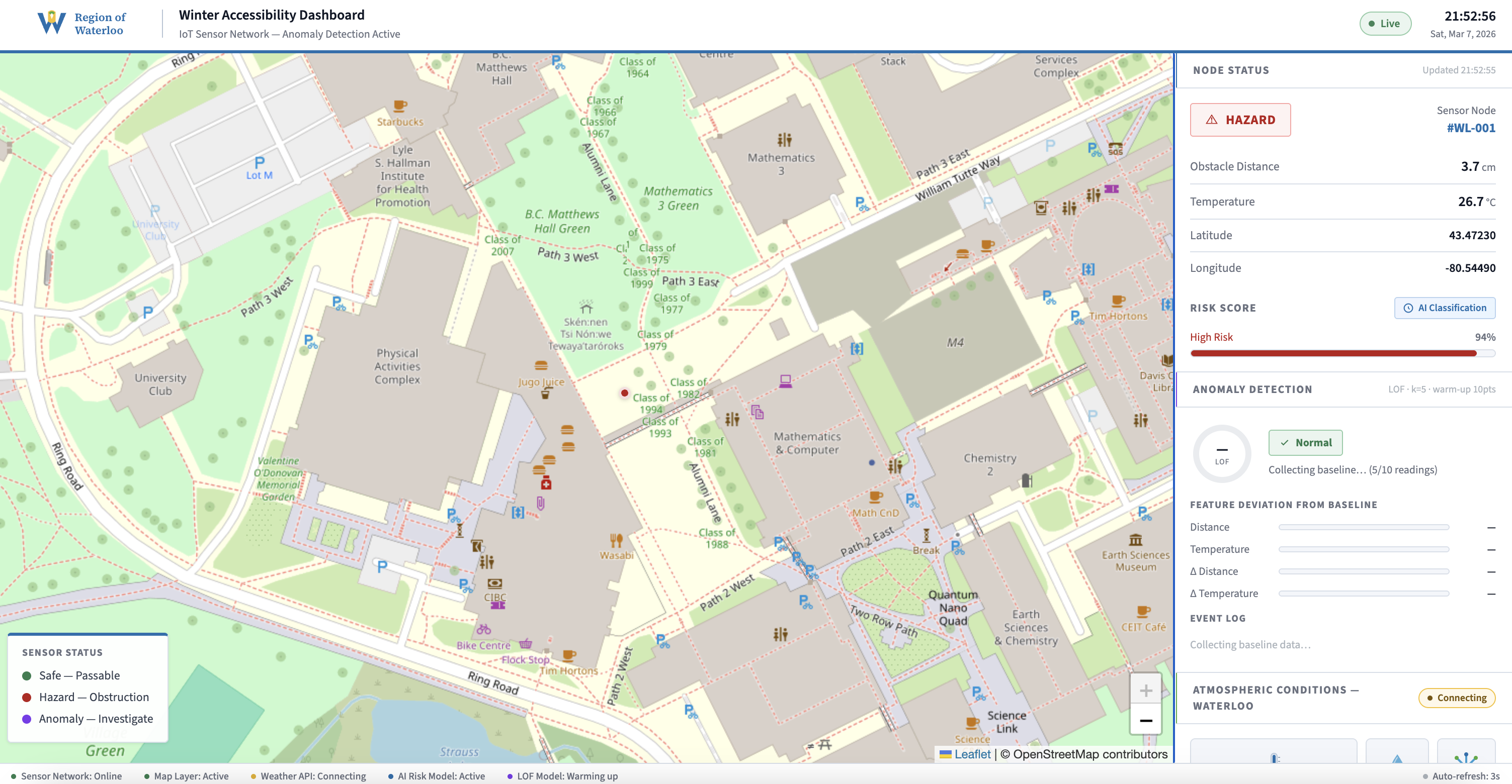
Real-Time Flask Dashboard
- Leaflet.js map & municipality data sidebar with markers for green (safe), red (hazard) or purple (anomaly)
- Node Status panel: live distance, temperature, and GPS coordinates updated every 3 seconds
- AI Risk Score bar: logistic-regression-style sigmoid classifier scoring 0–100% based on distance, temperature, humidity, and snow depth
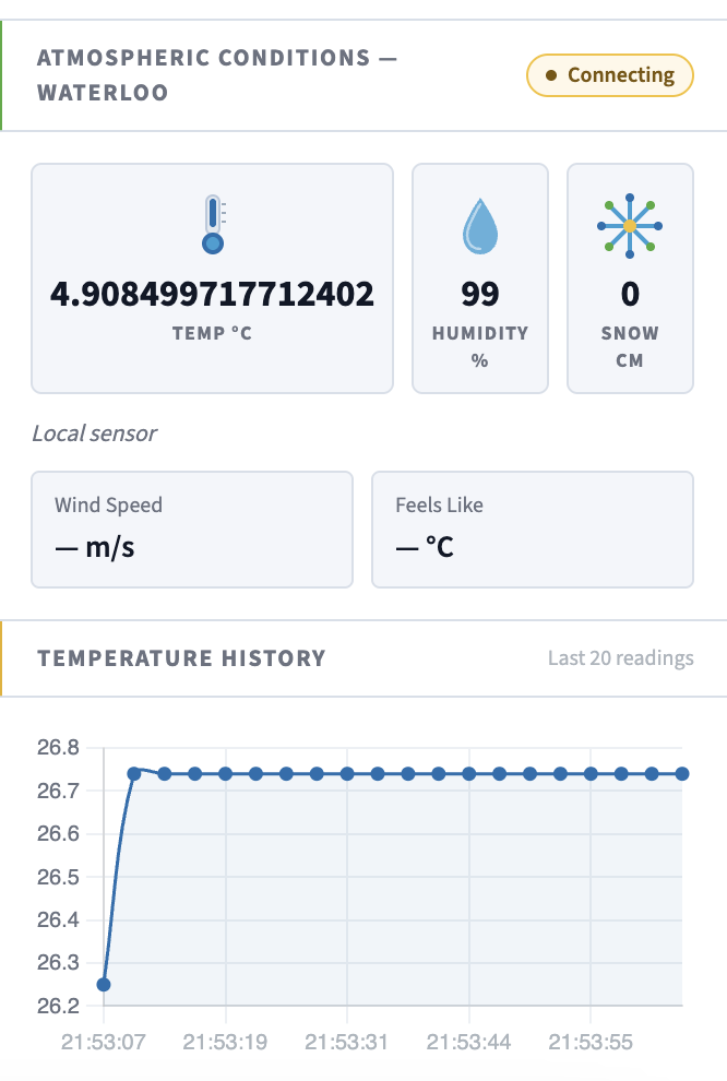
- Atmospheric Conditions panel: Open-Meteo API with OpenWeatherMap information
- Live connection indicators for sensor network, map layer, weather API, AI risk model, and LOF anomaly model
Anomaly Detection — Local Outlier Factor
The system implements unsupervised machine learning anomaly detection using scikit-learn’s LocalOutlierFactor. This approach requires no labelled training data and adapts automatically to the evolving baseline of a given sensor node’s environment.
Feature Vector (4-Dimensional)
| Feature | Unit |
|---|---|
| Distance | cm |
| Temperature | °C |
| Δ Distance | cm / reading |
| Δ Temperature | °C / reading |
What Makes This Different
- Combines real-time IoT edge sensing with server-side unsupervised ML
- Zero labelled training data required: LOF adapts to each deployment location’s unique baseline automatically
- Scalable: 16-metre ultrasonic detection range means a single mobile unit can survey an entire sidewalk block in one pass
- Accessibility Outcomes: City operations staff receive real-time hazard maps without waiting for resident 311 complaints or scheduled inspections
- Anomaly detection catches sensor malfunctions before they produce false safe readings, improving reliability for vulnerable users
- Prioritizes snow removal: hazard data can be routed directly to dispatch systems to schedule clearing at curb ramps and crossings first
What's next for SnowSense IoT Network
- Supervised ML upgrade: once labelled data accumulates from LOF-flagged events, train a RandomForestClassifier on [distance, temperature, Δdistance, Δtemperature, hour_of_day, humidity, snow_depth] to replace the Arduino threshold with a server-side model
- Predictive pre-alerts: use Open-Meteo’s hourly forecast to push pre-emptive warnings when the temperature + humidity forecast crosses ice-formation thresholds
Built With
- arduino
- chart.js
- dht11
- flask
- hc-sr04
- html/css/js
- leaflet.js
- open-meteo
- polling
- pyserial
- scikit-learn


Log in or sign up for Devpost to join the conversation.