-
Landing Page
-

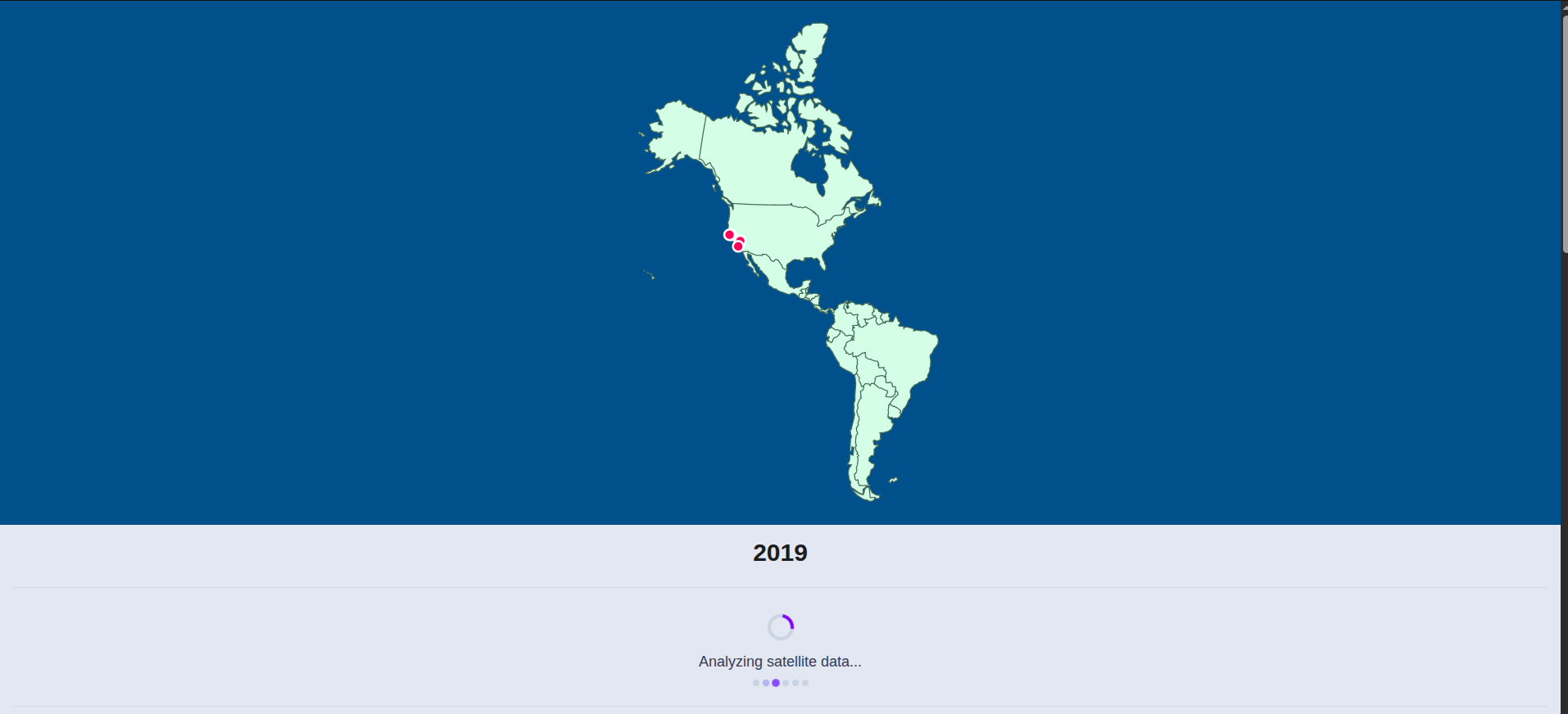
America-wide Map
-

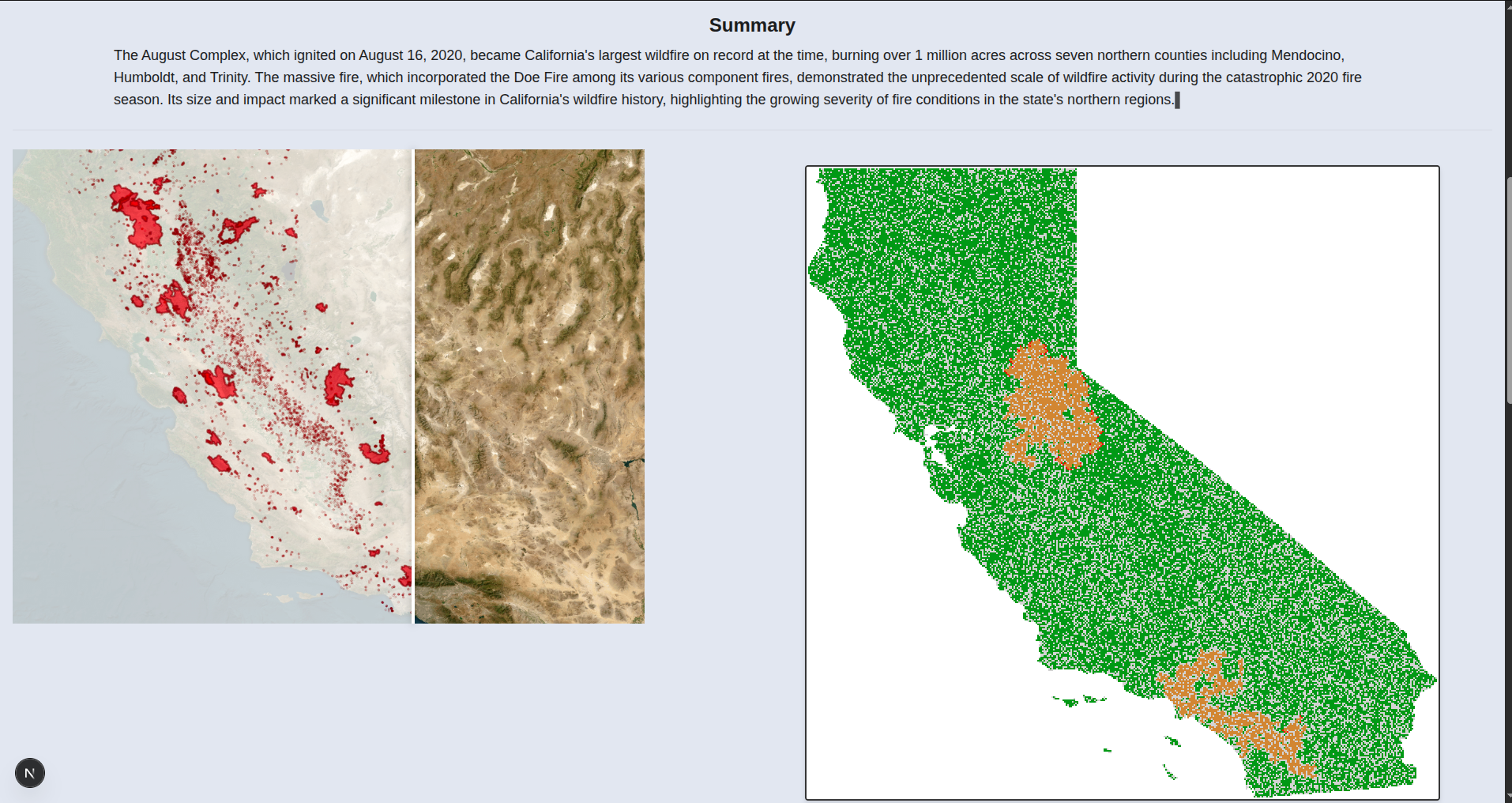
Fire spread model comparison with the data points of the fire starting locations
-
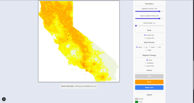
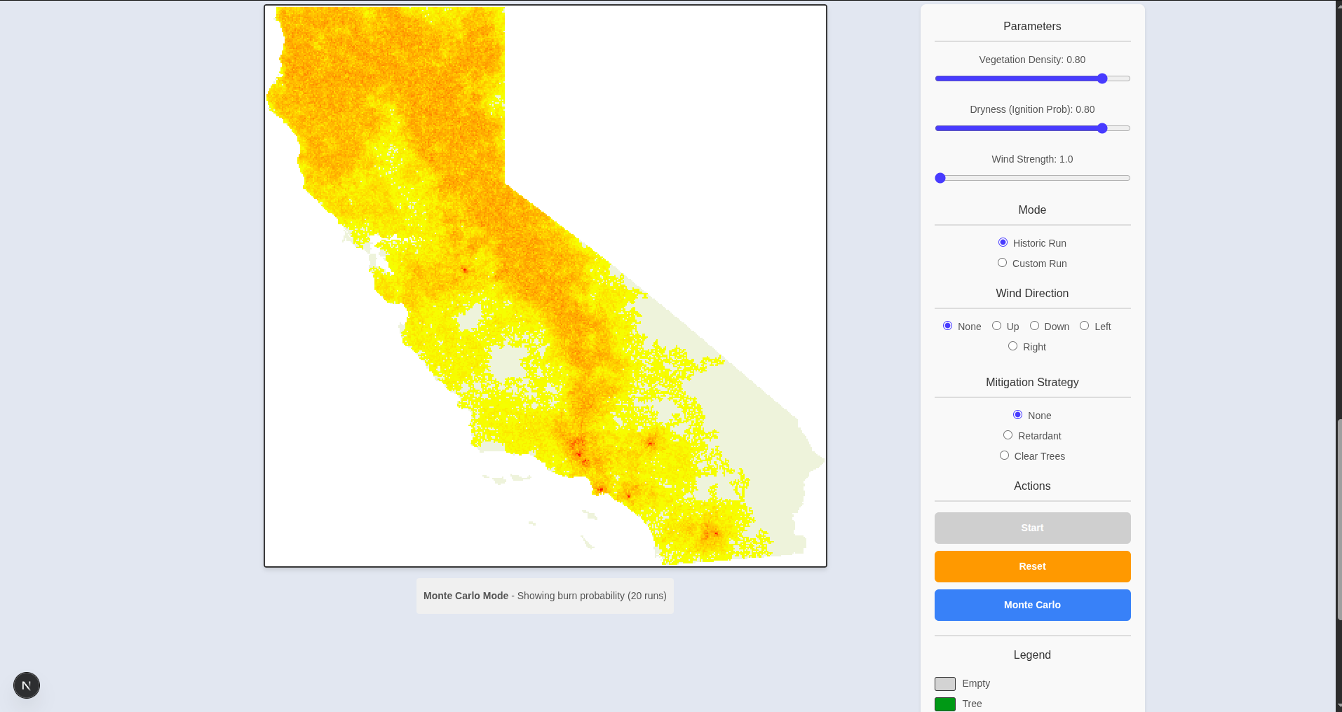
Monte carlo simulation showing predicted spread

What did we do?
After a sleepless night, multiple Claude sessions, and 3.14 mental breakdowns, we delivered a project!
Wildfires are bad. They destroy homes and habitats, pollute the air, harm people’s health, cost a lot of money, and release carbon that worsens climate change. What if we could create something that not only predicts the spread of wildfire events, but also predicts how mitigation strategies would help improve the safety of the community?
That's where we come in.
We created mathematical models to predict wildfire spread based on historical data, using stochastic Percolation-based simulations and Monte Carlo techniques for more robust modelling. These allow us to replicate the spread of fires in our targeted area, California.
It doesn't stop there! Using our models, we can test out mitigation strategies such as clearing tree lines and retardant areas, and evaluate their effect as a deterrent for spread.
Inspiration
Due to global warming, the frequency and impact of wild fires has grown significantly. Modelling the spread of wild fires is a difficult challenge that reveals insights into optimising the response strategy from the emergency services.
How we built it
We used all of the following:
- Python for our backend
- React for our frontend
- Satellite API for California images
- California Fire Department API for uniquely identifying fires
- Forest Service in the US Department of Agriculture for accurate vegetation density mapping
- Weather / Wind Data of the California Area
- Claude API for summarising historical events
Challenges we ran into
- Converting Matplotlib model to React
- Reverse engineering Fire Department API using "isactive=true"
- C++ Compiled Python Modules
- Frontend
Accomplishments that we're proud of
Successful project and good vibes throughout the event!
What we learned
When in doubt Claude it out.
What's next for WildFire
Predicting wildfires in the wider world!


Log in or sign up for Devpost to join the conversation.