-
-
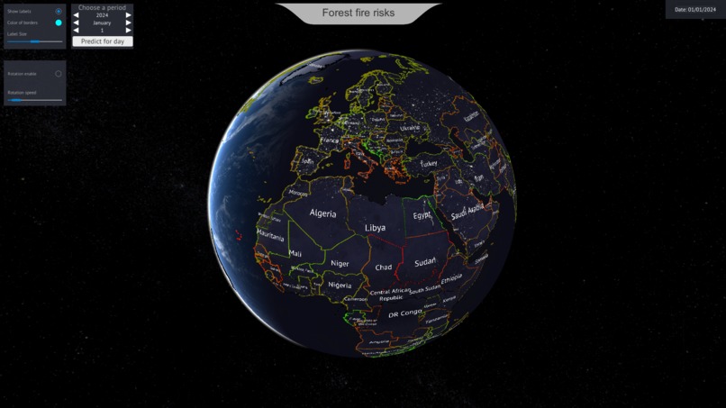
Europe night view
-
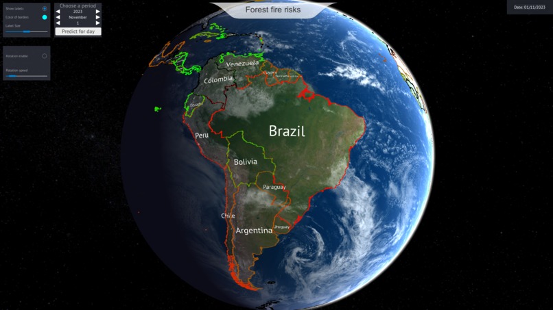
South America view
-
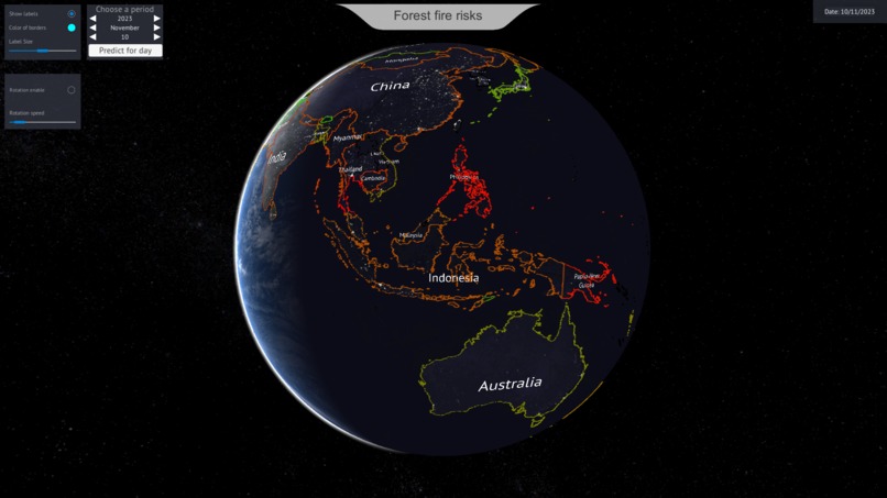
Oceania night view
-

Kosice view
-
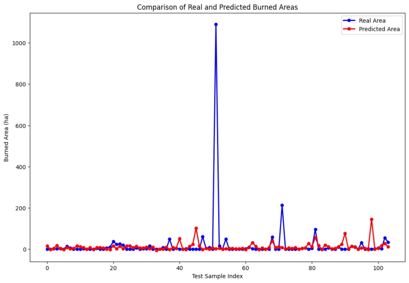
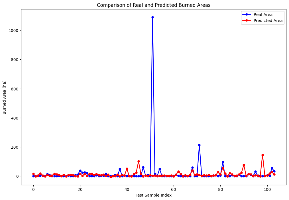
Model evaluation


Inspiration
As soon as we heard about this project, we knew it was something we wanted to focus on. Climate change is one of the most serious issues currently being tackled by scientists worldwide. Unfortunately, the problem is so vast that it needs to be addressed in parts. One such part is the increasing frequency of forest fires, leading to the loss of human and animal lives and the destruction of forests. Therefore, we wanted to try our hand at calculating the risk of fire occurrence in different countries and visualizing these risks - firstly, to have a convenient interactive tool for risk analysis, and secondly, to draw more people's attention to the issue, as we believe that visualisations work better in drawing attention than raw numbers.
What it does
Our project utilises an AI model to predict the risk of forest fires for each country on a daily basis. These predictions are then visualised on a dynamic 3D world map within the Unity engine, offering an intuitive overview of global fire risks.
How we built it
We built the AI model using machine learning techniques, training it on historical weather and fire occurrence data. The prediction is based on temporal and weather conditions, such as the time of year, temperature, relative humidity, wind strength, and so on. The model's predictions are integrated into Unity, where we crafted a 3D map to display the risk levels interactively.
Challenges we ran into
The most challenging part was finding and extracting the necessary data that would be truly useful in determining the risk of fire occurrence, and combining information from different sources. The second difficulty was integrating the final information into Unity for building the visualisation.
Accomplishments that we're proud of
Of course, we can't claim that our solution, created in 24 hours, provides highly accurate assessments of the risk of forest fires and is already a finished product, but we are proud that we have built a baseline model and integrated its predictions into a 3D world map in such a short time window. This serves as a solid start for a larger and more serious product, giving us insight into the feasibility of such a concept and providing a foundation on which we can continue to improve the model and enhance the quality of the visualisation.
What we learned
We learned a lot about the vast amount of data currently available on climate issues. We discovered which factors could influence the occurrence of forest fires and delved into the problems currently being addressed in the field of climate change. From a technical perspective, we learned how to work with APIs to extract the necessary data, how to process this data, and how to visualize it in Unity.
What's next for Forest Fire Risks
Looking ahead, we plan to refine our model's accuracy further and make it possible to predict the fire risk for any point given the latitude and longitude. Additionally, we aim to develop a more interactive user experience, providing additional useful capabilities of the tool.
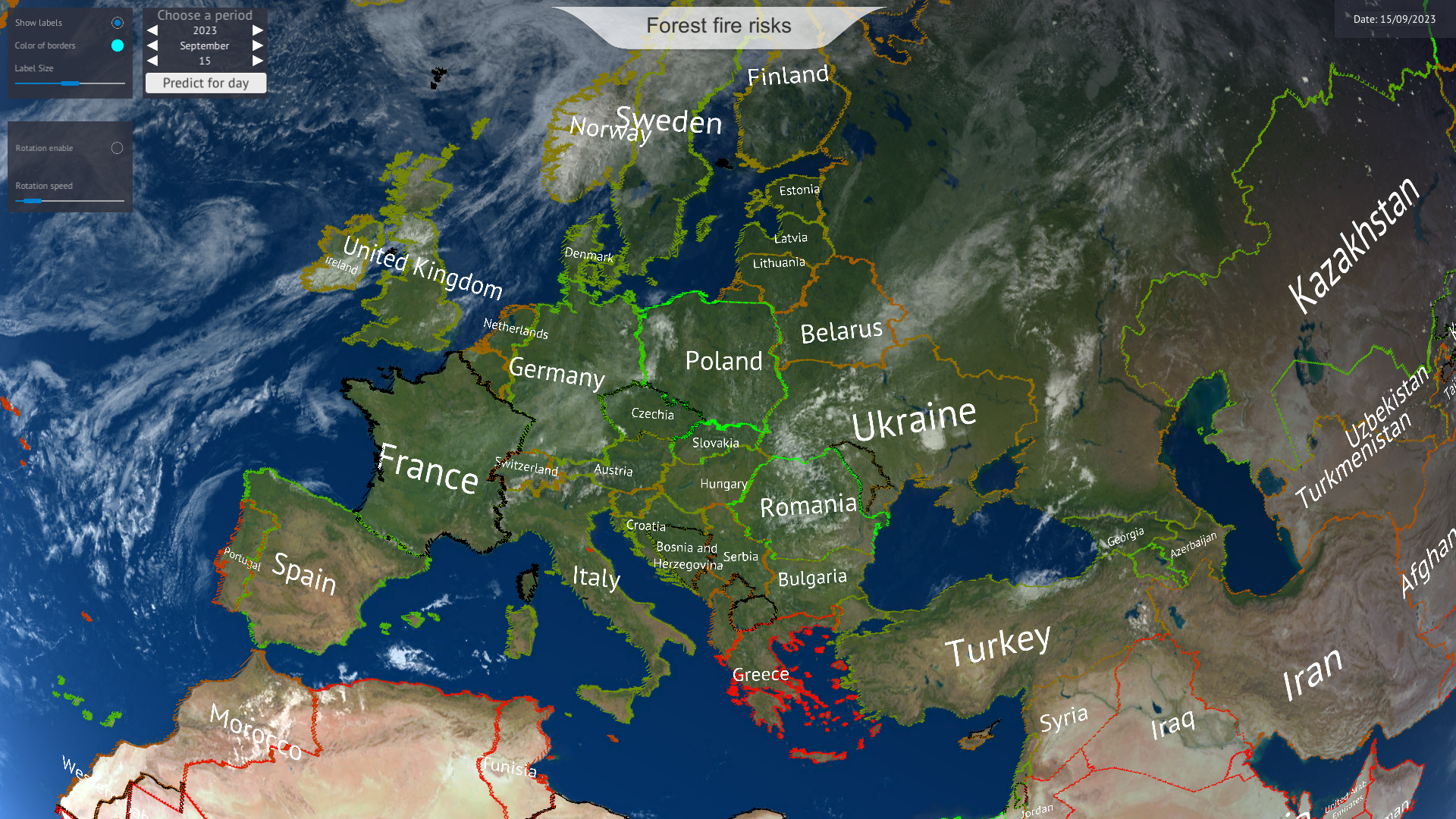
Controls
Select the year, month, and day. Press Predict to make a prediction. Each country will be colored. The redder the color, the higher the risk of fire. Black color means no data found.
Control the planet's rotation right-left/up-down by pressing and holding the left mouse button/wheel.
How to run it
Load this directory from Git: https://github.com/rOwe08/ForestFireRisks
Run /ForestFireRisks/BuildForPlay/ForestFireRisks.exe.


Log in or sign up for Devpost to join the conversation.