-
-

WaterwayInfo.com
-
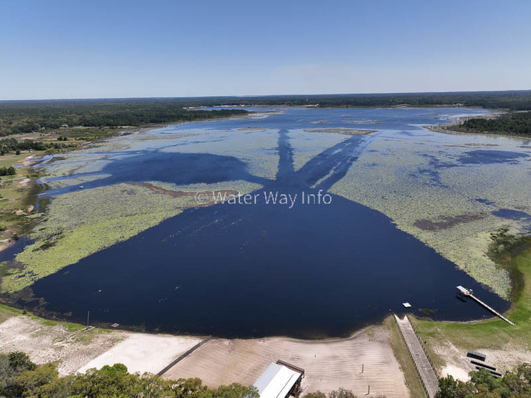
Example of our drone photography

Inspiration
We are nature lovers who code. Our goal is to help others find fun things to do outside that aren't easy to find anywhere else on the web.
What it does
Provides locations and features of Florida waterways, small and large. Important attributes are associated to each waterway to help users plan their trips and select the best option for them.
How we built it
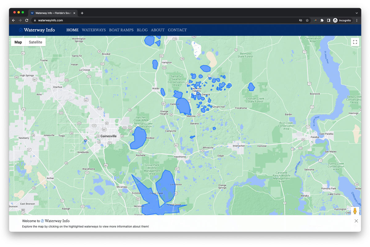
Built a WordPress theme with custom posts that send data into the Google Maps API. Backend GUI is easy to use so no-code contributors can post pictures and waterways.
Challenges we ran into
Trying to put all of our photos, points of interest, and waterway outlines on a single map ended up providing poor user experience and often overloading the API. We overcame this by separating each waterway into it's own URL and keeping the main map to polygons/outlines only.
Accomplishments that we're proud of
The site is still young and needs a lot of content, but it's already useful and can help people find a fun way to enjoy the outdoors on a weekend. We've already seen a small amount of organic traffic and hope those people are out catching fish or paddle-boarding after closing the site!
What we learned
The Maps API is really flexible and just requires the correct inputs to accomplish whatever location-based concept you are envisioning. There were several features we had not been aware of used before that fit in really nicely (such as the custom map markers for each type of POI).
What's next for Waterway info
Our next steps are to photograph, document, and write about 100s more waterways. The fun thing about this project is that it makes us go enjoy nature.
Log in or sign up for Devpost to join the conversation.