-
Interactive Visualization of Graphs
Built For NASA Space Apps Pre-Hack
Inspiration
To allow industrialists or real estate agencies to know more about the land they are going to buy or help farmers to know better about lands and water bodies
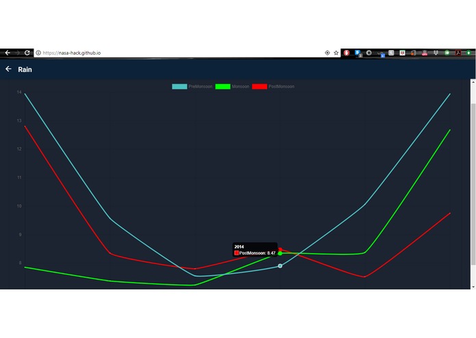
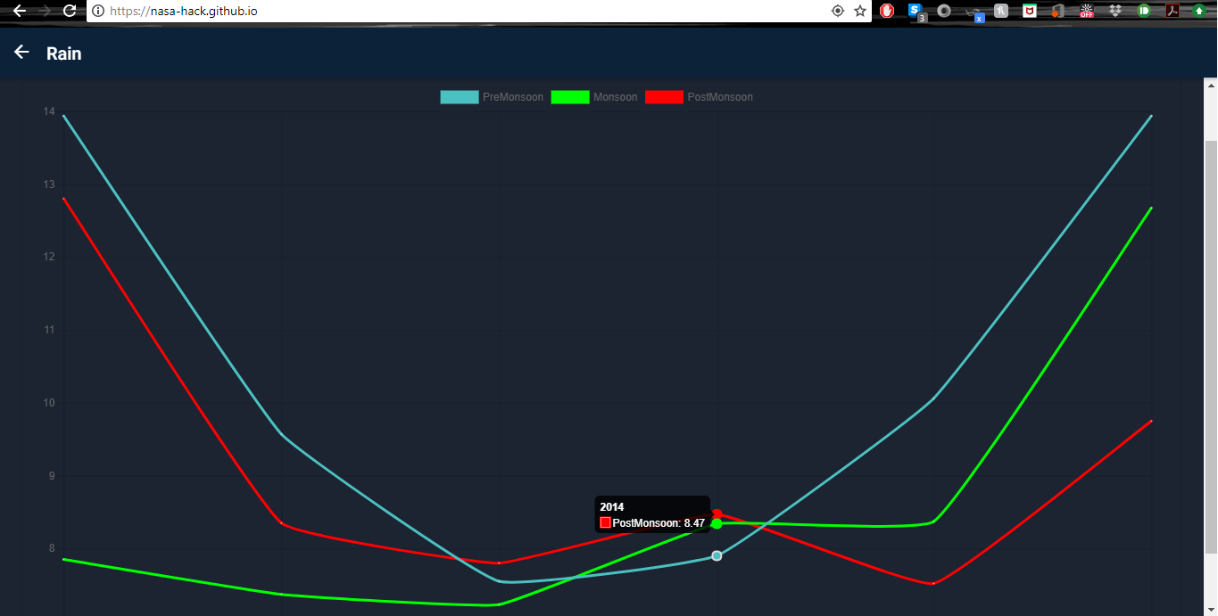
What it does
An hybrid app interface is provided which allow people to choose a position on map and displays the real time interactive graphs for water level in nearby bodies, precipitation rate, rain level etc. over the years
How I built it
Built in NASA space apps pre-hack using data provided by NASA with my friends.
Challenges I ran into
To properly clean and format the data was biggest task
Accomplishments that I'm proud of
The interface works properly with map and the graphs are accurate on basis of position chosen on map
What I learned
To use the knowledge of data analytics in some real life product rather than Kaggle challenges only.
What's next for Waterlook
To expand our app and make it more detailed. Add maps which predicts the ground water level,precipitation etc.over the next 10 years to make it more interactive and easy to use. Add a compare feature so that land owners and farmers can easily determine where to buy the land.
Currently Under Development
Built With
- d3.js
- django
- google-maps
- ionic
- leaflet.js
- nasa-real-time-data
- numpy
- pandas
- python
- scikit-learn
- tensorflow.js
Log in or sign up for Devpost to join the conversation.