Inspiration
Reservoirs are artificial lakes constructed by the implementation of a dam to regulate water flow. Communities utilize reservoirs as major sources of electricity, water access, and recreational activity. As a result of the drying climate, the National Integrated Drought Information System indicates that approximately 85.4% of California is experiencing severe drought conditions. This has ultimately led to a decrease in the lake reservoir volumes and the exposure of shorelines. Such effects can have negative impacts on the surrounding communities and the environment such as in precipitation, irrigation systems,, real estate, and hydroelectric power plants.
What it does
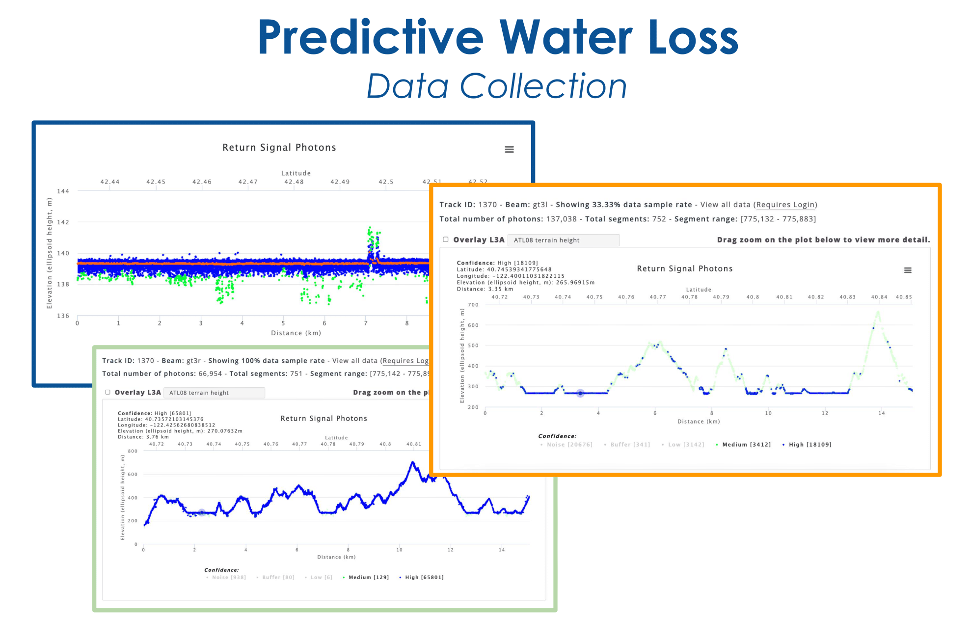
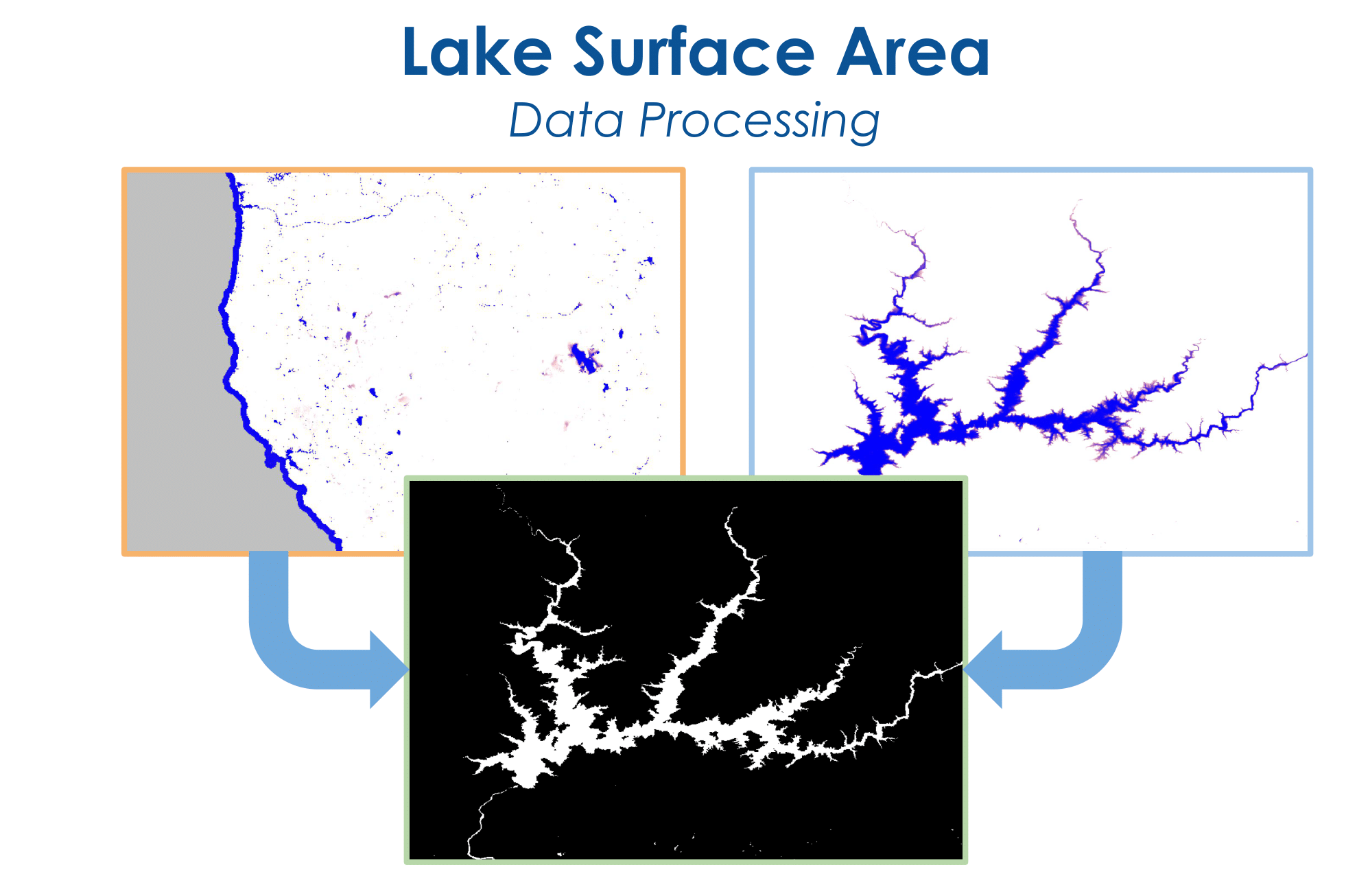
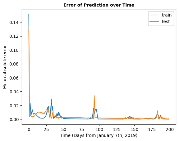
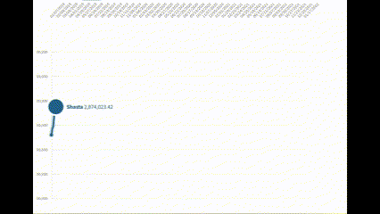
We investigated water level issues in California by analyzing data from ten major reservoirs. Utilizing ICESat-2 elevation data and information from the California Department of Water Resources, we confirmed a consistent yearly decrease in lake water levels, evident in Global Surface Water Explorer maps. Water managers struggle with long-term predictive analyses, leaving cities unprepared. Our research identified similar trends in over 40 California reservoirs. Employing Python scripts, we created an automated process to analyze ICESat-2 data for more than 40 bodies of water, calculating volume losses over two years. Our goal is to develop a machine learning model predicting future water level changes, aiding water resource managers in understanding regional fluctuations.
Challenges I ran into
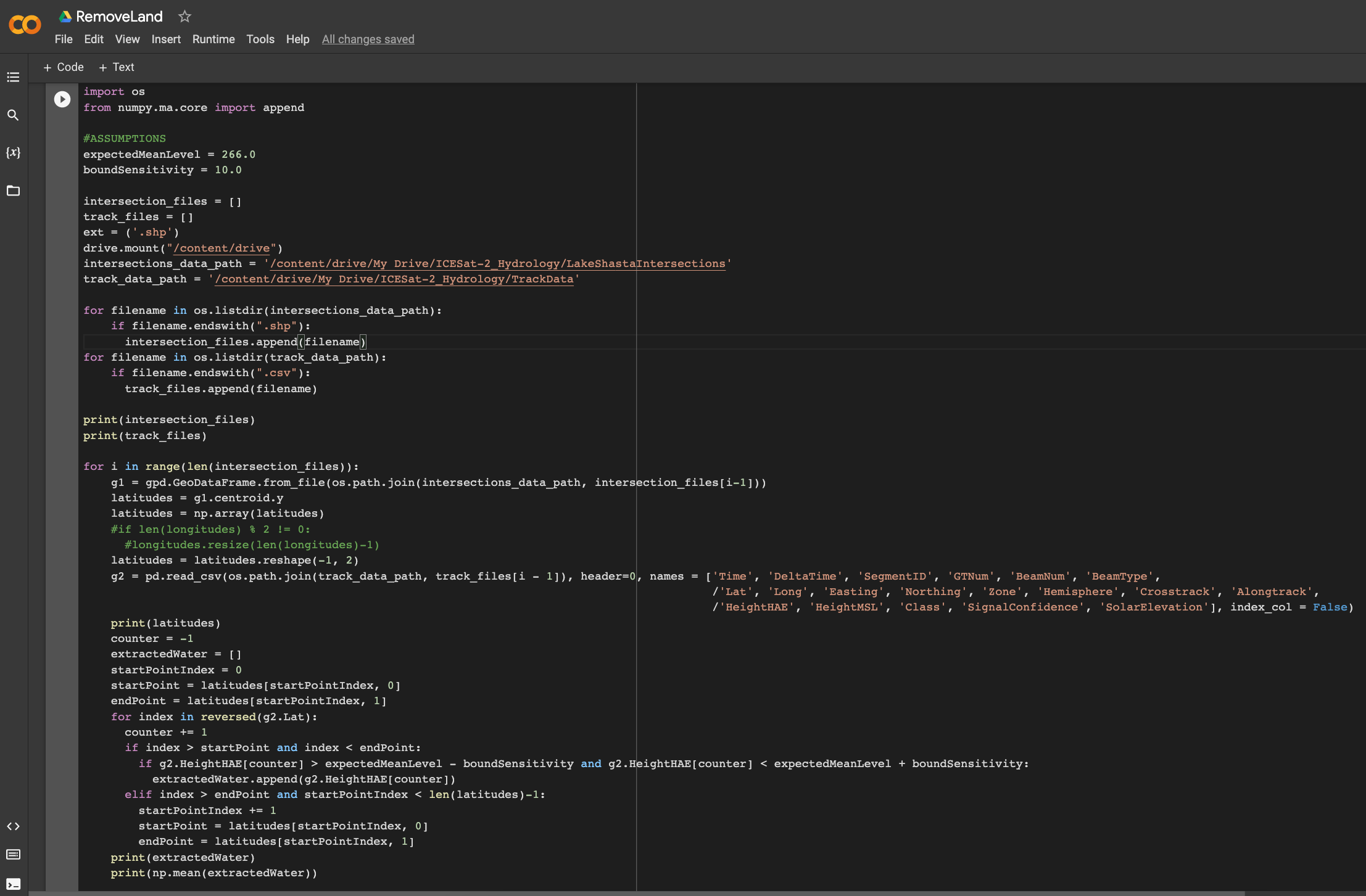
Throughout our project, we encountered challenges in handling large ICESat-2 data files, approaching a terabyte, requiring creative solutions to enhance efficiency. The unique diagonal sinusoidal pattern of the data posed initial difficulties in selecting an accurate machine learning model for predicting future water statistics. After thorough research, a suitable model was identified. In terms of QGIS, apprehensions about manually processing vast data led us to explore QGIS's native Python scripting for automation. To address discrepancies caused by river dynamics, we implemented intersection points, focusing on the most voluminous part of lakes for accurate water level measurements, disregarding elevation variations introduced by natural flow.
Built With
- icesat-2
- landsat-8
- python
- qgis

Log in or sign up for Devpost to join the conversation.