-
That's a lot of pizza to track

Inspiration
The Washington Pizza incident. A seemingly inconspicous event leeks very critical information.
What it does
Tracks progress through google earth images from the past to present, to set a general trend of places of importance. Anything which deviates from the trend is highlighted and evaluated (criticality). As trends have already been trained into the model, we can predict basic events.
How I built it
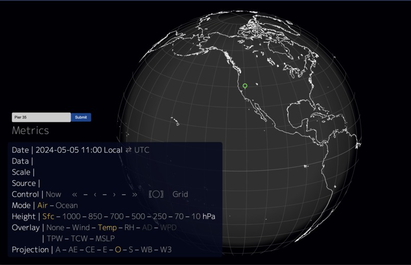
Website which maps geolocation on global with the latitude and longitude. This calls the Google Earth api - which also takes previous years satellite images. Basic image comparison between the images, to highlight changes. Run it through Open AI api, which flags if anything in a checklist is present (tanks, military weapons, etc.) Skyfi would provide real time tracking and alerts in that region and repeat.
Challenges we ran into
Each case, needs to specifically given conditions to build system for what it is looking for.
Accomplishments that we're proud of
Geospatical global mapping. Adding image compare to help accuracy of Open AI vision model flagging.
What we learned
Skyfi is really cool, but hard to use :(
What's next for Warp
Hopefully add some of the features built out here/brainstormed into the startup which I have founded.

Log in or sign up for Devpost to join the conversation.