-
-
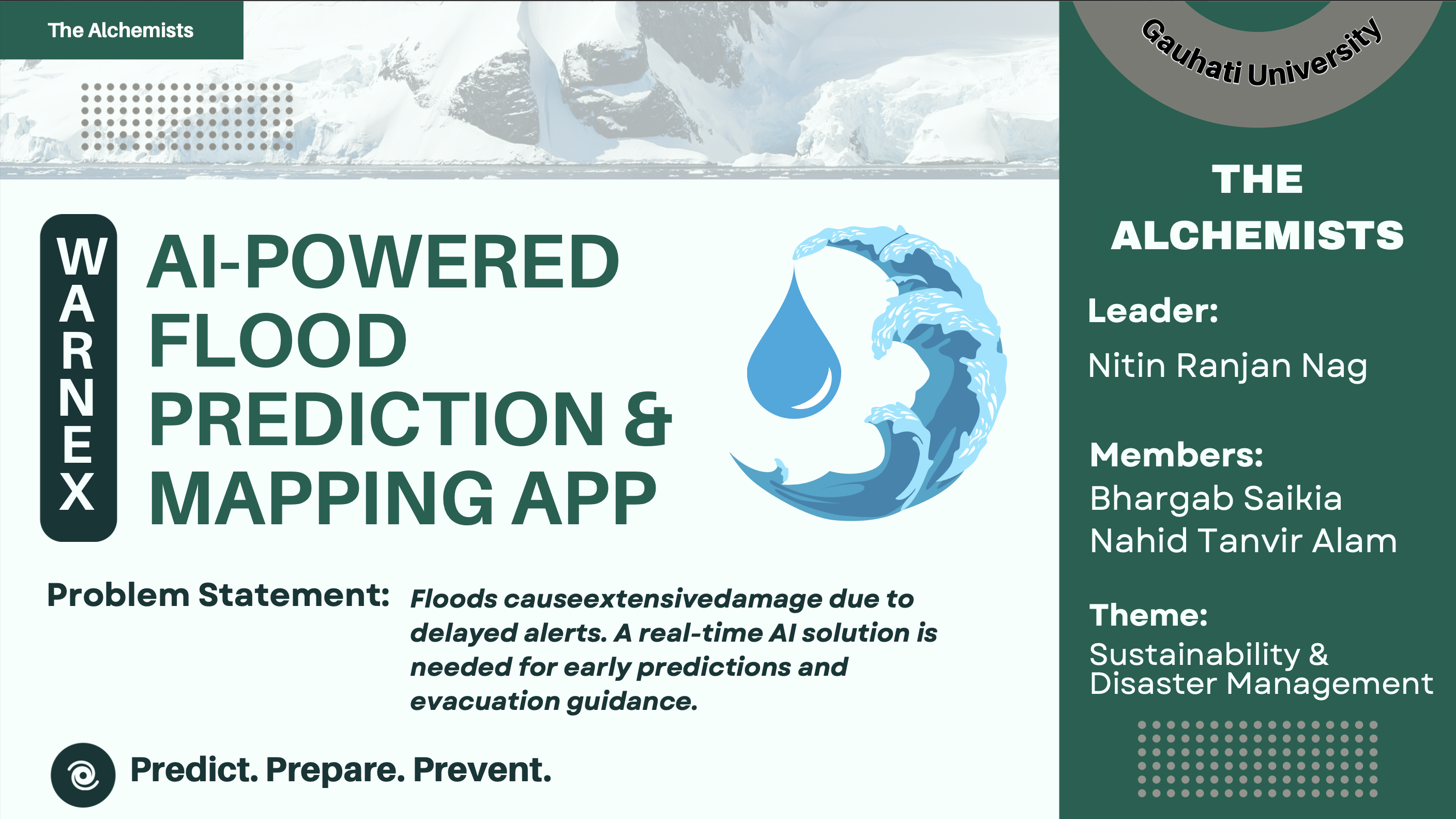
PPT 1
-
Introduction
-
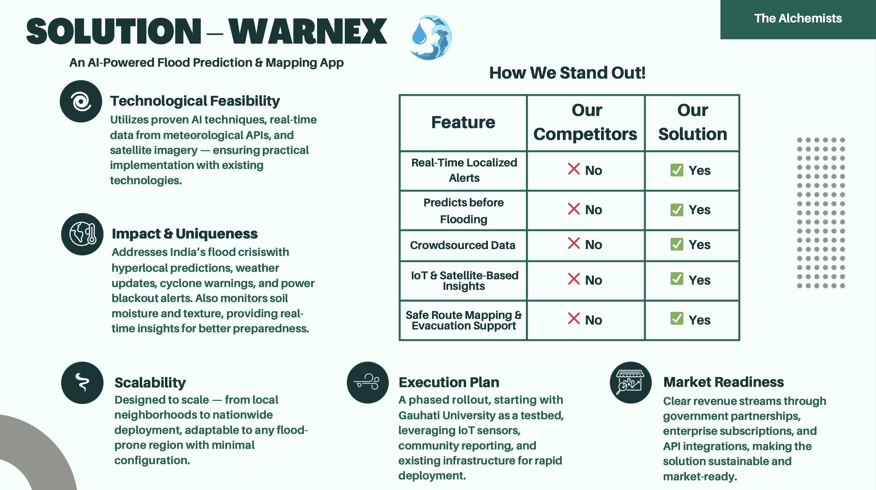
Solution
-
How it Works?
-

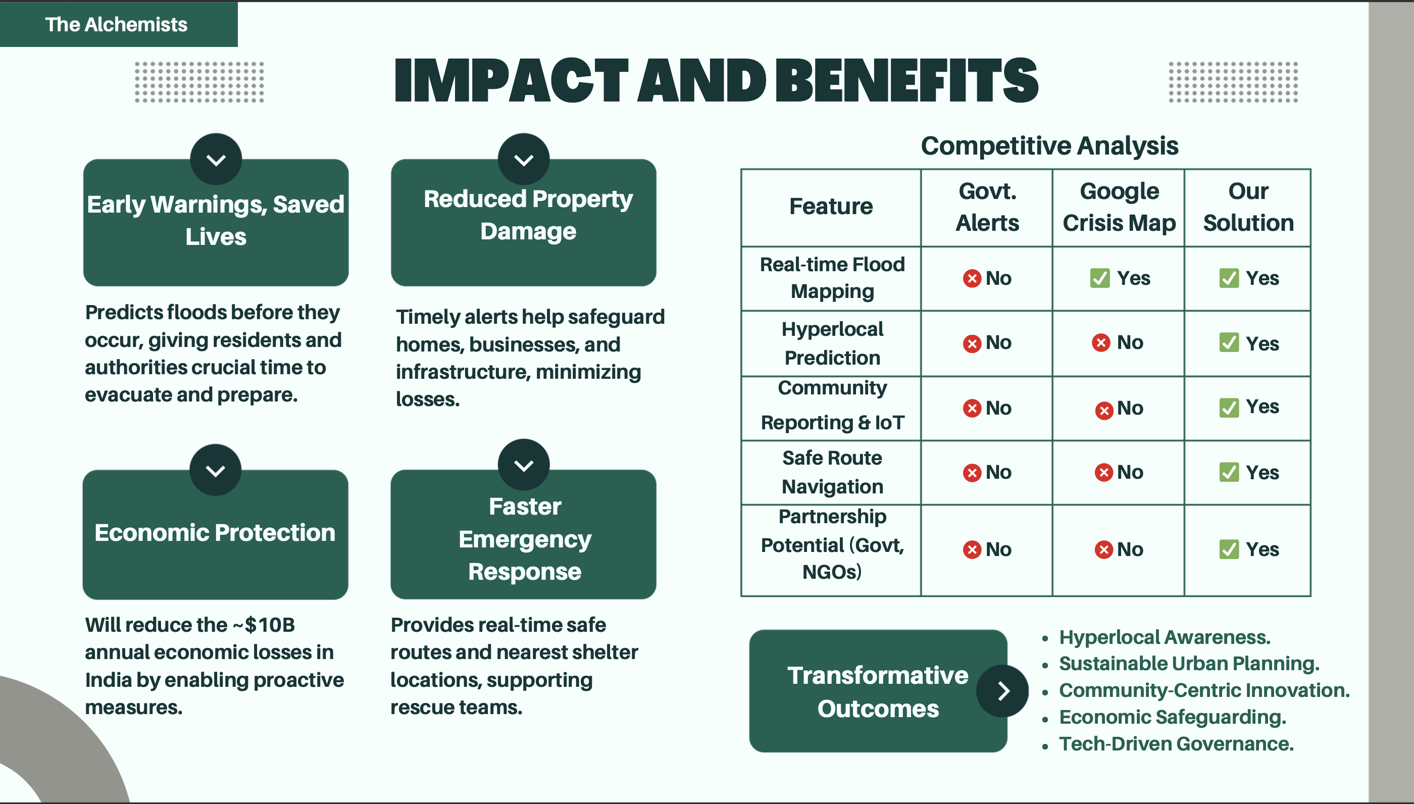
Impact and Benefits
-

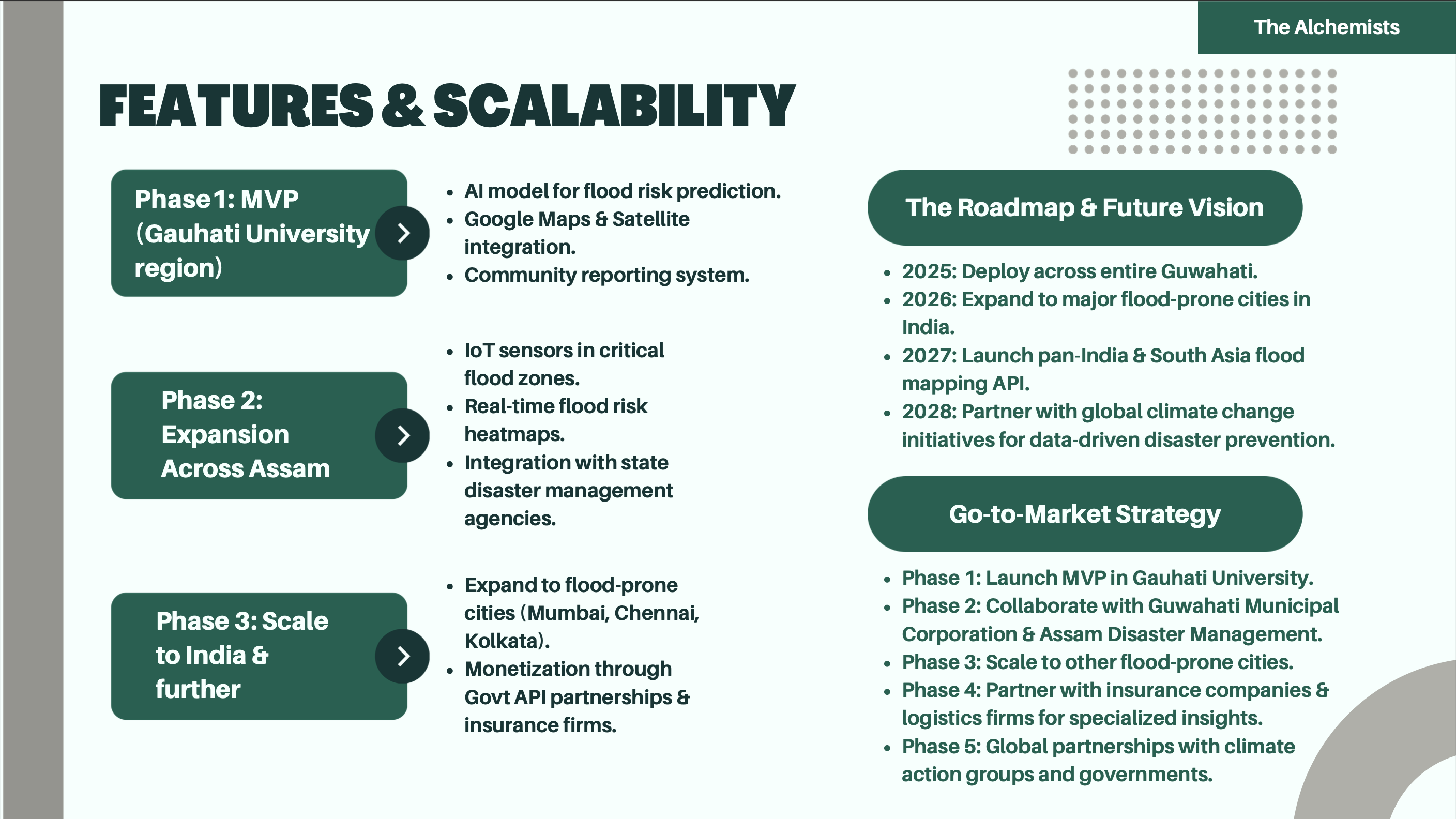
Features and Scalability
-

Glimpse of Warnex
-
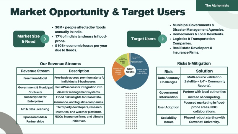
Market Opportunity and Target Users
-
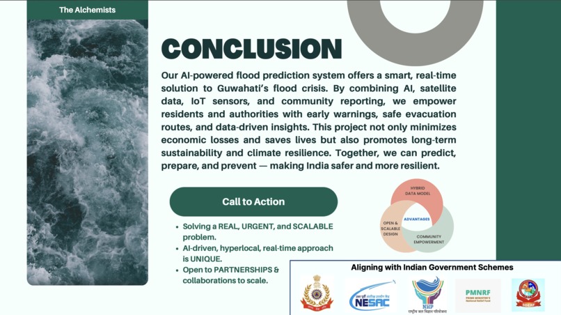
Conclusion
-

Thank You


Inspiration
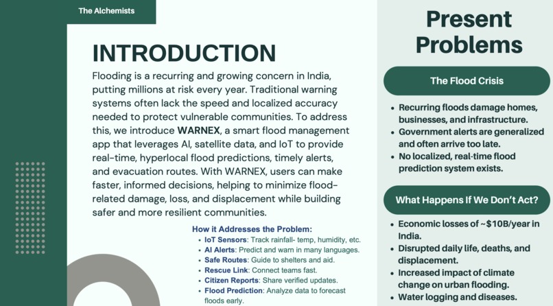
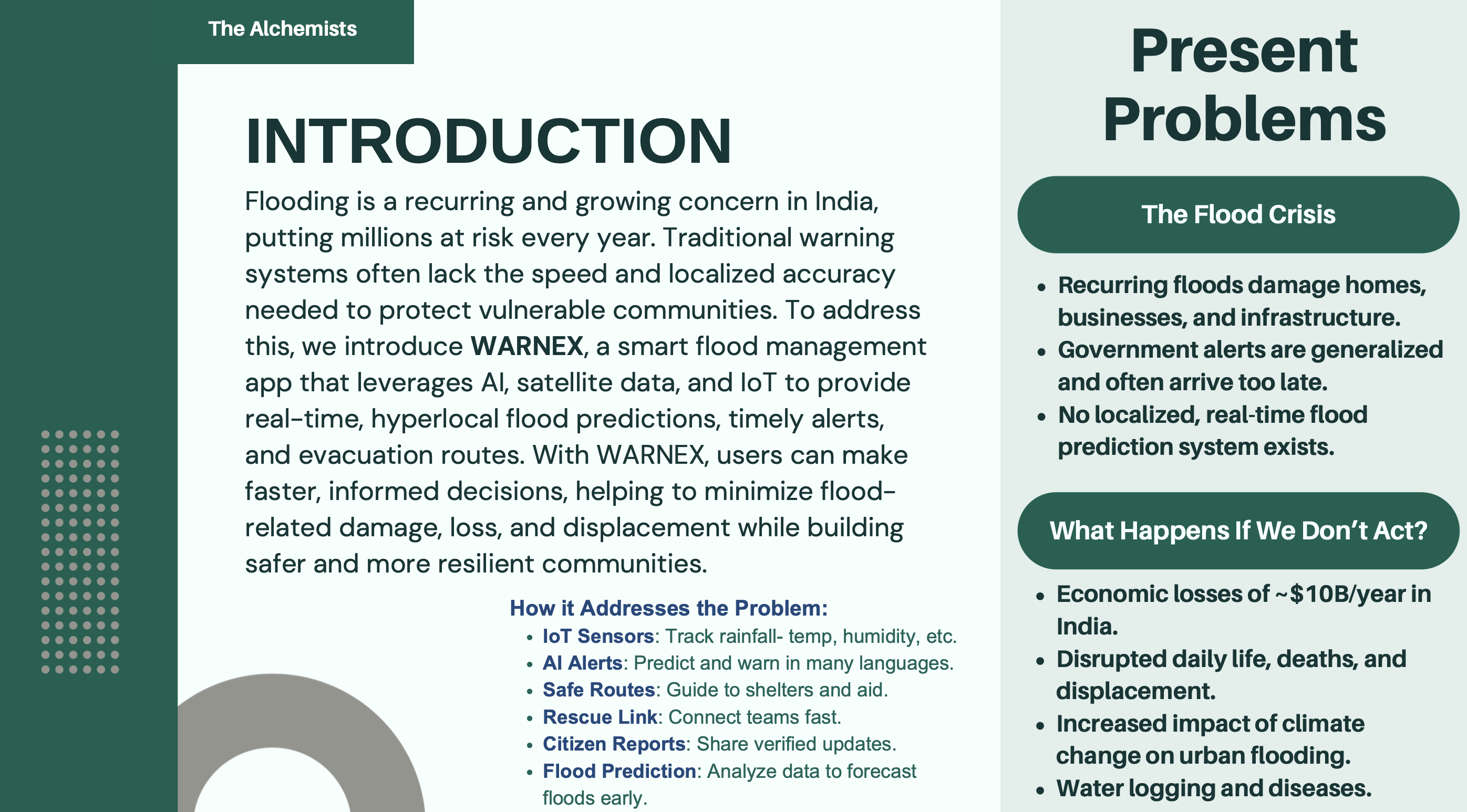
Flooding is a recurring crisis in Assam and many parts of India, causing displacement, infrastructure damage, and significant economic losses every year. Growing up in Guwahati, we have witnessed severe waterlogging, delayed alerts, and the lack of localized evacuation guidance. Existing systems are mostly generalized and reactive, often arriving too late to prevent damage.
We wanted to build a solution that could predict floods before they occur, provide hyperlocal alerts, and empower both citizens and authorities to take timely action. This vision led to WARNEX — a smart, AI-powered flood prediction and disaster preparedness platform.
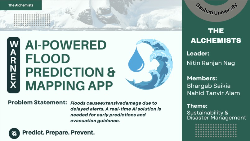
What it does
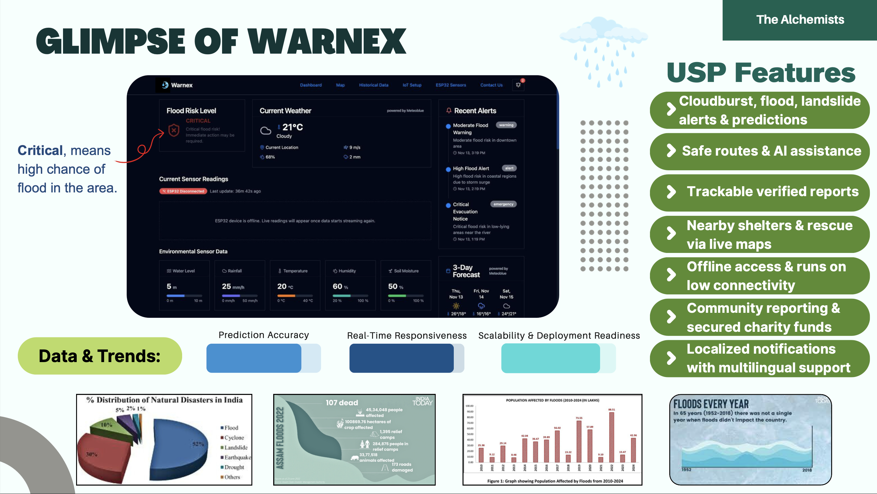
WARNEX is an AI-powered flood prediction and mapping platform that delivers real-time, hyperlocal flood risk insights and emergency guidance.
It provides:
- Hyperlocal flood risk prediction
- Real-time alerts with multilingual notifications
- Dynamic flood risk heatmaps
- Safe evacuation routes via live maps
- Nearby shelters and rescue assistance guidance
- Soil moisture monitoring and agricultural risk insights
- Community reporting for real-time validation
- Offline-friendly alerts for low-connectivity situations
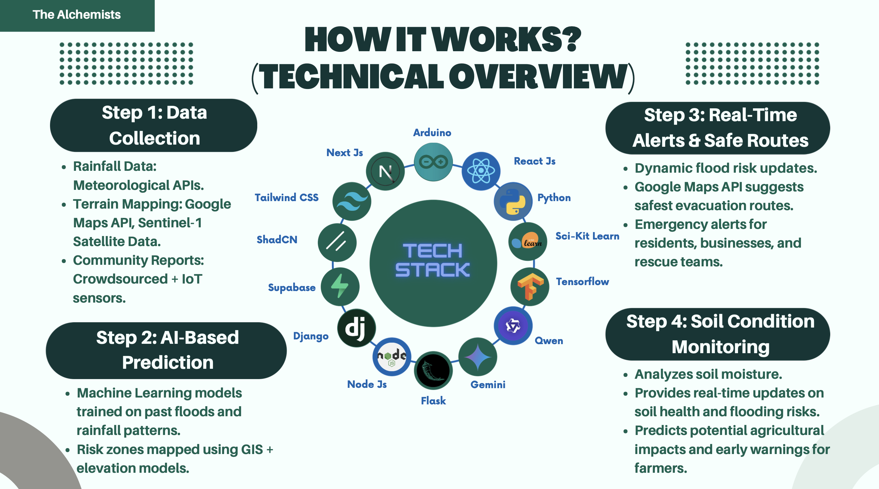
How we built it
WARNEX combines environmental data, machine learning, and geospatial intelligence to deliver real-time flood risk insights.
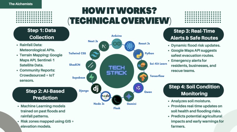
Data Collection
We aggregated multiple data sources:
- Meteorological and rainfall APIs
- Satellite imagery and terrain elevation models
- IoT sensors measuring rainfall, humidity, and soil moisture
- Crowdsourced community reports
Flood risk is estimated using a hybrid risk model:
[ FRI = w_1R + w_2S + w_3E + w_4D ]
where:
- (R) = rainfall intensity
- (S) = soil saturation
- (E) = elevation factor
- (D) = drainage efficiency
- (w_i) = learned weights from historical data
AI Prediction Engine
- Machine learning models trained on historical flood and rainfall patterns
- GIS-based elevation risk mapping
- Continuous real-time risk scoring updates
Alerts and Routing
- Dynamic flood risk heatmaps
- Safe evacuation routing using mapping APIs
- Emergency alerts for residents and responders
Community and IoT Integration
- Crowdsourced verified reports
- Sensor-based environmental monitoring
- Multi-source validation for improved accuracy
Challenges we ran into
Data availability and reliability: Flood datasets were fragmented and inconsistent. We addressed this by combining satellite data, IoT sensors, and community reports.
Real-time data processing: Handling continuous environmental data streams required efficient pipelines and lightweight prediction logic.
Hyperlocal prediction complexity: Flood risk can vary street by street. Elevation models and localized sensor inputs helped improve precision.
Connectivity issues during disasters: Internet access may fail during emergencies. We designed lightweight alerts and offline-friendly functionality.
Balancing speed and accuracy: Real-time alerts must be fast yet dependable. A hybrid risk scoring model enabled quick predictions with practical accuracy.
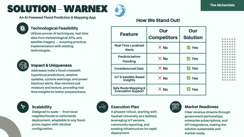
Accomplishments that we're proud of
- Built a functional AI-based flood risk prediction system
- Achieved hyperlocal risk mapping using GIS and elevation data
- Integrated satellite, IoT, and community data into one unified platform
- Designed real-time alerts with evacuation route guidance
- Created a scalable solution adaptable to other flood-prone regions
What we learned
- Reliable data pipelines are more critical than complex AI models in real-time systems
- Hyperlocal disaster prediction requires multi-source data fusion
- Community participation significantly improves accuracy and responsiveness
- Disaster-tech solutions must prioritize accessibility, speed, and simplicity
- Designing for low-connectivity environments is essential for resilience
What's next for WARNEX
- Deploy a pilot implementation in the Gauhati University region
- Expand across Guwahati and other flood-prone areas in Assam
- Integrate with disaster management authorities and emergency services
- Improve AI accuracy using larger historical datasets
- Develop a scalable flood risk API for governments and enterprises
- Partner with climate resilience and disaster response organizations to scale impact
Built With
- gemini
- python
- react
- scikit-learn
- supabase
- tensorflow

Log in or sign up for Devpost to join the conversation.