-
-

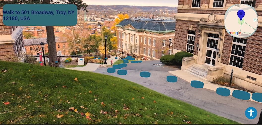
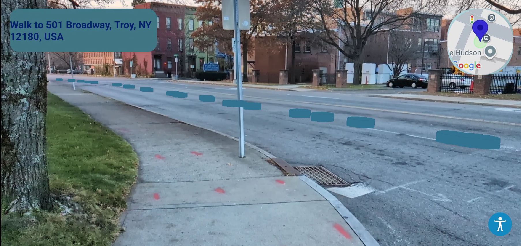
WALKR in Action: Real-time AR navigation guiding you seamlessly through the city.
-

WALKR in Action: Real-time AR navigation with wheelchair-accessible routes, guiding you seamlessly through the city.
Inspiration
Have you ever exited the subway or been dropped off in a big city, unsure of which direction to go? The anxiety of heading the wrong way or getting lost can be overwhelming. WALKR was created to solve this problem with a mixed-reality navigation experience that keeps users oriented without needing to check a map constantly. Our design stands out especially in dense urban areas where GPS or map apps can struggle to provide clarity. Inspired by the over 12% of the US population affected by mobility disabilities, we designed WALKR to make city navigation accessible and enjoyable for everyone.
What it does
WALKR combines GPS coordinates with advanced geospatial mapping to instantly pinpoint the user’s location and provide guidance based on nearby landmarks. Our approach integrates real-time positioning with the angle and orientation of the user’s phone to project an accurate walking route displayed in a mixed-reality headset. Users can simply say their destination aloud, and WALKR’s hands-free voice recognition sets up a precise route without needing a glance at the screen. Notably, WALKR also offers a fully integrated wheelchair-accessible route option, ensuring that users with mobility challenges receive optimal path guidance.
How we built it
We built WALKR using a robust tech stack that includes the Android SDK, Google Maps, ARCore, Directions, Places, Cloud Natural Language, Vosk voice recognition, MySQL, Leaflet, Azure, and ML-powered geospatial processing. Together, these tools enable a seamless mixed-reality experience displayed through a heads-up interface in a wearable headset. This continuous path display shows clear markers that guide the user along the route with real-time updates, ensuring they reach their destination accurately and comfortably. Our design includes math-based geospatial adjustments that adapt based on the phone’s angle and GPS coordinates, which aligns the path precisely with physical surroundings.
Challenges we ran into
A major challenge was implementing accurate, wheelchair-accessible routing. Although the Google Maps API lacks built-in support for accessible routing, we adapted our app to handle this limitation by customizing routes ourselves and ensuring that accessibility needs were prioritized. Another challenge was integrating all components within the 24-hour timeframe, from geospatial calculations to mixed reality displays, especially given our team’s limited experience with Java and Kotlin.
Accomplishments that we’re proud of
Within just 24 hours, we built a fully functional app from scratch, writing over 5,000 lines of code (an average of 210 lines per hour). We tackled numerous technical challenges, and we’re proud of creating a reliable, accessible navigation experience with limited experience in Java and Kotlin. WALKR’s capability to provide wheelchair-accessible routes and our integration of multiple complex APIs into a cohesive product are key achievements.
What we learned
This project gave us practical experience in Android development, mixed reality programming, and collaborative problem-solving under pressure. We learned the importance of balancing speed with quality to produce a functional product within a tight deadline. Along the way, we also gained a better understanding of user-centered design, especially when creating accessible features that genuinely benefit diverse groups of users.
What’s next for WALKR
We see WALKR as a potential game-changer in urban navigation. Next steps include expanding compatibility to support iOS and other mobile devices and enhancing WALKR’s wheelchair-accessible routes to ensure all users have the best navigation experience possible. We’re also considering development of a proprietary, universally compatible headset to offer a more refined, hands-free experience. In the future, we envision WALKR as a go-to tool for both everyday navigation and accessibility, helping merge AR into daily life. Mixed reality can empower individuals with better access and will become an integral part of society.
Built With
- android-studio
- google-arcore
- google-directions
- google-maps
- google-places
- java
- kotlin
- mysql
- php


Log in or sign up for Devpost to join the conversation.