Inspiration
Most maps tell you where to go. WalkingAtlas shows where you have actually been.
I built it to make familiar places feel unexplored again. Instead of optimizing a walk around distance, pace, or calories, WalkingAtlas rewards curiosity: take a different street, walk through a new park, and uncover a new part of your personal map.
What it does
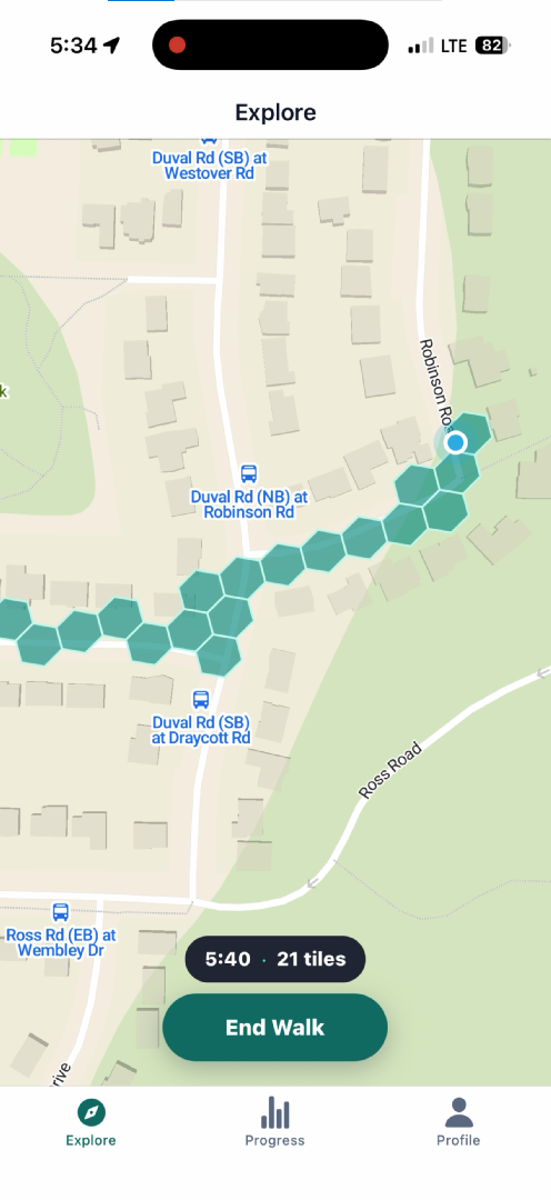
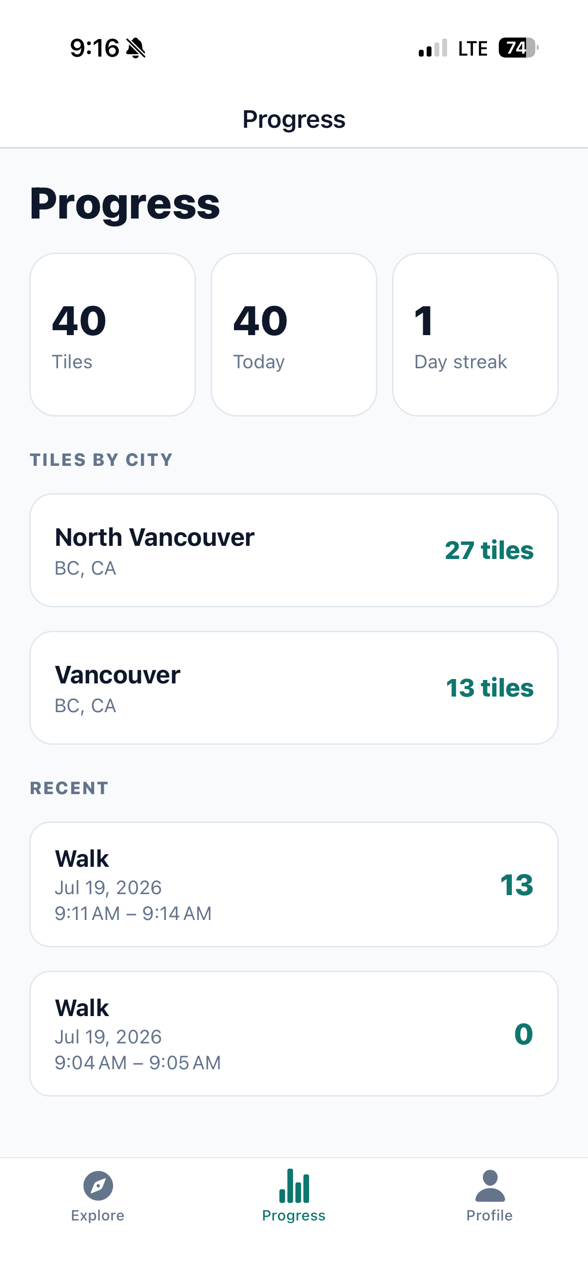
WalkingAtlas turns an ordinary walk into an exploration game. During a walk, it unlocks green hexagonal tiles as you move. After each walk, the Progress tab summarizes your total tiles, today’s discoveries, current streak, recent walks, and exploration across cities.
The app uses H3, Uber’s open-source geospatial indexing system, to represent explored places as stable hexagonal tiles rather than a GPS trail.
How we built it
WalkingAtlas is an Expo/React Native iOS app with a MapLibre map. It records precise background location during an active walk, with the user’s permission, queues fixes locally when connectivity is unavailable, and syncs them to a Cloudflare Worker API.
The backend uses Supabase/Postgres with PostGIS to validate locations and award new tiles. It also uses versioned official municipal boundary data to attribute tiles to cities.
I used Codex with GPT-5.6 Terra in Plan Mode to work through tile size, GPS quality, city attribution, and fair-play rules. We chose H3 resolution 12, whose cells are roughly 20 metres (22 yards) across: small enough for walking to feel rewarding, while reducing random unlocks from normal GPS drift.
Codex and GPT-5.6 Terra also helped plan and implement an automated city-boundary pipeline. It retrieves reviewed official boundary data from the U.S. Census and Statistics Canada, matches and converts it to map-ready data, then loads it into the database. The first version supports the 100 most populous U.S. cities and 25 Canadian cities.
Challenges we ran into
The hardest challenge was making a location-based game feel fair and trustworthy. GPS is noisy, permissions are complicated, and a tile-unlocking system cannot treat every location update as equally valid.
Background location also needs careful handling: the app must continue tracking during an active walk while the phone is locked, while remaining resilient to temporary connection loss.
Accomplishments that we’re proud of
We are proud that WalkingAtlas is more than a map prototype. It has a complete loop: start a walk, unlock verified tiles, view them on a personal map, and track progress over time.
We also built server-side safeguards against vehicle travel. The backend evaluates movement speed between consecutive fixes:
$$ \text{speed} = \frac{\text{distance between fixes}}{\text{elapsed time}} $$
Above roughly 9 mph, unlocking pauses. This supports walking and jogging while preventing tiles from being earned while driving. Because this validation lives on the backend, the threshold can be tuned without requiring an app update.
What we learned
We learned to treat location as a stream with quality constraints rather than a single source of truth. Precise, recent GPS fixes and realistic movement speeds are necessary to make the game feel dependable.
We also learned how much care geospatial data requires. Coordinate ordering, stable tile identifiers, official city boundaries, and changing boundary datasets all affect whether progress stays correct over time. Separating stable H3 tile ownership from versioned city attribution made the system easier to evolve.
Codex with GPT-5.6 Terra accelerated this learning and development process by helping turn product questions into implementation decisions, iterate on the location and sync architecture, and build and test the geospatial data workflow.
What’s next for WalkingAtlas
Next, we plan to add opt-in social features such as friends and leaderboards, while keeping individual exploration as the core experience. We also want to expand city coverage, refine anti-cheat and GPS-quality rules with real-world usage, and introduce new exploration goals that encourage people to discover more of their neighbourhoods.
WalkingAtlas turns an ordinary walk into an exploration game, one verified tile at a time.
Built With
- cloudflare-workers
- codex
- expo.io
- gpt-5.6-terra
- h3
- ios
- maplibre
- postgis
- postgresql
- react-native
- rest-api
- sqlite
- supabase
- typescript


Log in or sign up for Devpost to join the conversation.