

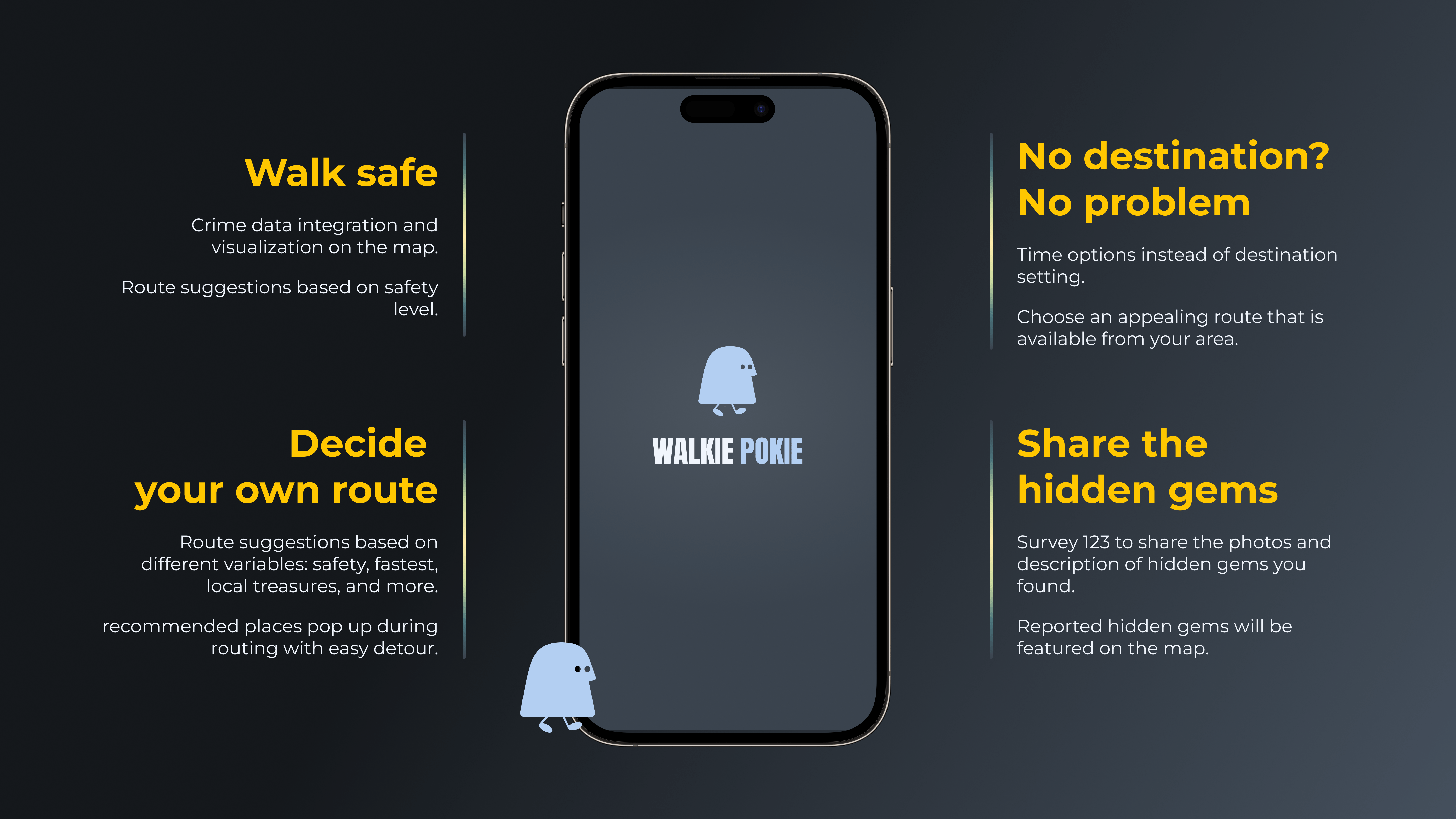

Inspiration
Early on we discovered that our team was split between people who walk for the journey and people who walk out of necessity. We wanted to provide those who love to explore with a randomized walking route based off how long you would like to go for a walk as well as Hidden Gem suggestions for you to see or stop by to add to your journey. For those who walk in need we wanted to provide the user the safest route available to get your destination based off data on nearby reports of crime activity, the presence of streetlights and sidewalk availability.
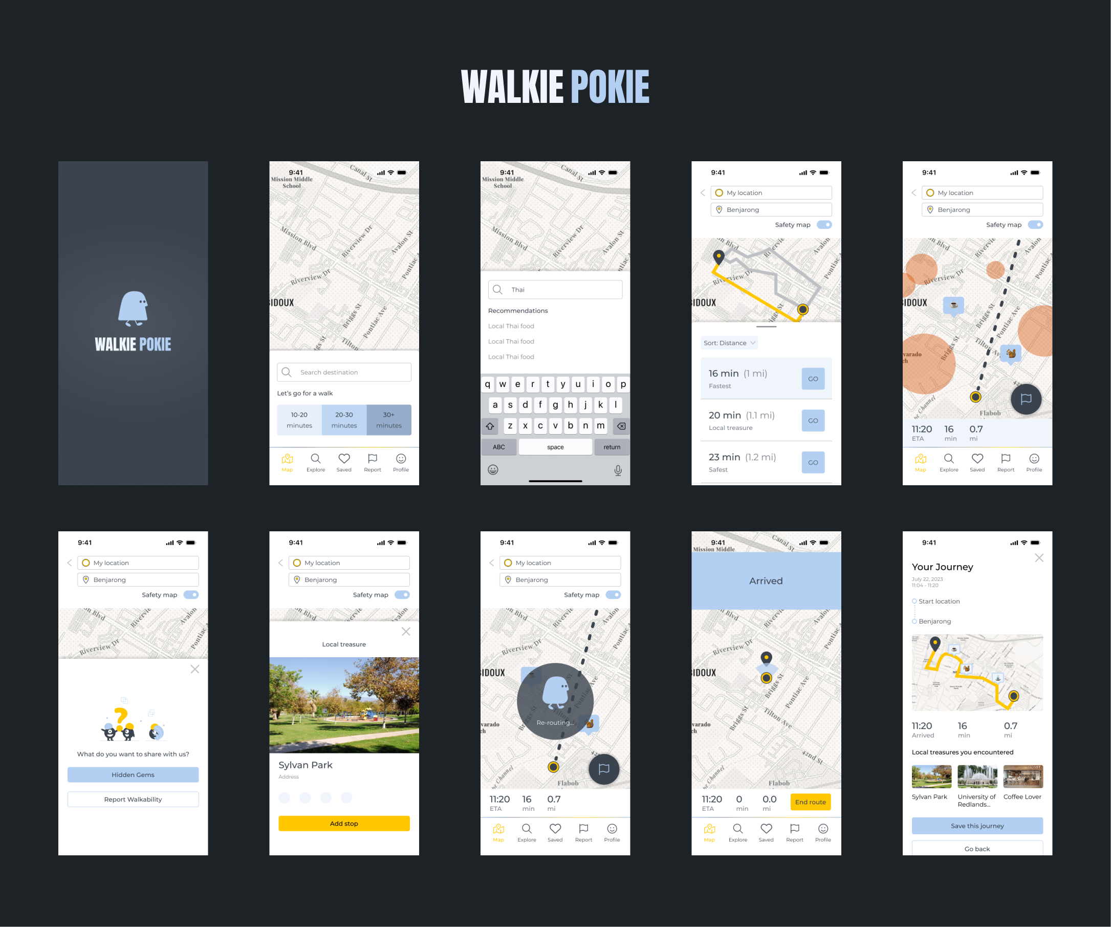
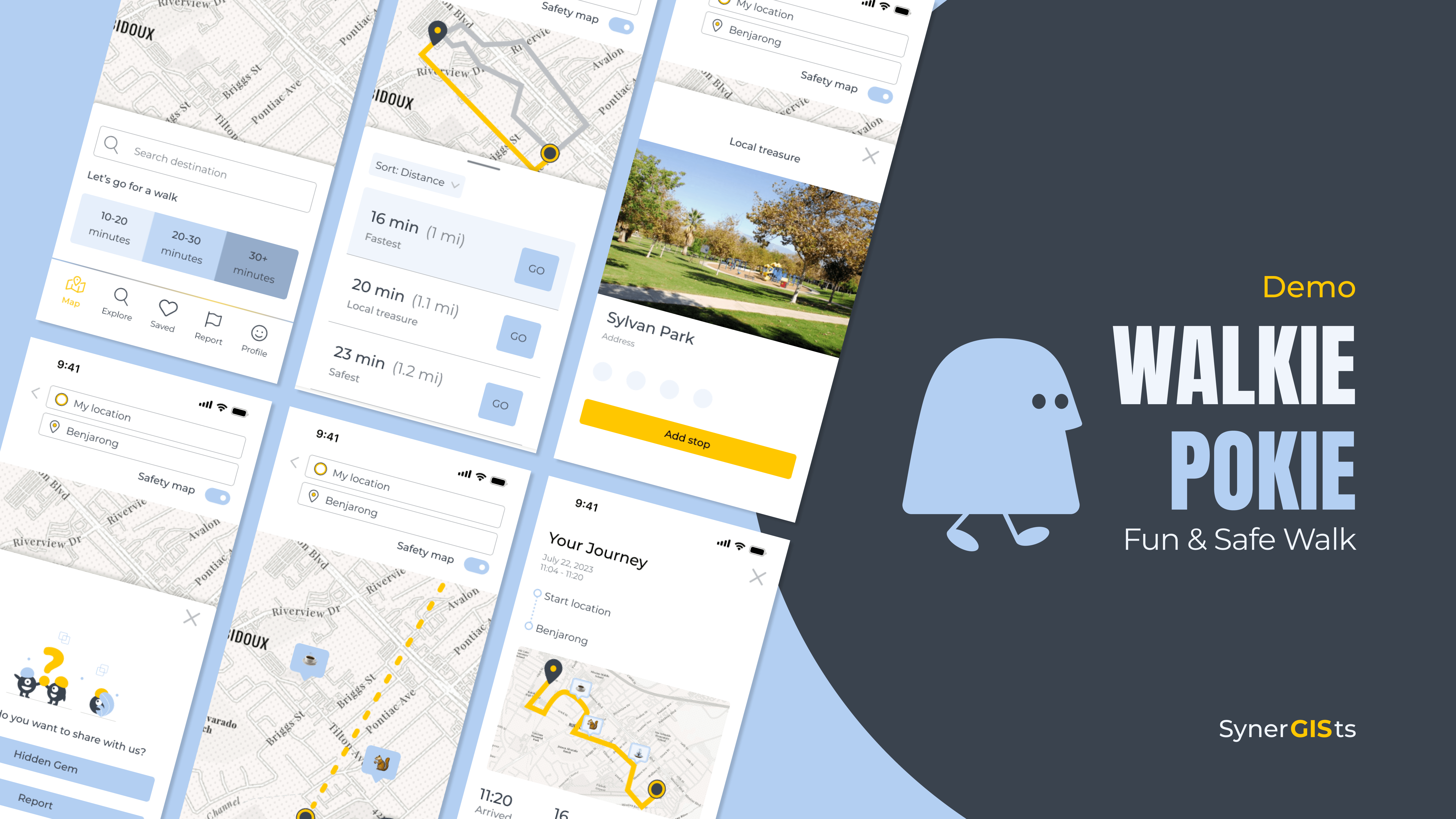
What it does
We have built a working IOS navigation app for walkers. Features include:
- User can set a route to their desired location
- The app will display to the user visualized crime data as well as hidden gems for their nearby area
- Hidden Gem Button: Opens up our ArcGIS InstantApps page for hidden gems that have photos and descriptions of each gem on the map
- Flag Button: Opens a menu for user to submit their own hidden gems or to report a location that is missing a sidewalk for someone on our team to update on OpenStreetMap to help improve the walking experience on our apps and others.
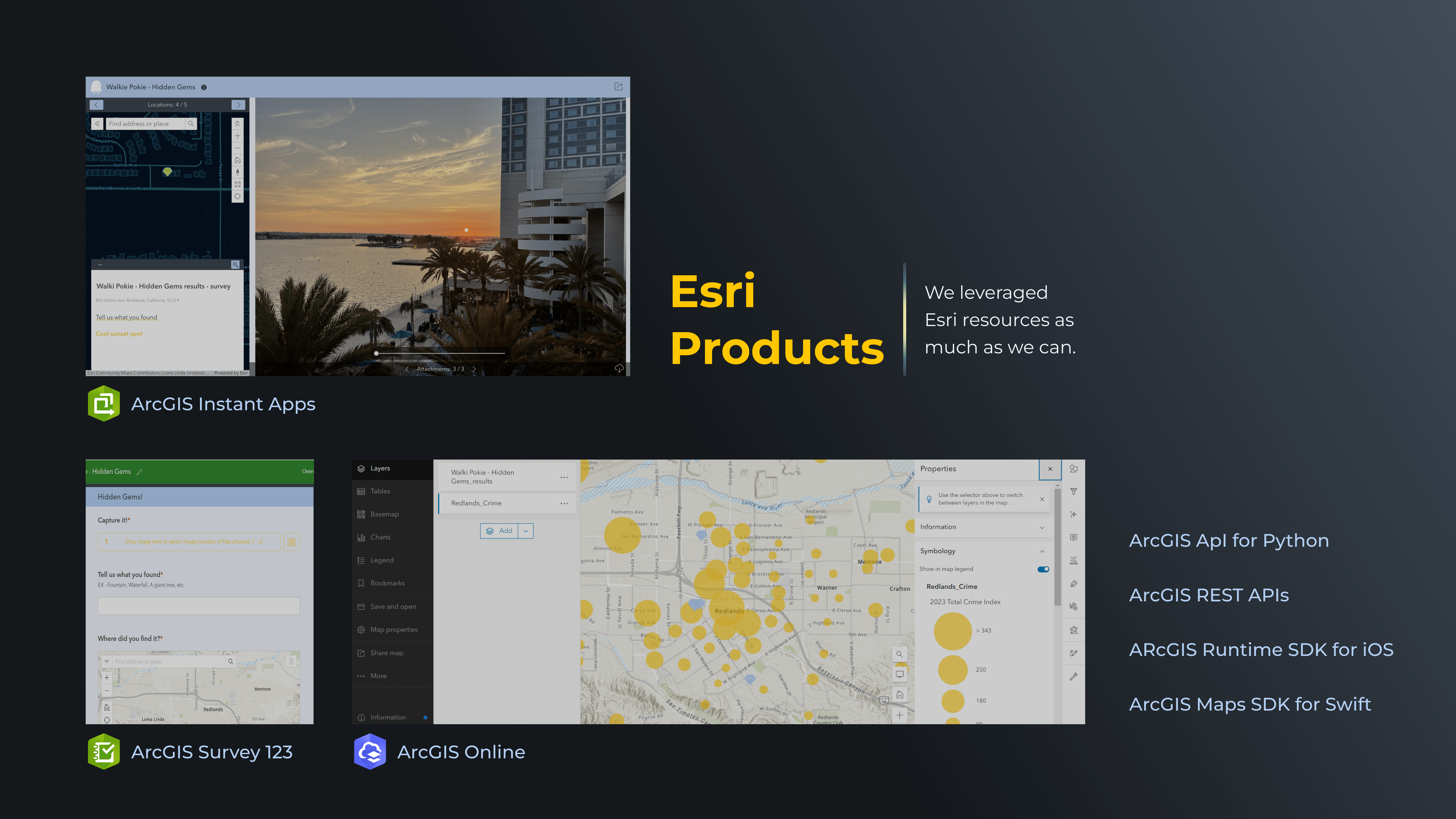
How we built it
We have successfully developed an advanced iOS mapping application that seamlessly integrates ArcGIS maps from ESRI, providing users with real-time tracking of their current position. The application boasts a sophisticated search bar equipped with Geocode's autosuggest functionality, ensuring the swift autocompletion of destination addresses. Our solution leverages FindAddressCandidates from the REST API to perform precise address geocoding, facilitating the identification of optimal routes through the utilization of the RouteResult within the REST API. By incorporating Enrichment Services, we have enhanced the map's utility by enriching it with valuable crime data and points of interest, providing users with comprehensive information. To further augment user experience, we have thoughtfully integrated multiple web views, enabling users to visualize and explore various points of interest. Additionally, we have seamlessly integrated ESRI's Survey123, empowering users to easily submit hidden gems and report issues related to places of interest directly through the application.
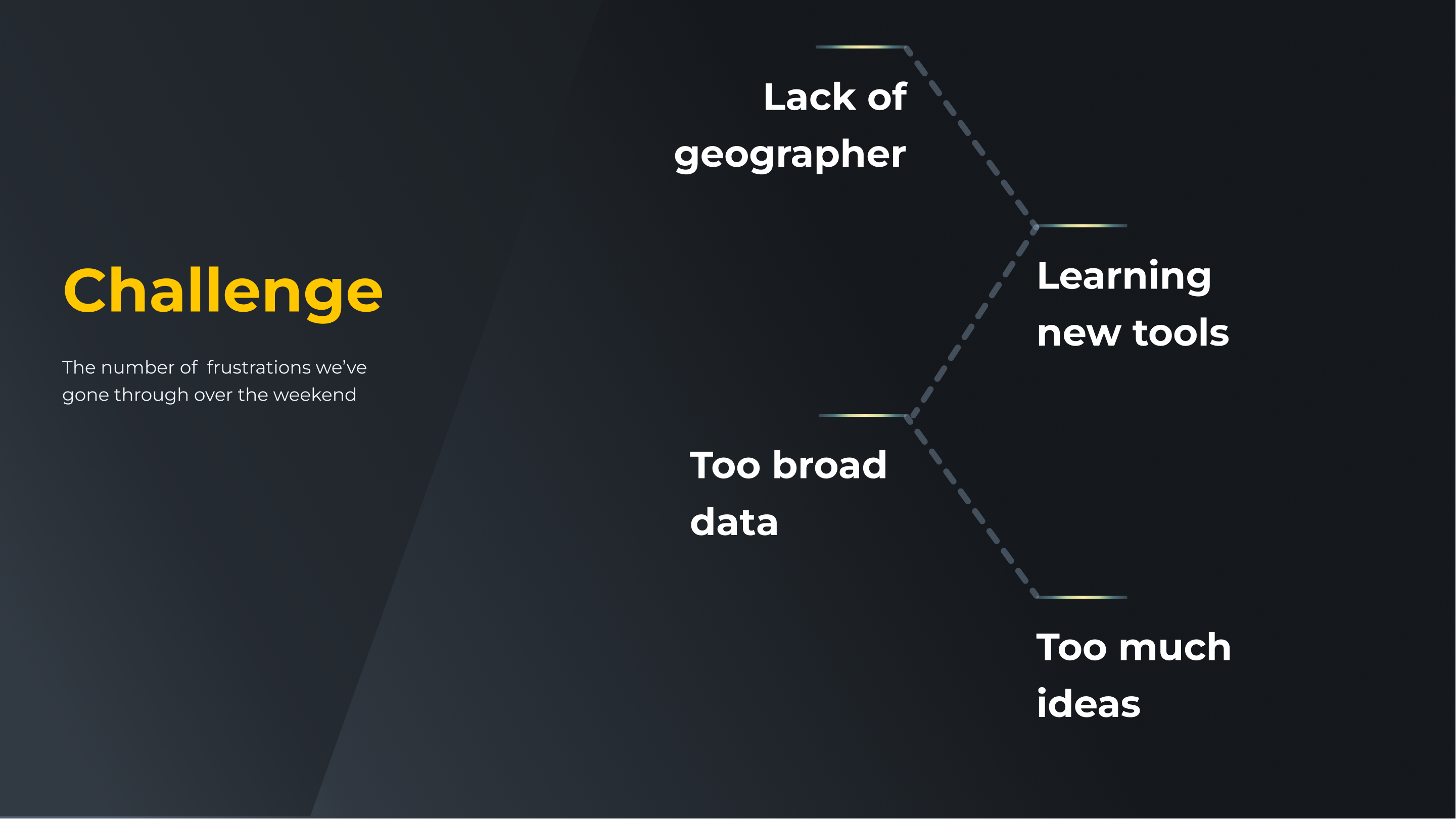
Challenges we ran into
The main challenge we ran into was that our team was not provided a geographer so that meant that we had to learn how to use ArcGIS products in a very short time Other Challenges Included:
- Working with the ArcGIS Maps SDK for Swift posed a challenge when trying to utilize multiple pages
- Found a live crime data API but could not receive the key in time so we had to move forward with enrichment data
- The enrichment data for our crime layer was too broad to give the user an exact visualization of the route safety
Accomplishments that we're proud of
- Building a functioning IOS app based off the swift SDK
- Including ArcGIS Survey123 and InstantApps seamlessly within the app
What we learned
We learned that making a navigation app is no joke.
What's next for WalkiePokie
We hope to expand on these features and use live crime data to give the user improved safety


Log in or sign up for Devpost to join the conversation.