Inspiration
Excited about the challenge proposed, with very little context and not much to start with, and coming up with an approach that is scalable.
What it does
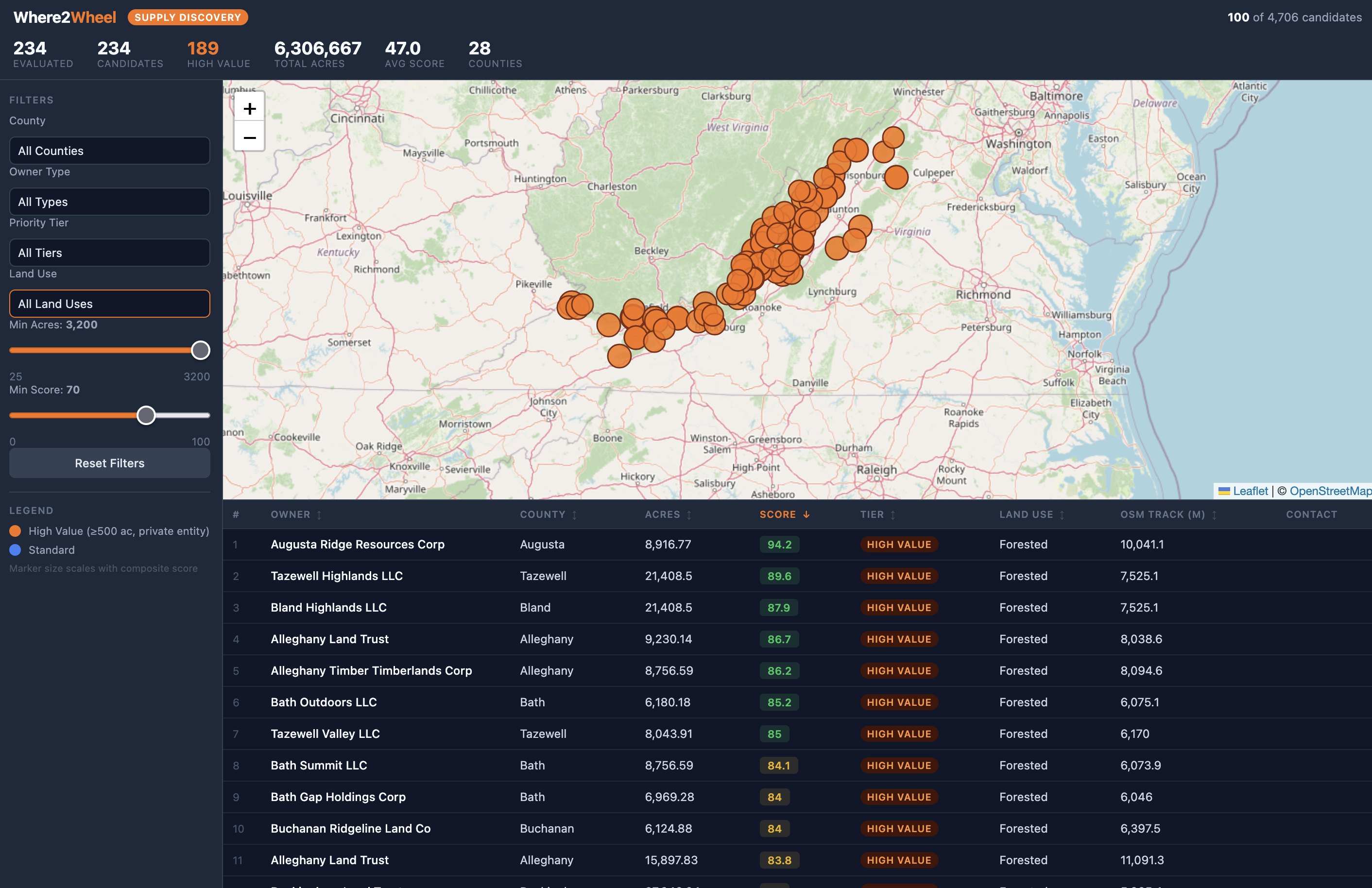
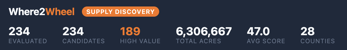
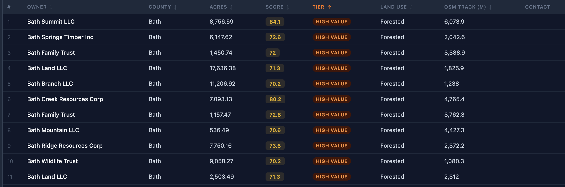
Their application pulls parcel data via an API and scores each parcel based on owner type, terrain, OSM tracks (publicly mapped tracks), parcel size, land cover, road access, and OHV proximity. The score then reflects the likelihood that the parcel has trails for 4x4 riding.
How we built it
Using Claude, was able to work through how to get to an acceptable solution and worked in partnership with the AI to develop a viable proof of concept.
The interface was a simple HTML page. The real value lay in the APIs and in how the data was queried, coupled with Python scripts that scored each parcel to allow ranking and prioritization, and then presented that in the UI for complete transparency.
Challenges we ran into
Getting access to enough data to demonstrate capabilities. Dummy data would not have worked because the goal is to demonstrate how to take real data and get to something useful for them.
Accomplishments that we're proud of
Delivering a viable POC in a short amount of time.
Built With
- api
- claude
- docker
- html5
- javascript
- python
- sql


Log in or sign up for Devpost to join the conversation.