-
-
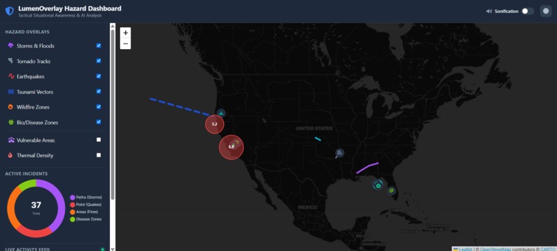
MainScreen
-
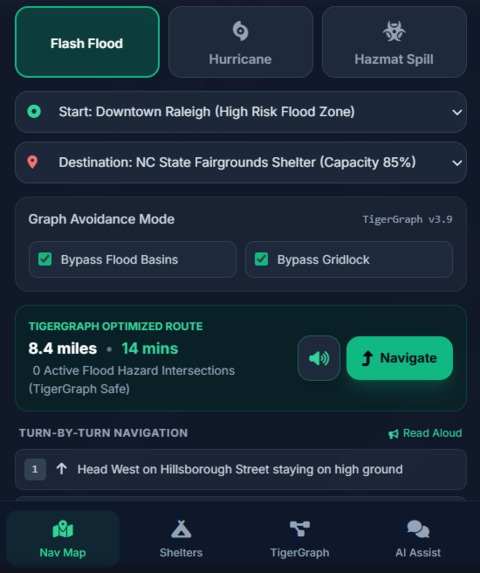
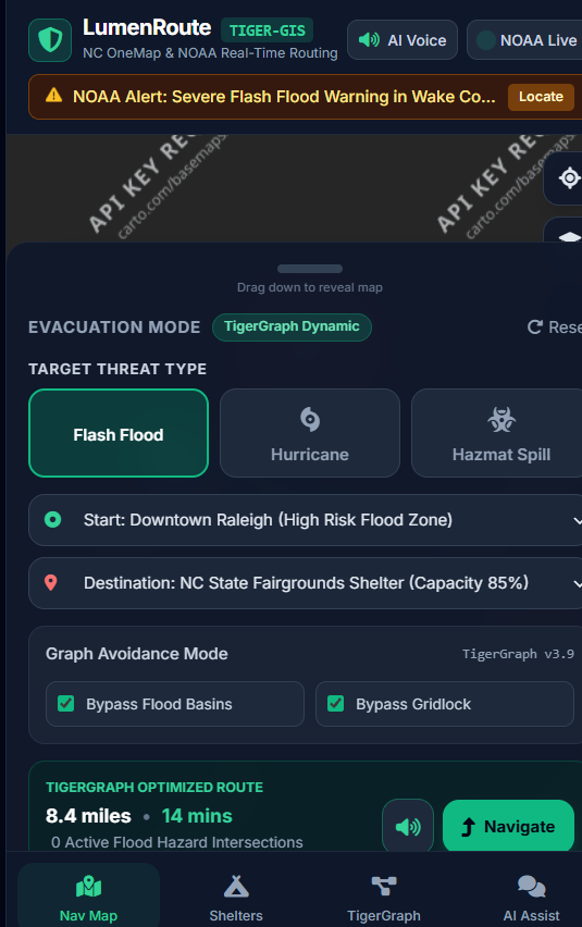
This is the home phone screen of the companion app
-
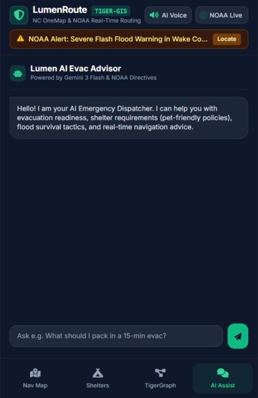
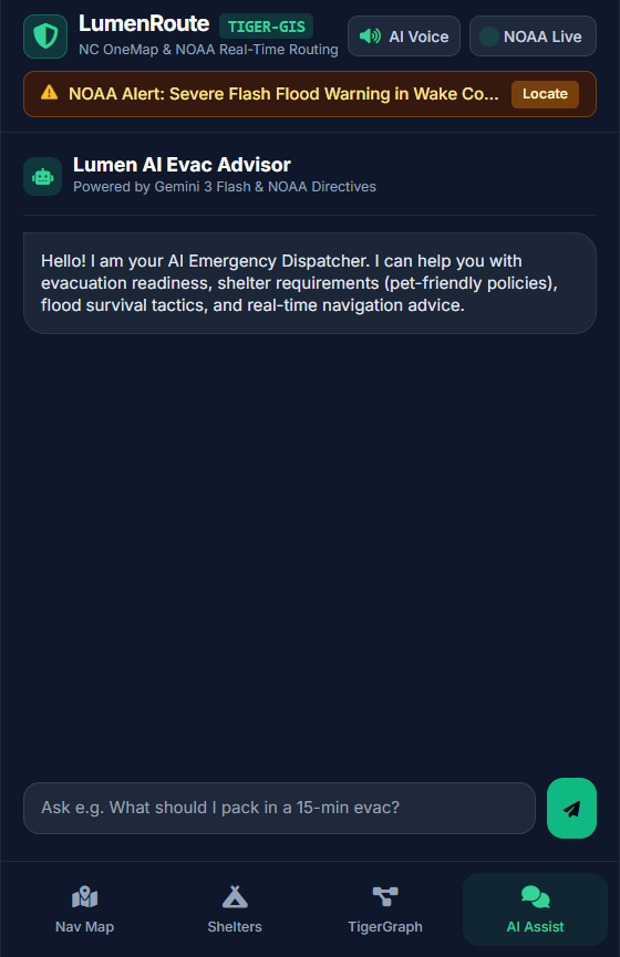
You can use the companion app and Gemini AI to help you and your family create a natural disaster plan
-
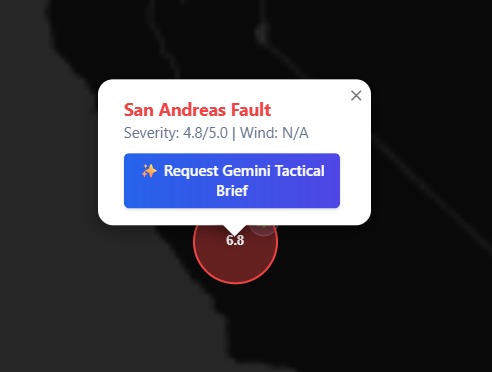
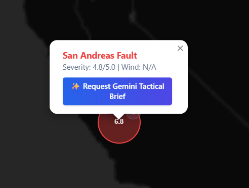
You can ask gemini for more precise information like severity, timeline, trajectory and more
-
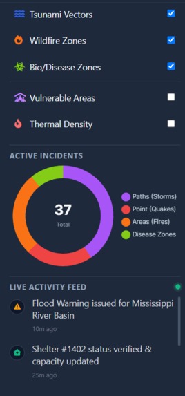
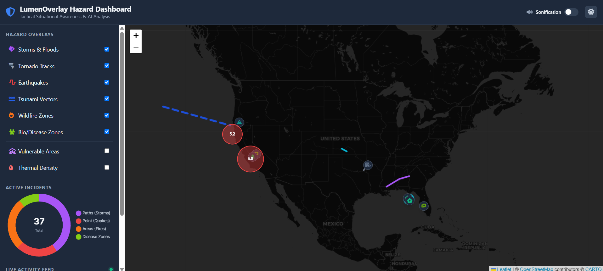
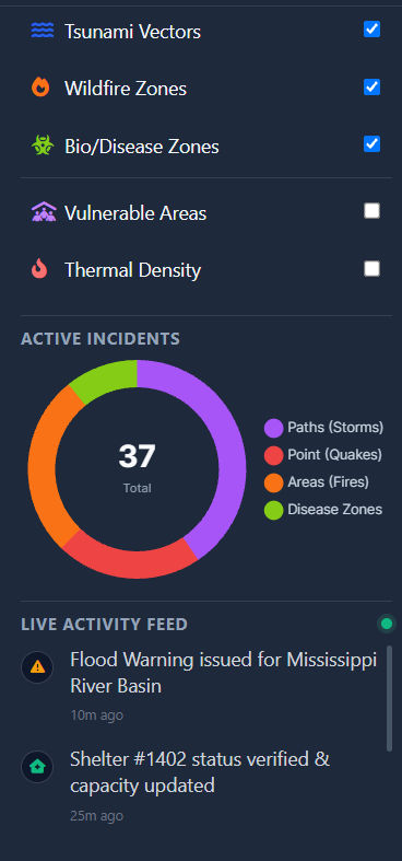
LiveActivity feed and toggleable disasters
-

Turn on Mother Natures Sounds, it will play music based on what events are happening live
-
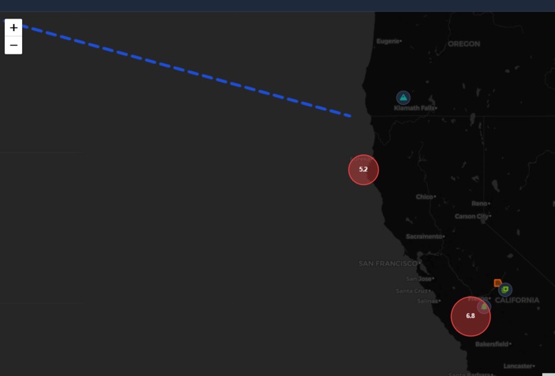
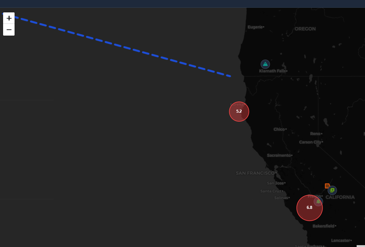
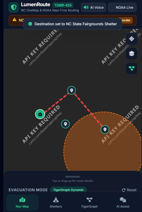
Using GeoPandas, and its friends, you can view area, trajectory/directionary and siesmic bubbles
-
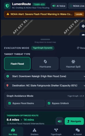
In a disaster you arent looking closely at your phone. You are able to enable AI voice that will help you reach saftey points
-
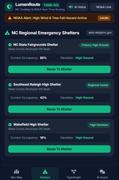
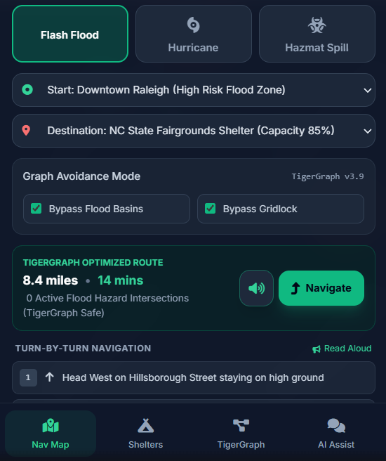
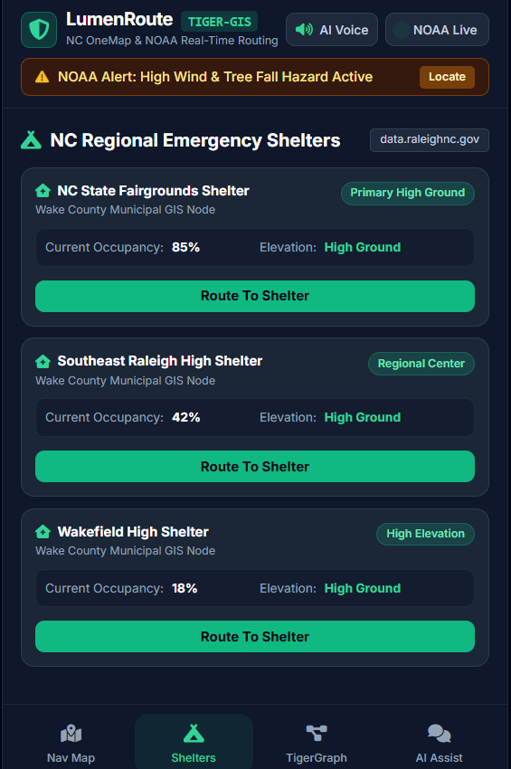
Need help finding saftey?
-
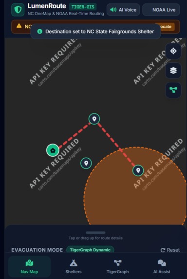
Pick and let it route you to the nearest one. If AI voice is enabled, it will verbally deliver directions

Inspiration
Taking our interest in weather phenomena to create a useful tool for families and communities. Natural disasters like flash floods, hurricanes, and severe storms often strike with little warning, leaving families and local emergency coordinators struggling to find safe, open evacuation paths.
What it does
Our platform ingests real-time geospatial, weather, and infrastructure data to generate dynamically optimized evacuation routes tailored to specific environmental threats. Rather than relying on standard GPS navigation
How we built it
Using a python interface to import data from NOAA, OpenStreetMap, data.raleighnc.gov, and NC Onemap data into a cleaned, centralized tiger cloud database for our website to query and present the information to the user, overlayed onto a Basemap map.
Challenges we ran into
Converting raw, disparate GIS data formats (Shapefiles, GeoJSON, tabular municipal feeds) into a structured graph schema compatible with Tiger cloud.
Accomplishments that we're proud of
Built a clean, intuitive, and responsive frontend that translates complex GIS and meteorological data into simple, color-coded, stress-free route guidance for users in high-anxiety situations.
What we learned
The importance of understanding the full functionality of the tools at our disposal, the first few hours were spent mostly on getting our IDEs and Git accounts setup and connected. Learned the complexities of cleaning, normalizing, and merging mismatched geographical datasets across national, state, and municipal boundaries.
What's next for you
Build the rest of the functions that we wanted to integrate into this project in a more relaxed environment to get it working how we imagined it. Take the skills we learned from our first hackathon to be able to come better prepared for the next one.
Built With
- geopandas
- html
- leaflet.js
- python
- tiger

Log in or sign up for Devpost to join the conversation.