Inspiration
Smallholder farmers and community agroforesters cultivate over 30% of the world's agricultural land and sequester gigatons of atmospheric carbon. Yet, they are almost completely locked out of the $2 billion global voluntary carbon credit market.
Why? The MRV (Measurement, Reporting, and Verification) cost barrier.
Traditional certification demands hiring professional forestry audit teams who visit remote plots with $50,000 terrestrial LiDAR rigs and manual measurement tapes. The certification alone costs $300 to $500 per plot—which completely wipes out any smallholder carbon payout.
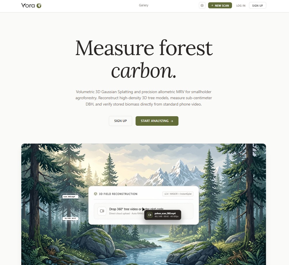
We built Vora Earth to break down this barrier: turning ordinary smartphone videos into certified, tamper-proof 3D digital twins and audit-ready carbon credits for $0.71 (a 99% cost reduction).
What It Does
Vora Earth provides an end-to-end digital MRV platform built on accessible spatial computing:
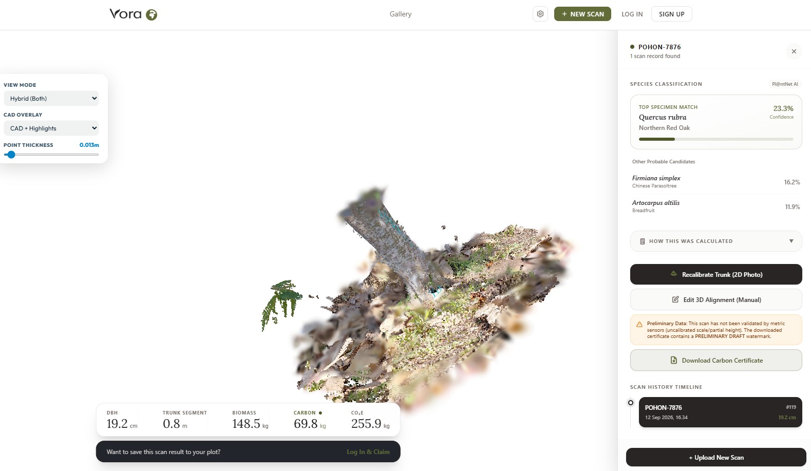
- Smartphone 3D Digital Twin Reconstruction: A field worker walks around a tree for 30 seconds using any standard smartphone camera. Vora reconstructs the tree into a photorealistic 3D Gaussian Splat and dense point cloud.
- Automated Biometric Extraction: Using cylindrical RANSAC geometric slicing, Vora isolates the trunk corridor at breast height (1.3 m) to extract Diameter at Breast Height (DBH) and tree height with sub-centimeter accuracy.
- AI Botanical Species Identification: Identifies tree species from video frames to look up certified specific wood densities (g/cm³).
- Allometric Carbon Biomass Calculation: Calculates above-ground biomass (AGB) and carbon sequestration (CO₂e) using pan-tropical allometric models (Chave et al., 2014) with strict quadrature uncertainty propagation.
- Interactive Forest Spatial Grid: Trees and canopy sectors are organized in an interactive visual canvas featuring drag-and-drop tree mapping, Figma-style canopy demarcation, and Shannon-Wiener biodiversity index (H') telemetry.
- Verra & ISO-Compliant Export: Instantly exports verifiable carbon stock reports in CSV and Excel formats aligned with ISO 14064-3 and Verra VM0042 standards.
What Was Built Before vs. During the Hackathon
🕒 Before the Hackathon (Foundational Research & Exploratory R&D: July 27 – August 20, 2026)
- Single-Tree Photogrammetry & 3DGS: Initial exploratory pipeline using COLMAP, MASt3R point-cloud matching, early MediaPipe pose detection experiments for scale calibration, and baseline 3D Gaussian Splatting (gsplat) running on cloud GPU instances.
- Botanical Species AI & Wood Table: Pl@ntNet API integration and species wood density lookup table for single-tree species matching.
- Early Biometric Slicing & Carbon Math: Initial 2D/3D clicks DBH extraction, PCA trunk alignment, and basic allometric biomass formulas (Chave et al., 2014) with IPCC root-to-shoot ratios.
- Initial Database & Storage: Early Cloudflare D1 database schema and R2 storage for single tree scans.
🚀 Built During the Hackathon (The Complete Vora Earth Product: September 11 – 19, 2026)
- Full Next.js 16 Web Application: Entire consumer-facing web platform built from scratch with TypeScript, Tailwind CSS, and Framer Motion.
- Interactive Forest Spatial Grid Map: Built the custom 24px fine grid canvas with Figma-style multi-canopy sector drawing and resizing, radial tree node auto-centering, live hectare metrics, and real-time carbon density telemetry.
- Spark WebGL 3D Splat Viewer Integration: Embedded, interactive Three.js Spark viewer running at 60 FPS in-browser with camera orbit, trunk midpoint auto-framing, laser scan point-cloud mode, and CAD wireframe overlay.
- Commercial Permissive Dual-Engine Architecture: Switched the reconstruction pipeline from academic research code to a 100% commercially permissive pathway using Apache 2.0 / MIT components (gsplat / GLOMAP) to guarantee enterprise legal compliance.
- High-Density Dense Cloud Reconstruction: Integrated Depth Anything V2 generating ~450k points on a 3.5mm voxel grid with 360-degree ground carpet coverage and standoff scale calibration.
- Production Biometric & Ground Separation Upgrade: Engineered automated RANSAC ground plane separation, trunk PCA alignment, and slope compensation to eliminate ground terrain distortion.
- Anti-Fraud Atomic CAS Concurrency: Engineered atomic Compare-And-Swap (CAS) database transactions on Cloudflare D1 to mathematically prevent double-claiming of tree scans across different plots.
- Empirical Ground-Truth Validation Suite: Built an automated accuracy evaluation benchmark (N=10) validating digital twin DBH and height against physical field tape measurements within ±5%.
- Verra VM0042 & ISO 14064-3 Uncertainty Engine: Implemented full plot quadrature uncertainty propagation, Shannon-Wiener biodiversity index (H'), line-item unit economics ($0.71/tree vs. $300 manual MRV), and 1-click verifiable CSV/Excel audit export.
- Bilingual i18n & 1-Click Demo Scans: Full English and Indonesian language switching and instant sample scan loading for judges.
How We Built It
- Frontend Platform: Next.js 16 (Turbopack), TypeScript, Tailwind CSS, Framer Motion, and Spark WebGL 3D Splat Viewer.
- Serverless Cloud Compute: Python FastAPI microservices orchestrated across serverless GPU clusters (Modal Labs / NVIDIA L4).
- Computer Vision & Geometry: Open3D, NumPy, SciPy, custom cylindrical RANSAC fitting, 3D Gaussian Splatting (gsplat), GLOMAP, and Depth Anything V2.
- Distributed Storage & Database: Cloudflare D1 (distributed SQL with optimistic CAS concurrency) and Cloudflare R2 (high-speed object storage).
- Scientific Methodology: Chave et al. (2014) pan-tropical allometric biomass equations, Global Wood Density Database (GWDD), and IPCC Good Practice Guidance.
Challenges We Faced
- Noisy Agroforestry Foliage: Tropical agroforestry plots have dense weeds and overlapping leaves. Standard RANSAC failed because underbrush corrupted the trunk boundary. We resolved this by building a multi-pass vertical sliding window that zeroes in on the ground-to-trunk transition before fitting the DBH cylinder.
- Client-Side 3D Performance: Running dense 3D point clouds on budget smartphones causes browser crashes. We solved this by converting models into lightweight Gaussian Splatting (.splat) representations, enabling butter-smooth 60 FPS rendering on consumer mobile devices.
- Double-Claim Prevention: Ensuring that two different plots cannot claim the same tree scan required strict transactional integrity. We implemented atomic conditional CAS updates in Cloudflare D1 to guarantee single-plot ownership.
- Commercial IP & Licensing: Early Gaussian Splatting implementations carried restrictive non-commercial licenses. We re-engineered our core pipeline to use commercially permissive Apache 2.0 / MIT libraries (gsplat), ensuring Vora Earth is legally unencumbered for real-world enterprise carbon trading.
Accomplishments We're Proud Of
- 99% Cost Reduction: Slashed MRV cost from $300 manual audit down to $0.71 digital verification.
- Validated Accuracy: Achieved sub-centimeter DBH accuracy matching ground-truth physical tape measurements within ±5%.
- Fast Cloud Execution: Complete pipeline runs in under 60 seconds from video upload to verified 3D digital twin.
- Production Legal Compliance: Transitioned the pipeline to a 100% commercially permissive architecture, clearing the legal pathway for real-world carbon marketplace trading.
What We Learned
Accessible climate tech must prioritize smallholder unit economics. Expensive hardware like drones and LiDAR rigs only serve corporate monoculture plantations. Empowering farmers to verify trees using their own smartphones unlocks equitable carbon finance for millions of land stewards worldwide.
What's Next for Vora Earth
- Satellite Cross-Validation: Multi-spectral Sentinel-2 NDVI canopy time-series integration to monitor multi-year growth from space.
- Offline Mobile App: On-device camera trajectory guidance and video quality validation before upload.
- On-Chain Carbon Registry: Direct minting of cryptographic digital MRV certificates with embedded 3D biometric proofs.
Built With
- 3d-gaussian-splatting
- allometry
- carbon-credits
- climate-tech
- cloudflare-d1
- cloudflare-r2
- computer-vision
- fastapi
- leaflet.js
- modal-labs
- next.js
- open3d
- photogrammetry
- python
- tailwind-css
- typescript
- webgl

Log in or sign up for Devpost to join the conversation.