-
-
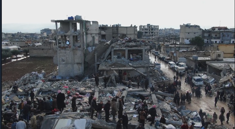
The Visionary Architect dashboard in action
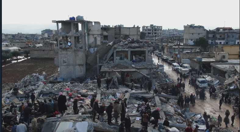
Inspiration
Urban safety assessments and disaster response still rely heavily on manual inspection, static reports, and delayed decision-making. After floods, earthquakes, or infrastructure failures, responders often have drone footage—but lack intelligent systems that can reason over that visual data.
What it does
Visionary Architect is a multimodal, agentic safety intelligence system for urban planners and disaster response teams. Users upload drone images or short video clips of a site. The system then: Detects visible hazards and structural damage Assesses safety risk levels (Low / Medium / High) Explains findings in clear, conservative language Generates actionable response and mitigation plans The goal is to transform raw visual data into decision-ready safety intelligence.
How we built it
Technical Deep Dive: The Gemini 3 Reasoning Engine
Visionary Architect is not driven by a single prompt or linear workflow. It is built as an agentic reasoning pipeline that leverages Gemini 3’s advanced multimodal understanding and high-level internal reasoning capabilities.
🔹 High-Fidelity Multimodal Processing
The system uses Gemini 3’s native multimodal input handling to process images and short drone video clips. To balance performance and detail: Initial analysis is performed at standard visual resolution to detect hazards efficiently. When potential structural damage or obstructions are identified, the system selectively re-analyzes those visual regions at high visual fidelity, enabling more precise inspection of cracks, debris, or access constraints. This adaptive visual strategy allows detailed inspection without unnecessary token or compute overhead.
🔹 Agentic Workflow & Context Sharing
Visionary Architect operates as a coordinated multi-agent reasoning system, not isolated prompts.
Visual Analysis Agent Extracts spatial layout, visible hazards, and structural indicators from imagery using high-level multimodal reasoning.
Risk & Integrity Agent Consumes the visual findings and evaluates safety severity, accessibility risks, and potential structural instability using conservative, safety-first logic.
Planning & Logistics Agent Translates assessed risks into prioritized response and mitigation recommendations, producing structured outputs suitable for downstream systems.
All agents share context across stages, ensuring consistent reasoning and preventing contradictory conclusions.
🔹 Structured Outputs for Real-World Systems
Instead of free-form text, the system generates structured, machine-readable outputs (e.g., JSON-style reports). This enables seamless integration with: GIS platforms Emergency response dashboards Urban planning and inspection workflows
🔹 Safety-First Reasoning Constraints
To minimize hallucination risk in safety-critical scenarios, the system enforces evidence-based reasoning constraints via system instructions: Conclusions must be grounded in visible visual evidence Hazard findings are linked to specific visual regions or frames Speculation beyond observable data is explicitly disallowed This creates a transparent, auditable reasoning process that supports human decision-makers rather than replacing them.
Why Gemini 3 Matters
Gemini 3’s multimodal reasoning capabilities make it possible to treat raw visual data as actionable intelligence, enabling Visionary Architect to move beyond chat interfaces into real-world planning and safety assessment workflows.
- Core Intelligence & Reasoning
This is the heart of your "Agentic Workflow."
LLM / Multimodal Engine: Gemini 1.5 Pro or Flash (utilizing the Gemini 3 Flash variant logic). This handles the native image/video processing and the "Chain of Thought" reasoning.
Orchestration Framework: LangGraph (by LangChain). This is the gold standard for building the "Visual → Risk → Planning" multi-agent loops you described, as it excels at managing state and shared context between agents.
Agent Communication: JSON Schema Enforcement. Using Pydantic models to ensure the "Risk Agent" and "Logistics Agent" output structured, machine-readable data.
- Video & Image Processing Pipeline To handle the "High-Fidelity" adaptive analysis:
Preprocessing: OpenCV (Python). Used to frame-sample drone footage or crop specific regions of interest (ROI) for high-fidelity re-analysis.
Metadata Extraction: ExifTool. To extract GPS coordinates and timestamps from drone images to ground them in real-world maps.
- Data Management & Geo-Spatial Integration Vector Database: ChromaDB or Pinecone. To store "Safety-First" instructions and historical disaster data for few-shot prompting.
Mapping/GIS: Mapbox GL JS or Leaflet. To visualize the "Visual Analysis Agent's" findings on a real-world map overlay.
Database: MongoDB. Since your output is heavily JSON-based and document-driven, a NoSQL approach fits the flexible nature of disaster reports.
- Frontend & Dashboards The interface for disaster responders needs to be fast and high-contrast:
Framework: Next.js 14.
Visualizations: Recharts or D3.js for risk-level heatmaps and "Low/Medium/High" severity charts.
Component Library: Shadcn/ui. For a clean, professional, "emergency-response" aesthetic.
- Deployment & Edge Computing Cloud Platform: Google Cloud Platform (GCP). Native integration with Gemini via Vertex AI.
Serverless Logic: Google Cloud Functions. To trigger analysis the moment a drone upload hits a storage bucket.
Edge (Future): TensorRT. If you eventually want to move the "Hazard Detection" agent onto the drone itself for offline processing.
Challenges we ran into
A key challenge was avoiding speculative conclusions. We addressed this by explicitly constraining the system to reason only from visible evidence and to prioritize public safety over assumptions.
This project demonstrated how Gemini 3 moves beyond chatbots into agentic, real-world reasoning systems capable of supporting critical infrastructure and safety workflows.
Accomplishments that we're proud of
We built an AI system that transforms chaotic disaster footage into clear, explainable guidance for emergency responders and urban planners. By enforcing evidence-based reasoning and traceable visual references, Visionary Architect prioritizes transparency and accountability—two critical requirements for deploying AI in public safety contexts. Our approach shows how advanced AI can support faster, more informed decisions without replacing human judgment.
What we learned
We learned that trust is the limiting factor in deploying AI for civic and emergency use. Even highly capable models must be designed with explainability, conservative reasoning, and human oversight at the core. This project reinforced the importance of aligning AI outputs with real-world decision workflows and ensuring that AI augments public institutions rather than introducing opaque or unaccountable systems.
What's next for Visionary Architect: Real-Time Safety Intelligence
Future versions could integrate: Temporal analysis across longer video sequences GIS and map overlays Live drone feeds and mobile responder dashboards
Built With
- javascript
- next.js
- react
- typescript

Log in or sign up for Devpost to join the conversation.